
Standing in front of a station map in Tokyo, with the names of prefectures, lines and far-off cities spread across it, it is easy to lose the shape of the country. Japan is an island nation, and it makes sense once you hold a few labels in your head: a handful of main islands, a set of regions that locals use every day, and cities that anchor each one.
What are the regions of Japan?
Japan is usually described as a set of eight or nine regions, which group the country’s prefectures into broad areas such as Hokkaido, Tohoku, Kanto, Chubu, Kansai, Chugoku, Shikoku and Kyushu. These regions are not official administrative units. Government officials have used them for statistics and other purposes since 1905, and you meet them constantly in maps, geography textbooks and weather reports.
The one common division counts eight regions: Hokkaido, Tohoku, Kanto, Chubu, Kansai, Chugoku, Shikoku, and Kyushu together with Okinawa. The other traditional grouping counts nine and gives Okinawa its own place. Okinawa Prefecture is usually considered part of the Kyushu region, but it is sometimes treated as a region of its own, so a map may show it either way.
Underneath the regions sit the prefectures, which rank immediately below the national government. Each has a directly elected governor and an assembly, and each has its own mon, the equivalent of a coat of arms in the West. You will see these emblems on manhole covers, signs and local souvenirs, which is a small pleasure when you start to match them to the map.
| Region | Population | Area (km²) |
|---|---|---|
| Hokkaido | 5.1 million | 83,000 |
| Kanto | 43.3 million | 32,000 |
Hokkaido and Tohoku
Hokkaido is both a region and a single prefecture, and the largest prefecture by area, covering 32,221.6 square miles. It is a regional prefecture, the only one of its kind, and it is divided into subprefectures that act as bureaus of the prefecture. On the plate you find dairy, seafood and bowls of miso ramen in Sapporo, the city that also hosts the High Court for Hokkaido.
Tohoku is the first of the five regions into which Honshu, the largest island, is split. Its High Court sits in Sendai.
Tohoku is known for its summer festivals with lantern floats and drums, for rice and sake country, and for rural onsen towns where the baths are the reason to stop. Nothing here is a single sight. It is a region you cross slowly, by rail or by road, with a long list of small towns on the way.
Kanto and Chubu
Kanto packs in subway lines, department stores, shrines tucked between office towers and neighborhoods that each feel like a separate town. The High Court for Kanto sits in Tokyo, and Niigata comes under the same court even though Niigata belongs to Chubu on most maps.
Chubu is the region in the middle of Honshu, and it can be divided into three subregions: Hokuriku, Koshin’etsu and Tokai. It holds Mount Fuji, a volcano dormant since 1707 in Shizuoka Prefecture, and the Shinano River, the longest in Japan, which winds through Nagano and Niigata. Kanazawa and Nagoya also belong to this region, which explains why a Chubu itinerary can swing from castles and gardens to mountain villages and big-city shopping.
Kansai and Chugoku
Kansai is the region of Osaka, Kyoto, Kobe and Nara, and the High Court for it sits in Osaka. Its cities are close neighbors on the map, so a trip here often mixes temples and tea houses in Kyoto with the street food of Osaka, such as okonomiyaki, takoyaki and kushikatsu. Kansai is also the home of Lake Biwa, an ancient lake and the country’s largest freshwater lake.
Chugoku is the last of the five regions of Honshu. It can be divided into the San’in and San’yo subregions, and its High Court sits in Hiroshima.
Hiroshima is where visitors reach the Peace Memorial grounds and taste the city’s own style of okonomiyaki, layered with noodles. Looking at the San’in and San’yo names on a map helps when a train line or a regional pass is described by one or the other.
Shikoku, Kyushu and Okinawa
Shikoku is a region and an island at once, with a High Court in Takamatsu, in Kagawa Prefecture, the smallest prefecture by area. It is the land of a Buddhist pilgrimage that circles the island, of udon noodles in Kagawa and of river valleys cut deep into the mountains. Kyushu is the region of Fukuoka, where the High Court for Kyushu and Okinawa sits, and of hot-spring towns and volcanic landscapes.
Okinawa sits last on the list, either folded into Kyushu or standing as a ninth region. Its separate feel on the map matches its separate feel on the ground: its own music, its own cooking and a distinct Ryukyu heritage. When a weather report or a rail map groups it with Kyushu, remember that the map is simplifying.
Where are the major cities?
Major cities include Tokyo and Yokohama in Kanto, Osaka and Kyoto in Kansai, Nagoya in Chubu, Sapporo in Hokkaido, Hiroshima in Chugoku and Fukuoka in Kyushu. One handy way to remember them is by the eight High Courts, each in a regional hub: Sapporo, Sendai, Tokyo, Nagoya, Osaka, Hiroshima, Takamatsu and Fukuoka. Those court cities do not line up exactly with the eight-region division, but they give you a ready list of the places that anchor the map.
Tokyo and the Greater Tokyo Area
Tokyo is the capital of Japan and has the highest population of any prefecture, with 14,261,000 residents. It is a merged city-prefecture, a metropolis with features of both a city and a prefecture, so the word Tokyo can mean the central wards or the whole prefecture. The Greater Tokyo Area on Honshu is far larger still, and it had a population of 38,140,000 people in 2016.
Day to day, that scale shows up as a patchwork of districts: Asakusa with its temple, Shibuya with its crossing, Ginza with its department stores, Shinjuku with its towers and its tiny bars. Haneda Airport, the largest in Japan, is in Tokyo, and it was Asia’s second-busiest airport in 2019. Think of Tokyo as the hub where many itineraries start and end.
Osaka, Kyoto and the Kansai cities
Osaka and Kyoto are the two urban prefectures, called fu, of the 47 prefectures. Everything else is a ken, apart from Hokkaido, the regional prefecture (do), and Tokyo, the metropolis (to). It is a neat bit of vocabulary for reading a map, because the final syllable tells you what kind of prefecture you are looking at.
The cities themselves have different tempers. Osaka is a city of food counters, canal-side walks and loud, cheerful dining streets. Kyoto is a city of wooden machiya houses, temple gates and gardens. Nara and Kobe round out Kansai, and Their close spacing makes it practical to explore several Kansai cities from one or two bases.
Nagoya, Hiroshima, Fukuoka and the regional hubs
Nagoya anchors Chubu and hosts the High Court for that region. It is a city of castle grounds, industry and its own cooking, with miso-based dishes and chicken wings glazed in sweet sauce. Hiroshima in Chugoku sits on a river delta and is a base for the Peace Memorial grounds and for a trip out to Miyajima.
Fukuoka is the hub of Kyushu, a city of open-air food stalls called yatai and of tonkotsu ramen in a rich pork-bone broth. Takamatsu holds the court for Shikoku, and Sapporo and Sendai hold those of Hokkaido and Tohoku. Between them, these cities give each region a name to look for on the map, and a meal to plan around.
What are the main islands?
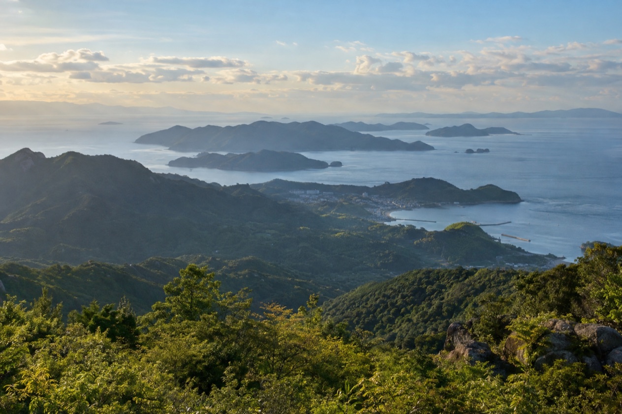
Japan has five main islands: Hokkaido, Honshu, Shikoku, Kyushu and Okinawa, listed from north to south. They are part of an archipelago of 14,125 islands that extends along the Pacific coast of Asia. The coastline is the sixth longest in the world at 18,486 miles, which gives you a sense of how much of Japan faces the water.
The land itself is mostly green. About two thirds of the archipelago is forest, and there are 108 active volcanoes. Five sites are inscribed on the UNESCO World Heritage List for their outstanding natural value. It is a country of mountains and valleys with cities packed into the spaces between them, which is why the map looks the way it does.
Honshu
Honshu is the largest island, and it is split into five regions: Tohoku, Kanto, Chubu, Kansai and Chugoku. On the map it is the long central island that the Shinkansen follows, and Mount Fuji and the Shinkansen together are notable features of Japan.
A trip on Honshu is a succession of changes in scenery: neon in Tokyo, rice terraces and mountain villages in the middle, castles and temples in Kansai, and the quiet coast of the San’in side of Chugoku. Because the island holds so much, a first visit to Japan often stays here, and the other islands become a second trip.
Hokkaido
Hokkaido is the northernmost of the five main islands and also the largest prefecture, with 14 subprefectures. It is a place for wide landscapes, farmland, seafood markets and onsen, and its cities, Sapporo above all, have a grid layout that looks different from the winding streets of the older cities of Honshu.
The late summer and early autumn typhoons that can bring heavy rain to Japan belong to the same calendar as a Hokkaido autumn trip, so it helps to keep the weather report open. For most travelers the island works best as its own destination, with a flight or a long rail connection from Honshu, and plenty to see once you arrive.
Shikoku and Kyushu
Shikoku is the smallest of the four large islands and the home of Kagawa, Ehime, Kochi and Tokushima Prefectures. It is known for its pilgrimage route among temples, its udon, and its rural feel. Visitors who come here are usually looking for something slower than the big cities of Honshu.
Kyushu is the southern island of the main group, and it holds Fukuoka, Nagasaki, Kumamoto and Kagoshima. It is a place of hot springs, volcanoes and a distinctive cuisine, from tonkotsu ramen to dishes of local pork and chicken. Many travelers pair Kyushu with Hiroshima and the rest of Chugoku on one long trip.
Okinawa and the smaller islands
Okinawa is the southernmost of the five main islands in the list, and it is the one with a tropical feel. The main rainy season begins in early May there, and its culture, its cooking and its music carry the Ryukyu stamp. Okinawa has a world of its own, far to the southwest of Kyushu.
Beyond the five, the many thousands of smaller islands include places that few travelers have ever heard of. You do not need to learn them, but it helps to know they are there when a map shows small specks off the coast, or when a ferry line is described by the island it serves.
Good to know before you go
Japan runs on yen, and the map is easier to read once you accept that the regions are loose groupings while the 47 prefectures are the units that count on signs and tickets. In late summer and early autumn, typhoons often bring heavy rain, so a trip that crosses several regions should allow for a weather day or two. Okinawa has its own calendar, with the main rainy season starting in early May.
Sources
- Wikipedia, Geography of Japan (https://en.wikipedia.org/wiki/Geography_of_Japan), checked October 11, 2026
- Wikipedia, Japan (https://en.wikipedia.org/wiki/Japan), checked October 11, 2026
- Wikipedia, Prefectures of Japan (https://en.wikipedia.org/wiki/Prefectures_of_Japan), checked October 11, 2026
- Wikipedia, Regions of Japan (https://en.wikipedia.org/wiki/Regions_of_Japan), checked October 11, 2026
To plan your stay
- Best Time to Visit Japan: Cherry Blossoms, Autumn Colors, Weather and Festivals
- Where to Stay in Japan: Ryokan, Temple Stays, Capsule Hotels and the Best Cities to Base In
- Sending Luggage from the Airport in Japan: Hands-Free Travel, Hotel Delivery and Coin Lockers
- Know Before You Go to Japan: Entry, Money, Etiquette and Getting Around