
On the evening of August 6, thousands of paper lanterns slip onto the river in Hiroshima, each carrying a handwritten wish for peace, and the water glows in front of the Atomic Bomb Dome.
The Chugoku region, at the western end of Honshu, is a place of memorials, island shrines, castles, sand dunes and mountain trails. It suits travelers who like to move slowly from coast to coast.
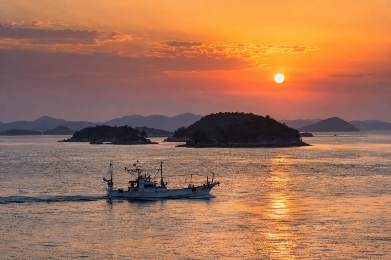
Where is the Chugoku region and what is it like?
The Chugoku region is the westernmost part of Honshu, Japan’s main island, and it groups five prefectures: Tottori, Shimane, Okayama, Hiroshima and Yamaguchi. It is also called the San’in-San’yo region.
San’in is the northern half facing the Sea of Japan, and San’yo is the southern half facing the Seto Inland Sea. That split explains much of the trip, because two coasts with two different moods sit on either side of one mountain spine.
Japan’s regions are not official administrative units, though they appear on maps, in geography textbooks and in weather reports. Chugoku is one of the five regions of Honshu, and the city of Hiroshima is considered its capital. Hiroshima was rebuilt after being destroyed by an atomic bomb in 1945, and today it is the usual point of entry into the region and a popular destination in its own right.
The southern side is the busier one. Hiroshima Prefecture has heavy sea traffic across the Seto Inland Sea toward Shikoku, and Okayama Prefecture has a bustling capital and old merchant quarters. Yamaguchi, at the far end, is a gateway to Kyushu and has long had exchange with South Korea and China.
The northern side feels different. Tottori is known for the sand dunes beside its capital, for Mount Daisen and for a long coastline, while Shimane holds Matsue and Izumo, towns built around a castle, a lake and some of Japan’s oldest-feeling shrine country.
The region rewards people who enjoy a history lesson, a plate of regional food and a slow train ride. It is less suited to anyone who wants every stop packed into one afternoon, because the sights are spread over two coasts.
What is there to do in the Chugoku region?
The big reasons to come are remembrance in Hiroshima, an island shrine at Miyajima, the castles and gardens of Okayama and Matsue, and the dunes and peaks of Tottori. What sets Chugoku apart from its neighbors is the pairing of two seas in one region. You can spend a morning on the Seto Inland Sea and a day later stand on a dune above the Sea of Japan.
Hiroshima: peace sites and okonomiyaki
Hiroshima’s Peace Memorial Park and the Atomic Bomb Dome are the heart of a visit, and the prefecture also has peace-related shrines and museums. Visitors walk along the river and take in the quiet weight of the place, then often turn to lighter business at lunchtime. The local version of okonomiyaki, a griddled savory pancake, is built in layers with noodles and cabbage and eaten straight from the hot plate.
On August 6, the ceremony brings thousands of people to the river, where they write messages on lanterns that are lit at sunset and floated past the Dome. It is a solemn evening and a moving one. Anyone planning a trip around that date should know that it shapes the mood of the whole city.
Miyajima: the shrine in the sea
Miyajima, officially Itsukushima, is an island off the coast of Hiroshima, and its nickname means Shrine Island. Itsukushima Shrine is the island’s iconic landmark, with a red torii gate standing in the sea. Deer roam near the pier and the village streets, and visitors come for the shrine, the gate and the island’s wooded setting.
The island belongs to the city of Hatsukaichi. Frequent ferries from Miyajimaguchi, run by JR West and by Miyajima Matsudai Tourist Ship, make the crossing in about ten minutes.
Okayama and Kurashiki: gardens, a black castle and old canals
Okayama sits on the Seto Inland Sea facing Shikoku. Its castle is called the Crow Castle because of its black walls, and Korakuen, its garden, is known as one of the top three traditional gardens in Japan. The two stand close to each other, so they make a natural pairing for a day of strolling among lawns, ponds and pine trees.
Kurashiki lies 30 minutes west of Okayama on the Sanyo Line, a trip the Japan Rail Pass covers. The Takahashi River runs through the city to the sea, and its historic merchant quarter, with whitewashed storehouses beside a willow-lined canal, makes for an afternoon of slow browsing.
Tottori and Shimane: dunes, a castle and mountain trails
Tottori is best known for the Tottori Sakyu, Japan’s largest sand dunes, which rise beside the Sea of Japan coast. Mount Daisen, also in Tottori Prefecture, offers rewarding hikes on stunning peaks. Together they give the northern side its outdoor character, with open sand and sea views on one hand and mountain ridges on the other.
Matsue in Shimane keeps a castle that is one of only 12 in Japan to have preserved its original donjon. Izumo, close by, is the town people associate with ancient shrine traditions. The two together make a quiet, history-minded stop for those who prefer a castle town to a big city.
How many days do you need in the Chugoku region?
A long weekend covers Hiroshima and Miyajima, while a week lets you cross the whole region from the Seto Inland Sea to the Sea of Japan. The distances between the two coasts are real, so the more of the north you want, the more days you will want to spend.
With three or four days, stay based around Hiroshima. Spend one day in the city itself, with the Peace Memorial Park, the Atomic Bomb Dome, the river and a lunch of okonomiyaki.
Give another day to Miyajima, with its shrine, its deer and its ferry crossing, and add Okayama and Kurashiki if time remains. The Sanyo Shinkansen continues west from Hiroshima toward seaside towns and the islands of the Seto Inland Sea, which gives a short stay a little room to roam.
A week opens up the San’in side. Okayama is the springboard, since Matsue is 2 hours and 40 minutes from there by train. A longer loop could pair Okayama’s castle and garden with Kurashiki’s canal, then head north for Matsue’s castle and Izumo’s shrines, and finish at the dunes near Tottori.
With extra time, Mount Daisen is a good reason to linger in Tottori Prefecture, with hiking on its peaks. Yamaguchi, at the western tip, suits travelers continuing to Kyushu, since the prefecture is a gateway there. Anyone who loves ferries can also spend a day or two crossing the Seto Inland Sea by boat, since the sea traffic here is busy and varied.
Where to stay in the Chugoku region
Hiroshima is the main base for most trips, because it is the point of entry into the region and a popular destination in itself. Staying in the city puts the memorial sites, the riverside and the okonomiyaki restaurants close at hand in the evening. It is the right choice for first-timers and for anyone using the Sanyo Shinkansen as a spine.
Miyajima also has places to stay, and the island suits travelers who want to be there when the day crowds have gone. Evenings by the sea, with the torii gate and the shrine in view, have a different feel from a daytime crossing. Anyone choosing the island should expect a slower, more traditional rhythm than in the city.
Okayama works as a base for the middle of the region. It is a bustling prefectural capital on the Seto Inland Sea, and from there you can reach Kurashiki in half an hour and Matsue by a longer train ride. Travelers use it to split the journey between Hiroshima and the north coast.
Kurashiki itself suits those who want to wake up beside the old canal and walk the merchant quarter before the day visitors arrive. Matsue and Izumo, in Shimane, make sense for a night or two among the castle, the lake and the shrines. Tottori is the base for the dunes and for Mount Daisen, and it suits hikers and travelers who want the northern coast without a rush back south.
How do you get to the Chugoku region and get around?
Visitors arrive through Hiroshima, which is the point of entry into the region, and the region’s largest airport is Hiroshima Airport, about 31 miles east of the city. The Sanyo Shinkansen then carries travelers west along the Seto Inland Sea coast, toward seaside towns and island ports.
Shimane has its own way in. Izumo Airport receives five flights a day from Tokyo’s Haneda Airport, taking 80 minutes, followed by a 30-minute bus ride to Izumo Station. That makes the north coast reachable without first traveling down the southern rail line, which suits anyone whose plans center on Matsue and Izumo.
Within the region, trains tie the cities together. From Okayama Station, the Sanyo Line runs to Kurashiki Station, and the Japan Rail Pass covers that trip. Matsue is 2 hours and 40 minutes by train from Okayama, which shows how much time the crossing to the northern coast takes.
Ferries matter here more than in most of Japan. The crossing from Miyajimaguchi to Miyajima is operated by JR West and by Miyajima Matsudai Tourist Ship, and the trip lasts about ten minutes. Hiroshima Prefecture also has busy sea traffic toward Shikoku and across the Seto Inland Sea, so boats are part of the regional rhythm and not only an add-on to a day trip.
When is the best time to visit the Chugoku region?
The most significant date in the region is August 6, when Hiroshima holds its peace ceremony and thousands of lanterns are floated on the river at sunset. Travelers who want to witness it should plan around that day and expect the city to be absorbed in remembrance. Anyone who prefers a more reflective visit without the ceremony will find the memorial park open to them on every other day.
Weather needs some thought. Kurashiki has a humid subtropical climate, with September as its wettest month, so a trip to the Seto Inland Sea side that month may bring a good deal of rain. The region has a long list of outdoor pleasures, including the Mount Daisen hikes, the dunes at Tottori, the island shrine at Miyajima and the garden at Korakuen, and these all feel better on a dry day.
The region has two coasts, and they do not share the same conditions on the same day. Since the northern side faces the Sea of Japan and the southern side faces the Seto Inland Sea, a wet morning in one place does not rule out a better afternoon in another. Travelers who are flexible about the order of their stops can use that to their advantage.
Good to know before you go
Japan’s regions are not official administrative units, so the Chugoku label is a traveler’s convenience and local signs speak of prefectures and cities. Plan the trip by town: Hiroshima, Okayama, Matsue, Tottori.
Carry yen for small purchases in island villages and smaller towns, and expect to travel in the usual Japanese way, with shoes off at the door of a ryokan and a quiet manner on public transport. Rain can arrive on either coast, and September is the wettest month at Kurashiki.
Sources
- Japan National Tourism Organization, the Chugoku region (https://www.japan.travel/en/destinations/chugoku/), checked October 11, 2026
- Wikipedia, Chūgoku region (https://en.wikipedia.org/wiki/Ch%C5%ABgoku_region), checked October 11, 2026
- Wikipedia, Regions of Japan (https://en.wikipedia.org/wiki/Regions_of_Japan), checked October 11, 2026
- Wikivoyage, Chugoku (https://en.wikivoyage.org/wiki/Chugoku), checked October 11, 2026
- Japan National Tourism Organization, Hiroshima (https://www.japan.travel/en/destinations/chugoku/hiroshima/), checked October 11, 2026
- Wikipedia, Itsukushima (https://en.wikipedia.org/wiki/Itsukushima), checked October 11, 2026
- Wikivoyage, Miyajima (https://en.wikivoyage.org/wiki/Miyajima), checked October 11, 2026
- Japan National Tourism Organization, Okayama (https://www.japan.travel/en/destinations/chugoku/okayama/okayama-and-around/), checked October 11, 2026
- Wikipedia, Okayama (https://en.wikipedia.org/wiki/Okayama), checked October 11, 2026
- Japan National Tourism Organization, Kurashiki (https://www.japan.travel/en/destinations/chugoku/okayama/kurashiki/), checked October 11, 2026
- Wikipedia, Kurashiki (https://en.wikipedia.org/wiki/Kurashiki), checked October 11, 2026
- Japan National Tourism Organization, Matsue (https://www.japan.travel/en/destinations/chugoku/shimane/matsue-and-around/), checked October 11, 2026
- Wikipedia, Matsue (https://en.wikipedia.org/wiki/Matsue), checked October 11, 2026
- Japan National Tourism Organization, Tottori (https://www.japan.travel/en/destinations/chugoku/tottori/tottori-and-around/), checked October 11, 2026
- Wikipedia, Tottori (city) (https://en.wikipedia.org/wiki/Tottori_(city)), checked October 11, 2026
- Wikipedia, Izumo, Shimane (https://en.wikipedia.org/wiki/Izumo,_Shimane), checked October 11, 2026
- Wikivoyage, Izumo (https://en.wikivoyage.org/wiki/Izumo), checked October 11, 2026
To plan your stay
- Best Time to Visit Japan: Cherry Blossoms, Autumn Colors, Weather and Festivals
- Where to Stay in Japan: Ryokan, Temple Stays, Capsule Hotels and the Best Cities to Base In
- Sending Luggage from the Airport in Japan: Hands-Free Travel, Hotel Delivery and Coin Lockers
- Know Before You Go to Japan: Entry, Money, Etiquette and Getting Around