
At dusk in Old San Juan, the blue-gray cobblestones turn violet, someone is frying alcapurrias a few blocks away, and the sound of a cuatro guitar drifts out of a doorway. A few hours west or east, the scene changes to surfers waiting for sunset swells, kayak paddles glowing green in a dark bay, and wild horses standing on an empty beach. Puerto Rico is a Caribbean island with a Spanish colonial heart, a rainforest, a coffee country and some of the best beaches in the region, all reachable without leaving the United States.
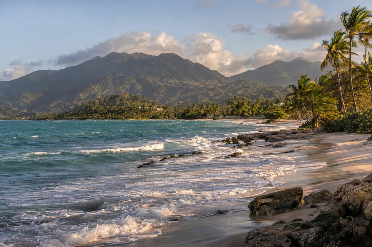
Where is Puerto Rico and what is it like?
Puerto Rico is a U.S. territory in the northeastern Caribbean, a main island of beaches, rainforest and mountains with two smaller islands, Culebra and Vieques, off its east coast. The main island is about 100 miles long.
It is only about 35 miles wide, so a morning in the rainforest and an afternoon on a beach can easily share the same day. Spanish and English are both official languages, and you will hear Spanish nearly everywhere outside the tourist areas, so a few words go a long way.
The island never has a true winter. It is warm and humid all year, with a drier season from about December to April and a wetter one from about May to November. The north coast and the central mountains collect the most rain, while the south and west coasts are generally drier and hotter. The sea stays warm in every month, which is why people swim, snorkel and paddle here all year.
The character of the place comes from layers. There is the Spanish colonial city with its forts and plazas, the Taino and African roots that show up in the food and the music, and a modern island that loves its Sunday beach days, its roadside kiosks and its long Christmas season. People tend to describe the island as friendly and loud in the best way, with a radio on somewhere and a plate of food always on its way to the table.
It suits almost every kind of traveler. Couples and history lovers settle into Old San Juan, families head for calm beach parks and the rainforest, surfers go west, and anyone who wants quiet takes the small ferry to Culebra or Vieques. For U.S. citizens, getting there means a domestic flight, no passport and no visa, and the same dollar in your pocket.
Where to go in Puerto Rico
San Juan
San Juan, the capital on the north coast, is where most trips begin. Old San Juan is a walled colonial city on a small islet, with pastel townhouses, shady plazas and two Spanish forts, El Morro and San Cristobal, which belong to a UNESCO World Heritage Site inscribed in 1983. It is a city for walking slowly, ducking into cafes and following the sea breeze along the old walls.
Beyond the old city, Condado and Isla Verde are the beach-and-hotel strips, and Santurce is the arts and food district around Calle Loiza, full of murals, bars and new kitchens. Pinones, east of the airport, is the place for fritters at beachside kiosks. The city beaches face the Atlantic, so surf changes from day to day, and the Balneario de Escambron, just outside the old city, is known for calmer water inside a reef.
Fajardo and the northeast
Fajardo, on the northeast corner of the island, is a marina town and the base for catamaran and sailing day trips to the cays offshore. Icacos, a small uninhabited cay reached by boat, is the classic day out, with white sand and snorkeling. At night, Laguna Grande inside the Las Cabezas de San Juan Nature Reserve is a bioluminescent bay usually visited by kayak with a guide, and the glow is strongest on dark, moonless nights.
On the coast road from San Juan, Luquillo beach and its row of food kiosks make an easy stop, close to the turnoff for El Yunque. Fajardo is also the jumping-off point for the islands, though the public ferries to Culebra and Vieques leave from the port of Ceiba, a short drive south.
Culebra
Culebra lies about 17 miles east of the main island and is reached by public ferry from Ceiba or by a short flight. It has one town, Dewey, a quiet harbor and no large resorts, and visitors get around on rented golf carts and bikes. Flamenco Beach is a wide horseshoe of pale sand and clear shallow water, known for the rusted military tanks left on the sand.
Snorkelers head to Carlos Rosario Beach, a short walk from Flamenco, where a coral reef sits close to shore, and to Tamarindo Beach on the west side, where green sea turtles are often seen feeding over the seagrass. Zoni Beach, at the eastern end, is long, quiet and far less visited. Around mid-July, the Virgen del Carmen, patron saint of fishermen, is honored with a procession of boats in the harbor of Dewey.
| Site | Open |
|---|---|
| Culebra National Wildlife Refuge, public areas and hiking trails | Every day, 6:00 AM to 6:00 PM |
Vieques
Vieques is the larger island southeast of Fajardo, reached by public ferry from Ceiba or by small plane. Much of the land was once a U.S. Navy range and is now a wildlife refuge, which left long, undeveloped beaches, and wild horses roam its roads and beaches. Isabel Segunda is the ferry town on the north coast, while Esperanza, on the south coast, is a laid-back waterfront village of guesthouses and open-air restaurants.
Sun Bay, Red Beach and Blue Beach are among the most visited stretches of sand. After dark, Mosquito Bay is the island’s big draw, visited by kayak or electric boat with a guide. The glow is strongest on moonless nights, and when it works, every paddle stroke leaves a trail of blue light.
Rincon and the west
Rincon is a small town on the west coast and the island’s surf capital, host of the 1968 World Surfing Championships. In winter, swells from the north bring big waves to breaks such as Domes and Tres Palmas. In summer the water flattens, and the beaches suit swimming, snorkeling and paddleboarding. Facing west, the town is known for its sunsets, and evenings on the sand are a local habit.
From about January to March, humpback whales pass offshore, and they can sometimes be seen from the lighthouse area at Punta Higuero. The beaches around Aguadilla, close by, add more sand and an airport with commercial flights.
Ponce
Ponce, the island’s second city and the Pearl of the South, sits on the drier, hotter south coast. Its historic center is built around Plaza Las Delicias, the red-and-black striped Parque de Bombas firehouse and the Ponce Museum of Art. The pace is slower than in San Juan, with benches under trees and ice cream vendors working the plaza in the afternoon.
Castillo Serralles, a 1930s mansion on a hill above the city, gives views toward the sea, and La Guancha is the boardwalk by the water. In the weeks before Lent, Carnaval de Ponce fills the streets with parades of vejigantes in horned masks.
Things to do in Puerto Rico
Walk the forts and old streets of San Juan
Start at El Morro in the morning, when the lawns are cooler and the sea wind carries over the walls, then follow the old ramparts toward San Cristobal. The forts are part of the San Juan National Historic Site, and the standard pass covers both for a full day. The park does not take cash, so bring a card.
Afterward, wander the blue-gray streets to the plazas, peek into courtyards and stop for coffee. Free entrance days still ahead include October 27 and November 11, which can be a good excuse to plan around.
Spend a morning in El Yunque
El Yunque is the rainforest in the northeast, not far from Luquillo. The main visitor center, El Portal, shows a film in Spanish and English, has a full restaurant and keeps live Puerto Rican parrots on view. Rangers lead walks and talks every day, and there is a fully accessible trail, so the whole family can get a taste of the forest.
Go early, wear shoes that can get wet and expect a shower, since the northeast is among the rainier parts of the island. Many people pair the morning with lunch at the Luquillo kiosks and an afternoon on the beach.
Watch the water glow
Puerto Rico has three bioluminescent bays: Mosquito Bay in Vieques, Laguna Grande near Fajardo and La Parguera in Lajas on the southwest coast. They glow all year, with the strongest glow on moonless nights. Tours are usually by kayak or boat with a guide, and the glow is a chance, never a promise.
Pick the bay by where you are staying. Laguna Grande is an easy night out from San Juan or Fajardo, La Parguera suits the southwest, and Mosquito Bay is the reason many people sleep on Vieques.
Eat your way around the island
Puerto Rican cooking centers on mofongo, mashed fried plantain, along with pasteles, lechon asado (roast pork), tostones, alcapurrias, piraguas (shaved ice with syrup) and tembleque, a coconut pudding. You find them at chinchorros, the casual roadside restaurants, at beach kiosks and in cafes. Coffee from the central mountains and rum are the island’s best-known drinks.
Pinones and Luquillo are good places for fritters, and Santurce for newer kitchens. Piraguas are the right answer to a hot afternoon anywhere.
Beaches, snorkeling and whales
Beach days range from the surf of Rincon to the reef-protected water at Escambron and the sheltered shores of Culebra and Vieques. Conditions change from day to day and beach to beach, so follow any flag, sign or lifeguard you find. In some springs and summers, sargassum seaweed can reach east and south coasts.
Add festivals to the calendar. The long Christmas season ends with the Calle San Sebastian street festival in Old San Juan in mid to late January, Carnaval de Ponce comes before Lent, and humpback whales pass the west coast in winter. In spring and summer, sea turtles nest on some beaches.
When to visit Puerto Rico
The drier season, from about December to April, is the easiest time for beaches, hiking and walking Old San Juan, with trade winds softening the heat. It is also the season of big winter swells on the north and west coasts, which delights surfers in Rincon but makes some beaches rough for swimming. Whales pass the west coast in the early part of the year.
From about May to November the island is wetter and more humid. Rain often comes as an afternoon downpour followed by sun, and the north coast and the central mountains see the most of it. The south and west coasts stay drier, so Ponce and Rincon can be good choices when San Juan and El Yunque are damp. Summer is the calm, clear season for snorkeling on the west coast.
The Atlantic hurricane season, which covers the Caribbean Sea, runs from June 1 to November 30. The peak comes in September, with most activity from mid-August to mid-October. A trip in those weeks needs a flexible plan, and the right habit is to follow the National Hurricane Center and local official alerts as the trip approaches.
Holidays shape the crowds. The Christmas season runs from late November into mid-January, with parrandas (singing house visits) and Three Kings Day on January 6. Holy Week fills the beaches when it falls in spring, and midsummer brings the Noche de San Juan Bautista on June 23, when people walk into the sea at midnight. Culebra’s Virgen del Carmen boat procession in mid-July is a small, local pleasure.
Getting around Puerto Rico
Most visitors fly into Luis Munoz Marin International Airport in San Juan, the main airport. Aguadilla in the northwest and Ponce in the south also have commercial flights, which saves a long drive if you are heading to Rincon or the south coast.
A rental car is the usual way to see the island beyond San Juan. It gives access to the rainforest, the Luquillo kiosks, the coffee towns and the west coast beaches. Mountain roads are winding and slow, so allow extra time.
Within Old San Juan, you simply walk. The streets are narrow and steep in places, comfortable shoes matter, and a car is more nuisance than help there.
For the islands, public ferries to Culebra and Vieques leave from Ceiba, a short drive south of Fajardo, never from Fajardo itself. Both islands can also be reached by small plane, and on Culebra visitors get around on rented golf carts and bikes. Marinas in Fajardo run private catamaran and sailing day trips to the cays.
Good to know before you go
The currency is the U.S. dollar, and the forts of San Juan take cards only. Common-sense habits apply as in any city: keep valuables out of sight on the beach and in parked cars. Sea conditions change quickly, so respect flags and signs on every beach, and follow local official alerts if a storm is forecast during hurricane season.
Sources
- National Park Service, San Juan National Historic Site, Fees & Passes (https://www.nps.gov/saju/planyourvisit/fees.htm), checked October 8, 2026
- Recreation.gov, El Yunque National Forest tickets (https://www.recreation.gov/ticket/facility/10089811), checked October 8, 2026
- U.S. Fish and Wildlife Service, Culebra National Wildlife Refuge (https://www.fws.gov/refuge/culebra), checked October 8, 2026
- NOAA National Hurricane Center, Climatology (https://www.nhc.noaa.gov/climo/), checked October 8, 2026
All our pages
When to go
- Best Time to Visit Puerto Rico: Dry Season, Hurricane Season, Beaches and Festivals
- Puerto Rico in January: Weather, Three Kings Day, San Sebastian Street Festival and Where to Go
- Puerto Rico in March: Weather by Coast, Whales, Carnaval Season and Where to Go
- Puerto Rico in April: Weather by Coast, Beaches, Holy Week and What to Do
- Puerto Rico in June: Weather, Noche de San Juan and Beaches by Coast
- Puerto Rico in July: Weather, Beaches, Santiago Apostol in Loiza and What to Do
- Puerto Rico in August: Weather, Beaches, Bioluminescent Bays and Hurricane Season
- Puerto Rico in September: Weather, Hurricane Season, Beaches and What to Do
- Puerto Rico in October: Weather by Coast, Beaches, Rain Showers and What to Do
- Puerto Rico in November: Weather, Early Christmas Season and Where to Go
- Puerto Rico in December: Weather, Christmas Parrandas and Where to Go
- Puerto Rico Hurricane Season: Dates, Peak Months and Whether to Go
Things to do
- Things to Do in Puerto Rico: Old San Juan, Beaches, Bioluminescent Bays and Island Food
- 3 Days in Puerto Rico: Itinerary for San Juan, El Yunque and the Northeast Coast
- 5 Days in Puerto Rico: Itinerary with San Juan, El Yunque and Vieques
- The Best Beaches in Puerto Rico: Flamenco, Culebra, Vieques and Luquillo
- Bioluminescent Bays in Puerto Rico: Mosquito Bay, Laguna Grande, La Parguera and the Best Nights to Go
- Boqueron: Blue Flag Beach, Seafood, Nightlife and the Salt Flats Nearby
- Caja de Muertos Island: Beaches, Lighthouse, Nature Reserve and How to Get There
- Rio Camuy Cave Park: Underground River, Giant Sinkholes and Nearby Caves
- San Cristobal Castle: Ramparts, Tunnels, Tickets and How to Get There
- Icacos Island: Snorkeling, White Sand and the Water Taxi from Fajardo
- Crash Boat Beach: Old Military Pier, Snorkeling and Getting There from Aguadilla
- Cueva Ventana: Arecibo Cliff Cave, Guided Tours and How to Get There
- Do They Speak English in Puerto Rico? Spanish, Menus and Everyday Phrases
- Do You Need a Passport for Puerto Rico?: ID Rules, REAL ID and Flying from the Mainland
- Flamenco Beach, Culebra: Tanks, Sooty Terns, Getting There and When to Go
- Puerto Rican Food and Drink: Mofongo, Beach Kiosks, Old San Juan and Where to Eat
- Guanica Dry Forest: Trails, Endemic Birds, the Ancient Guayacan and Getting There
- Hacienda Buena Vista: Coffee History, the Barker Turbine and a Day Above Ponce
- Puerto Rico Honeymoon: Old San Juan, Culebra, Vieques and Bioluminescent Bays
- La Parguera Travel Guide: Bioluminescent Bay, Fishing Town Life and Southwest Day Trips
- La Parguera Bioluminescent Bay: Night Glow, Southwest Coast Setting and Best Time to Go
- La Perla: Painted Houses, Bomba on the Malecón, El Bowl and How to Reach It
- Patillas Travel Guide: Beaches, Charco Azul, Carite Forest and Festivals
- Pinones: Beachside Kiosks, Fritters, Coast and Mangroves
- Renting a Car in Puerto Rico: Do You Need One, Tolls, Roads and Your License
- Snorkeling and Diving in Puerto Rico: Culebra, Icacos Cay, Caja de Muertos and Getting on the Water
- Surfing in Puerto Rico: Rincon, Aguadilla, Isabela and When the Swells Arrive
- Puerto Rico with Kids: El Yunque, Old San Juan Forts, Glowing Bays and Family Beaches
Where to stay
Getting there
- Getting Around Puerto Rico: Rental Cars, Tolls, Carros Publicos and Ferries to Culebra and Vieques
- Flights to Puerto Rico: Airports, Which One to Choose and Nonstop Options
Practical
- Know Before You Go to Puerto Rico: ID, Money, Getting Around and Local Customs
- Is Puerto Rico Safe?: Safety by Area, Getting Around, Beaches and Hurricane Season
- Condado vs Isla Verde: Beaches, Nightlife, Getting Around and Who Each Suits
- Condado vs Old San Juan: Beaches, Forts, Nightlife and Where to Stay
- Rincon vs Aguadilla: Beaches, Surf Breaks, Things to Do and Getting There
Places
- San Juan Travel Guide: Old San Juan, Beaches, Food and Where to Stay
- Ponce Travel Guide: Plaza Las Delicias, Art Museum, Caja de Muertos and Carnaval
- Culebra Travel Guide: Flamenco Beach, Snorkeling, Getting There and the Best Time to Go
- Aguadilla Travel Guide: Crash Boat Beach, Surf, Sunsets and Day Trips to Rincon and Isabela
- Vieques Travel Guide: Mosquito Bay, Wild Horses, Beaches and How to Get There
- Luquillo Travel Guide: Luquillo Beach, El Yunque Rainforest and the Coconut Festival
- Dorado Travel Guide: Beaches, Resort Life, Ojo de Buey and When to Go
- Fajardo Travel Guide: Icacos Cay, Laguna Grande at Night and the Islands Beyond
- Arecibo Travel Guide: Cueva Ventana, the Observatory Site, Lighthouse and North Coast Beaches
- El Yunque National Forest: Waterfalls, Rainforest Trails and How to Plan Your Visit
- Old San Juan Travel Guide: Forts, Blue Cobblestones, La Perla and Where to Stay