
A green sea turtle lifts its head from a meadow of seagrass, takes a breath, and sinks back to its lunch while a few snorkelers float quietly above it. Scenes like this repeat all year around the small islands and cays that ring Puerto Rico, where the water stays warm in every season. The best of it lies off Culebra, the cays of Fajardo and the south coast near Ponce, and it suits first-time snorkelers as much as certified divers.
Where is the best snorkeling in Puerto Rico?
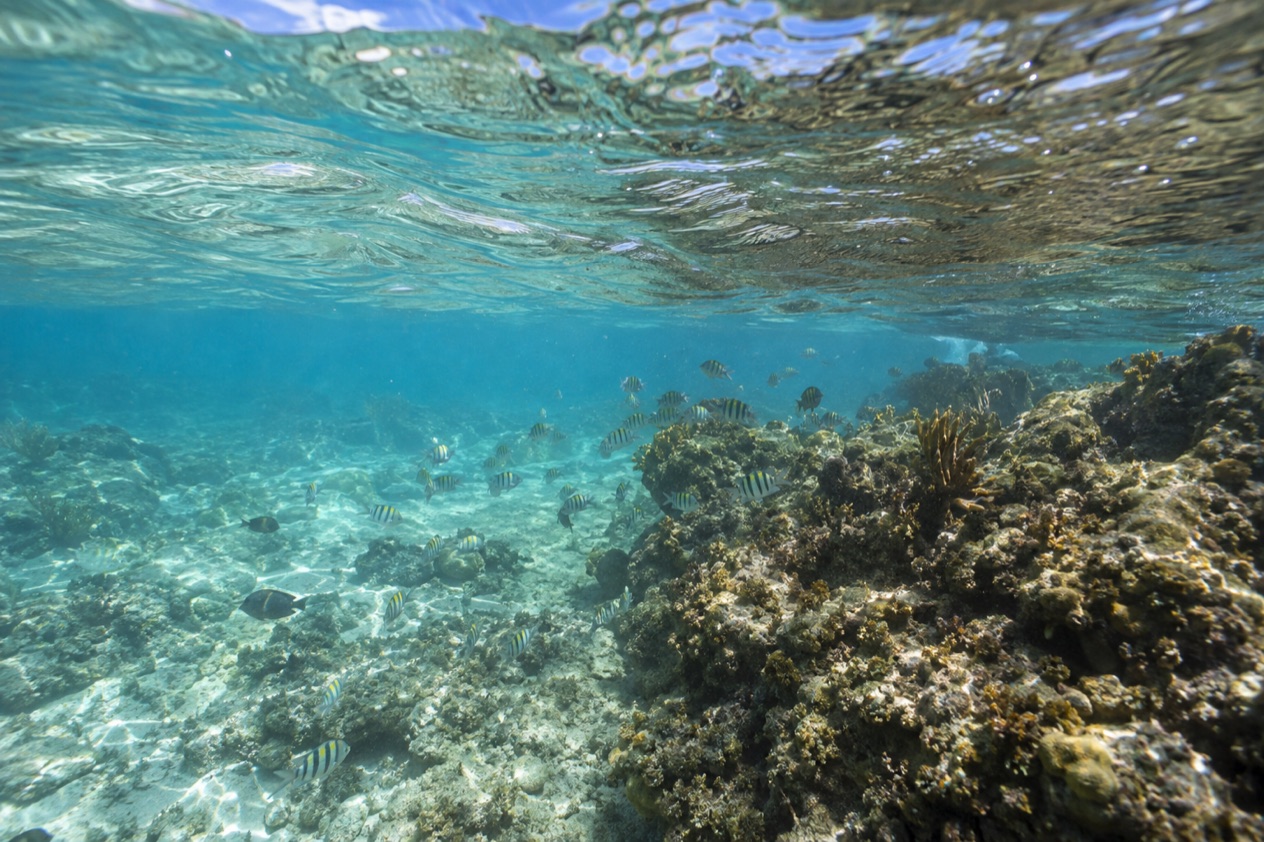
The best snorkeling is on the small islands off the east and south coasts, with Culebra the favorite and Icacos Cay and Caja de Muertos close behind. These are places where reef, seagrass and clear shallow water sit a short swim from the sand, so you can drift over fish and turtles without any gear beyond a mask and fins.
The sea stays warm all year, so there is no wrong month to get in the water. The shore’s character shifts instead, since each beach and each day brings its own conditions, so check the water before entering, and obey any flag, sign or lifeguard you find there. Sargassum seaweed can show up on the east and south coasts during some springs and summers, but that is only a chance, not a sure thing.
Culebra: turtles and a reef near the sand
From Ceiba, you can reach Culebra by public ferry or on a quick flight, and this little island sits right off the northeast coast. Dewey is its only town, the harbor stays quiet, big resorts are absent, and travelers explore by way of bikes and golf carts they rent. Mornings begin with feral chickens wandering the road and the smell of coffee from the waterfront, then the day belongs to the beaches.
Tamarindo Beach, on the west side, is the snorkeling beach to know. You will often see green sea turtles feeding on the seagrass, so keep your movements slow and calm, hold your distance, and allow them to do whatever they like. A coral reef sits close to shore at Carlos Rosario Beach, just a short walk from Flamenco Beach, so it suits anyone who would rather not swim a long way from the sand.
Flamenco Beach is the famous one, a wide horseshoe of pale sand with clear shallow water and the rusted military tanks left on the beach. It works well for paddling and a swim, but at the eastern end Zoni Beach stretches out long and calm, with noticeably fewer people around. Pack a mask for all of them, and plan a day that mixes a snorkel stop with a long, lazy hour on the sand.
Icacos Cay: a day on the water from Fajardo
Icacos is the largest uninhabited cay in a chain of cays, reefs and skerries off the coast of Fajardo, and it is part of La Cordillera Reef Nature Reserve. It is a popular snorkeling and beach destination, a spot of sand and clear water with nothing built on it, so the day is about swimming, floating and a picnic in the shade of whatever you carry.
A water taxi from Fajardo makes the crossing in about fifteen minutes. That short hop means you can have a full morning in the water and still be back on the mainland for a late lunch of fried snacks such as alcapurrias (fritters of mashed root vegetables stuffed with meat) from a roadside kiosk. It suits families, groups of friends and anyone who wants a taste of the cays without a long trip.
Caja de Muertos: the south coast option
Caja de Muertos is an uninhabited island off the southern coast, in the municipality of Ponce, and the island and its surrounding waters are protected as a nature reserve. It has five beaches: Playa Pelícano, Playa Ensenadita (known as Pocitas), Playa Larga, Playa Blanca (also called Playa Coast Guard) and Playa Chica. Each has its own feel, from long open sand to small sheltered corners.
The ferry leaves from the La Guancha Boardwalk area of Ponce Playa, and the island faces the Caribbean, so the south coast gives you a different sea from the Atlantic-facing north. A still-working lighthouse crowns the island’s highest hill. Plan a swim and a snorkel in the morning, then a hike and a rest in the shade.
Where can you dive in Puerto Rico?
You can dive around the same island groups that draw snorkelers, chiefly Culebra, the cays off Fajardo and the reefs off Ponce and the south coast, where the warm water and protected reserves give you coral, fish and the occasional turtle. Diving here is a year-round pastime, and the better question is which side of the island suits your mood and your experience.
Big winter swells reach the north and west coasts from the Atlantic, which means getting into the water there can be tough now and then. Culebra offers both protected coves and open shores, while the Caribbean lies along the south coast. Conditions change from day to day, and a dive operator will read them better than any guide, which is a good reason to dive with a local shop rather than on your own.
Around Culebra and its cays
Culebra sits at the center of a refuge that encompasses 21 offshore cays, and the island is part of a larger group that includes Culebrita and its protected Tortuga Beach. For a diver, this means a patchwork of reef and small islands, with seabirds overhead and turtles using the nearby beaches for nesting. Leatherback, green and hawksbill turtles all come ashore on Culebra.
The Culebra archipelago is arid and has no rivers or streams. Divers who base themselves here find a slow rhythm, with morning dives, an afternoon swim at the beach and dinner in Dewey. Between mid-July festivities and the quiet of other months, the harbor town stays small and friendly.
The south coast near Ponce
Caja de Muertos sits about five miles south of the mainland, and its protected waters make it a natural stop for divers based in Ponce. Caja de Muertos and its surrounding waters are protected as a nature reserve, while conditions depend on the day and the wind.
If you are not certified to dive, you can still enjoy the water at the surface with a mask and snorkel. After the water, Ponce itself has its old plaza, its firehouse painted in red and black stripes and plenty of places for a long lunch.
Choosing when to go
The Atlantic hurricane season runs from June 1 to November 30, with most activity between mid-August and mid-October. Outside that window, boat trips are less likely to be disrupted by a distant system, though weather can change at any time of year. During hurricane season, stay flexible with your dive plans and follow both the National Hurricane Center and updates from local officials.
Winter brings the drier season and the big Atlantic swells to the north and west, while summer is calmer on those coasts. For a trip built around the east and south, the choice of month matters less than the choice of day, so keep a spare morning in your schedule.
Do you need a boat to snorkel in Puerto Rico?
No, you do not always need a boat, because several of the best spots can be reached from the sand. Tamarindo Beach and Carlos Rosario Beach on Culebra are snorkeling beaches you can walk into, and both have the seagrass or coral close to shore. The boat becomes useful when you want the cays and the more distant reefs.
From the beach
On Culebra, a day without a boat can be a very good one. You rent a golf cart or a bike, carry a mask and fins, and move between Carlos Rosario for the reef and Tamarindo for the turtles. Between swims you can walk the quiet shore, find shade under a sea grape and watch the pelicans.
The refuge’s public areas and hiking trails are open every day, and you can feel the rhythm of those hours as you wander. A beach snorkel lets you return to the sand to rest between swims.
| Site | Open |
|---|---|
| Culebra National Wildlife Refuge (public areas and trails) | Every day, 6:00 AM to 6:00 PM |
By water taxi or ferry
Icacos Cay needs a boat, and the water taxi from Fajardo is the usual way, a ride of about fifteen minutes. Caja de Muertos needs one too, with the ferry leaving from the La Guancha Boardwalk in Ponce Playa. Culebra itself is reached by the public ferry from Ceiba, which is the departure point for the island ferries, or by a short flight.
These short crossings turn the water itself into part of the day. You watch the coast shrink, the color of the sea shift from green to blue, and the cay come into view with its pale strip of sand. For travelers who want a first taste of island hopping, Icacos is the easiest introduction, and Culebra is the richer one for a longer stay.
Good to know before you go
Travelers holding U.S. citizenship need no passport or visa to come here, and the U.S. dollar is accepted for all purchases on the island. Bring a mask, fins and sunscreen, and respect the nature reserves: the turtles, seagrass and coral are the reason these places are special.
Follow beach flags, signs and lifeguards where they exist, since conditions shift from beach to beach and day to day. The Atlantic hurricane season runs from June 1 to November 30, so follow the National Hurricane Center and local alerts when you plan.
Sources
- U.S. Fish and Wildlife Service, Culebra National Wildlife Refuge (https://www.fws.gov/refuge/culebra), checked October 8, 2026
- Wikipedia, Culebra (https://en.wikipedia.org/wiki/Culebra,_Puerto_Rico), checked October 8, 2026
- Wikipedia, Cayo Icacos (https://en.wikipedia.org/wiki/Cayo_Icacos), checked October 8, 2026
- Wikipedia, Caja de Muertos Island (https://en.wikipedia.org/wiki/Caja_de_Muertos_Island), checked October 8, 2026
- NOAA National Hurricane Center, Climatology (https://www.nhc.noaa.gov/climo/), checked October 8, 2026
To plan your stay
- Best Time to Visit Puerto Rico: Dry Season, Hurricane Season, Beaches and Festivals
- Where to Stay in Puerto Rico: San Juan, Rincon, Vieques and the Best Areas for Your Trip
- Getting Around Puerto Rico: Rental Cars, Tolls, Carros Publicos and Ferries to Culebra and Vieques
- Know Before You Go to Puerto Rico: ID, Money, Getting Around and Local Customs