
By the middle of this trip you are standing on a dark road on Vieques, the coquí frogs singing from the trees and the last of the rainforest mist still in your hair from the morning. Old San Juan’s blue-gray cobblestones and the fort walls overlooking the Atlantic now lie back behind you. The route runs from the capital to the northeast rainforest and out to the island, a first taste of Puerto Rico for anyone who wants history, jungle, food and a quiet Caribbean night.
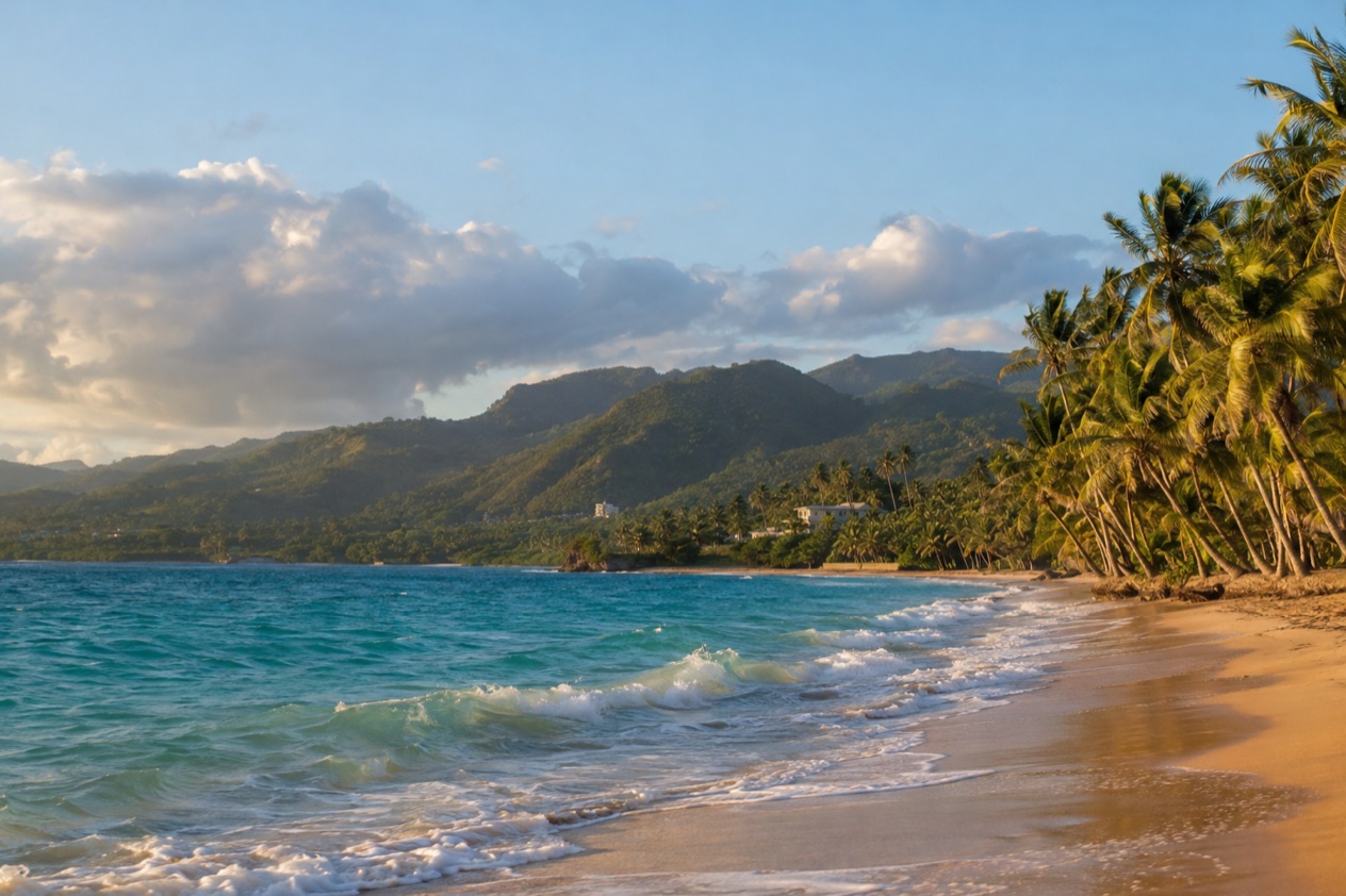
Is 5 Days enough for Puerto Rico?
Yes, for a first visit, and it suits travelers who like to sleep in few places and still feel they have seen the island change from city to forest to sea. With a size of roughly 100 miles by 35 miles, the main island is compact enough that a route centered on San Juan and the northeast never feels like a stretch.
You will not see everything. You will see enough to know which half of the island you want to come back for.
The route here starts in the capital, where the walled colonial city, the beach strips and the food districts could fill days on their own. Next the journey heads east toward El Yunque, a rainforest counted among the island’s two UNESCO biosphere reserves, then continues to the shoreline close to Fajardo. It ends on Vieques, reached by the public ferry from Ceiba, with its famous bioluminescent bay and its quieter pace.
What the route leaves out is a lot. The west coast, with Rincon and the beaches around Aguadilla, is a different trip, shaped by surf in winter and snorkeling in summer. Ponce and the hotter, drier south have their own architecture and light.
In the central mountains you get the coffee towns and cooler air, while the Guánica reserve, the second biosphere reserve, is dry forest and not rainforest. Culebra, the other small island off the east coast, deserves its own stay.
There is also the matter of pace. Puerto Rico rewards a slow table, a second coffee, an afternoon on a plaza bench while the rain passes. The route keeps each day to one main idea and leaves room around it, so that the food stops, the beach stops and the long dinners are part of the plan rather than casualties of it.
Because Puerto Rico is a U.S. territory, U.S. citizens need no passport and no visa, the dollar is the currency and the flight from the mainland is a domestic one. That removes the usual first-day friction. You can land, drop your bags and be eating alcapurrias at a roadside kiosk the same afternoon.
If you have fewer days, drop the island stage and stay with San Juan and El Yunque. If you have more, add the west or the south rather than squeezing in extra stops. The sections below cover how to adapt the route and what to settle first.
The itinerary stage by stage
Three stages carry the trip: the capital, the rainforest and northeast coast, and the island of Vieques. Each one changes the scenery and the mood, and each one ends with a short, easy move toward the next.
Days 1 and 2: San Juan
Once you have arrived and gotten settled, give your first afternoon to Old San Juan, a colonial city behind walls on a tiny islet, where pastel townhouses, plazas and slim streets of blue cobblestone await. Stroll the Paseo de la Princesa beside the southern wall to take in the bay and the city walls, then go through Puerta de San Juan, the sole surviving original gate of the city. Dinner can be mofongo, the mashed fried plantain that anchors the local table, or lechon asado, the slow-roasted pork.
Day two puts El Morro and San Cristobal in the spotlight, a pair of Spanish forts forming the San Juan National Historic Site, which in turn belongs to a UNESCO World Heritage Site. Go early, when the stone is cool and the wind off the Atlantic is strongest, and finish with lunch in a café on a plaza. Later, head to Balneario de Escambron, a public beach park known for calmer water inside a reef, yet the city beaches face the Atlantic and conditions change from one day to the next.
As night falls, you could make your way to Santurce, the neighborhood of arts and food close to Calle Loiza, or enjoy an evening out on the Condado strip. If you would rather eat like a local, Pinones, east of the airport, has beachside kiosks selling alcapurrias and bacalaitos, the fritters that are easy to eat with your hands.
For atmosphere, stay in Old San Juan, or pick Condado or Isla Verde when you’d like the beach right outside your door. The move east to the next stage is a short morning drive out of the city.
Day 3: El Yunque and the northeast coast
El Yunque is the rainforest of the northeast, a National Forest and a UNESCO biosphere reserve. Expect heat, humidity, mist and sudden showers, with huge ferns and the loud chorus of the coquí, the small frog that has become a symbol of Puerto Rican pride. Spend the morning there, when cloud often sits low on the peaks and the air is cooler, and bring a light rain layer even on a sunny start.
When afternoon comes, make your way to the coast by Fajardo, the launching point for boats bound for Laguna Grande, which ranks among Puerto Rico’s three bioluminescent bays. They shine throughout the year, brightest when no moon is out, so think of a visit as a possibility instead of a guarantee, and check the moon calendar to choose between tonight and the night on Vieques. Dinner at a roadside chinchorro, the casual restaurants of the island, suits the mood after a day outdoors.
Sleep near Fajardo or Ceiba so that the ferry is a short hop the next morning. As you choose where to stay, remember that the public ferries for Culebra and Vieques leave from Ceiba, not Fajardo.
Days 4 and 5: Vieques and the way back
Travel by public ferry from Ceiba to Vieques on the fourth day. The island feels a world away from San Juan: quieter roads, wide beaches, small guesthouses and the sense that the day will take the shape you give it. After you get there, you will discover calm, protected coves along with open stretches of shore brushed by the wind, so check out each beach, heed every flag, sign or lifeguard you come across, and keep in mind that conditions differ from one beach to the next.
On a moonless night the water can light up around anything that moves through it, and on a bright night the effect may be fainter. Eat dinner early and slowly beforehand, and do not plan anything else for the night.
On the last day keep the morning gentle, with coffee, one more beach and a lunch you do not rush. Then take the ferry back to Ceiba and the road to San Juan’s Luis Munoz Marin airport only if the ferry timetable leaves a comfortable cushion before your flight. A flight from the island is simpler if you have not packed the last day with sights.
Getting between stops
| Leg | How |
|---|---|
| Mainland to San Juan | Flight to Luis Munoz Marin International Airport |
| San Juan to El Yunque | Road, heading east along the northeast coast |
| El Yunque to Fajardo and Ceiba | Road, continuing along the coast |
| Ceiba to Vieques | Public ferry from Ceiba |
| Vieques to San Juan airport | Public ferry to Ceiba, then road west |
Most of this route is a single line from west to east, which keeps the planning simple. San Juan’s airport is the main gateway, and nearly every itinerary begins and ends there. Commercial service is also available in the northwest at Aguadilla and in the south at Ponce, a plus should the west coast or the south join a longer trip down the road.
Between San Juan and the northeast, you travel on the road. The route follows the north coast and then turns toward the mountains of El Yunque, with the Atlantic on one side and green hills on the other.
A drive here is part of the scenery and gives you the freedom to stop at a beach or a roadside kiosk. Look to the weather, because rain in the northeast can come quickly and change how a road feels.
The only water crossing is the ferry to Vieques, which is public and leaves from Ceiba. That small port is the hinge of the trip, the place where the mainland ends and the island pace begins. Treat the crossing as part of the day rather than a gap in it, with a sit by the rail and the view of the east coast sliding by.
If you prefer not to drive, a trip like this can be reshaped around San Juan alone, with the city’s sights on foot. In Old San Juan, folks travel by car or on foot these days, and the free trolley that once served the area is gone. For the rainforest and the islands, though, you will want a plan for the road, and it is worth settling it before you land.
What to book before your 5 Days in Puerto Rico
The forts of San Juan have a clear entry rule. A single pass, good for 24 hours, gets you into El Morro and San Cristobal, so you can take your time at both. Everyone over the age of 16 needs a pass, including passengers in a vehicle, and children under 16 do not.
The park does not accept cash, so plan to pay by card. If you already hold a national parks pass, bring it. The America the Beautiful annual pass costs $80 for U.S. citizens and residents, and there are free or reduced versions for seniors, military families, people with permanent disabilities and fourth graders. A few free entrance days are also scheduled through the year, which is worth a look if your dates are flexible.
Next comes your sleeping plan for the island. The ferry from Ceiba is the key link, and so the nights at either end of it, one near Fajardo or Ceiba and one on Vieques, are the ones to settle first. Choose a base for those nights before anything else and the rest of the route falls into place around them.
The bioluminescent bays are the other piece of timing that deserves attention. Mosquito Bay, which sits on Vieques, and Laguna Grande, located near Fajardo, both shine throughout the year, yet the darkest nights without a moon give the best show.
Look at the moon calendar for your dates and decide which night you want to be on the water, then arrange your visit around that rather than the reverse. A bright full moon can dull the glow, and a visit is always a chance rather than a certainty.
Leave plenty free. A rainforest morning can change with the clouds, a beach day with the swell, and an Old San Juan afternoon with a long lunch that turns into a longer one. Leave the evening of day two open for Santurce or for Pinones, and keep the last day on Vieques unplanned. The best parts of Puerto Rico are often the stops you did not schedule.
Adapting the route
For a shorter trip, keep San Juan and El Yunque and drop the island. A long weekend of a night in Old San Juan, a rainforest morning and a night near Fajardo still gives a sense of the place, and the bay at Laguna Grande can stand in for the one on Vieques. You lose the quiet of the small island but keep most of the route’s character.
For a longer trip, add the west or the south rather than more days in the same corner. Winter brings sizable waves to Rincon, the island’s surfing hub, while summer offers gentler seas for snorkeling, and from roughly January through March, humpback whales swim by off the west coast.
Ponce delivers a hotter, drier climate plus colonial streets of its own, while coffee towns and cooler air await you in the central mountains. Culebra makes a second island stay.
All year long, Puerto Rico stays warm and humid. From roughly December through April the weather turns drier, which is great for spending hours outside, while roughly May through November tends to be wetter, with rain falling harder and more often, especially along the north coast and up in the mountains. The south and west are generally drier. In El Yunque rain is part of the experience, and a light rain layer is useful in every month.
The Atlantic hurricane season runs from June 1 to November 30, with the peak on September 10 and most activity between mid-August and mid-October. Pick a month beyond that window and you are past the official hurricane season, yet conditions can shift quickly, so if you go during that time, keep up with the National Hurricane Center and with updates from local officials. During certain trips in spring and summer, sargassum seaweed can appear on the east and south coasts, so check conditions when picking your beaches.
For families, the route works well with a few adjustments. Escambron’s reef-sheltered water is a gentler start than most city beaches, and kiosks serve alcapurrias and piraguas, shaved ice with syrup. Kids who have not yet turned 16 can visit the forts without a pass. Beaches change from day to day, so check each one and follow any flag or sign.
For a slower trip, give each stage an extra night rather than adding a stage. A third night in San Juan lets you wander Santurce and linger over tembleque, the coconut pudding. A second night on Vieques lets you watch the island settle into evening twice. The route works because it is spacious, and stretching it only makes that clearer.
Good to know before you go
Since the forts in Puerto Rico run on the U.S. dollar but accept no cash, paying by card is the smarter routine there. Puerto Rico keeps Atlantic Standard Time the whole year and never switches to daylight saving time, which means the difference from the East Coast shifts depending on the season.
Spanish and English are both official there, which means a little Spanish carries you surprisingly far. Keep to the usual travel habits with your belongings and your plans, and follow local official alerts if weather turns during the hurricane season.
Sources
- Wikipedia, Puerto Rico (https://en.wikipedia.org/wiki/Puerto_Rico), checked October 8, 2026
- National Park Service, San Juan National Historic Site, Fees & Passes (https://www.nps.gov/saju/planyourvisit/fees.htm), checked October 8, 2026
- National Park Service, San Juan National Historic Site, Hours & Operating Seasons (https://www.nps.gov/saju/planyourvisit/hours.htm), checked October 8, 2026
- Wikipedia, Old San Juan (https://en.wikipedia.org/wiki/Old_San_Juan), checked October 8, 2026
- NOAA National Hurricane Center, Climatology (https://www.nhc.noaa.gov/climo/), checked October 8, 2026
To plan your stay
- Best Time to Visit Puerto Rico: Dry Season, Hurricane Season, Beaches and Festivals
- Where to Stay in Puerto Rico: San Juan, Rincon, Vieques and the Best Areas for Your Trip
- Getting Around Puerto Rico: Rental Cars, Tolls, Carros Publicos and Ferries to Culebra and Vieques
- Know Before You Go to Puerto Rico: ID, Money, Getting Around and Local Customs