
Somewhere between the first rum punch and the second round of fry jacks, almost every traveler is asked the same thing by a friend back home: where exactly is Belize? The short answer is that it is a small, English-speaking country on the Caribbean side of Central America, on the Yucatán Peninsula, with a long barrier reef off its shore and rainforest behind it.
Where is Belize located?
Belize sits on the Yucatán Peninsula in Central America, at about 17°15′ north of the equator and 88°45′ west of the Prime Meridian. That puts it in the tropics, which explains the rainforest, the warm sea and the rhythm of wet and dry seasons that shape every trip.
It is a small country. The area is 22,970 square kilometers (8,867 square miles), and the 2022 census counted 397,483 people. Those numbers help explain why a single trip can take you from a reef caye to a jungle lodge, and why the country feels so intimate once you arrive. Belize achieved independence from the United Kingdom on September 21, 1981, a date still marked each year with National Celebrations.
What the map tells you about the land
One detail jumps out when you look at a map of the region: Belize is the only country in Central America without a Pacific coastline. Everything here faces the Caribbean Sea.
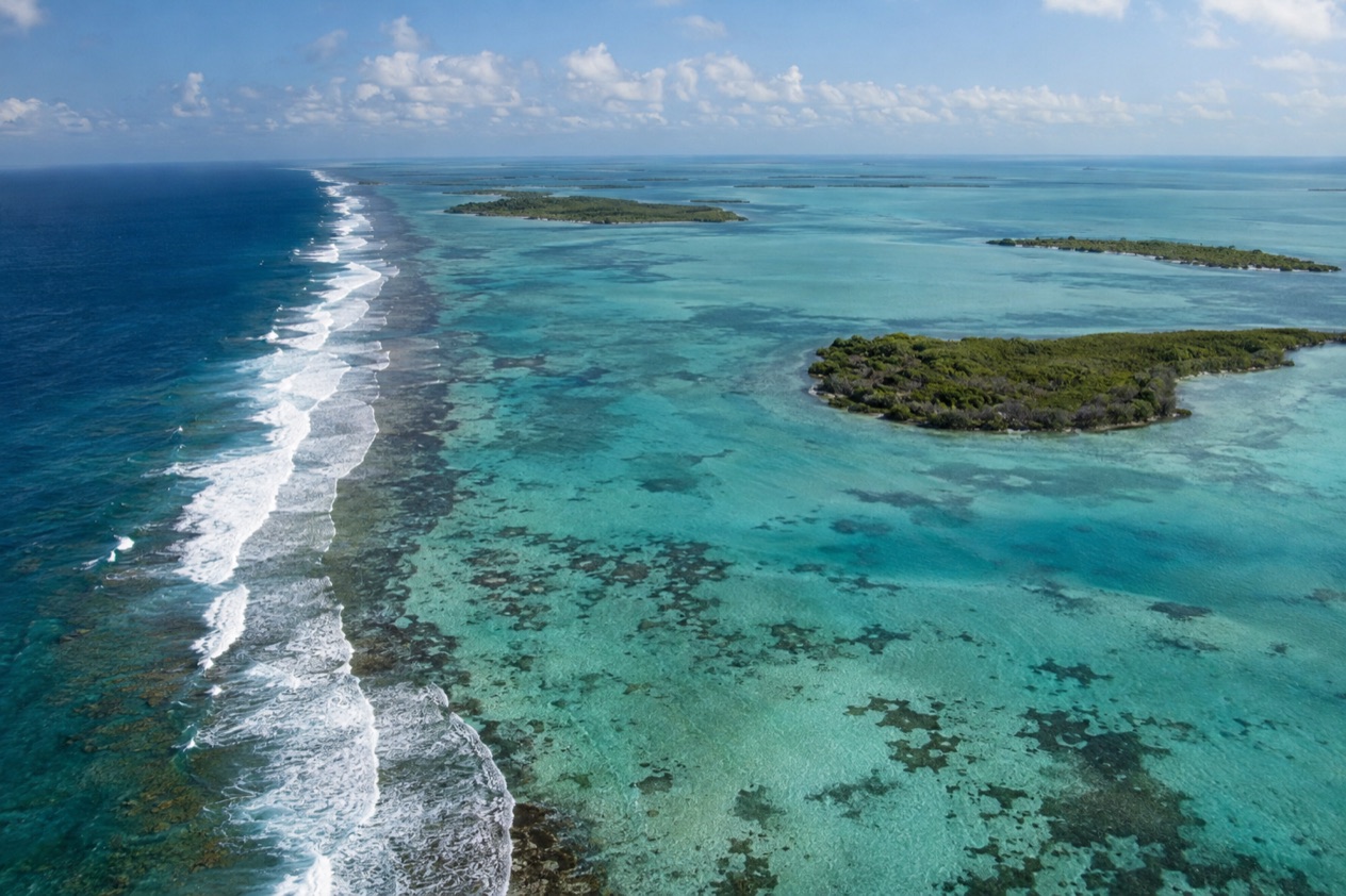
Offshore runs the Belize Barrier Reef, a UNESCO World Heritage Site and the second-largest coral reef system in the world. It stretches roughly 200 miles, the longest in the western hemisphere, and it includes Ambergris Caye, Lighthouse Reef, Glover’s Reef and the Turneffe Islands.
Also tied to the sea is the Great Blue Hole, a karst formation that sits in the waters of Belize and draws divers and aerial sightseers alike. Inland, the country turns to forest, which is why the Cayo District is the base for the cave and jungle outings of the interior.
Cities, time and money
Belmopan is the capital, while Belize City is the largest city. Both names often surprise people who expect the biggest city to hold the government. Belize observes Central Standard Time (UTC−06:00) all year, with no clock change, so the time difference with the U.S. shifts when daylight saving begins and ends back home.
The currency is the Belize dollar (BZD). English is the official language and the language of schools, government and most media, so reading signs and ordering dinner rarely needs anything more than your own tongue. Along the way you will also hear Creole, Spanish, Garifuna and the German dialects of the Mennonite villages.
Climate in the places you will visit
The climate is tropical, with a rainy season from June to November and a dry season that runs from January to May. Along the coast, average temperatures climb from 75°F in January to 81°F in July.
Rainfall changes a great deal across the country, from the north and west, where annual totals are about 53 inches, to the extreme south, where they exceed 177 inches. In the south the dry season is shorter, normally lasting only from February to April, so a southern trip in spring is greener than a northern one.
Is Belize in Central America or the Caribbean?
Belize is in Central America, but it looks out on the Caribbean Sea, which is why it feels like both and why people argue about the label. Geographically it is a Central American nation on the Yucatán Peninsula. Its coast, its cayes and its reef belong to the Caribbean.
A Central American country with a Caribbean face
Belize is a mainland country, not an island. It is the only one in Central America without a Pacific coast, so its entire shoreline is the Caribbean one. That is where you find the water taxis, the sand-street villages on the cayes and the long reef that draws snorkelers and divers from around the world.
Its history adds to the mix. After independence from the United Kingdom, English remained the official language, and Belize is the only country in mainland Central America where that is so.
In daily life this means menus, road signs and conversations in English, with a Caribbean-style Creole spoken alongside it. Creole is the main language in the Stann Creek district, and English is the major language in the Belize District, in Cayo and in Toledo.
A mix of languages and cultures
The Central American side shows up in the north, where Spanish is the most used language in the frontier districts of Orange Walk and Corozal. In northern towns such as Corozal and San Pedro you may hear what is called Kitchen Spanish, an intermediate form of Spanish mixed with Belizean Creole. It is a good example of how the country blends its two worlds in one sentence.
Other voices add to the picture. About 16,100 people speak Garifuna, the Arawakan-based language tied to Garifuna culture. In Mennonite colonies and villages the vast majority speak Plautdietsch in everyday life, while a minority of some 10 percent speaks Pennsylvania German. Few places this small hold so many languages.
What it means for your trip
In practice, you can plan a Belize vacation around two settings. On the coast and cayes, the Caribbean sets the pace, with reef outings, seafood and sea breezes. In the interior, the Central American forest takes over, with Maya sites and caves. In the Cayo District, entering the caves without a licensed guide is both dangerous and illegal, so the cave outings there are done with one.
Both halves share the same tropical calendar. The rainy season runs through November, and the dry season is typically February to May, so the label you choose for the country matters less than the month you pick.
Which countries border Belize?
Belize shares its land borders with its neighbors on the Yucatán Peninsula and in Central America, and on the east it opens onto the Caribbean Sea. Because it has no Pacific coast, the only open water you reach from here is the Caribbean.
The north and west: the frontier districts
The clearest sign of the border is the language. In the frontier districts of Orange Walk and Corozal, Spanish is the most used language, and the towns there carry that Spanish-speaking flavor in their markets and menus. Corozal and San Pedro are the northern towns where Kitchen Spanish is spoken.
It is the major language in the Belize District, in the capital district of Cayo and in Toledo in the far south, and Creole leads in the Stann Creek district. A drive across the country therefore turns into a small tour of languages.
The coast: a reef instead of a neighbor
On the east, Belize does not meet another country but the sea. The Belize Barrier Reef runs along that edge, with Ambergris Caye, Lighthouse Reef, Glover’s Reef and the Turneffe Islands among its cays and islands. If you arrive by air, the Philip S. W. Goldson International Airport is the gateway, with check-in counters for all airlines in Terminals 1 and 2.
Belizean Vibes and Toucan Gift Shop are in Terminal 1, and Ueta of Belize is in the Departure Lounge. Taxis wait outside both terminals from 6:00 a.m. to 6:00 p.m. daily, and the car rental agencies are across from the Airport Terminal Building at the Rental Services Center.
What to expect in border communities
In the north, the daily mix of Spanish, Creole and English is part of the charm. In Mennonite villages you may hear German, and in Stann Creek you may hear Garifuna and Creole. Education policy treats Creole as a language to be used appropriately but not as the language of lessons, so English remains the classroom language.
A Kriol dictionary published in 2007 by the Belize Kriol Project gives translations and grammar for those curious about the language they hear on the street. Reading a few phrases before you go is a simple way to feel the country’s character.
Good to know before you go
The U.S. State Department rates Belize Level 2, “Exercise increased caution”, because of crime, and says the south side of Belize City has historically had the highest concentration of violent crime.
The currency is the Belize dollar, and ATMs of the Belize Bank, Scotiabank and Atlantic Bank accept Mastercard. The Atlantic hurricane season runs from June 1 to November 30, and in Belize the hurricanes that bring coastal flooding, especially in the south, are mostly a late-season concern from September to December. The country follows Central Standard Time all year.
Sources
- Wikipedia, Belize (https://en.wikipedia.org/wiki/Belize), checked October 11, 2026
- Wikipedia, Geography of Belize (https://en.wikipedia.org/wiki/Geography_of_Belize), checked October 11, 2026
- Wikivoyage, Belize (https://en.wikivoyage.org/wiki/Belize), checked October 11, 2026
- Wikipedia, Languages of Belize (https://en.wikipedia.org/wiki/Languages_of_Belize), checked October 11, 2026
- Philip S. W. Goldson International Airport (Belize), FAQ (https://www.pgiabelize.com/about-us/faq/), checked October 11, 2026
- Philip S. W. Goldson International Airport (Belize), Quick facts (https://www.pgiabelize.com/passenger-info/quick-facts/), checked October 11, 2026
- Philip S. W. Goldson International Airport (Belize), Passenger info (https://www.pgiabelize.com/passenger-info/), checked October 11, 2026
- Philip S. W. Goldson International Airport (Belize), Shopping and dining (https://www.pgiabelize.com/passenger-info/shopping-and-dining/), checked October 11, 2026
- U.S. Department of State, Belize Travel Advisory, Level 2, March 11, 2026 (https://travel.state.gov/), checked October 11, 2026
- NOAA National Hurricane Center, Climatology (https://www.nhc.noaa.gov/climo/), checked October 11, 2026