
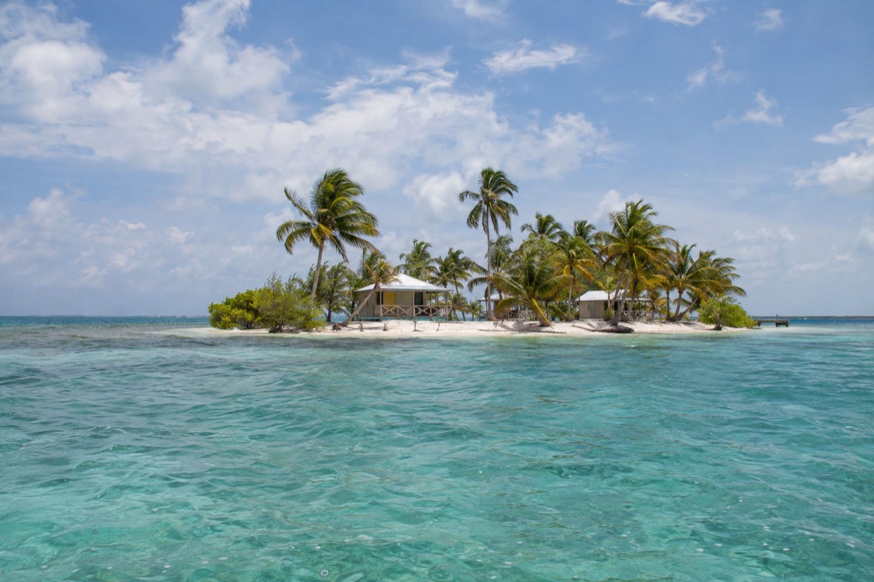
Early light slides across the water behind the reef, and the mangroves along the edge of the cayes turn from black to green. Pelicans drop into the shallows, palm fronds click in the breeze, and the sea carries the day’s first color. South Water Caye sits in a protected stretch of the Belize Barrier Reef off the Stann Creek coast, a place for people who want water, coral and stillness more than a long list of sights.
Where is South Water Caye and what is it like?
South Water Caye lies off the southern coast of Belize, inside the South Water Caye Marine Reserve in Stann Creek District, on the inner side of the Barrier Reef. The reserve sits 11 miles off the mainland, west of the most southerly part of Glover’s Reef, and the nearest mainland town of any size on this coast is Dangriga. It is a small-island place, defined by open water, reef and mangrove rather than by streets, shops or a town center.
The reserve is the second largest marine protected area in Belize, covering 117,875 acres of mangrove and coastal ecosystems. It was established by the Fisheries Department in 1996 and is one of the seven protected areas that make up the Belize Barrier Reef Reserve System World Heritage Site. That status shapes the whole feel of the area: the point of coming here is the living sea around the island, and the pace follows from it.
The character is quiet and outdoorsy. Days are organized around the water, the light and the meals, and the evenings belong to the sky. Travelers who like a beach-club scene, nightlife or a choice of restaurants will find the cayes of this reserve a poor fit. Travelers who like to look at fish, watch birds work the mangrove edge and do very little else will find the pace exactly right.
A neighbor within the same reserve gives a good sense of the scale of things. Tobacco Caye is a tiny island of about three acres, with a permanent population of about 20 and five small lodges. South Water Caye belongs to the same family of small cayes strung along the reef, and the Fisheries Department also keeps a Rangers Station on Twin Cayes within the reserve, with accommodation for rangers and a visitor center.
Behind it all is the reef itself. The Belize Barrier Reef is a series of coral reefs that runs along the coast of the country, and it sits much farther offshore in the south than in the north, at about 25 miles. Out beyond the reserve, the atolls of Turneffe, Glover’s Reef and Lighthouse Reef complete a seascape that reaches from the mangrove shallows to deep blue water.
What is there to do in South Water Caye?
The things to do here come from the sea and the reserve around it, with the culture of the mainland coast close behind. Four reasons draw people to this part of Belize, and each is quite different in spirit.
The reserve and its reef life
The reserve is the main event. The Belize Barrier Reef is home to 70 hard coral species, 36 soft coral species, 500 species of fish and hundreds of invertebrate species, and the reserve protects a good slice of that richness along with the mangrove stands that shelter young fish. Fishing is restricted inside the reserve, which is part of the reason the water here is valued by people who love marine life.
Spend your hours looking: at the color of the water over sand and over coral, at the birds along the mangrove line, at the shapes moving beneath a boat. The cayes suit those who bring a mask, a camera or simply patient eyes. The reserve is also the sort of place where a slow hour on a dock can be as rewarding as an outing.
Tobacco Caye, the small island next door
Tobacco Caye lies about 10 miles east of Dangriga and within the same marine reserve, and it shows what island life looks like at this scale. There are no roads or vehicles of any sort, and not even a single sidewalk. Hurricane Mitch levelled most of the island in 1998, and nearly everything seen today has been rebuilt since then, which gives the little lodges a hand-made, resilient air.
Life on Tobacco Caye follows a bell. The meal bells usually ring around 7AM, noon and 6PM, and checkout at the lodgings is at 10AM. For a traveler it is a simple, structured rhythm: breakfast, a morning with the sea, lunch, an afternoon with a book, supper, and an early night under a lot of stars.
Dangriga and Garifuna culture
Dangriga, on the coast at the mouth of the North Stann Creek River, is the capital of Stann Creek District and the largest settlement in southern Belize. It is commonly known as the culture capital of Belize because of its influence on punta music and other forms of Garifuna culture. Drums, call-and-response singing and the rhythms of punta are woven into the town’s identity.
A walk through Dangriga is a pleasant counterpoint to the quiet of the cayes: a coastal town with its own rhythm, its own foods and its own music. It makes a natural pairing with time on the reef, because it gives the trip a human side as well as a marine one.
The atolls beyond the reserve
The reserve lies west of the most southerly part of Glover’s Reef, one of three distinct atolls in the Belize reef system. The others are Turneffe Atoll, the nearest to Belize City, and Lighthouse Reef, the most easterly diving area in Belize and home to the Great Blue Hole, made famous by Jacques Cousteau in 1970.
Seeing these names on the map gives the reserve its context. South Water Caye is the gentle, sheltered, inner-reef part of the story, while the atolls are the far outer edge of it. It is a good reason to think of the reserve as a doorway into the larger reef rather than as a stand-alone stop.
How many days do you need in South Water Caye?
A few days is the natural length of a stay in the reserve, and a week suits those who want to do very little at all. The cayes reward slowness, so a single night feels like a taste, and three or four nights allow the rhythm of the water to take hold.
In a short stay, spend your time on the reef, the mangrove edges and the shoreline, and let the days settle into meals, swims of the eye and long stretches of reading. On an island as small as Tobacco Caye, the meal bells and the 10AM checkout give a clear daily shape, so a night or two is easy to fit into a wider tour of southern Belize.
With more time, add Dangriga on the mainland. Its place as the culture capital of Belize makes it a rewarding stop for music, Garifuna heritage and a look at a working coastal town. The stretch of coast around it is an easy way to widen the trip beyond the water, and it pairs well with the quiet of the cayes.
A longer trip can also look outward to the atolls. Glover’s Reef lies just east of the reserve, Turneffe Atoll is the nearest atoll to Belize City, and Lighthouse Reef, with the Great Blue Hole, is the most easterly diving area in Belize. Each is a different kind of reef experience from the sheltered inner side where South Water Caye sits.
Where to stay in South Water Caye
The choice of where to sleep is small and island-based. The setting is the draw: a rebuilt island, a sand and palm shoreline, and the sea within a few steps of the door.
A stay on a caye of this kind suits travelers who like simple, structured days, with meals rung in by a bell and a checkout set in the morning. It is a way of staying that favors the sea over the room, and a good match for people who spend their daylight outdoors.
Those who want more of a town around them can base themselves in Dangriga, the district capital, on the coast at the mouth of the North Stann Creek River. It has its own airport, its own Garifuna culture and the services of the largest settlement in southern Belize. A mainland base suits those who want a look at the culture of the coast alongside time on the cayes.
The two choices serve different moods. The island offers silence, mangrove and sea. The town offers music, history and the feel of everyday Belizean life. Many trips naturally combine the two, with the mainland as a starting point and the reef as the heart of the stay.
How do you get to South Water Caye and get around?
The way in is from the Stann Creek coast. The South Water Caye Marine Reserve lies on the inner side of the Barrier Reef, 11 miles off the mainland, so the journey ends with a crossing of open water. On the mainland side, Dangriga, on the Caribbean coast at the mouth of the North Stann Creek River, is the town the cayes face, and it is served by Dangriga Airport.
Tobacco Caye, a neighbor within the reserve, lies about 10 miles east of Dangriga. That gives a sense of the geography: the mainland town on one side, a scatter of small cayes on the other, and the reef between them and the open Caribbean beyond.
Getting around on the cayes themselves means very little getting around. On Tobacco Caye there are no roads or vehicles of any sort, and not even a single sidewalk, so the island is explored on foot and the sea is the larger geography. The scale of these islands means that everything you need is within a few steps of where you sleep.
Travelers arriving from farther away can think of the trip in two parts: the mainland leg to the Stann Creek coast, and the short sea leg out to the reserve. The first is where you pick up supplies and a sense of the region, and the second is where the pace of the trip changes and the island days begin.
When is the best time to visit South Water Caye?
The months from December through May are the ones outside the official Atlantic hurricane season, which runs from June 1 to November 30, so they are the natural choice for a stay on a small, low island. January stands as a clear example: in Belize City, January highs reach the low 80s and nights stay in the upper 60s, with just over ten rain days in the month.
July, in the middle of the hurricane season, is hotter. In Belize City, July highs reach the high 80s, and nights stay in the upper 70s, with a few more rain days than in January. The sea and the reef are still there, but a trip in these months is a trip inside the season, and storms are part of the picture for travelers planning on a small island.
The reserve’s history gives the season a human face. Hurricane Mitch levelled most of Tobacco Caye in 1998, and the island has been rebuilt since then. That is a reminder that the cayes live with the weather, and that the months outside the official season, from December to May, are the ones that suit a first visit to this stretch of the reef.
Good to know before you go
The U.S. State Department rates Belize Level 2, “Exercise increased caution”, because of crime, and says the south side of Belize City has historically had the highest concentration of violent crime.
The reserve is protected water, with a range of restrictions on fishing, so the sea here is treated as something to look after as well as enjoy. Island life runs on its own clock, with meal bells around 7AM, noon and 6PM on Tobacco Caye and a 10AM checkout at its lodgings. The Atlantic hurricane season runs from June 1 to November 30, so plan around it when choosing your dates.
Sources
- Belize Fisheries Department, South Water Caye Marine Reserve (https://fisheries.gov.bz/swcmr/), checked October 11, 2026
- Wikipedia, South Water Caye Marine Reserve (https://en.wikipedia.org/wiki/South_Water_Caye_Marine_Reserve), checked October 11, 2026
- Wikipedia, Tobacco Caye (https://en.wikipedia.org/wiki/Tobacco_Caye), checked October 11, 2026
- Wikivoyage, Tobacco Caye (https://en.wikivoyage.org/wiki/Tobacco_Caye), checked October 11, 2026
- Wikipedia, Dangriga (https://en.wikipedia.org/wiki/Dangriga), checked October 11, 2026
- Wikipedia, Belize Barrier Reef (https://en.wikipedia.org/wiki/Belize_Barrier_Reef), checked October 11, 2026
- Wikipedia, Climate of Belize (https://en.wikipedia.org/wiki/Climate_of_Belize), checked October 11, 2026
- NOAA NCEI, GHCN-Daily station BHM00078583 (Philip S. W. Goldson International Airport, Belize City), normals 1991-2020 computed from the daily record (https://www.ncei.noaa.gov/access/services/data/v1?dataset=daily-summaries&stations=BHM00078583), checked October 11, 2026
- U.S. Department of State, Belize Travel Advisory, Level 2, March 11, 2026 (https://travel.state.gov/), checked October 11, 2026
- NOAA National Hurricane Center, Climatology (https://www.nhc.noaa.gov/climo/), checked October 11, 2026