
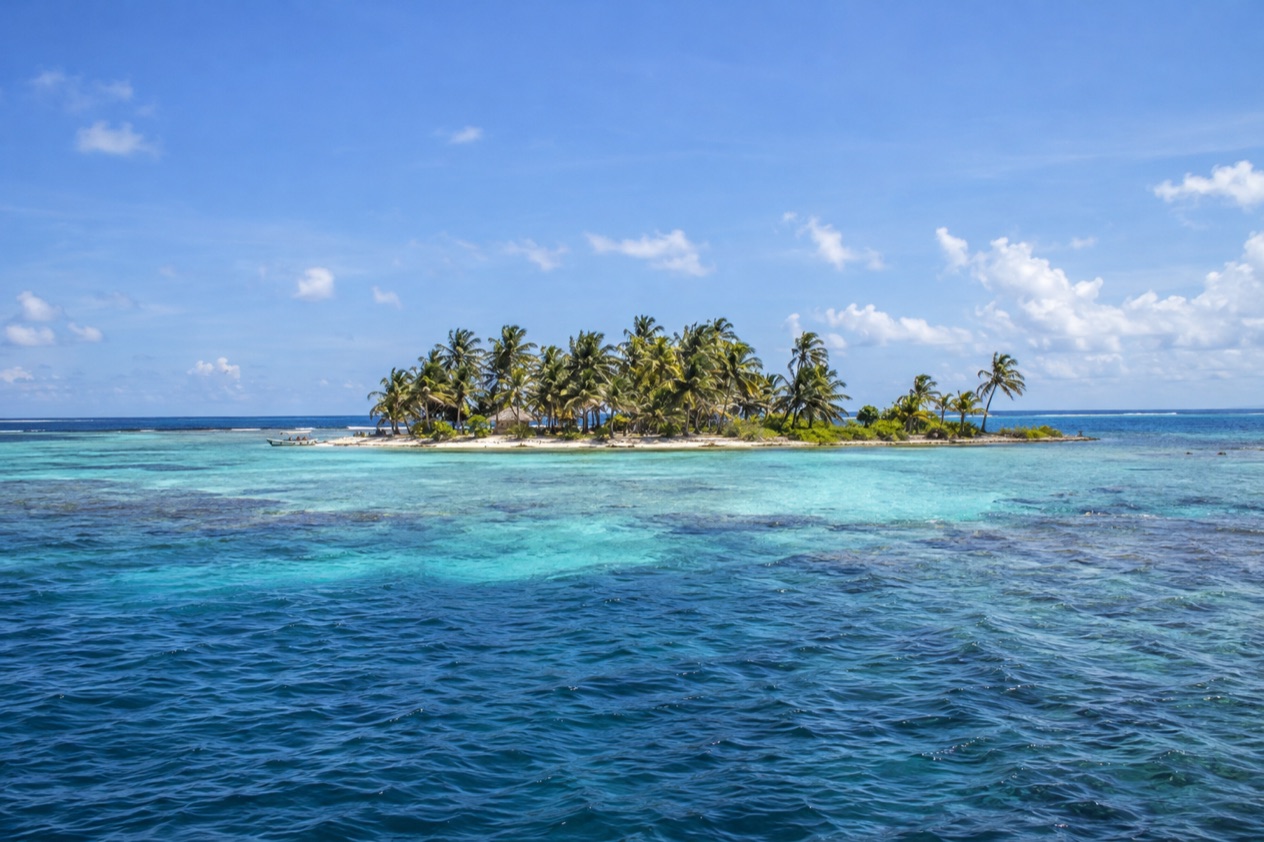
At first light, the surf breaks in a long white line on the outer edge of Glover’s Reef, and inside it the water turns from deep blue to a pale, glassy green around a handful of palm-topped cays. There are no streets here, no town square, no traffic, only sand, coconut palms, mangrove edges and the sound of waves on coral. This is an atoll far out in the Caribbean, a place for travelers who want the reef itself to be the destination.
Where is Glover’s Reef and what is it like?
Glover’s Reef is a partially submerged atoll off the southern coast of Belize, roughly 28 miles out to sea, with Dangriga as the nearest mainland town on the map and Belize City to the northwest. It is one of the three atolls of the Belize Barrier Reef system, along with Turneffe Atoll and Lighthouse Reef, and it is the southernmost of them. Think of it as an oval ring of living reef with a lagoon in the middle, and a few small cays resting on the rim.
The ring is 20 miles long and 7.5 miles wide, which is big enough that the lagoon feels like its own small sea. Scattered through that lagoon are about 850 reef patches and pinnacles that rise toward the surface, each one a miniature garden of coral with its own fish. Glover’s Reef is also noted for holding one of the greatest varieties of reef types in the western Caribbean, so the underwater scenery changes as you move from the exposed outer wall to the sheltered inner lagoon.
The character of the place is simple and quiet. The major cays are Northeast Cay, Long Cay, Middle Cay, Southwest Cay and Amounme Point Cay, and they are small enough to take in at a glance, with sand underfoot, palms overhead and the horizon in every direction.
Days are shaped by the tide, the light and the weather rather than by a schedule of attractions. The sound at night is wind in the palms and waves on the reef.
Glover’s Reef suits people who like nature at close range, who are happy with a slow rhythm and who care more about what is under the surface than about nightlife, shopping or a long list of restaurants. It will feel too remote, and too empty of urban comforts, for travelers who want a lively main street, a variety of bars or a beach club. The whole atoll is protected as a marine reserve, and that protection shapes the visit.
What is there to do in Glover’s Reef?
The main reasons to come are snorkeling and diving among the lagoon’s patch reefs and along the outer reef. It differs from its neighbors because it is the outermost of the southern reef, a ring well out to sea, rather than a strip of coral running parallel to a coastline.
The reef and what lives on it
The Belize Barrier Reef as a whole is home to 70 hard coral species, 36 soft coral species, 500 species of fish and hundreds of invertebrate species, and Glover’s Reef is part of that living library. In the lagoon the patch reefs concentrate life in small, easily distinguished clusters: fan corals swaying with the current, brain corals shaped like rounded boulders, schools of small fish that flash silver when they turn together.
What you see depends on where you look. The outer edge faces open sea and the swell, while the lagoon patches sit inside the ring, so the same atoll offers different scenes in a single outing. Bring an eye for detail, since much of the pleasure here lies in the small things: a feathery worm retreating into its tube, a parrotfish nibbling, a spiny lobster tucked under a ledge.
A protected marine reserve
Glover’s Reef Marine Reserve was established in 1993 and covers about 86,653 acres, which is far more water than land. In 1996 it became part of the Belize Barrier Reef Reserve System World Heritage Site, designated by UNESCO. For a visitor, this means the atoll is valued as a whole, a seascape rather than a single sight, and it explains why a visit here feels more like entering a natural area than checking into a resort town.
Part of the appeal is simply knowing that the reef around you is looked after. Many travelers find that a place with this status rewards unhurried looking, so spend your time watching the water, the birds crossing overhead and the way the color of the lagoon shifts with the clouds.
Life on the cays
On land, the cays offer a gentler set of pleasures: walks along the sand, shade beneath coconut palms, a hammock, a book, a long view over turquoise water. Sunrise comes straight out of the sea on the eastern side and sunsets fall over the lagoon, so the light is a daily show that needs no ticket.
The stars are a reason of their own. With no city for miles, the night sky over an atoll can be thick with stars, and on a clear night the Milky Way may arch overhead. Nights without a moon are the darkest, and the sound of waves on the reef is the only background.
How many days do you need in Glover’s Reef?
A long weekend is the shortest stay that does the atoll justice, and a full week lets the place sink in. Because Glover’s Reef lies well offshore, you want enough time to make the crossing worthwhile and still have days left to spend on the reef rather than in transit.
With a few days, the plan is simple: pick a cay as a base, spend one day on the lagoon and its patch reefs, another looking at the outer edge of the atoll, and keep a slow day for the beach, the shade and the light. That is enough to see how different the lagoon and the outer reef feel, and to notice the changes in the sea from morning to evening.
With a week or more, the rhythm slows further. You can repeat the places you loved at different times of day, since the same patch reef looks different in low morning light and under a high sun. You can also explore more of the atoll’s cays, from Northeast Cay to Southwest Cay, and simply spend whole afternoons doing very little, which is the true luxury here.
If you want to add to the trip, the neighboring parts of the reef system are the natural companions on a map of Belize. Lighthouse Reef, to the north, is the atoll home to the Great Blue Hole, made famous by Jacques Cousteau in 1970, and Turneffe Atoll lies directly east of Belize City.
On the mainland, Dangriga and Belize City are the towns closest to the reserve. Belize City is the country’s largest city and its principal port, and the Swing Bridge there is the only functioning, manually operated swing bridge in the world.
Where to stay in Glover’s Reef
There are two ways to think about where to sleep: on the atoll itself, among the cays, or on the mainland, in the towns from which the reef is reached. Staying on the mainland gives you a base with more of the ordinary comforts and a shorter list of logistics before you leave for the reef.
The cays of the atoll are small, and each has its own feel. Northeast Cay, Long Cay, Middle Cay, Southwest Cay and Amounme Point Cay are the major ones, spread around the rim of the ring. If the idea is to wake up beside the reef, it is worth looking at where on the atoll a stay sits, since the cays face different parts of the lagoon and the open sea.
On the mainland side, Dangriga is the town directly west of the atoll, with the reserve about 28 miles east of it, and Belize City lies to the northwest. Dangriga is a Garifuna center, which gives a stay there a cultural dimension that complements the reef: drumming, cassava bread, and a calendar of Garifuna celebrations that lend the town its character. Belize City brings the life of a real port city, with its harbor, its history as the former capital of British Honduras and its role as the financial and industrial hub of the country.
Choose by what you want from the trip. A stay on a cay is for travelers who want the reef to be the whole day, all day.
How do you get to Glover’s Reef and get around?
You reach Glover’s Reef by sea, because the atoll lies out in open water far from any road. On the map, the reserve is approximately 28 miles east of Dangriga and approximately 47 miles southeast of Belize City, so the mainland towns of the southern coast are the points from which the reef is approached.
Belize City is the country’s principal port and its largest city, and Dangriga sits on the southern coast closer to the atoll. Dangriga sits on the southern coast closer to the atoll, while Belize City lies to the northwest. How you make the crossing is a matter to settle with your lodging or your tour, since the details of boats and arrangements depend on where on the atoll you are going.
The cays are small enough that you can see a good part of one on foot, and the lagoon and the reef are reached from the shore.
There are no roads, no cars and no traffic to think about, which is a large part of the appeal. Distances on a cay are measured in a few steps along the sand, and the sound you notice most is the water.
Pack with the isolation in mind. The atoll is a place where what you bring is what you have, so think about the things that make time on the water comfortable for you. Everything else, from the light to the sea, is provided by the place itself.
When is the best time to visit Glover’s Reef?
There is no single answer for every traveler, but the pattern of the year is easy to read. The Atlantic hurricane season runs from June 1 to November 30, so the months from June through November are the ones in which a storm can affect plans, and December through May fall outside the official hurricane season. For a trip to an offshore atoll, where the crossing depends on the weather, that division is the first thing to weigh.
Air temperatures on the mainland coast give a sense of the year. In Belize City, January highs average about 83°F with lows near 68°F, and it is a month with around ten days of measurable rain.
By July, highs in Belize City reach the upper 80s, lows are near 77°F, and there are close to twelve rain days. Winter is therefore the gentler stretch for the air, while midsummer is hotter and falls inside the hurricane season.
If you are choosing months, early in the year is a natural place to look: January sits outside the official hurricane season, with moderate air temperatures. If the summer is the only time you can travel, the reef is still there, and the hurricane season dates are the thing to keep an eye on as the trip approaches. Whatever the month, the sea around the atoll can change from one day to the next, so build a little flexibility into your plans.
Good to know before you go
The U.S. State Department rates Belize Level 2, “Exercise increased caution”, because of crime, and says the south side of Belize City has historically had the highest concentration of violent crime.
Glover’s Reef is a marine reserve, established in 1993 and part of a World Heritage Site. The Atlantic hurricane season runs from June 1 to November 30, which matters for a trip that depends on open-water crossings.
In Belize City, the departure point for many travelers, the south side of the city has historically had the highest concentration of violent crime, so plan your time in town with that in mind. On the atoll itself, the main concerns are the sun, the water and what you remembered to bring.
Sources
- Wikipedia, Glover's Reef (https://en.wikipedia.org/wiki/Glover's_Reef), checked October 11, 2026
- Belize Fisheries Department, Glover's Reef Marine Reserve (https://fisheries.gov.bz/grmr/), checked October 11, 2026
- Wikipedia, Belize Barrier Reef (https://en.wikipedia.org/wiki/Belize_Barrier_Reef), checked October 11, 2026
- Wikipedia, Belize City (https://en.wikipedia.org/wiki/Belize_City), checked October 11, 2026
- Wikipedia, Climate of Belize (https://en.wikipedia.org/wiki/Climate_of_Belize), checked October 11, 2026
- NOAA NCEI, GHCN-Daily station BHM00078583 (Philip S. W. Goldson International Airport, Belize City), normals 1991-2020 computed from the daily record (https://www.ncei.noaa.gov/access/services/data/v1?dataset=daily-summaries&stations=BHM00078583), checked October 11, 2026
- U.S. Department of State, Belize Travel Advisory, Level 2, March 11, 2026 (https://travel.state.gov/), checked October 11, 2026
- NOAA National Hurricane Center, Climatology (https://www.nhc.noaa.gov/climo/), checked October 11, 2026