
Early in the morning in Placencia, the only sounds on the concrete Sidewalk are flip-flops, a screen door and the clink of a coffee cup, while boats rock at the docks a few steps away. By midday the village has filled with the smell of grilled fish and the chatter of people deciding which reef to visit.
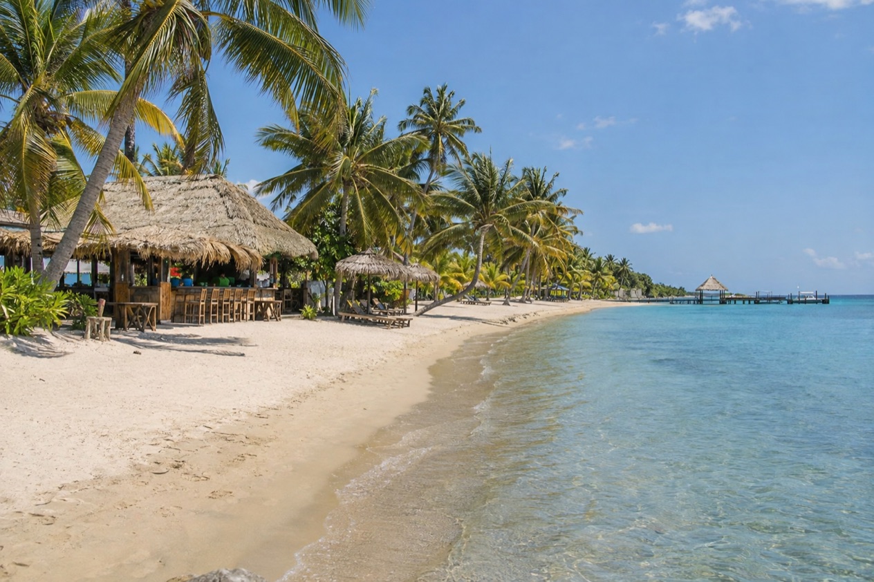
Where is Placencia and what is it like?
Placencia sits at the southern tip of a narrow peninsula in the Stann Creek District of southern Belize, with the Caribbean on one side and a lagoon on the other. It is a tourist village of about 1,600 people, and its beaches, resorts, guest houses and hotels have made it one of the most popular tourist destinations in the country.
The peninsula runs 18 miles, and Placencia is the last settlement at the end of it. Going from north to south you pass Riversdale Village, Maya Beach Village and the Garifuna village of Seine Bight before reaching Placencia itself. Each has its own feel, and together they make a strip of coast where beach, village life and fishing boats sit side by side.
The village is built around the Sidewalk, a concrete pedestrian-only path that runs most of the length of the village and ends at the seashore. It is lined with shops, restaurants, bars, dive outfits and small businesses, so a walk along it doubles as an errand run and an evening stroll. Placencia also claims the narrowest main street in the world according to the Guinness World Book of Records.
The mood is relaxed and a little scruffy in a pleasant way. People who like a base with a beach, a handful of cafes and a reef offshore tend to love it. People looking for nightlife on a big scale or a dense city may find it too small.
Placencia was also settled long before resorts arrived. Before European colonization the peninsula was home to Maya people who produced salt and traded it with other coastal settlements. That older layer, together with the Garifuna community of Seine Bight nearby, gives the area more depth than the beach postcards suggest.
What is there to do in Placencia?
The big reasons to come are the reef and the cayes offshore, the whale shark season, the rainforest and river trips inland, and the village itself. What sets Placencia apart from its neighbors is that you can combine a beach base with all of these without changing hotels. The barrier reef, a marine reserve, a national park caye and a wildlife sanctuary all sit within reach of the same Sidewalk.
Reef days and Laughing Bird Caye
From Placencia, the longest barrier reef in the northern hemisphere lies a 45-minute boat ride off the coast. Laughing Bird Caye is even closer, a national park and World Heritage Site about 12 miles out from the village. It is tiny, only a couple of acres, and it is named for the laughing gulls that once bred there.
Dive and snorkel operators in the village run trips to the reef and the southern cayes, and the reef sits within the Southern Belize Reef Complex, which also takes in South Water Caye and the Sapodilla Cayes Marine Reserve. Expect a day built around the boat, with time in the water at the reef and a break on a caye. Ask your outfitter which stops are on the day’s route.
Whale sharks at Gladden Spit
Between March and June, around the full moon, whale sharks pass by Gladden Spit, a spot about 22 miles off the coast of Placencia. Visitors can dive or snorkel with them at the site, which is also a spawning ground for snappers. These are chances, never promises, since the sharks follow the fish and the moon, not a timetable.
The area is protected as the Gladden Spit and Silk Cayes Marine Reserve, which covers roughly 25,980 acres and is managed by the Southern Environmental Association, a community-based organization. The whale shark feeding site was declared a special protected zone in 2001. Arrange your spot in advance if the sharks are the reason you are coming.
Monkey River and Cockscomb Basin
From Placencia, travelers can explore Monkey River, Cockscomb Basin, or sail to the southern cayes. Monkey River Town sits at the mouth of its river in the Toledo District, a village of fishing and ecotourism where a road built in the late 1980s now links the community to the outside world, though much travel is still by sea.
Cockscomb Basin Wildlife Sanctuary lies in the Stann Creek District and holds Victoria Peak, the second highest point in Belize at 3,670 feet. Together they offer a green counterpart to the blue of the reef, with river and rainforest scenery in place of coral.
The village and its breakfasts
A good part of the pleasure in Placencia is simply the village routine: coffee, a long breakfast, a walk to the water, a late lunch. Belgian Cafe on Main Street in Harbour Place serves breakfasts and lunches, and it offers free WiFi for patrons. It is one example of the small cafes that line the Sidewalk and the harbor.
| Site | Open |
|---|---|
| Belgian Cafe, Main Street, Harbour Place | 8AM to 2:30PM |
How many days do you need in Placencia?
A long weekend gives you a taste of Placencia, and a week lets you do it properly. With three or four days you can walk the Sidewalk, spend a day at the beach, and take one boat trip to the reef or Laughing Bird Caye. That is enough to understand why people come back.
With a week, the area opens up. You can add a second outing, such as the southern cayes, and give one day to the land side with Monkey River or Cockscomb Basin. Whale shark season rewards flexibility, because the sharks gather around the full moon, so extra days give you more than one chance at it.
A longer stay also makes room for the rest of the peninsula. Maya Beach, Seine Bight and Riversdale each deserve an afternoon, and Seine Bight in particular is a Garifuna village whose history and food are part of the region’s character. Time spent in the village itself, with its cafes, docks and evening bars, is part of the stay and not a gap between excursions.
Placencia also works as one stop in a longer trip through the Stann Creek District. A suggested route heads south from Dangriga to Hopkins, a Garifuna village, and then on to Placencia. Travelers who add those stops will want several extra days beyond a stay on the peninsula alone.
If your time is short, put the reef first. The Gladden Spit and Silk Cayes area and Laughing Bird Caye are what set Placencia apart from the inland parts of Belize, and a short stay should include at least one boat day. If you have more time, the rainforest and river trips balance it out.
Where to stay in Placencia
The main places to stay are Placencia village itself and the other settlements strung along the peninsula: Seine Bight, Maya Beach and Riversdale. The area has a large selection of resorts, guest houses and hotels, along with white sandy beaches, so the choice is mostly about where on the peninsula you want to wake up.
It is the end of the peninsula, so the village is where the boats leave for the reef and where evenings are busiest. If you want to step out and find a meal, a bar or a tour desk, this is the base.
Seine Bight lies 2.5 miles south of Maya Beach Village and north of Placencia village. It is a Garifuna village, and at the 2010 census seven in ten residents were Garifuna, with smaller Mestizo, Creole and Maya communities. The name comes from early settlers, who named it for the seine fishing technique and a bight, a bend in the coastline. Staying near it puts you close to that cultural thread.
Maya Beach and Riversdale lie further up the peninsula. Maya Beach Village is named for its stretch of sand, and Riversdale is the northernmost of the four settlements. Choosing one of these means being farther from the Sidewalk, in return for a quieter setting along the same coast. Each area is a different distance from the village center, so decide how much of your time you plan to spend there.
Placencia has been voted as having one of the best beaches in the world, a reputation that helped build the resort scene. Whichever area you choose, the same boats, reef trips and day excursions are available from the village, so the base you pick changes the daily scene more than the list of things to do.
How do you get to Placencia and get around?
You reach Placencia by air or by road. Placencia, the southernmost village on the peninsula, is served by Placencia Airport, and Maya Island Air flies there in a forty-minute flight. Dangriga Airport serves the wider Stann Creek District if your route runs through the capital of the district.
By road, the Stann Creek District is served by the Hummingbird Highway and the Thomas Vincent Ramos Highway. These connect to Belize City by way of the George Price Highway at Belmopan. From the highway you turn onto the peninsula, and the settlements follow one after another until you reach Placencia at the far end.
Once you arrive, the village is made for walking. The Sidewalk is a concrete pedestrian-only path that runs most of the length of the village, so most of what you need sits along it. Restaurants, shops and tour desks are all on or just off it.
The peninsula itself is a single strip, so getting from village to village follows the one line of settlements: Riversdale, Maya Beach, Seine Bight, Placencia. Seine Bight is 2.5 miles south of Maya Beach and sits north of Placencia village. Think of the peninsula as a line, with Placencia at the end.
The sea also serves as a road. Boats take visitors to the reef, Laughing Bird Caye and the southern cayes, and to Monkey River Town, where much of the travel is still by sea. Monkey River has two small hotels and a nearby fishing resort that can be reached by a five-minute sea trip.
When is the best time to visit Placencia?
Spring is the best time for whale sharks, which pass Gladden Spit between March and June around the full moon. If the sharks are your reason to come, plan your days around those months and around the lunar calendar. Outside that window, the reef, the cayes and the village are there all year.
January is the cooler end of the year. In Belize City, highs average in the low 80s and lows in the upper 60s, with about ten days of rain in the month, while the sea near Placencia averages 81.0°F.
That is a comfortable month for walking the Sidewalk and planning boat days. July is the warm end, with Belize City highs near 90 and lows in the upper 70s, and the sea near Placencia averaging 86.4°F.
Rain shows up in both seasons. In Belize City, January records about ten rainy days and July close to twelve, so pack for showers in either month. The Atlantic hurricane season runs from June 1 to November 30, which covers the second half of the year in Placencia.
The peninsula has its own history with storms. Hurricane Iris struck southern Belize on October 8, 2001, with winds of 145 mph and damaged nearly 95% of the buildings in Placencia. Visitors choosing dates between June and November should know that the whole stretch falls inside the official season.
Good to know before you go
The U.S. State Department rates Belize Level 2, “Exercise increased caution”, because of crime, and says the south side of Belize City has historically had the highest concentration of violent crime.
The Belize dollar is the national currency, and Placencia is a small village, so plan your days around the Sidewalk and the docks. Boat trips to the reef, Laughing Bird Caye and Gladden Spit depart from the village, and whale shark outings should be arranged upfront. If you travel between June and November, remember that this period falls within the Atlantic hurricane season, and think about how your plans would change if a storm formed.
Sources
- Wikipedia, Placencia (https://en.wikipedia.org/wiki/Placencia), checked October 11, 2026
- Wikivoyage, Placencia (https://en.wikivoyage.org/wiki/Placencia), checked October 11, 2026
- Wikipedia, Seine Bight (https://en.wikipedia.org/wiki/Seine_Bight), checked October 11, 2026
- Belize Fisheries Department, Gladden Spit and Silk Cayes Marine Reserve (https://fisheries.gov.bz/gsscmr/), checked October 11, 2026
- Wikipedia, Gladden Spit and Silk Cayes Marine Reserve (https://en.wikipedia.org/wiki/Gladden_Spit_and_Silk_Cayes_Marine_Reserve), checked October 11, 2026
- Wikipedia, Silk Cayes (https://en.wikipedia.org/wiki/Silk_Cayes), checked October 11, 2026
- Wikipedia, Laughing Bird Caye (https://en.wikipedia.org/wiki/Laughing_Bird_Caye), checked October 11, 2026
- Tropic Air, Placencia (https://www.tropicair.com/placencia-plj/), checked October 11, 2026
- Maya Island Air, Placencia flights (https://www.mayaislandair.com/belize-flights-placencia/), checked October 11, 2026
- Wikipedia, Stann Creek District (https://en.wikipedia.org/wiki/Stann_Creek_District), checked October 11, 2026
- Wikivoyage, Stann Creek (https://en.wikivoyage.org/wiki/Stann_Creek), checked October 11, 2026
- Wikipedia, Monkey River Town (https://en.wikipedia.org/wiki/Monkey_River_Town), checked October 11, 2026
- Wikipedia, Climate of Belize (https://en.wikipedia.org/wiki/Climate_of_Belize), checked October 11, 2026
- Open-Meteo Marine API, average 2015-2024, checked October 11, 2026
- NOAA NCEI, GHCN-Daily station BHM00078583 (Philip S. W. Goldson International Airport, Belize City), normals 1991-2020 computed from the daily record (https://www.ncei.noaa.gov/access/services/data/v1?dataset=daily-summaries&stations=BHM00078583), checked October 11, 2026
- U.S. Department of State, Belize Travel Advisory, Level 2, March 11, 2026 (https://travel.state.gov/), checked October 11, 2026
- NOAA National Hurricane Center, Climatology (https://www.nhc.noaa.gov/climo/), checked October 11, 2026
All our pages
When to go
- Best Time to Visit Placencia: Dry Season, Whale Sharks, Sea Temperatures and Hurricane Months
- Placencia in January: Warm Sea, George Price Day and Marine Reserves
- Placencia in February: Sea Temperature, Daylight and Things to Do
- Placencia in March: Warm Sea, Whale Shark Season, Baron Bliss Day and a Two-Day Plan
- Placencia in April: Whale Sharks, Warm Sea and Sunny Days on the Peninsula
- Placencia in May: Warm Sea, Whale Shark Season, Reef Trips and a Two-Day Plan
- Placencia in June: Sea, Rain, Whale Shark Season's End and What to Do
- Placencia in July: Weather, Warm Sea, Lobster Season and Reef Outings
- Placencia in August: Warm Sea, Rainy Season Rhythm and Days on the Peninsula
- Placencia in September: National Celebrations, a Warm Sea and Reef Outings
- Placencia in October: Warm Sea, Late Hurricane Season and Village Days
- Placencia in November: Garifuna Settlement Day, Warm Sea and What to Do
- Placencia in December: Sea Temperature, Weather, Things to Do and a Two-Day Plan
Things to do
- Things to Do in Placencia: Reef Days, Whale Sharks, Garifuna Culture and Where to Eat
- Day Trips from Placencia: Laughing Bird Caye, Whale Sharks, Monkey River and Cockscomb
- 3 Days in Placencia: Sidewalk Strolls, Reef Trips and Garifuna Seine Bight
- The Placencia Peninsula, Placencia: The Sidewalk, Seine Bight, Reef Boats and Where to Stay