
Spread a map of Belize on a table and the same few questions come up. Where does the reef start, which town is the base for the jungle, and which ruins sit near which road?
The country is small, with a Caribbean coast on one side, a chain of cayes offshore and rainforest, rivers and Maya sites behind. Once you see how its districts, its reef and its ancient cities fit together, the rest of a trip falls into place.
Where are the districts of Belize?
Belize is divided into six districts, and the towns you will hear about most are the main towns of those districts: Corozal, Orange Walk, Belize City, San Ignacio, Dangriga and Punta Gorda. The country sits on the Yucatán Peninsula in Central America, and it is the only country in Central America without a Pacific coastline. Its whole shoreline faces the Caribbean, which is why the coast, the cayes and the reef organize so much of the map.
The country covers a modest area, and English is the official language, the only one in mainland Central America with that status. That shapes the map in a practical way: place names, signs and conversations with people along the road are in a language an American traveler already speaks, even when the names themselves come from Maya, Garifuna, Spanish or Creole roots.
Belize District and Belmopan
Belize City is the largest city in the country, and Belmopan is the capital. People often assume the two are the same, so it helps to fix them as separate dots on the map. Belize City is the coastal hub that most of the cayes are connected to in one way or another, while Belmopan is the administrative town that holds the government.
Turneffe Atoll lies directly to the east of Belize City and is the nearest of the atolls to it. That single line of geography tells you why the city appears in so many itineraries that end on the water. The south side of Belize City has historically had the highest concentration of violent crime, a detail worth having in mind when you look at a street map of the city.
Cayo District and the interior
The Cayo District is the inland heart of the map, the part of Belize that is about rivers, forest and caves rather than the sea. Names such as Mountain Pine Ridge belong to this same stretch of green country.
In the Cayo district, it is dangerous and illegal to enter the caves without a licensed guide. That rule shapes how people see places such as the ATM cave (Actun Tunichil Muknal): you go with a guide or not at all. Inland places have no sea, so a Cayo trip is one of rainforest, river and stone.
Corozal, Orange Walk, Stann Creek and Toledo
Corozal and Orange Walk are the districts of the north, each named for its main town. Sarteneja, a fishing village, belongs to this part of the map too. Rainfall in the north and west is around 53 inches a year, the lower end of the national range, which gives these districts a different feel from the wet far south.
Stann Creek is the district of Dangriga, Hopkins and Placencia, the Garifuna coast with its drumming, cassava bread and long beaches. Toledo, with Punta Gorda as its town, lies in the extreme south, where rainfall passes 177 inches in a year. In southern Belize the dry season is shorter, normally only February to April, and coastal flooding is a recognized hazard there, so the southern map carries more green than the rest.
Across the country the pattern is a rainy season from June to November and a dry season from January to May. Coastal temperatures run from about 75°F in January to about 81°F in July, so the seasons feel like a shift in rain and humidity more than in cold and heat.
Where are the cayes and the reef?
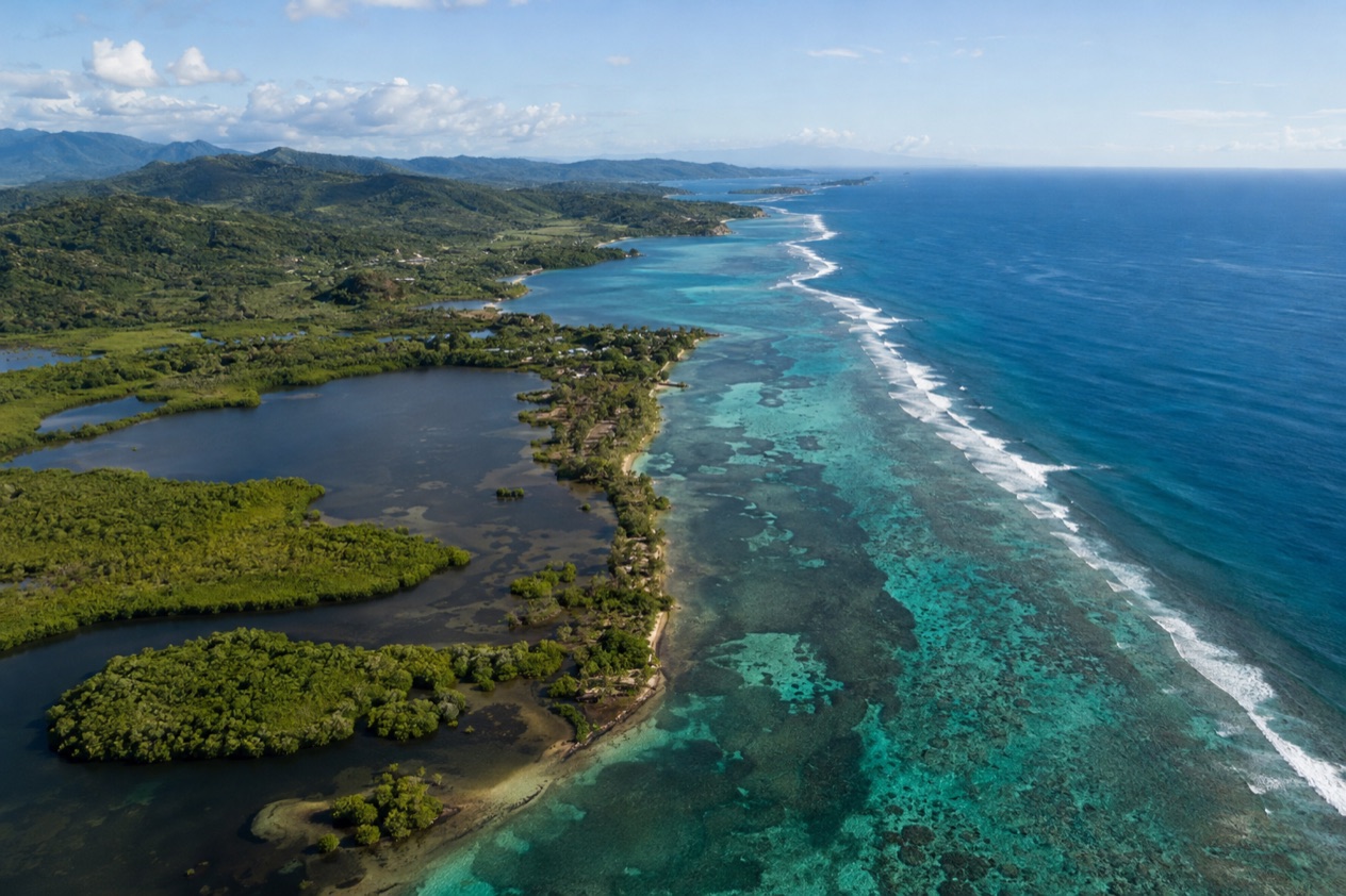
The cayes and the reef lie in the Caribbean off the whole coast of Belize, in a long line that parallels the mainland. The Belize Barrier Reef stretches roughly 200 miles and is the longest in the western hemisphere. It is also the second-largest coral reef system in the world and a UNESCO World Heritage Site, listed in 1996.
The reef does not hug the shore evenly. In the north it lies roughly 980 feet offshore, while in the south it lies about 25 miles out. Picture a wide gap between mainland and reef down south and a narrow strip up north, and you have the shape of the water side of the map.
Ambergris Caye and the cayes of the coast
Ambergris Caye is the island most travelers have in mind when they say Belize and beach in the same sentence, with San Pedro as its town. Caye Caulker, St. George’s Caye, Caye Chapel, Tobacco Caye and South Water Caye are other names on the same coastal chain, each one a small dot with its own character. Hol Chan and Shark Ray Alley are reef sites you will find named on maps near Ambergris Caye.
Resorts add their own islands to the map. Matachica and Victoria House are on Ambergris Caye, while Cayo Espanto and Thatch Caye are on private islands. Harvest Caye is a cruise destination in the south. Each of these is a single place, so a stay at one tells you nothing about the others.
The three atolls
Beyond the barrier reef sit three distinct Caribbean atolls: Turneffe Atoll, Glover’s Reef and Lighthouse Reef. Turneffe is the nearest to Belize City, directly to its east. Lighthouse Reef is the most easterly diving area in Belize, so on the map it is the dot farthest out to sea.
Lighthouse Reef is home to the Great Blue Hole, a karst formation that Jacques Cousteau made famous in 1970. Half Moon Caye is another name found on this part of the map. Glover’s Reef completes the trio, and together the three give the offshore map its shape of rings and lagoons rather than a single line.
What lives on the reef
The reef is home to 70 hard coral species and 36 soft coral species, along with 500 species of fish and hundreds of invertebrates. The reserve system was designated a World Heritage Site because of its vulnerability and its significant natural habitats for conserving biological diversity.
Belize has acted to protect it. It became the first country in the world to completely ban bottom trawling in December 2010, and in December 2015 it banned offshore oil drilling within a kilometer of the barrier reef. Scientists say that over 40 percent of the reef has been damaged since 1998, a reminder that what you see on the map is a living, fragile place.
Where are the Maya sites?
The Maya sites are mostly inland, in the districts away from the cayes, and the names you will see on a Belize map are Xunantunich, Caracol, Cahal Pech, Lamanai, Altun Ha, Lubaantun and Nim Li Punit. The Maya, the people who built them, still live in Belize today, so these places belong to a living culture and not only to the past.
The Cayo sites
Xunantunich, Cahal Pech and Caracol are the names associated with the Cayo District, the jungle country around San Ignacio. Cahal Pech is a ruin of plazas and temples set above the town, and Xunantunich and Caracol are further into the green interior. Mountain Pine Ridge belongs to the same area of the map.
The district is also the place for caves, including the ATM cave. Entering any cave in Cayo without a licensed guide is dangerous and illegal. Ruins and caves together make the Cayo District the part of Belize where the Maya past is most present in the landscape.
Sites of the north and the south
Lamanai and Altun Ha are the sites people connect with the northern part of the country, around Orange Walk and Belize City, and both are known for their temples set among forest. Lamanai is reached through Orange Walk country, where rivers and lagoons shape the surroundings.
Lubaantun and Nim Li Punit are the names of the south, in Toledo, close to Punta Gorda. In this wettest corner of the country, with rainfall over 177 inches a year in the extreme south, the ruins are surrounded by dense green. A map of the sites therefore runs from the dry-edged north to the rain-soaked south.
Good to know before you go
The U.S. State Department rates Belize Level 2, “Exercise increased caution”, because of crime, and says the south side of Belize City has historically had the highest concentration of violent crime.
The currency is the Belize dollar, and ATMs of three banks accept Mastercard: Belize Bank, Scotiabank and Atlantic Bank. The country keeps Central Standard Time all year, so there is no clock change to think about.
The Atlantic hurricane season runs from June 1 to November 30, with hurricanes mostly arriving late in it, from September to December, and coastal flooding is a particular risk in the south. Independence from the United Kingdom came on September 21, 1981, a date that colors the country’s calendar each September.
Sources
- Wikipedia, Geography of Belize (https://en.wikipedia.org/wiki/Geography_of_Belize), checked October 11, 2026
- Wikipedia, Belize (https://en.wikipedia.org/wiki/Belize), checked October 11, 2026
- Wikivoyage, Belize (https://en.wikivoyage.org/wiki/Belize), checked October 11, 2026
- U.S. Department of State, Belize Travel Advisory, Level 2, March 11, 2026 (https://travel.state.gov/), checked October 11, 2026
- NOAA National Hurricane Center, Climatology (https://www.nhc.noaa.gov/climo/), checked October 11, 2026