
SAGRES · PORTUGAL · THE SOUTHWEST CORNER
Walk out past the fortress gate onto the flat table of rock, and the wind arrives before the view does. It presses on one ear, flattens the scrub, and does not let up while you are out there. That pressure is the point. Travelers who book this village expecting a calm sunbed coast tend to leave disappointed, because that coast is an hour back east. What the southwest corner of Europe hands you instead is exposure: open Atlantic on two sides, hard cliff light, and a great deal of empty ground between the buildings.
SAGRES AT A GLANCE
Come for wind, cliffs and open ocean, plan to switch sides of the village when it blows, and treat the cape at last light as the fixed appointment of the day.
SOUTHWEST TIP OF THE CONTINENT · TWO EXPOSURES, ONE VILLAGE · SHORT SEASON
Go for: the compass rose inside the fortress walls, a beach swap when the Atlantic side is unswimmable, cliff-path walking, and the light going down off the cape.
Think twice before: booking this as a swimming holiday. The sea is open ocean, the sand travels when it blows, and the village runs a short season with plenty shut in winter.
Air, sea and season figures live on our Algarve guide · full sources at the end of this guide
On this page
- Why every plan starts with wind directionWhat the wind changes, hour by hour
- The fortress, the cape, the sunsetFortaleza and Cabo de São Vicente
- Which beach todayMareta and Martinhal, or Tonel and Beliche
- Learning to surf, or walking the cliffsSchools and the Rota Vicentina
- What is open, and what is shutThe season and time-of-day table
Wind in Sagres: what it affects and where to check the forecast
Wind runs the day here, not the forecast temperature. It sets what the air feels like on the sand, which side of the village is swimmable, how the surf lines up, and whether a boat leaves the harbor at Baleeira. Air and sea figures for this coast, month by month, sit on our Algarve guide, and the shape of the year across the country is in the month-by-month planner. Read them for the averages, then accept that the daily variable in Sagres is direction, and it changes your plans far more than the thermometer does.
In practice that means checking wind direction each morning the way you would check rain elsewhere, and packing for it: something windproof earns its place in the bag even in high summer, as the packing guide argues. Mornings are often the quieter half of the day, with less local wind and thinner traffic on the cliff road. They are not a promise of a smaller sea. Swell here is generated by distant Atlantic systems and keeps its own schedule, so the call on whether a lesson or a boat trip runs belongs to the operator reading the water that morning.
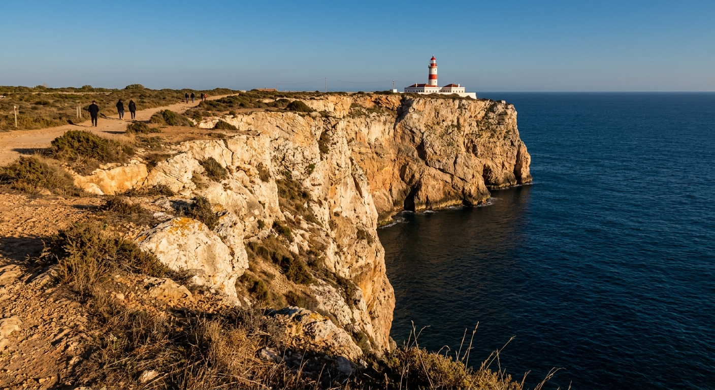
The Fortaleza and Cabo de São Vicente: the wind rose, the lighthouse, the sunset
The Fortaleza occupies its own promontory at the edge of the village, and what is inside the walls is mostly emptiness: a long rampart across the neck of the headland, a small church, and a vast compass rose of stones set into the ground whose date and purpose are still argued over. The exhibit that stays with you is the walk around the rim, with the ocean working the cliffs underneath. Keep children on the inland side of the path. The drops are abrupt and the gusts are not polite.
The story you will hear, in guidebooks and from drivers, is that Prince Henry the Navigator ran a school of navigation on this headland. Historians dispute it, and there is no consensus that any formal school stood here. Repeated often enough, a thin record hardens into a fact. What nobody argues about is the geography: this is where the south coast stops running east and the open Atlantic takes over, which mattered enormously to anyone pointing a ship south.
Cabo de São Vicente sits a short drive west along the headland road, a lighthouse on the last cliff of continental Europe and the sunset appointment for everyone within reach. Parking fills first, then the verges. Arrive with light still on the rock, walk a stretch of clifftop, and expect the railing to be far windier than the village felt when you left it. If the cape looks like a parking lot, the fortress faces the same ocean and the same sunset with a fraction of the cars.
Sagres beaches: the sheltered east side, the exposed west, and how to swap
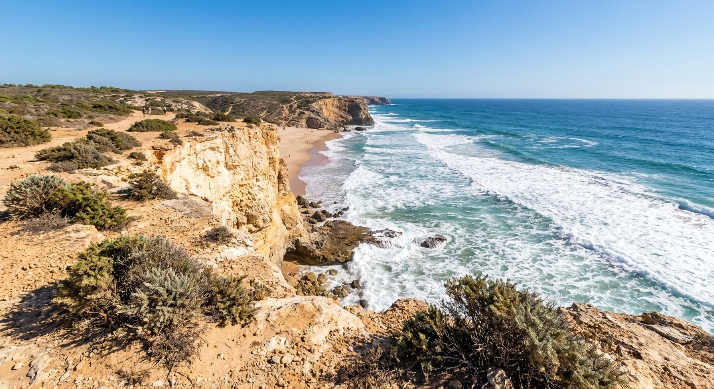
East of the village, the water is sheltered. Praia da Mareta lies directly below town and is the default walk-down beach. Praia do Martinhal, further east, is broader and flatter, the one families gravitate to. Porto da Baleeira in between is a working harbor with fishing boats and the dive and boat operators, not a swimming beach. When the wind comes hard off the Atlantic, this whole side stays usable while the other side is being sandblasted at ankle height.
West and north, the coast is fully exposed. Praia do Tonel sits just across the isthmus from Mareta, close enough to walk between the two in flip-flops, and it faces the open ocean squarely. Praia do Beliche is a notch in the cliff on the road toward the cape, reached by a staircase, with more drama than square footage. Keep going north and you reach Praia do Amado and the string of Costa Vicentina beaches, which our regional guide covers as a whole.
The rule that makes this village livable: when it blows on one side, cross to the other. Locals do it without discussion, and it turns a written-off afternoon into a swim. What the swap does not change is the water. These are open-ocean beaches with shore break, cold upwellings and currents that pull sideways along the sand. Respect flags where they are flown, get out when a lifeguard tells you to, and read our Portugal safety guide on Atlantic swimming before turning teenagers loose on Tonel.
Surf schools, the Rota Vicentina cliff paths and the drive from Faro
Surf schools are the village’s main industry, and the good ones use the wind instead of fighting it: the van goes wherever is working that morning, which may be Mareta for a first lesson or Amado, a competition beach, when the swell is up. Tonel and Beliche turn serious fast and are not beginner water on a big day, and on the days when wind and swell leave no workable side, the good schools cancel rather than improvise. Walkers get the other half of the deal, since sections of the Rota Vicentina run along the clifftops from the cape and north up the coast, and they work as out-and-back day walks straight from the village.
Getting here is the real cost of choosing Sagres. This is the farthest base on the coast from Faro airport, the regional railway stops well short at Lagos, and bus links thin out as you go west. A car is close to unavoidable, with the fine print in our car rental guide and the alternatives in getting around Portugal. Fly into Faro and collect the car there. To see the opposite coast on the same trip, pair these cliffs with Tavira and its lagoon.
Sagres by season and time of day: what is open and what is shut
| When | What is running | What is not | The trap |
|---|---|---|---|
| Summer, daytime | Schools, board rental, cafés, boat operators, cape parking | Little is closed, but the sheltered beaches fill first | Rolling up to Mareta at midday with no parking plan |
| Summer, evening | The sunset crowd at the cape, restaurants seating late | Kitchens still wind down earlier than in Albufeira | Leaving for the cape at the last minute and watching the light from a queue |
| Spring and fall | Surf schools, most restaurants, beaches with room on them | Some places take a midweek rest day | Assuming warm air on the cliff means a warm swim below it |
| Winter | The cape, the fortress, the cliff paths, a core of year-round cafés | Many restaurants, rentals and small guesthouses close for the season | Booking a long stay here with no car and no walking plan |
| Any windy day | The sheltered side, the fortress rim, an inland lunch | The exposed beaches, for swimming or for lying down | Digging in on the wrong beach all afternoon out of stubbornness |
When to go. The month-by-month case for Sagres — what the normals say, when the sea is warm enough to swim and which weeks fill up — sits on the best time to visit Sagres.
The last word
This village suits people who treat weather as part of the trip rather than an obstacle: surfers, walkers, photographers after the low light on rock, anyone who has had enough of sunbed rows. A good day here is a small, repeatable sequence. Coffee in the village, the wind check, the fortress rim while the air is still, a beach swap after lunch, the cape when the light goes long. Book it for that, and add Lagos or Carvoeiro if you also want the cove-and-boat version of this coast.
It does not suit a traveler whose vacation stands or falls on still afternoons, warm shallow water and a full street of open restaurants in February. That reader belongs east, on the lagoon. What people regret in Sagres is never the wind. It is arriving for a single night, with sunset already crowded and no time left for the other trick this place does: the morning after, an empty cliff path, gulls hanging in the updraft, and the whole southwest corner of the continent to yourself before the first van comes down to the beach.
Sources & data for this guide
- Village layout, beach exposures and the fortress and cape geography · Turismo de Portugal destination pages plus editorial ground notes · checked Sep 3, 2026
- Prince Henry the Navigator’s alleged school of navigation at Sagres · treated here as disputed: there is no scholarly consensus that a formal school existed on this headland, and we decline to repeat it as fact · checked Sep 3, 2026
- Air temperatures, sea temperatures and month-by-month season data are deliberately not repeated on this page · they live on our Algarve guide and the month pages · checked Sep 3, 2026
- Rail service on this coast runs east to Lagos, with no train onward to Sagres · CP regional line, as summarized in our Algarve coverage · checked Sep 3, 2026
- Opening and closing patterns by season are qualitative editorial observation, not operator data · check individual businesses directly for winter travel · checked Sep 3, 2026