
You step out of the international terminal in Ladyville with a beach in mind and a map that shows the whole country stretched out to the south. Somewhere down there, at the tip of a long, thin peninsula, is Placencia, with its pedestrian sidewalk and its reef. The short answer is that a small plane from Belize City’s Municipal Airport is the way the airline itself describes the trip, and the roads are the other path.
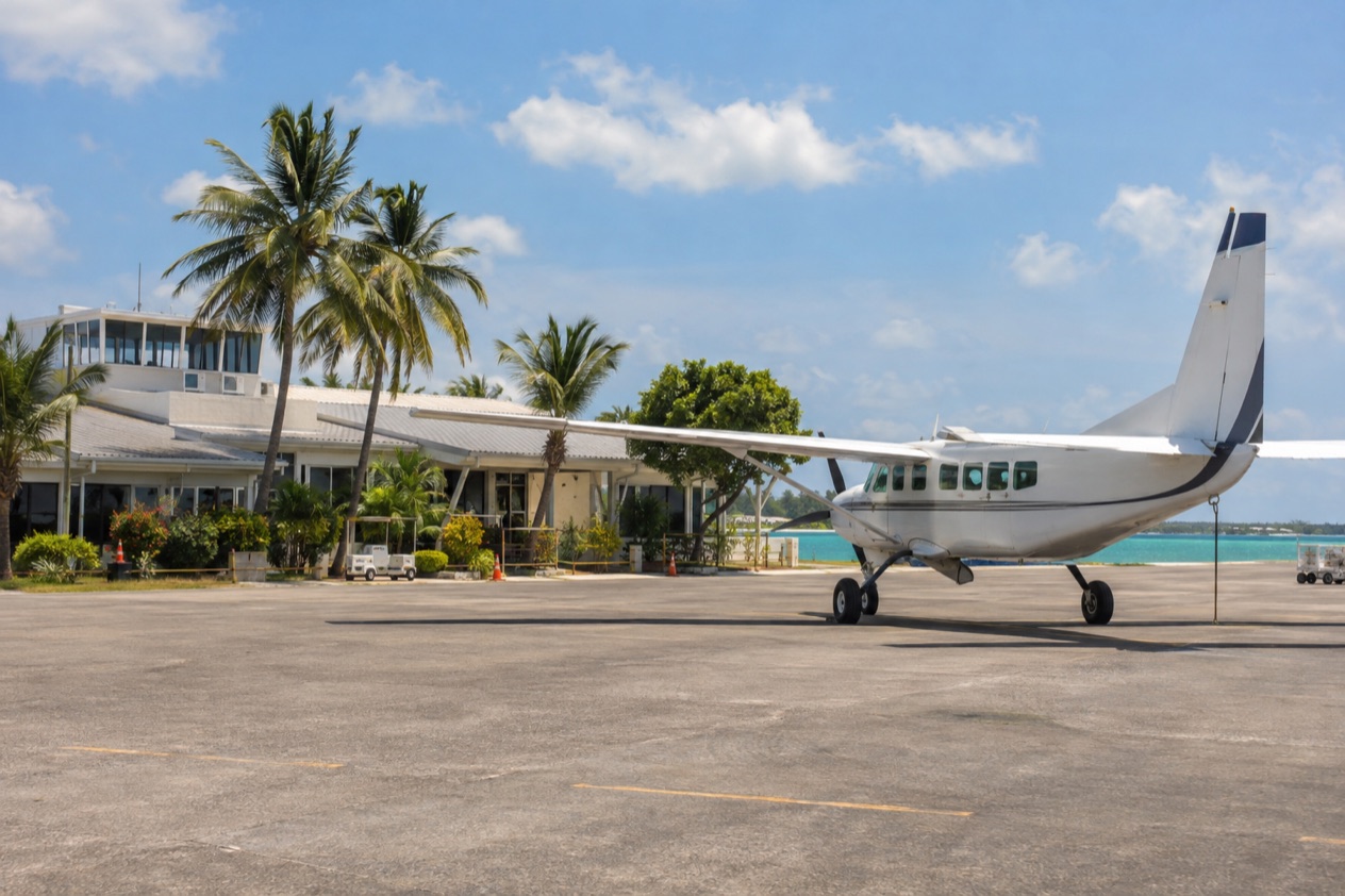
How do you get from Belize City to Placencia?
You fly: Maya Island Air connects Belize City to Placencia, and the airline describes it as a forty minute flight. The other way is overland on Belize’s roads, which run from two-lane pavement to dirt and gravel tracks. Both end in the same place, the village at the southern tip of the Placencia Peninsula in the Stann Creek District.
Placencia is a small tourist village, home to about 1600 people. Its main street has a claim to fame, since the village is said to have the narrowest main street in the world according to the Guinness World Book of Records. Knowing that helps you picture the arrival: this is a place of footpaths and low buildings, not a town of broad avenues.
The flight in a few words
Maya Island Air flies the route, and early flights from Belize City head south to Dangriga, Placencia, Savannah and Punta Gorda. That tells you something useful about the shape of the trip. Placencia sits on a small southbound circuit of airstrips, so the plane you board may be calling at other southern towns on its way.
The airline’s headquarters can be reached by phone for the Belize City end of things, and the Placencia terminal building has its own numbers. Both are in the table.
| Maya Island Air office | Phone |
|---|---|
| Terminal and administration headquarters, Belize City | 501-223-1403 |
| Terminal Building, Placencia | 501-523-3443 or 501-523-4072 |
The overland option
Going by road means taking on Belize’s driving conditions, which vary from one stretch to the next. Some roads are paved two-lane highways, and others are dirt or gravel. Vehicles drive on the right, as in the United States, which is one familiar thing among the unfamiliar ones.
Two cautions apply to any road trip in the country. Driving at night is strongly discouraged, and roadside assistance is frequently unavailable. Those two points shape how you plan a day on the road, and they are the reason many travelers look first at the air route.
Which airport in Belize City
Belize City has two airports, and the difference matters for this trip. Philip Goldson International Airport (BZE) handles all the international flights and sits in Ladyville. The Belize City Municipal Airport (TZA) is only for domestic flights, and it is the one tied to the small planes heading south.
If you arrive from the United States, you land at the international airport and connect to the municipal one for the Placencia flight. The two are different places, so a traveler reading an itinerary should look at the airport code, TZA for the domestic departure, before anything else.
| Airport | Code | What it serves | Where it is |
|---|---|---|---|
| Philip Goldson International Airport | BZE | All international flights | Ladyville, ten miles from the center of Belize City |
| Belize City Municipal Airport | TZA | Domestic flights only | About one mile outside downtown Belize City |
The municipal airport links Belize City with ten domestic destinations, and Placencia is one of them. It is also Tropic Air’s main cargo hub, a reminder that these small planes carry the country’s goods as well as its visitors.
What you may do in Belize City first
If your connection leaves you with time in the city, the Museum of Belize shows ancient artifacts and historic memorabilia, and the city also offers local dining and shopping. It is a way to meet the country’s past before heading to a peninsula known for its beaches. The Belize History Museum is another stop for visitors.
Can you fly to Placencia?
Yes, Placencia has its own airport, and Maya Island Air flies there from Belize City. The village is the southernmost on the peninsula, and Placencia Airport serves it directly, which is why the flight ends close to the sand rather than on a distant highway.
From the sky
A flight out of Belize City gives you an aerial view of the Caribbean Sea, the same view that carries travelers to San Pedro and Caye Caulker. Heading south toward Placencia, you see the coast from above before the peninsula comes into view as a narrow strip with water on both sides.
The Placencia flight is a forty minute hop. Window seats suit this route, since the point of a small plane is the view it gives of the coast and the reef line offshore.
Other flights from the same airport
Belize City Municipal Airport has the busiest list of departures in the domestic network. Tropic Air offers hourly flights between the municipal airport and San Pedro on Ambergris Caye, a different direction entirely from Placencia. That contrast is worth knowing when you book: the northern cayes and the southern peninsula are different trips with different flights.
For the south, the early flights are the ones that go to Dangriga, Placencia, Savannah and Punta Gorda. If your plan includes more than one southern town, those stops are the same ones you see on the schedule.
What you find after landing
Along the Placencia Peninsula you pass Maya Beach, the Garifuna village of Seine Bight, and at the very south end the village of Placencia. The settlements include Riversdale Village too, and together they hold a few thousand permanent residents. Placencia has been voted as having one of the best beaches in the world, and it is known for friendly people and great fishing.
In the village, the Sidewalk is a concrete pedestrian-only path that runs most of the length of the village and ends at the seashore. Businesses line it, so the walk from one end to the other takes you past shops, restaurants and galleries. Belgian Cafe on Main Street serves breakfasts and lunches, and the Barefoot Beach Bar has a happy hour in the early evening and a band on Sunday nights.
The reef and the seasons
Placencia is a base for the water. Kayaking, snorkeling, diving, saltwater fly fishing and light tackle fishing are all part of the offer, and from the village the longest barrier reef in the northern hemisphere lies a 45-minute boat ride off the coast. Laughing Bird Caye National Park is a short boat ride away, closer than the reef.
In the spring, whale sharks pass near Gladden Spit around the full moon, and visitors can dive or snorkel with them. You may see them, though nature gives no promises. Other dates on the calendar are the Sidewalk Arts Festival in February and Lobsterfest in June.
What are the ground options?
On the ground you have two choices, a taxi or your own wheels, and neither comes with the ride-hailing apps Americans know. Uber and Lyft are not available in Belize, so a trip by road starts with different expectations from a trip at home.
Taxis
Taxis in Belize are identified by green license plates, which is the quickest way to tell a taxi from a private car. Without an app to summon one, you look for the green plate at the airport or in town. That plain detail is the one sure thing about taxis, and the rest you arrange on the spot.
A taxi suits the short hops that connect an airstrip to a hotel, a terminal to a street, or the municipal airport to the center of Belize City, which lie about a mile apart. For the long haul toward the peninsula, the flight is the route the airline describes.
Driving yourself
Valid U.S. or international driver’s permits are accepted in Belize only for a period of three months after initial entry. Drivers use the right side of the road, which makes the basics feel familiar. What changes is the road itself, since paved two-lane stretches give way to dirt or gravel tracks.
Cyclists commonly fail to obey red lights or stop signs and often ride against traffic, so a driver watches for bikes in every town. Driving at night is strongly discouraged, and roadside assistance is frequently unavailable. Together these points explain why a road trip needs daylight and patience.
Getting around once you arrive
In Placencia itself, the Sidewalk is the main thoroughfare for people on foot. It is pedestrian-only, so the village center asks you to leave the car behind and walk from the Belgian Cafe to the Barefoot Beach Bar. From there, the water takes over: boats go out to Laughing Bird Caye and to the southern cayes.
Other outings from the village include Monkey River and the Cockscomb Basin. Each is a different kind of day, one on a river and one in a wildlife sanctuary, and both start from Placencia.
Good to know before you go
The U.S. State Department rates Belize Level 2, “Exercise increased caution”, because of crime, and says the south side of Belize City has historically had the highest concentration of violent crime.
The tap water in Placencia is drinkable, plumbed in from an artesian well on the mainland. Mosquitos are less common than on the mainland, but bring repellent and sunscreen, and consider eco-friendly versions if you plan to snorkel or dive near the reefs.
The Atlantic hurricane season runs from June 1 to November 30, and Hurricane Iris struck southern Belize on October 8, 2001, with major damage to nearly all the buildings in Placencia. Whale shark outings need to be arranged upfront.
Sources
- Tropic Air, Placencia (https://www.tropicair.com/placencia-plj/), checked October 11, 2026
- Maya Island Air, Placencia flights (https://www.mayaislandair.com/belize-flights-placencia/), checked October 11, 2026
- Tropic Air, Belize City municipal airport (https://www.tropicair.com/belize-city-tza/), checked October 11, 2026
- Maya Island Air, Belize City flights (https://www.mayaislandair.com/belize-city-flights/), checked October 11, 2026
- Wikipedia, Placencia (https://en.wikipedia.org/wiki/Placencia), checked October 11, 2026
- Wikivoyage, Placencia (https://en.wikivoyage.org/wiki/Placencia), checked October 11, 2026
- U.S. Department of State, Belize Travel Information, Traveling and transportation (https://travel.state.gov/), checked October 11, 2026
- U.S. Department of State, Belize Travel Advisory, Level 2, March 11, 2026 (https://travel.state.gov/), checked October 11, 2026
- NOAA National Hurricane Center, Climatology (https://www.nhc.noaa.gov/climo/), checked October 11, 2026
To plan your stay
- Best Time to Visit Belize City: Weather by Month, Hurricane Season and What to Do
- Things to Do in Belize City: Museum of Belize, Nearby Cayes, Day Trips and Local Food
- Where to Stay in Belize City: Haulover Creek, Ladyville, the Cayes and Hotel Taxes
- Know Before You Go to Belize City: Entry Papers, Money, Getting Around and Health