
FLORIDA · GULF ISLANDS NATIONAL SEASHORE · AUGUST
August on Gulf Islands National Seashore brings a sea that averages 87.8°F at its daily peak, afternoon highs of 90.6°F and a sun that stays up until 7:27 p.m. The barrier islands off Pensacola and the Mississippi coast offer bath-warm swimming from the first hour of light, and the air turns heavy soon after breakfast.
The trade-off is rain and timing. NOAA records measurable rain on 8.1 days in an average August, more than in July or September, and the month falls inside the Atlantic hurricane season that runs June 1 to November 30 (our Florida orientation has the NOAA dates). Weighing a month earlier or four weeks later instead? All three months line up in our comparison.
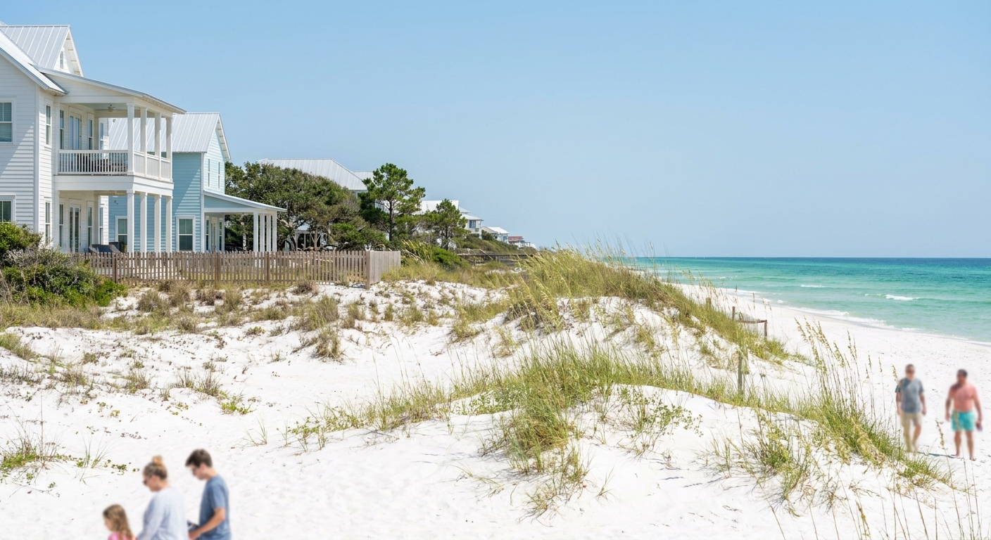
AUGUST AT A GLANCE · GULF ISLANDS NATIONAL SEASHORE
August is the swimmer’s month on the seashore: warm water all day, hot air by midmorning, and measurable rain on roughly one day in four.
HIGHS 90.6°F · SEA 87.8°F · 8.1 RAIN DAYS · BOOK REFUNDABLE
Go for: 87.8°F water, sunrise swims, and beach evenings that run until 7:27 p.m.
Think twice before: booking non-refundable in hurricane season, or planning midday hikes in 90.6°F heat.
Climate: NOAA NCEI, South Walton station · Sea: Open-Meteo Marine API · Light: sunrise-sunset.org · full sources at the end
On this page
- Gulf Islands weather in AugustHighs of 90.6°F and 8.1 rain days
- Can you swim in August?Sea at 87.8°F, as daily maxima
- Crowds and prices in AugustBooking lead time, lodging tax and the refundable rate
- Things to do in AugustBeaches and forts from Pensacola to Mississippi
- A two-day August itineraryTwo days built around the 6:10 a.m. sunrise
- August vs July and SeptemberHighs, rain and sea for all three months
- Is August a good time to visit?Who should go, and the month to pick instead
Every air figure here comes from one NOAA station, USW00053853, at South Walton in the Panhandle (our South Walton guide covers that beach town). The seashore stretches 160 miles west from there into Mississippi, so these normals describe its eastern end, not Ship Island or Davis Bayou. Sea temperatures come from a separate source, the Open-Meteo Marine API, averaged over 2015-2024.
Gulf Islands National Seashore weather in August: average highs, lows and rain days
| August at the seashore | Normal | Source |
|---|---|---|
| Average high | 90.6°F (32.6°C) | NOAA NCEI, 1991-2020 |
| Average low | 75.8°F (24.3°C) | NOAA NCEI, 1991-2020 |
| Precipitation | 6.08 in | NOAA NCEI, 1991-2020 |
| Days with 0.10 in or more | 8.1 | NOAA NCEI, 1991-2020 |
| Days with 1 in or more | 1.8 | NOAA NCEI, 1991-2020 |
| Sea surface (mean of daily maxima) | 87.8°F (31.0°C) | Open-Meteo Marine API, 2015-2024 |
| Daylight, Aug 15 | 13 h 16 min | sunrise-sunset.org |
| Sunrise / sunset, Aug 15 | 6:10 a.m. / 7:27 p.m. CDT | sunrise-sunset.org |
NOAA’s National Centers for Environmental Information set the August normals over 1991-2020: an average high of 90.6°F (32.6°C), an average low of 75.8°F (24.3°C) and 6.08 inches of precipitation. These are official station normals, read from a real thermometer at South Walton instead of a reanalysis model’s estimate for a grid cell. We found no station normals for the Pensacola or Mississippi districts, so treat the decimals as South Walton’s own.
Precipitation of at least a tenth of an inch falls on 8.1 days of an average August, roughly one day in four. Over a week-long trip that works out to about two wet days. Inch-plus downpours come 1.8 times a month, less than one per week on average, and those are the days to move plans indoors. Florida’s wet season runs on afternoon thunderstorms, as our Florida orientation explains, so the morning is the safer beach window.
Nights barely cool. The gap between the 90.6°F high and the 75.8°F low is 14.8°F, and nobody needs a sweater at a campsite after dark. Pack for sweat and rain: two swimsuits so one can dry, quick-dry shirts, a brimmed hat, plenty of sunscreen and a packable rain shell for the storm days. A cooler with ice matters more than a jacket on the barrier islands, where shade is scarce away from the fort walls and the Naval Live Oaks trails.
On August 15 the seashore gets about 13 hours 16 minutes of daylight. The sun rises at 6:10 a.m. and sets at 7:27 p.m. Central Daylight Time, which covers both the Florida and Mississippi districts. The first hour after sunrise is the coolest time to walk the sand, and the light turns gold over the Gulf in the hour before sunset.
Can you swim in Gulf Islands National Seashore in August? Sea temperature and what it feels like
The Open-Meteo Marine API puts the sea surface off the seashore at 87.8°F (31.0°C) in August, averaged over 2015-2024. That figure is the mean of each day’s maximum, so it runs a shade warmer than a 24-hour average would, and a dawn swim meets slightly cooler water than the number suggests. Tables that average around the clock will show a lower figure, and both can be correct.
In practice there is no cold shock at all. The water sits only 2.8°F below the average afternoon high of 90.6°F, so it cools you less than you might hope in mid-afternoon and feels like a warm bath by midmorning. Swimmers who usually need a wetsuit can leave it at home. Bring drinking water down to the sand, since a swim at this temperature does little to bring your body heat down.
We could not find a wave or wind series for August off these islands, so we give no swell figure. Conditions still change from one day to the next. Florida beaches fly colored warning flags for surf and rip currents, and a purple flag signals dangerous marine life such as jellyfish (our Florida safety guide covers the system). Tropical weather is the larger variable: a storm in the Gulf can bring days of high surf and closed beaches well before any landfall.
How busy is Gulf Islands National Seashore in August? Crowds and prices
We found no occupancy or room-rate series for Pensacola Beach, Navarre, Fort Walton Beach or Ocean Springs, so we crown no month cheap or expensive. The calendar facts are plain enough. August is still summer vacation for many American families, school years restart during the month in many districts, and the whole month sits inside hurricane season.
Fort Pickens Campground on Santa Rosa Island takes reservations through Recreation.gov, and rooms on the islands book ahead through the summer. Our working rule is four to six weeks ahead for a room or campsite near the sand (est.), longer for a Saturday night. We have not tested it against booking data. Most visitors fly into Pensacola for the Florida districts (our Florida flights guide compares airports), and our where-to-stay guide sorts the bases.
We could not verify the lodging-tax rate for Escambia, Santa Rosa or Okaloosa County, or for the Mississippi coast counties, so we give no percentage. Ask for the total with taxes and any resort fee before you commit to a stay. Our Florida trip-cost guide covers the fee layer that lands on top of a nightly rate.
Pay for flexibility. A refundable rate costs more than a prepaid one, and in hurricane season it separates a Gulf storm that costs you a trip from one that costs you a rebooking. Our Florida orientation recommends refundable bookings for the late-summer and fall window for the same reason. A room on Santa Rosa Island or Perdido Key is the second spend worth making, because it puts you in the water soon after the 6:10 a.m. sunrise without a drive.
Things to do in Gulf Islands National Seashore in August
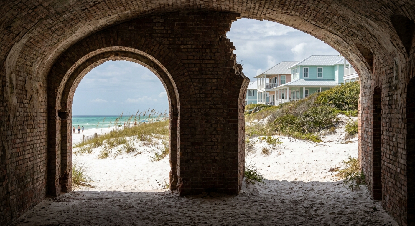
Of July, August and September, August holds the warmest water, 87.8°F against 85.9°F in both neighbors. It is the month for staying in the Gulf long past the point where you would normally get cold: snorkeling in calm water, floating off Johnson Beach, or a last swim after dinner before the 7:27 p.m. sunset.
In Florida, the best-known district is the Fort Pickens Area at the western tip of Santa Rosa Island, with its brick fort, beaches and campground. Opal Beach, farther east on the same island, has picnic pavilions beside the dunes. Johnson Beach sits on Perdido Key, Naval Live Oaks in Gulf Breeze adds shaded trails, and the Okaloosa Area near Fort Walton Beach lies closest to the South Walton station. In Mississippi, Davis Bayou in Ocean Springs holds the visitor center, and West Ship Island is reached by a seasonal ferry from Gulfport. We could not verify August fees, hours or ferry fares, so we list none. Our Florida national parks guide places the seashore among its neighbors.
Between July and August the sea warms by 1.9°F while the average high barely moves, from 90.9°F to 90.6°F. Midday is the time to leave open sand at Opal Beach or Johnson Beach for shade: the vaulted rooms inside Fort Pickens and the live-oak canopy at Naval Live Oaks are the obvious refuges. By September the high falls to 88.5°F while the water holds at 85.9°F, giving hikers more slack.
We could not verify any National Park Service fee-free day falling in August, so we name none. An America the Beautiful annual pass covers entrance at federal fee areas, including the seashore’s, which matters if you plan to return to Fort Pickens on several days of the trip.
Gulf Islands National Seashore in August: a two-day itinerary
Day one belongs to Santa Rosa Island. Reach the Fort Pickens Area close to the 6:10 a.m. sunrise, swim while the water sits at the cool end of its daily range, and walk the fort before the brick heats up. Leave the open beach by late morning, eat lunch indoors in Pensacola Beach or Gulf Breeze, and spend the early afternoon under the oaks at Naval Live Oaks or back at your room. Return to Opal Beach late in the day and stay for the 7:27 p.m. sunset. Moving between districts takes a car, as our Florida getting-around guide explains.
On day two, choose an end of the seashore. Johnson Beach on Perdido Key keeps you near Pensacola, while Davis Bayou in Ocean Springs trades the Florida sand for Mississippi’s bayou trails and visitor center. Swim first in either case, before storms build. With 8.1 rain days in an average August, one wet afternoon in two days is ordinary. On one of the 1.8 inch-plus days, move the swim to the next morning and spend the storm inside the Fort Pickens casemates or the Davis Bayou visitor center.
Gulf Islands National Seashore in August vs July and September
| Normal | July | August | September |
|---|---|---|---|
| Average high | 90.9°F | 90.6°F | 88.5°F |
| Average low | 76.2°F | 75.8°F | 72.4°F |
| Precipitation | 5.77 in | 6.08 in | 5.18 in |
| Days with 0.10 in or more | 7.2 | 8.1 | 5.3 |
| Sea surface, daily maxima 2015-2024 (Open-Meteo) | 85.9°F | 87.8°F | 85.9°F |
July runs a high of 90.9°F and a low of 76.2°F, August 90.6°F and 75.8°F, September 88.5°F and 72.4°F, all NOAA normals from the same South Walton station. Rain peaks in August at 6.08 inches and 8.1 days of measurable rain, against 5.77 inches and 7.2 days in July and 5.18 inches and 5.3 days in September. The sea figures come from the Open-Meteo Marine API: 85.9°F in July, 87.8°F in August and 85.9°F again in September.
Moving to July costs you 1.9°F of sea and saves 0.9 rain days, with the air nearly identical. Moving to September cools the high by 2.1°F and the low by 3.4°F, trims rain days by 2.8 and keeps the sea at 85.9°F. September carries its own risk: the hurricane season peaks around September 10, per the NOAA dates in our Florida orientation. Our July guide has the month-earlier detail.
Is August a good time to visit Gulf Islands National Seashore?
Yes for swimmers, snorkelers and families who build each day around the beach at dawn and dusk. August suits a long weekend or a week of vacation spent mostly in the water. It is a poor fit for hikers, cyclists and anyone planning long fort-and-trail days in the open, and for travelers who can only book non-refundable during hurricane season.
If August is out, pick September. The high drops to 88.5°F, the low to 72.4°F, measurable rain falls on 5.3 days instead of 8.1, and the sea stays at 85.9°F. Book it refundable for the storm reason above, and see our Florida best-time guide for the cooler months beyond.
Of the three summer months we compare, only August puts the Gulf at 87.8°F.
The last word
Book the refundable room near the sand, set the alarm for 6:10 a.m., and swim before anything else. The sea’s daily peak averages 12°F above the 75.8°F average low, so the first swim of an August morning means stepping out of the dawn air into warmer water, with the rest of the long day still ahead.
Sources & data for this guide
- August normals, rain days and inch-plus days, 1991-2020 · NOAA NCEI monthly normals, station USW00053853 (South Walton) · checked Sep 24, 2026
- July and September normals · same NOAA station and period · checked Sep 24, 2026
- Sea surface temperature for July, August and September, mean of daily maxima 2015-2024 · Open-Meteo Marine API · checked Sep 24, 2026
- Daylight, sunrise and sunset for Aug 15, converted from UTC to Central Daylight Time · sunrise-sunset.org · checked Sep 24, 2026
- Hurricane season dates and September peak · NOAA National Hurricane Center, via our Florida orientation · checked Sep 24, 2026
- What we could not verify: entrance fees, hours, ferry fares, lodging-tax rates, wave and wind data, and normals for the western districts. The booking lead time is our own estimate. Check the National Park Service before you go.
To plan your stay
- Best Time to Visit Gulf Islands National Seashore: Weather, Sea Temperature and the Quiet Months
- Gulf Islands National Seashore in July: Weather, Sea Temperature, Rain and Crowds
- Gulf Islands National Seashore in September: Weather, Sea Temperature, Crowds and Hurricane Season
- Gulf Islands National Seashore in June: Weather, Sea Temperature, Crowds and Prices