
FLORIDA & MISSISSIPPI · JULY · THE MONTH GUIDE
July at Gulf Islands National Seashore is the full-summer version of a barrier-island trip. The Gulf sits less than two degrees below August’s water, the sun is up before six, and the average high reaches 90.9°F. The seashore splits across two states. Santa Rosa Island, Perdido Key and the Pensacola forts are in Florida. Davis Bayou and the offshore islands are in Mississippi. A July vacation here usually means picking one side and staying put.
The date adds warm water, long light and a steady ration of storms. It takes away comfortable midday hours and a clear calendar, since July falls inside the Atlantic hurricane season, June 1 to November 30 according to our Florida overview. If you are weighing a shift of four weeks earlier, our June guide covers the month before.
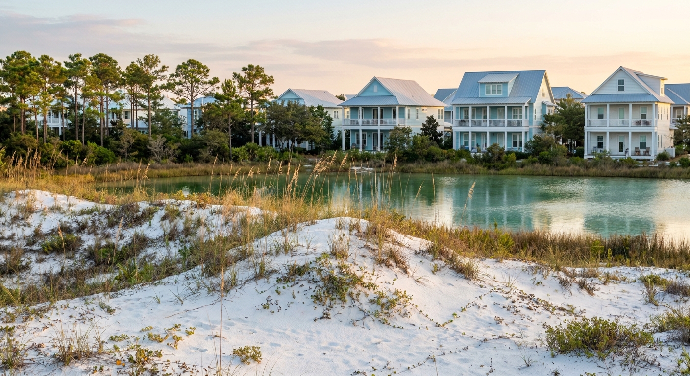
JULY AT A GLANCE · GULF ISLANDS NATIONAL SEASHORE
July brings warm swimming close to August’s peak and long evening light, at the price of 90.9°F afternoons and 7.2 rain days: go for the water, and plan everything on land around the heat.
HIGH 90.9°F · SEA 85.9°F · 7.2 RAIN DAYS · HURRICANE SEASON
Go for: swimming in water that peaks near 85.9°F, evening beach sessions with sunset at 7:49 p.m., and mornings on the sand before the heat builds.
Think twice before: planning long midday walks at the forts under a 90.9°F average high, or a trip that cannot bend around afternoon storms and hurricane season.
Climate: NOAA NCEI station USW00053853 · Sea: Open-Meteo Marine · Light: sunrise-sunset.org · full sources at the end
On this page
- Gulf Islands weather in JulyHighs of 90.9°F, lows of 76.2°F, 7.2 rain days
- Is the Gulf warm enough to swim in July?Sea at 85.9°F by its daily peak
- How busy is the seashore in July?School break, hurricane season and booking terms
- What to do at Gulf Islands in JulyOpal Beach, Fort Pickens, Johnson Beach, Davis Bayou
- Two days at Gulf Islands in JulyDawn swims, morning forts, sunset at 7:49 p.m.
- July vs June and AugustHow heat, rain and sea compare across three months
- Is July a good time to go?Who should go, and why June is the alternative
Our Florida flights guide covers which airport serves which coast. For the Florida units, Pensacola is the natural arrival point, while the Mississippi district around Ocean Springs sits closer to Gulfport-Biloxi. Two days cover the core of either side, and a car is the practical way between beaches, as our getting-around guide explains for the rest of the state.
Gulf Islands National Seashore weather in July: average highs, lows and rain days
| July measure | Value | Source |
|---|---|---|
| Average high | 90.9°F | NOAA NCEI, 1991–2020 |
| Average low | 76.2°F | NOAA NCEI, 1991–2020 |
| Precipitation | 5.77 in | NOAA NCEI, 1991–2020 |
| Days with 0.10 in or more | 7.2 | NOAA NCEI, 1991–2020 |
| Sea surface, mean of daily maxima | 85.9°F | Open-Meteo Marine, 2015–2024 |
| Daylight on July 15 | 13 h 57 min | sunrise-sunset.org |
| Sunrise · sunset, July 15 | 5:52 a.m. · 7:49 p.m. CDT | sunrise-sunset.org, converted from UTC |
The normals below and above come from NOAA NCEI’s official 1991–2020 series for station USW00053853, a physical weather station rather than a reanalysis grid cell. They give an average July high of 90.9°F, a low of 76.2°F and 5.77 inches of rain. That station stands in the Panhandle at South Walton, and the seashore runs 160 miles west from there into Mississippi. Read every figure here as eastern-end climate. We found no station series from Santa Rosa Island or West Ship Island themselves.
Rain falls on 7.2 days in an average July, counting any day with at least a tenth of an inch. That comes to a little under one day in four, or roughly one or two wet days across a week-long stay. Statewide, Florida’s wet season runs on afternoon thunderstorms, as our Florida overview notes, so put the beach in the morning and keep a roofed option for mid-afternoon. When thunder starts, leave the sand and the water.
The average high and low sit 14.7°F apart, and with nights at 76.2°F no evening layer is needed. Pack for heat at both ends of the day: breathable long sleeves against the sun, a wide-brimmed hat, reef-safe sunscreen and your own water for the fort grounds. A light cover-up serves one purpose, the air-conditioning in restaurants and cars.
On July 15 the seashore gets about 13 hours 57 minutes of daylight. Sunrise comes at 5:52 a.m. and sunset at 7:49 p.m. Central Daylight Time, converted from the UTC times published by sunrise-sunset.org. The Florida and Mississippi units both keep Central time. The coolest light for the forts runs from sunrise to mid-morning, and an evening swim starting at 6 p.m. still has nearly two hours of daylight.
Can you swim in Gulf Islands National Seashore in July? Sea temperature and what it feels like
The Gulf off the seashore averages 85.9°F in July, according to the Open-Meteo Marine API over 2015–2024. That figure is the mean of each day’s maximum surface temperature, so it runs a shade warmer than a 24-hour average would. It also comes from a different source and period than the NOAA air normals. Take it as the water at its warmest hour.
At 85.9°F, the Gulf is bath-warm by ocean standards. Nobody needs a wetsuit, children can stay in as long as the sun allows, and wading in brings no chill. Relief is limited, though. With the average high at 90.9°F, the water sits only 5.0°F below the air at midday, so a swim cools you for minutes. Shade, a hat and a midday break indoors matter more than another dip.
We could not read wind or swell data for July, so we make no claim about calm or rough water. Two checks settle it on the day: the National Weather Service surf-zone forecast for the coast, and the warning flag posted at the beach. Rip currents can run under clear skies, and our Florida safety guide covers how to get out of one.
How busy is Gulf Islands National Seashore in July? Crowds and prices
We found no occupancy series and no monthly room rates for the seashore, so we crown no month expensive or cheap. Two calendar facts do apply. July falls in the American school summer break, when family beach trips cluster. It also sits inside hurricane season. NOAA dates the season June 1 to November 30, peaking around September 10, as our Florida overview reports.
We have no booking-lead data, so we give no number of weeks. The rule that holds is about terms: book a refundable room for July, because a named storm in the Gulf can change plans at short notice, and check the tropical outlook a week before you fly. Our Florida trip-cost guide sets out lodging tiers for the state.
We could not verify the lodging-tax rates for the Florida and Mississippi counties along the seashore, so we give no percentage. Ask for the all-in nightly total when you book, taxes and resort fees included, and compare those totals on both sides of the state line.
Location is the one line where paying more changes July. A room on Santa Rosa Island at Pensacola Beach puts Opal Beach and Fort Pickens a short drive away, so escaping a 90.9°F afternoon means a quick return to air-conditioning. Inland rooms can cost less, but every beach session then starts with a longer drive and a parking search. Our where-to-stay guide compares bases across Florida.
Things to do in Gulf Islands National Seashore in July
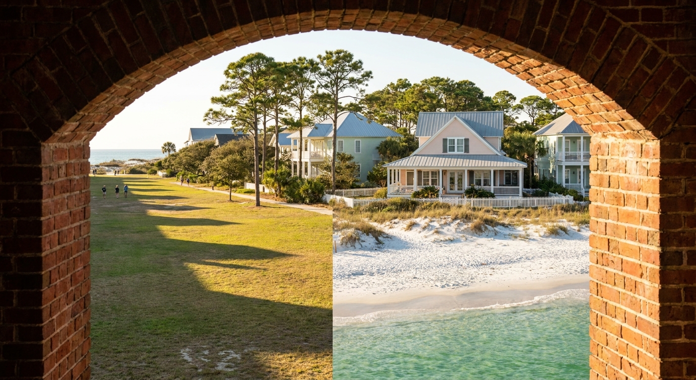
Against June, July offers warmer water: 85.9°F against 82.9°F, three degrees more at the daily peak. Against August, it offers a slightly drier sky, with 7.2 rain days against 8.1 and 5.77 inches against 6.08. That pairing suits a trip built around swimming, morning and evening, with light until 7:49 p.m. on July 15.
In Florida, Opal Beach is the undeveloped stretch of Santa Rosa Island between Pensacola Beach and Navarre Beach, and Fort Pickens holds the island’s western tip with its brick fort and campground. Across Pensacola Pass, Johnson Beach covers Perdido Key, and Naval Live Oaks in Gulf Breeze swaps sand for shaded trails. In Mississippi, Davis Bayou near Ocean Springs has the visitor center, and West Ship Island, home to Fort Massachusetts, is reached by seasonal passenger ferry from Gulfport. Check the NPS seashore site for current fees, hours, and ferry fares before you go.
July narrows the gap between air and water. The average high runs 5.0°F above the sea’s daily peak in July, against 6.0°F in June and 2.8°F in August. At Opal Beach or Johnson Beach, the water feels less and less like a cool-down as summer goes on. At Fort Pickens and Naval Live Oaks, where the visit happens on foot, the 90.9°F afternoon sets the schedule: go early.
We could not verify July entrance fees or any free-entry date, so we list neither. Watching the sunset from a public beach costs nothing, and on July 15 it falls at 7:49 p.m. If you plan several national-park visits this year, compare the NPS annual pass against the per-visit fee at the gate.
Gulf Islands National Seashore in July: a two-day itinerary
Day one, Santa Rosa Island. Reach Opal Beach around 6:30 a.m., about 40 minutes after the 5:52 sunrise, and swim before the heat builds. By 10 a.m., head west to Fort Pickens and walk the fort while the morning holds, then break for an air-conditioned lunch before noon. Keep 1 p.m. to 5 p.m. for a rest or indoor time, the window when Florida’s afternoon storms tend to build. Return to the beach at 6 p.m. for a swim in water that peaks near 85.9°F, and stay for the 7:49 p.m. sunset.
Day two, Perdido Key and Gulf Breeze. Start at Johnson Beach at first light, then take the shaded trails at Naval Live Oaks in late morning. If thunder builds, stay off the sand and out of the water until it passes, spend the afternoon indoors in Pensacola, and move the swim to evening if the sky clears before sunset. If a named storm appears in the forecast, NPS closure notices and local evacuation orders come before any plan of ours.
Gulf Islands National Seashore in July vs June and August
| June | July | August | |
|---|---|---|---|
| Average high | 88.9°F | 90.9°F | 90.6°F |
| Average low | 74.1°F | 76.2°F | 75.8°F |
| Precipitation | 4.70 in | 5.77 in | 6.08 in |
| Days with 0.10 in or more | 6.1 | 7.2 | 8.1 |
| Sea surface, daily max (2015–2024) | 82.9°F | 85.9°F | 87.8°F |
On the NOAA normals, July runs 2.0°F hotter than June by day and 2.1°F warmer by night, and August then eases back by 0.3°F and 0.4°F. Rain climbs through all three months: 4.70 inches on 6.1 days in June, 5.77 inches on 7.2 days in July, 6.08 inches on 8.1 days in August. The sea, measured by the Open-Meteo Marine API rather than the station, climbs faster, from 82.9°F to 85.9°F to 87.8°F.
Shifting four weeks earlier into June buys a cooler, drier trip, with highs 2.0°F lower and 1.1 fewer rain days, and costs 3.0°F of sea temperature. Shifting four weeks later into August adds 1.9°F of water, 0.9 more rain days and a trip closer to the September 10 hurricane peak. On air temperature alone, July and August are nearly the same month.
Is July a good time to visit Gulf Islands National Seashore?
Yes for swimmers, families on a school-break calendar and anyone whose trip centers on the water: an 85.9°F sea and light until 7:49 p.m. make long beach days easy. No for travelers who want to walk the forts and trails through the afternoon, or who dislike planning around storms. With a 90.9°F average high, anything on land belongs before 10 a.m. or after 6 p.m.
If July is a no, June is the better move: highs of 88.9°F, 6.1 rain days, a sea still reaching 82.9°F at its daily peak, and a hurricane season in its first month. Our June guide has the details, and our Florida best-time guide covers the cooler seasons.
Among the three summer months we compared, July alone pairs water within 2°F of August’s peak with fewer rain days than August.
The last word
Book July when the swim is the point of the trip, and build each day around the clock: sand at dawn, forts by mid-morning, the Gulf again after six. One more figure belongs in the decision. In an average July, 1.6 days bring an inch of rain or more at the NOAA station, roughly a one-in-three chance of a proper downpour in any given week (est.). Pack the rain plan with the sunscreen, and save your last evening for Opal Beach at 7:49 p.m.
Sources & data for this guide
- July, June and August air normals, precipitation and rain days · NOAA NCEI monthly normals 1991–2020, station USW00053853 (Panhandle, South Walton) · checked Sep 24, 2026
- Station scope: the seashore runs 160 miles west of the station into Mississippi, so figures describe its eastern end · NOAA NCEI · checked Sep 24, 2026
- Sea surface for June, July and August, mean of daily maxima 2015–2024 · Open-Meteo Marine API · checked Sep 24, 2026
- Daylight, sunrise and sunset on July 15, converted from UTC to Central Daylight Time · sunrise-sunset.org · checked Sep 24, 2026
- Hurricane season dates and September 10 peak · NOAA National Hurricane Center, via our Florida overview · checked Sep 24, 2026
- What we could not verify: entrance fees, ferry fares and schedules, lodging-tax rates, wind and swell, booking lead times · check the NPS and operators when you book.
To plan your stay
- Best Time to Visit Gulf Islands National Seashore: Weather, Sea Temperature and the Quiet Months
- Gulf Islands National Seashore in June: Weather, Sea Temperature, Crowds and Prices
- Gulf Islands National Seashore in August: Weather, Sea Temperature, Crowds and a Two-Day Plan
- Gulf Islands National Seashore in May: Weather, Sea Temperature, Crowds and a Two-Day Itinerary