
At the edge of a glacial lake, the quiet breaks with a low crack, and a slab of blue-white ice slides from the face and drops into the water. Alaska holds more than 100,000 glaciers, and some can be reached by a parking lot and a trail while others wait at the end of a boat ride or a flight. From the Mendenhall Glacier outside Juneau to the Matanuska Glacier along the Glenn Highway and the vast ice of Hubbard Glacier, each one has its own way of being seen.
Where can you see glaciers in Alaska?
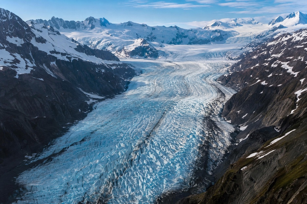
You can see them across much of the state, from Juneau and the Southeast to Anchorage, the Kenai Peninsula, Glacier Bay and the far eastern edge of Alaska where Hubbard Glacier meets the water. Some sit beside roads you can drive in a car, and others sit in country where only a boat or a small plane gets you close.
The ice itself tells a story worth knowing before you arrive. Of the more than 100,000 glaciers in Alaska, 95% are currently thinning, stagnating or retreating, and the rate of thinning is increasing. Looking at a glacier here means looking at something that is changing as you watch, which gives even a simple viewpoint a certain weight.
Glaciers you can drive to
Mendenhall Glacier lies near Juneau, Exit Glacier is reached by a spur road at Seward, and Matanuska Glacier rises beside the Glenn Highway. At each you can stand within sight of the ice with a short step from the car, then choose how much further to go on foot.
Mendenhall brings a calving glacier to the edge of a lake, Exit Glacier invites you onto trails that climb toward the Harding Icefield, and Matanuska is a wide valley glacier you see up close. Each one shows a different face of the same slow river of ice, and together they make a good way to compare how glaciers look in different settings.
Glaciers that need a boat or a plane
Others keep their distance. Portage Glacier is viewed across Portage Lake by boat in summer, Knik Glacier is seen by air, jetboat, airboat, all-terrain vehicle or on a guided packrafting tour, and Hubbard Glacier ends in Disenchantment Bay, where ships keep back from the face because newly calved icebergs can shoot up dramatically.
Glacier Bay National Park & Preserve adds another kind of ice. Some of its glaciers are tidewater glaciers that calve into saltwater at sea level, and a few others reach the sea only at high tide. Icebergs there may last a week or more, and they give harbor seals a place to haul out and bald eagles, cormorants and gulls a place to perch.
What the ice is like
Glacier ice moves slowly and carries old time inside it. The ice at the face of Hubbard Glacier is about 400 years old, and in Glacier Bay the ice at the face of the park’s glaciers is estimated to be about 200 years old. You are looking at snow that fell long before anyone alive today was born.
Not every glacier is shrinking at the same pace. Glacier Bay has 11% less glacial ice than in the 1950s, yet heavy snowfall in the Fairweather Mountains means it remains home to a few stable glaciers, a rarity in today’s world. Whatever you choose, the sound, the color and the cold air coming off the ice are what stay with you.
Which can you reach by road?
Mendenhall Glacier near Juneau, Exit Glacier near Seward and Matanuska Glacier along the Glenn Highway are the glaciers you reach by road, and Portage Glacier is close to the road system too, though seeing it takes a boat in summer.
Mendenhall Glacier, Juneau
Mendenhall Glacier is about 12 miles from downtown Juneau, and it is a lake-terminating, calving glacier that you can view from the visitor center and the area around it. The ice runs about 13.6 miles from end to end, and the glacier and its surroundings are protected within the 5,815-acre Mendenhall Glacier Recreation Area, part of the Tongass National Forest.
The U.S. Forest Service runs the visitor center, with interpretive programs throughout the year for children and adults. Photo Point Trail and the Steep Creek Trail are easy and accessible trails near it. Elevated boardwalks above Steep Creek give you a chance to watch salmon and bears, which makes the stop more than a look at the ice.
Exit Glacier, Seward
A spur road off the Seward Highway leads to the Exit Glacier area, the only road-accessible portion of Kenai Fjords National Park. The road runs beside the Resurrection River, a braided river fed by meltwater from several glaciers flowing off the Harding Icefield, including Exit and Lowell. Nearly 51 percent of the park is covered by ice, and moist air off the Gulf of Alaska drops, on average, 60 feet of snow a year on the Harding Icefield.
Trails lead from the area to the glacier’s terminus and up to the icefield. On the Edge of Glacier Trail you can hear meltwater rushing beneath the ice, then gushing across the outwash plain, and the rocks carry fine scratches called striations left by ice and frozen gravel. Wildlife that may be seen includes American black bear, hoary marmot, mountain goat and various owl species.
In summer, ranger-led walks to the glacier run daily at set times, and a ranger talk is held at the Exit Glacier Pavilion. A guided hike to Marmot Meadows on the Harding Icefield trail also runs every day of the summer season. Exit Glacier is accessible year-round, but when snow arrives, usually in mid-November, the road closes to cars and opens to snow machines, dogsleds, fat-tire bicycles and cross-country skiers.
| Exit Glacier program (summer season) | Time | Length |
|---|---|---|
| Ranger-led walk to the glacier | 10 am, 11 am, 1 pm, 2 pm | 1 to 2 hours |
| Ranger talk, Exit Glacier Pavilion | 12:30 pm | 20 to 30 minutes |
| Guided hike to Marmot Meadows | 9 am | 3 to 4 hours |
Matanuska Glacier, Glenn Highway
Matanuska Glacier lies near the Glenn Highway about 100 miles northeast of Anchorage, in Glacier View. It is a valley glacier 27 miles long and 4 miles wide, and it is the largest glacier accessible by car in the United States. The ice flows about 1 foot a day, a pace you cannot see but can picture when you stand beside it.
The glacier sits in Matanuska Glacier State Recreation Site, an Alaska State Park with trails and a small campground. A private entity affiliated with Cook Inlet Region, Inc. charges a toll on the only bridge connecting the recreation site to Alaska Route 1, and the private land owner requires $100 tours for first-time visitors.
Portage Glacier, near Whittier
Portage Glacier lies adjacent to Turnagain Arm, 50 miles southeast of downtown Anchorage and 4 miles west of Whittier. Its terminus is a glacial lake, and its status is retreating. Hundreds of years ago it filled the entire Portage Valley, a distance of 14 miles, and was connected to what are now five separate glaciers.
In summer, a boat ride across Portage Lake is required to view the glacier, and commercial boat tours are available. In winter, if Portage Lake freezes, the glacier sees much foot, bike and ski traffic.
Which need a boat or a plane?
Hubbard Glacier, the tidewater glaciers of Glacier Bay and Knik Glacier near Anchorage all call for a boat or a plane, and Portage Glacier needs a boat across its lake in summer. These are the glaciers where the scale sinks in, because you meet the ice from the water or the air.
Hubbard Glacier
Hubbard Glacier lies in Wrangell–St. Elias National Park and Preserve in eastern Alaska and in Kluane National Park and Reserve in Yukon, Canada. Its longest source begins 76 miles (76 mi) from its snout, and it takes about 400 years for ice to travel its length. It routinely calves icebergs the size of a ten-story building.
In Disenchantment Bay, where the glacier meets the water, ships must keep their distance from the edge because newly calved icebergs can shoot up dramatically. The Alaska Marine Highway System ferry MV Hubbard is named after the glacier.
Glacier Bay
In Glacier Bay National Park & Preserve, some glaciers calve straight into saltwater at sea level, while a few reach the sea only at high tide. Tidewater and terrestrial glaciers in the park have been thinning and slowly receding over the last several decades. Even so, heavy snowfall in the Fairweather Mountains keeps a few glaciers stable.
The icebergs matter to the scene. They may last a week or more, and harbor seals haul out on them while bald eagles, cormorants and gulls perch on top. A calved chunk of ice can become a small floating habitat that you may see on the water.
Knik Glacier
Knik Glacier is 50 miles east of Anchorage, on the northern end of the Chugach Mountains. It averages over 25 miles long and over 5 miles across, making it one of the largest glaciers in southcentral Alaska. It feeds the 25-mile Knik River, which empties into the Knik Arm section of Cook Inlet.
Visitors can view it by air with a flightseeing company, by all-terrain vehicle, jetboat or airboat charter, or on a guided packrafting tour. Lake George, a glacial lake formed near the face, was recognized as a National Natural Landmark, and it flooded in an outburst, a jökulhlaup, every year until 1967, when glacial recession ended it. In 1991, Paramount Pictures filmed a portion of Star Trek VI: The Undiscovered Country here.
Good to know before you go
Seasons shape these visits. Exit Glacier’s road closes to cars once snow arrives, usually in mid-November, and Portage Glacier’s boat viewing is a summer arrangement, with foot, bike and ski traffic when the lake freezes in winter. At Matanuska, the toll on the bridge to the state recreation site and the tour required of first-time visitors are costs to plan for.
| Fee | Amount | Who pays |
|---|---|---|
| Guided tour on private land at Matanuska Glacier | $100 | First-time visitors |
Sources
- Wikipedia, Mendenhall Glacier (https://en.wikipedia.org/wiki/Mendenhall_Glacier), checked October 11, 2026
- Wikipedia, Hubbard Glacier (https://en.wikipedia.org/wiki/Hubbard_Glacier), checked October 11, 2026
- Wikipedia, Matanuska Glacier (https://en.wikipedia.org/wiki/Matanuska_Glacier), checked October 11, 2026
- Wikipedia, Portage Glacier (https://en.wikipedia.org/wiki/Portage_Glacier), checked October 11, 2026
- National Park Service, Glacier Bay glaciers (https://www.nps.gov/glba/learn/nature/glaciers.htm), checked October 11, 2026
- National Park Service, Kenai Fjords glaciers (https://www.nps.gov/kefj/learn/nature/glaciers.htm), checked October 11, 2026
- Wikipedia, Exit Glacier (https://en.wikipedia.org/wiki/Exit_Glacier), checked October 11, 2026
- Wikipedia, Knik Glacier (https://en.wikipedia.org/wiki/Knik_Glacier), checked October 11, 2026