
Past the red-painted mill buildings of Kennecott, the town gives way to a wall of gray rubble and, beyond it, the pale ridges of ice. Root Glacier lies in Wrangell-St. Elias National Park and Preserve, in the Wrangell Mountains. A day here pairs a ghost town of copper-mining history with a walk onto a real glacier.
Is visiting Root Glacier worth it?
Yes, for anyone who wants to stand on a glacier without mounting an expedition, and who is comfortable with a day outdoors in a big, wild park. Root Glacier is described as one of Alaska’s most accessible glaciers, since you can walk onto the ice after hiking just two miles from Kennicott. That is a rare thing in a state where most glaciers are seen from a boat, a plane or a viewing platform.
What sets it apart from other glacier stops is the setting around it. You begin in a mining camp that still stands beside the Kennicott Glacier, with its old buildings, artifacts and colorful history, and you end on moving ice with the Wrangell Mountains around you.
The trip is also a journey in itself, because reaching Kennecott means going through McCarthy and over a gravel road. People who like the idea of a place that takes some effort to reach tend to enjoy the whole sequence as much as the glacier.
It suits hikers, history lovers and travelers who want a day built around one clear goal. It is less suited to anyone expecting a paved overlook and a gift shop at the ice. The park is larger than Vermont and New Hampshire combined, and Root Glacier sits in the McCarthy and Kennecott area, one of the five areas where visitor services are found.
What to see at Root Glacier
The mill town of Kennecott
Every visit to the glacier starts in Kennecott, and it deserves time of its own. The old copper-mining settlement is crowded onto a hillside beside the Kennicott Glacier, with weathered red buildings stepping up the slope. At its center stands the concentration mill, fourteen stories tall, where ore was once processed before it left the mountains.
Kennecott-based tour groups now lead guided tours of the mill, so you can go inside a structure that otherwise just looms above the town. Even from the ground you can read the logic of the place, with the buildings arranged down the hill the way the work once flowed. Allow some time to wander among the artifacts and the quiet buildings before or after your glacier day.
The hike to the ice
The route to Root Glacier begins at Kennicott and covers about two miles before you can step onto the glacier. Along the way the landscape changes from forest and town edge to the open, rocky margin where the ice begins. The glacier’s edge is often covered in debris, so the first sight of clean ice comes a little later, as you move onto it.
There are no maintained trails in the Wrangell-St. Elias backcountry, and the park lists river crossings, rock fall and extreme weather among its hazards. If you want route-finding help, local guide services offer these hikes. Plan the walk as an outing in real mountain country, not a stroll on a groomed path.
On the glacier itself
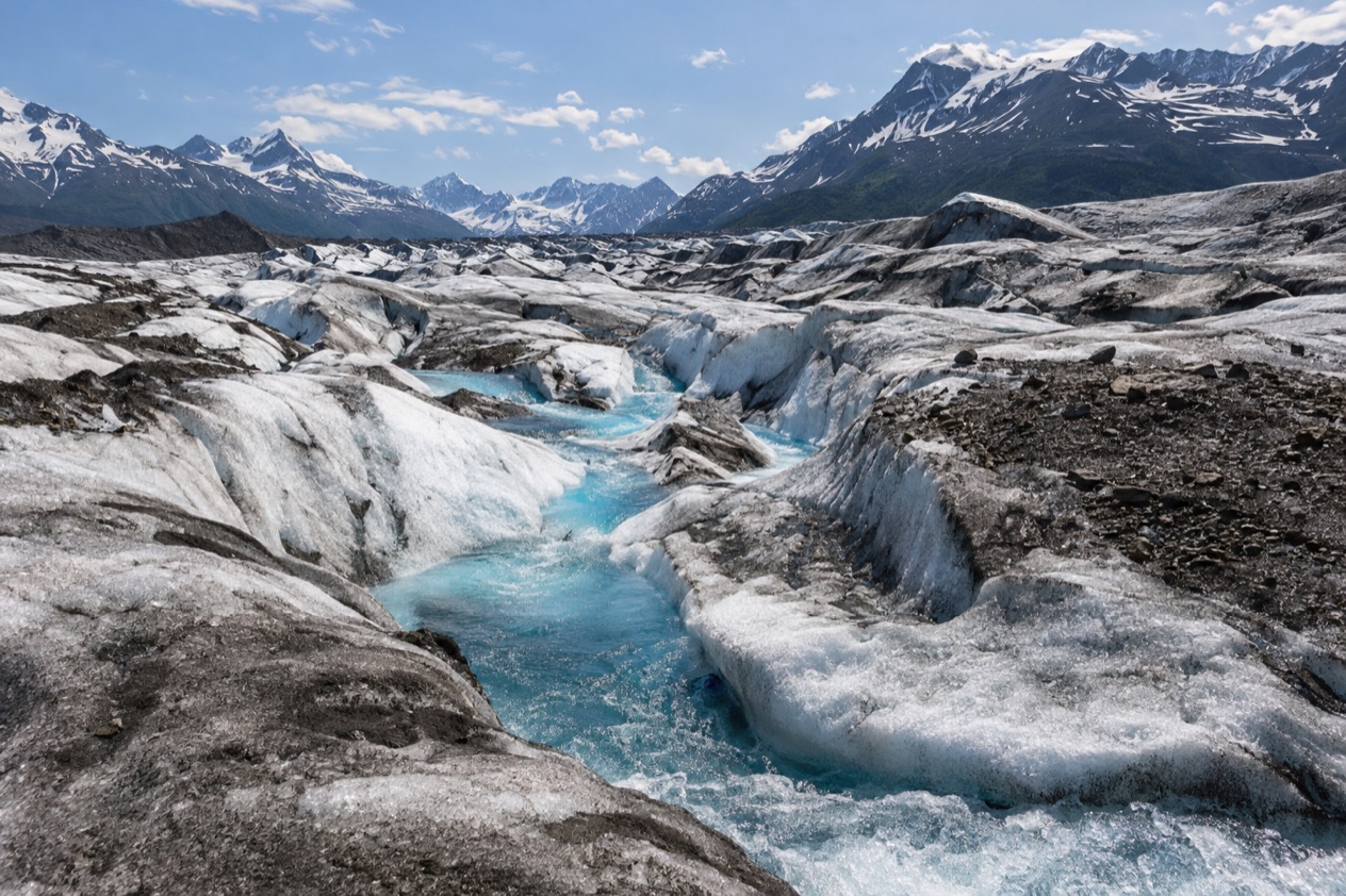
Once on Root Glacier you are on a river of ice, with ridges, shallow channels of meltwater and blue-tinged hollows where the surface has cracked and refrozen. Glacier hiking is one of the popular activities at Kennecott, and it is the reason people come. Glacier travel is among the hazards the park names, so this is a place for care and good judgment.
Look at the surface texture, the sound of water running under and through the ice, and the way the mountains frame the glacier on every side. The glacier changes with the weather and the time of day, so the same stretch can look quite different from one hour to the next. Ice climbing is also listed among the activities in the area, for those who go with the right skills or with a guide.
Hours, tickets and rules
Root Glacier is a stretch of ice in a national park, not a gated site with a ticket window. The mill tours are run by Kennecott-based tour groups, and guide services lead the glacier hikes for those who want help finding the route. The shuttle vans and buses that carry visitors from the footbridge to McCarthy and Kennecott run during the tourist season.
The rules that matter here are the park’s backcountry guidelines. There are no maintained trails, so visitors must be skilled at off-trail hiking. Satellite phones and satellite messengers are the only way to communicate from the backcountry, which means a call for help is not something to count on from a phone.
River crossings are the other big one. Most backcountry routes need numerous creek and river crossings, and bridges and log crossings are virtually non-existent. The park advises crossing early in the day, because water levels can change drastically with season, temperature and upstream weather.
It also advises crossing at the widest, most braided area, which is usually where the water is shallowest, and never crossing in bare feet. Loosen your pack’s shoulder straps and unbuckle the hip belt first, so you can shed it quickly if you fall. Alaskan waters are extremely cold, so hikers must know safe crossing techniques.
How to get to Root Glacier
You reach Root Glacier by getting to Kennecott first, then hiking. Kennecott sits beside the Kennicott Glacier, northeast of Valdez, inside Wrangell-St. Elias National Park and Preserve. The nearest town is McCarthy, and every road route runs through it.
By road
Drivers take the Edgerton Highway to the McCarthy Road, an unimproved gravel road that stretches from the town of Chitina to the Kennicott River. The road ends half a mile from McCarthy, and this is the road you must pass through to reach Kennecott. Plan the drive as part of the adventure, since the road is gravel from end to end.
The road stops at the Kennicott River, where a footbridge carries pedestrians across to McCarthy. A private service bridge for vehicles was built downstream in 2004, but only residents, businesses and the National Park Service can use it, for an annual fee. For visitors, that means crossing on foot.
From the footbridge to Kennecott
From the end of the road, you can walk to McCarthy in about 15 minutes. During the tourist season, shuttle vans and buses run from the bridge to both McCarthy and Kennecott. From McCarthy it is 4.5 miles to Kennecott, and shuttles are available on that stretch too.
McCarthy is a small place, with a population of 107 at the 2020 census, set at the foot of the Wrangell Mountains. It is a natural spot to pause before the last leg, and a good point to find a guide service if you want one.
By air
Kennecott is also reachable by air, through McCarthy’s gravel runway, which is 3,500 feet long. Flying lands you in the same small-town setting as the road does, with the footbridge and shuttles still part of the last miles. If you use an air taxi to reach the backcountry of the park, the park suggests bringing extra food in case weather delays your pickup.
When to visit Root Glacier
The visit belongs to the tourist season, when shuttles run between the bridge, McCarthy and Kennecott, and when the old mine buildings draw people to the area during the summer months. A good share of McCarthy’s summer population lives elsewhere in the winter, so the town changes character with the season.
Weather in the park can swing widely. Plan on temperatures from as warm as 75 F to as cold as 20 F, possibly in the same day. McCarthy has a subarctic climate with cold winters and short, mild summers, and the gap between daytime and nighttime temperatures is particularly large in spring and summer. On the glacier, dress for both ends of that range, since you may meet them in a single outing.
Mosquitoes are typically a nuisance in the park from May to September, which covers the main season for glacier hiking. Their presence is more a matter of comfort than of timing.
The park also points to early in the day as the better time for river crossings, because water levels can change as the day warms and as upstream conditions shift. Starting early gives you that margin on the way out and on the way back.
Tips for your visit
You have a stretch of road or air travel to Kennecott, a hike of about two miles each way, time on the ice and time among the mill buildings. Build the day around moving slowly and keeping a margin for weather, river levels and shuttle connections.
- Wear boots, or bring extra shoes for any crossings, and never cross a river in bare feet.
- Pack for a wide range of temperatures, since the park can swing from warm to cold in a day.
- Bring insect protection if you visit between May and September, when mosquitoes are typically a nuisance.
- Carry a satellite phone or satellite messenger, as these are the only way to communicate from the backcountry.
- Consider a local guide service if you would like route-finding assistance.
Pair the glacier with the mill. The guided tours of the concentration mill give the hike a story, and the old buildings, artifacts and the Kennicott Glacier itself fill out a day at Kennecott. Ice climbing is another activity in the area for those with the skills or a guide.
For families and anyone with mobility concerns, remember that the route off the road system is a hike over uneven ground with no maintained trails, and the glacier is a natural landscape with real hazards. Think carefully about the terrain before you commit. For a lower-key day, McCarthy and Kennecott themselves offer the buildings, the history and the mountain views without going onto the ice.
The park’s visitor guide, K’elt’aeni, named for the local Ahtna Athabaskan word for Mount Wrangell, is the official newspaper for the park. The main visitor center is the Wrangell-St. Elias Visitor Center at Park Headquarters in the Copper Center Area.
Good to know before you go
Travel times between the park’s visitor service areas are long, longer than you might expect in a National Park, so treat Root Glacier as its own destination rather than a stop on the way to somewhere else. Satellite devices are the only way to call out from the backcountry, so plan with that in mind. Weather, river levels and your own pace set the shape of the day, and the shuttle season shapes how you get to and from Kennecott.
Sources
- Wikipedia, Kennecott, Alaska (https://en.wikipedia.org/wiki/Kennecott,_Alaska), checked October 11, 2026
- Wikipedia, McCarthy, Alaska (https://en.wikipedia.org/wiki/McCarthy,_Alaska), checked October 11, 2026
- National Park Service, Wrangell – St. Elias National Park & Preserve, plan your visit: backcountry (https://www.nps.gov/wrst/planyourvisit/backcountry.htm), checked October 11, 2026
- Wikivoyage, McCarthy (https://en.wikivoyage.org/wiki/McCarthy), checked October 11, 2026