
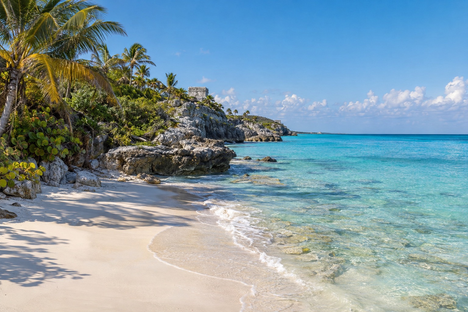
Early in the morning in Puerto Morelos, fishing boats rock beside the pier while pelicans wait on the posts, and the leaning old lighthouse on the beach catches the first sun. Farther south, the same light turns the cliffs at Tulum gold above a sea that goes from pale green to deep blue. The Riviera Maya is the Caribbean coast of Quintana Roo, a long run of beach towns, jungle ruins and underground pools for travelers who want sand and history in the same week.
Where is the Riviera Maya and what is it like?
The Riviera Maya is a stretch of Quintana Roo coastline of about 80 miles, running from Puerto Morelos, just south of Cancun, down to the Tulum ruins, with Playa del Carmen, Puerto Aventuras and Akumal along the way. The name is a tourism label rather than an official boundary. It first described only the Playa del Carmen to Tulum stretch and was later stretched north and south by promotion.
The land is a low, flat limestone shelf with no mountains at all. You get white-sand beaches, turquoise water, mangrove lagoons and, a little inland, cenotes, the sinkholes that open onto groundwater. Offshore runs the Mesoamerican Reef, the second-largest barrier reef system in the world, which is why snorkeling and diving are so central here.
It suits couples, families and friends who like to mix beach days with outings. Some towns are lively and walkable at night, others are quiet fishing villages, so you can pick your pace.
Where to go in the Riviera Maya
Most visitors fly into Cancun and continue south along the coastal highway, which links every town described here, so it is easy to string two or three bases together.
Puerto Morelos
Puerto Morelos is the quiet northern gateway, a small fishing village that is lower-rise and slower-paced than its bigger neighbors. You wander the plaza, eat fresh fish at simple seaside tables and look at the tilted lighthouse that storms left behind, standing beside the straight one that replaced it.
The protected reef sits close to shore, so the boat ride out to snorkel or dive is short. A botanical garden nearby preserves native plants of the peninsula and makes a calm morning outing. It suits travelers who want a village feel, easy reef access and a short ride from the Cancun airport.
Playa del Carmen
Playa del Carmen began in 1937 as a small fishing settlement and is now Quintana Roo’s second-largest city after Cancun. Its spine is Quinta Avenida, a pedestrian street running parallel to the beach, lined with shops, clubs and restaurants. Evenings are busy with street musicians, taco counters and people strolling in no hurry.
This is the practical hub: the ferry to Cozumel leaves from here, and Xcaret, cenotes and Tulum are all within reach. It suits first-timers, groups and anyone who wants plenty of restaurants and nightlife within walking distance. If you want silence, look to the smaller towns north or south.
Akumal
Akumal is a small bay town founded in 1958 on a former coconut plantation, curving around Akumal Bay and Half Moon Bay. The bay was declared a marine refuge to protect the green sea turtles that come to feed on sea grass, and watching them graze in shallow water is the reason most people stop here.
At the north end, Yal-ku Lagoon is a brackish inlet where fresh groundwater meets the sea, used for snorkeling among small fish. The town also hosts the Akumal Arts Festival each November, with artists from Mexico and abroad. It suits relaxed beach stays and families who want nature at the doorstep.
Tulum
Tulum sits at the southern end of the Riviera Maya, where Maya walls stand on cliffs directly above the Caribbean. Around the ruins, the town has grown into a mix of beach stays, cafés and boutique hotels, and its municipality has been its own since 2008. Go to the ruins early in the day, then spend the afternoon on the sand below or at a cenote nearby.
Tulum is the base for Coba, the Sian Ka’an reserve and several well-known cenotes, so it works well for travelers who want to spend their days outdoors. The ruins are the town’s great sight, and the sea below them completes the picture.
Things to do in the Riviera Maya
Tulum ruins and Coba
The Tulum ruins are small but dramatic: a walled Maya port on 39-foot cliffs, with the sea directly below. The entrance is on the highway south of Cancun, and visits are best in the cooler early hours before tour groups arrive. You walk the paths among the buildings and look down on the water.
Coba is the opposite, a large site still mostly under jungle, spread around several lakes and linked in ancient times by stone causeways. It lies northwest of Tulum, and you can rent a bike to cover the distances between groups of buildings. Its tallest pyramid, Nohoch Mul, is among the tallest on the peninsula, and climbing it was reinstated with a new wooden staircase.
| Site | Open | Admission (foreign visitors) |
|---|---|---|
| Tulum archaeological zone | Daily, 8:00 a.m. to 5:00 p.m. (last entry 3:30 p.m.) | 265 pesos |
| Coba | Daily, 8:00 a.m. to 5:00 p.m. (last entry 4:00 p.m.) | 210 pesos |
Mexican nationals and foreign residents of Mexico pay less at both, and enter free on Sundays.
Cenotes
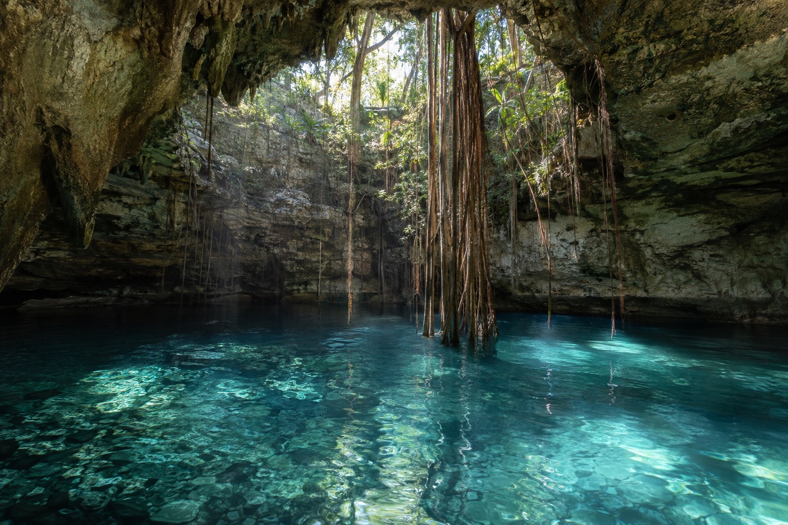
A cenote is a natural sinkhole in the limestone that exposes the groundwater below, from open sky-lit pools to fully enclosed caves. The peninsula has almost no surface rivers, which is why they are so common. Well-known ones include the Dos Ojos system and Gran Cenote near Tulum, and smaller sites toward Puerto Morelos.
Each cenote is run independently by its own operator, with its own posted price, so plan on one or two a day rather than a long list. The water is cool and clear, a welcome change from a hot afternoon on the beach.
Reef, turtles and snorkeling
The Mesoamerican Reef is the reason many people come. At Puerto Morelos the reef lies close to shore, so boat trips to snorkel or dive are short, and you spend more time in the water than on the boat. At Akumal, the green sea turtles feeding in the protected bay are the draw, and you see them gliding over the sea grass in shallow water.
Yal-ku Lagoon offers a gentler option, a sheltered inlet where fresh and salt water mix. Conditions at sea change from day to day, so check the beach flags and listen to the boat crews before getting in. These outings suit families, beginners and anyone who likes watching marine life at a slow pace.
Cozumel
Cozumel is the island across the water from Playa del Carmen, widely visited for scuba diving and snorkeling on its western reefs, among them Palancar, Colombia and Santa Rosa, inside a protected marine park. Most reef trips go by boat rather than from shore. The town of San Miguel sits on the calmer west coast, while the east coast faces the open Caribbean with rougher surf and a stronger undertow.
San Gervasio, on the island, was a sanctuary to the Maya goddess Ixchel, and most of its buildings date from the Late Postclassic period. It is a quiet, shaded site, though it has had temporary closures, so confirm it is open before building a day around it. Cozumel suits divers, and anyone who wants a day of island life.
Sian Ka’an and Xcaret
Sian Ka’an is a vast biosphere reserve of coastline, mangrove, wetland and tropical forest south of Tulum, a World Heritage site since 1987. Car access is limited and the interior roads are unpaved, so most visits go by boat or kayak with local cooperatives based in Muyil and Punta Allen. Expect quiet channels, birds and a very different mood from the beach towns.
Xcaret, south of Playa del Carmen, is a private park open from morning into the night, with underground rivers, an aviary, a butterfly pavilion and a coral reef aquarium. Its evening show, Xcaret Mexico Espectacular, has more than 300 performers. It suits families and travelers who like one big day with everything in one place.
When to visit the Riviera Maya
The most comfortable months are December to April, when rain falls on only a few days a month and the heat stays bearable, with February to April the driest; September and October bring the most rain. The Atlantic hurricane season, which governs this coast, runs from June 1 to November 30.
Storms can bring days of heavy rain and rough seas, and Hurricane Wilma in October 2005 is a reminder of how the coast has been shaped by them. Outside those dates, the beaches and reef trips are easier to plan.
November brings the Akumal Arts Festival, and the end of the hurricane season. Around Christmas and Easter, expect busier beaches and peak-season rates, and book rooms early. Throughout the year the coast is hot and humid, so the ruins are best visited early in the day, and cenotes are welcome in the afternoon.
Getting around the Riviera Maya
Most travelers arrive by air at Cancun, then head south along the coastal highway, which passes through each town in turn. Puerto Morelos is the closest, about 22 miles south of downtown Cancun. Tulum’s ruins lie about 80 miles south of Cancun, at the far end of the corridor.
Within the corridor, a rental car gives the most freedom for cenotes and ruins, and the road is straight and flat. Coba lies about 29 miles northwest of Tulum, while Sian Ka’an is usually visited on organized boat or kayak tours.
To reach Cozumel, take the ferry from the Playa del Carmen terminal. Ultramar and Xcaret Xpress both sail the crossing, and the ride takes you from the mainland to San Miguel’s pier on the calmer west coast.
Good to know before you go
Foreign visitors need a digital tourist permit, the FMMd, delivered as a QR code, and for arrivals by air the fee is collected by the airline. Dollars are not legal tender in Mexico, so shops and restaurants may or may not accept them and set their own rate, and pesos are the easier choice. Remember that the hurricane season runs through the end of November, and check the beach flags before swimming.
Sources
- Secretaria de Turismo federal, page for "Riviera Maya" (sectur.gob.mx), confirmed by the Consejo de Promocion Turistica de Quintana Roo, checked September 29, 2026
- fait de geographie administrative de notoriete publique
- Healthy Reefs for Healthy People Initiative / The Nature Conservancy, checked September 29, 2026
- common geographic knowledge
- NOAA National Hurricane Center, "Tropical Cyclone Climatology", nhc.noaa.gov, checked September 29, 2026
- common knowledge
- sourcing reserve (web research budget exhausted on September 29, 2026), no figure asserted.
- Wikipedia, "Coba", en.wikipedia.org, checked September 29, 2026 (source secondaire)
- INAH, official for the Coba archaeological zone, inah.gob.mx/zonas/515-zona-arqueologica-de-coba, checked September 29, 2026
- INAH, inah.gob.mx/zonas-arqueologicas, checked September 29, 2026
- Wikipedia, "Sian Ka'an" infobox, en.wikipedia.org, checked September 29, 2026 (secondary source ; official UNESCO whc.unesco.org not reached that day, 403)
- Wikipedia, "Sian Ka'an", en.wikipedia.org, checked September 29, 2026
- Wikipedia, "Tulum", en.wikipedia.org, checked September 29, 2026 (source secondaire)
- Xcaret (operator), xcaret.com/en/xcaret-park/, checked September 29, 2026
- Wikipedia, "Playa del Carmen", en.wikipedia.org, checked September 29, 2026 (source secondaire)
- Ultramar (exploitant), ultramarsales.ultramarferry.com/en/ferry-cozumel.php, checked September 29, 2026
- Xcaret (exploitant), xcaret.com/en/parque-xcaret/, checked September 29, 2026
- reserve de sourcage, aucun chiffre affirme
- INAH, official for the Tulum archaeological zone, inah.gob.mx/zonas/99-zona-arqueologica-de-tulum, checked September 29, 2026
- UNESCO World Heritage Centre, record 410, whc.unesco.org/en/list/410, checked September 29, 2026
- Wikipedia, "Tulum Municipality", en.wikipedia.org, checked September 29, 2026 (source secondaire)
- INAH, "Zona Arqueologica San Gervasio" (inah.gob.mx/zonas/zona-arqueologica-san-gervasio), checked September 29, 2026
- APIQROO, "Empresa" (apiqroo.com.mx), checked September 29, 2026
- Ultramar, "Ferry Cozumel" (ultramarsales.ultramarferry.com/es/ferry-cozumel.php), checked September 29, 2026
- Ley Federal de Derechos, art. 8-I ; Instituto Nacional de Migracion, gob.mx/inm, checked September 29, 2026
- Ley Monetaria de los Estados Unidos Mexicanos, art. 8
- Wikipedia, "Akumal", en.wikipedia.org, checked September 29, 2026 (secondary source ; CONAPESCA decree not reached that day, 404)
- Servicio Meteorologico Nacional (CONAGUA), normales climatologicas 1991-2020, estacion 23014 (Leona Vicario, Puerto Morelos), checked September 29, 2026