
Spread a map of the Bahamas on a café table in Nassau and the first surprise is how much of it is blue. Islands trail off in long chains, tiny cays dot the shallows, and a dock you pass today may belong to a different island group than the one you plan to visit next. The short answer: the Bahamas is an island nation in the Atlantic Ocean, made of many islands, each with its own character and its own way of getting there.
Where are the Bahamas?
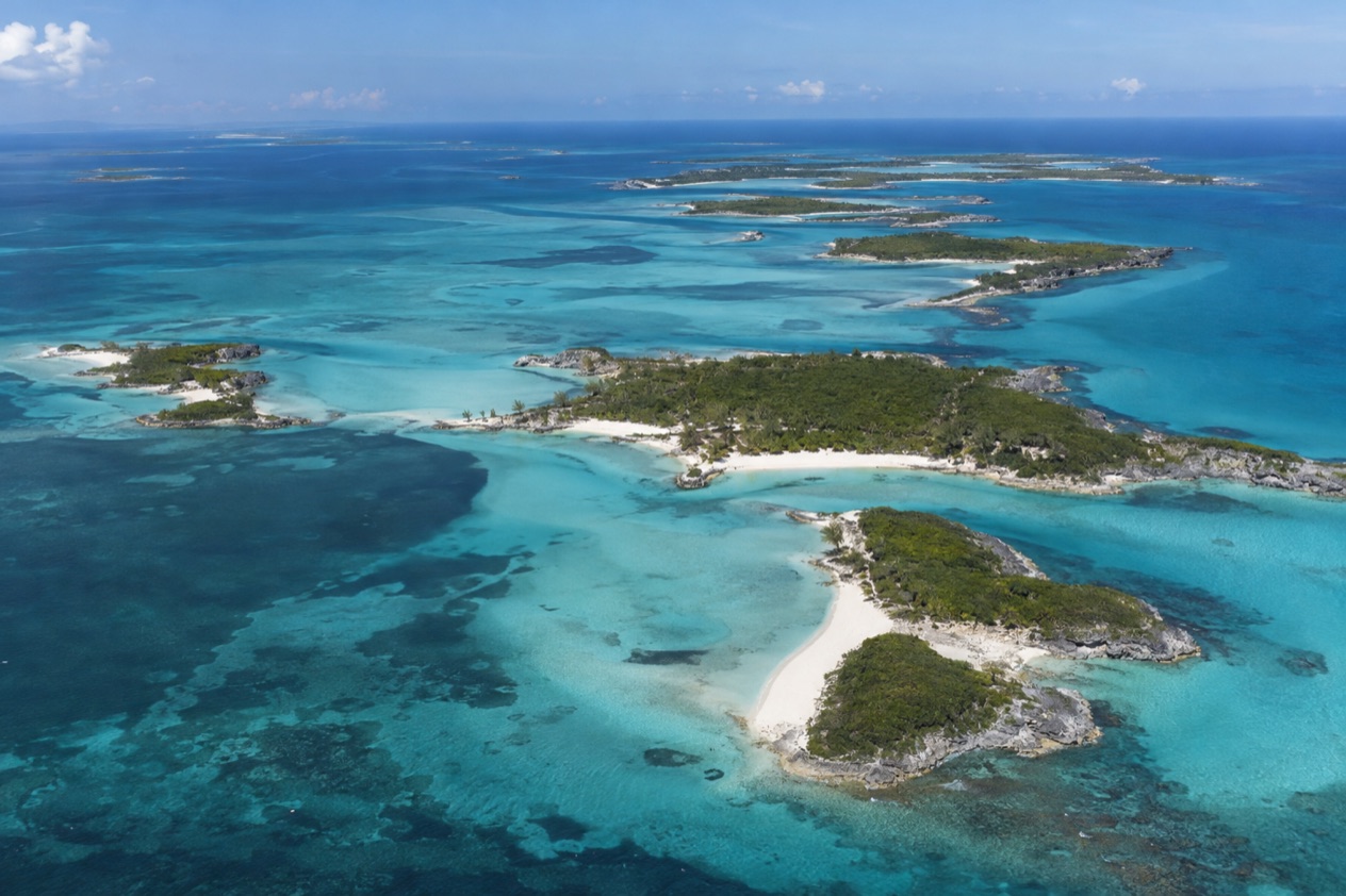
The Bahamas lies in the western Atlantic Ocean, a country built from about 700 islands and more than 2,500 cays rather than from one landmass. It is not in the Caribbean Sea, and it is a separate country from the United States, with its own government and its own Independence Day on July 10.
The nearest big landmarks help you place it. Andros, the largest island, lies north of Cuba and about 120 miles southeast of Florida. That is the anchor point for the rest of the map: from there the islands fan out across the ocean, and most of them are small, low and sparsely settled.
A country mostly made of water
Only between 30 and 40 of the islands are inhabited. The rest are cays and rocks, some of them with a single beach and a few palms, others with nothing but scrub and birds. The Berry Islands show how this plays out: a marine destination of nearly 30 cays, most of them uninhabited, where the attraction is the sea life around them rather than anything built on land.
Because the islands are separated by open sea, a fact about one island is rarely true for another. A town, an airport, a ferry or a restaurant belongs to one island and stays there. Reading the map as a set of separate places, not as one resort area, is the most useful habit a first-time visitor can pick up.
Flat land, big sky
Nothing in the Bahamas rises like a mountain. The highest point in the whole country sits on Cat Island and reaches only 207 feet above sea level, so the landscape is one of long beaches, pine flats, mangroves, salt ponds and shallow banks that turn from pale turquoise to deep blue at the edge of the drop-off.
That flatness explains why the sky looks so large from the water and why boaters read the color of the sea like a road map. It also explains the country’s rivers, or the lack of them: there are only a few freshwater lakes, and the single river in the Bahamas is found on Andros.
Nassau, the capital on New Providence
Nassau is the capital and the largest city, and it is a city on the island of New Providence, not an island of its own. Paradise Island, which has the natural attractions that sit right next to the capital, is the neighbor most visitors know by name. English is the official language, so signs, menus and conversation all work in American English with a Bahamian lilt.
Tourism and offshore finance carry the economy, and Nassau is where both are most visible: harbor-front streets, banks, cruise docks and the gateway for air travel into the country. Most maps put it at the center of the planning, even for travelers whose real destination is a quiet cay somewhere else.
How are the islands grouped?
The islands are grouped by the places visitors actually go: sixteen islands or island groups, from Nassau and Paradise Island to remote spots like Mayaguana and Ragged Island. The list runs through the Abacos, Andros, Bimini, the Berry Islands, Cat Island, Eleuthera and Harbour Island, the Exumas, Grand Bahama with Freeport, Inagua, Long Island, Mayaguana, Nassau and Paradise Island, Ragged Island, Rum Cay, San Salvador, and Acklins and Crooked Island.
Sorting them by what they are known for is more useful than sorting them by position, because it tells you what a day there looks like. Three loose families emerge: the islands of boats and fishing lines, the islands of famous beaches and wildlife, and the quiet, far-flung islands for people who like to be alone.
Boats, fishing and the sea
The Abacos are known as the boating capital of the Bahamas, a chain of cays where harbors, small towns and anchorages set the rhythm. Local ferries make it possible to explore the region hop by hop, and the sight of sailboats lined up in a protected bay is the picture most people carry home.
Bimini offers world-class fishing and diving, and Ragged Island is remarkable for deep-sea fishing, with bonefish, barracuda, tuna and kingfish among the catches. The Berry Islands, with their scatter of cays, belong in the same family: places where the day is organized around the water and what swims in it.
Famous beaches, pigs and flamingos
Eleuthera and Harbour Island are known for Pink Sands Beach, whose sand takes on a rosy tint in the right light. The best way to understand the smaller islands around Harbour Island and Eleuthera is by boat, which gives you a sense of how closely these places sit to one another.
The Exumas are known for the swimming pigs at Big Major Cay, also called Pig Beach, a sight that has become shorthand for the whole country. Inagua is the wild-bird counterpart: home to over 80,000 flamingos and 140 other species of birds. Grand Bahama, around Freeport, is about kayaking through mangroves, exploring underwater caves and off-roading through pine forests.
Quiet, far-flung islands
Some islands ask you to slow down. Mayaguana is an isolated, secluded destination for outdoor lovers, and Acklins and Crooked Island offer a secluded getaway by a lagoon. Long Island has Dean’s Blue Hole, the world’s second deepest blue hole, a dark circle of water that draws divers and curious onlookers.
Cat Island adds the country’s highest point to its list, a modest rise that feels grand in such flat country. Rum Cay and San Salvador round out the group, and Andros, the largest island, anchors the map with its single river and its sheer size. These are places to choose on purpose, not stumble into.
Which islands can visitors reach?
Visitors can reach all of the islands in the planning list, but each one has its own route: by commercial or charter flight, by ferry, on a cruise ship, or on a private plane or boat. The Bahamas has 20 international airports, plus dozens of smaller public and private airports and island landing strips.
Nassau is the country’s gateway for air travel, yet it is not a required stop. Travelers can fly directly into one of the Out Islands without going through Nassau, which changes the whole shape of a trip to the Abacos, the Exumas or Eleuthera.
By air, and between islands
Commercial and charter flights both bring visitors in, and scheduled air service between islands is provided by certified domestic and international carriers. Chartered air service between islands is also available, which suits places far from the main routes. Private pilots find near-perfect flying conditions and plenty of airports and landing strips. Returning to the United States has one convenient detail: U.S. immigration pre-clearance facilities are available at Nassau and Freeport, so travelers clear customs before they depart for home and walk off the flight as domestic arrivals.
By ferry, mailboat and private boat
Bahamas Ferry Services provide connections between major islands, and regularly scheduled mailboats link them too, carrying cargo and passengers in the way the islands have always moved goods. Local ferries serve a region like the Abacos, where short crossings from cay to cay are part of the trip.
Boaters can arrive by pleasure craft, whether a schooner, a powerboat or a mega-yacht. One rule applies to those arriving by private boat: firearms must be declared to customs and left aboard, since importing a firearm or ammunition without permission is illegal.
By cruise ship
Cruise ports of call include lively Nassau and secluded Half Moon Cay, and cruisers can choose from multiple ports throughout the islands. Several lines own private islands. Disney owns Castaway Cay and Lookout Cay at Lighthouse Point, Norwegian owns Great Stirrup Cay, Princess owns Little Stirrup Cay, Carnival owns Half Moon Cay, and Royal Caribbean owns Coco Cay.
Access to those private islands is usually limited to passengers of the owning cruise line, so they are stops on a ship’s route rather than destinations you plan on your own. Nassau is the port where a day ashore turns into a look at the capital itself.
Good to know before you go
The U.S. State Department rates the Bahamas Level 2, “Exercise increased caution”, and says most crime occurs in Nassau on New Providence and in Freeport on Grand Bahama.
The Atlantic hurricane season runs from June 1 to November 30, and the wet season of the archipelago runs from May to October, so a trip in those months can bring showers and stormy afternoons. Hurricane Dorian struck the Abaco Islands and Grand Bahama in September 2019.
Tap water is generally potable, though bottled water is recommended for visitors. The whole country is a national sanctuary for sharks, and swimmers are advised to avoid marinas where bull sharks often gather.
Sources
- Bahamas Ministry of Tourism, Investments & Aviation (bahamas.com), Map of the islands (https://www.bahamas.com/map), checked October 10, 2026
- Wikipedia, The Bahamas (https://en.wikipedia.org/wiki/The_Bahamas), checked October 10, 2026
- Wikipedia, Geography of the Bahamas (https://en.wikipedia.org/wiki/Geography_of_the_Bahamas), checked October 10, 2026
- Bahamas Ministry of Tourism, Getting here (https://www.bahamas.com/getting-here), checked October 10, 2026
- Bahamas Ministry of Tourism, Investments & Aviation (bahamas.com), Island hopping (https://www.bahamas.com/getting-here/island-hopping), checked October 10, 2026
- Wikivoyage, The Bahamas travel guide (https://en.wikivoyage.org/wiki/The_Bahamas), checked October 10, 2026
- U.S. Department of State, The Bahamas Travel Advisory, Level 2 (https://travel.state.gov/), checked October 10, 2026
- NOAA National Hurricane Center, Climatology (https://www.nhc.noaa.gov/climo/), checked October 10, 2026
To plan your stay
- Best Time to Visit the Bahamas: Weather, Hurricane Season, Sea Temperatures and Junkanoo
- Where to Stay in the Bahamas: Best Islands, Resorts, Boutique Stays and How to Choose
- Getting Around the Bahamas: Flights, Ferries, Mailboats and Taxis in Nassau
- Know Before You Go to the Bahamas: Entry Rules, Money, Getting Around and Local Customs