
When a warm evening settles over Mérida, the plazas fill with the scent of corn tortillas and slow-roasted pork, while tricycle taxis clatter by mansions painted ochre and rose. Out past the city the land goes flat and green, and underneath it run rivers no one sees, surfacing in round pools of cool water. The Yucatan Peninsula is Maya country, with ruins, colonial towns and Gulf beaches all within reach of one another.
Where is the Yucatan Peninsula and what is it like?
The Yucatan Peninsula is the broad, flat limestone shelf that juts north from southeastern Mexico between the Gulf and the Caribbean, shared by three states: Yucatan, Campeche and Quintana Roo. There are no highlands to climb here. The horizon is low scrub forest, henequen fields and village plazas with a church on one side.
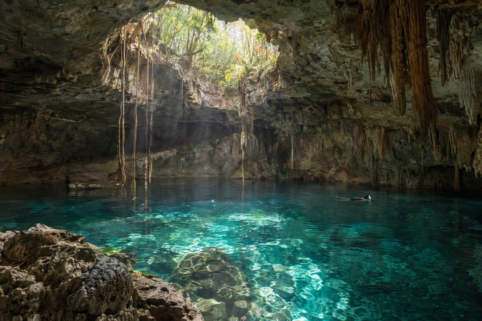
Rain sinks straight through the porous rock, so the peninsula has almost no surface rivers. Water collects underground and opens into cenotes, thousands of them, with estimates varying widely depending on what counts as one.
This is also the historical heartland of the Maya, and Yucatec Maya is still spoken in markets and villages today. It suits travelers who like to mix ruins, walkable old towns, swimming and long meals, and who don’t mind heat.
Where to go in the Yucatan Peninsula
Mérida
Mérida is the peninsula’s capital and its easiest base. It was founded by the Spanish on top of the Maya city of T’ho, and its cathedral, the first built on the North American mainland, still faces the main square. Paseo de Montejo, the grand avenue lined with early-20th-century mansions and sculpture, is the place for an evening stroll.
Days here run on a slow rhythm. Mornings go to the Gran Museo del Mundo Maya, a good primer before any ruin, afternoons to a shaded courtyard with a cold drink, and nights to a plaza where bands and dancers turn out for free. Uxmal, with its curved-edged pyramid and ornate stonework, lies south of the city and makes an easy day trip.
Mérida suits couples, food lovers and anyone who wants a city with character rather than a resort. Stay a few nights, because the town is also the hub for Progreso, Dzibilchaltún, Chichén Itzá and the flamingo coast.
Chichén Itzá
Chichén Itzá is the peninsula’s best-known ruin, a large Maya city arranged around the stepped pyramid of El Castillo, the Temple of Kukulcán. A worldwide vote placed it among the New Seven Wonders of the World, and it appears on the UNESCO World Heritage List. Beyond the pyramid you walk to the ball court, the observatory and carved stone walls.
The pyramid has been closed to climbing since a fatal fall, so you admire it from the ground, where the proportions are easier to take in anyway. From Cancún the drive takes about 2.5 to 3 hours each way, and it is also a day trip from Mérida or an easy stop on the way to Valladolid. Go early, before the tour buses arrive and the stone heats up.
| Site | Open | Admission |
|---|---|---|
| Chichén Itzá | Daily, 8:00 a.m. to 4:00 p.m. | 697 pesos for foreign adults (105 federal plus 592 state) |
| Ek Balam | Daily, 8:00 a.m. to 4:30 p.m., last entry 4:00 p.m. | 210 pesos, 105 pesos for Mexican nationals and foreign residents of Mexico |
| Dzibilchaltún | Daily, 8:00 a.m. to 4:00 p.m. | 105 pesos federal plus 223 pesos state for foreign visitors |
Chichén Itzá also grants free entry on Sundays to Mexican nationals and foreign residents of Mexico, and children under 13 and visitors 60 and older are exempt.
Valladolid and Ek Balam
Valladolid, a Pueblo Mágico, is a small colonial town of pastel facades, shaded squares and a market where you can eat lunch for very little. It sits between the Caribbean coast and Mérida, close to Chichén Itzá, and works well as a base for a few nights. Franciscan missionaries built the Convento de San Bernardino de Siena, which rises in the Sisal neighborhood and is reached by way of the Calzada de los Frailes, a colonial avenue that has been preserved.
Cenote Zací sits right in town, a landscaped sinkhole where you can swim, and next to it are a restaurant and artisan vendors. It is the easiest cooldown after a hot morning of walking.
Ek Balam lies north of town, on the road toward Tizimín, and tends to be quieter than Chichén Itzá. Its ruins sit in the forest, with carved details you can study at a calmer pace. Valladolid suits travelers who want a lived-in town, not a resort, and it is the best bridge between the coast and Mérida.
Progreso and the Chicxulub coast
Progreso is Mérida’s beach, about 30 minutes north by highway. A malecón runs along the Gulf-front sand, lined with seafood restaurants where ceviche and fried fish come to the table with cold beer. This is a cruise port as well, with ships tying up at an exceptionally long pier since the shallow shelf keeps them well offshore.
Weekends fill with families from Mérida, and the water is usually warm and shallow. On the Gulf, check the beach flags before going in, since conditions can change.
A calmer beach town just to the east, Chicxulub Puerto sits nearly at the exact center of the crater created by the asteroid that brought the age of the dinosaurs to a close, and a museum about the impact has opened there. On the road between Mérida and Progreso, the Maya ruins of Dzibilchaltún make a pleasant stop on the way out.
Campeche
Campeche is the peninsula’s walled port, a UNESCO-listed town rebuilt as a fortress against pirate raids. A hexagonal wall with eight bastions and four gates encloses candy-colored streets, and the Puerta de Tierra still stands as the land gate. You can walk the ramparts and then settle in a plaza for fresh seafood.
Two hilltop forts stand beyond the walls. The Fuerte de San José displays a collection of period boats and weapons, while the Fuerte de San Miguel, now an archaeology museum, shows pre-Hispanic pieces, and both have views over the Gulf.
Campeche feels calmer and less touristed than Mérida, and suits travelers who like history, sea breezes and slow evenings along the waterfront. It makes a good anchor for the western side of the peninsula.
Things to do in the Yucatan Peninsula
The ruins come first for most visitors. Chichén Itzá, Uxmal, Ek Balam and Dzibilchaltún each have a different character, from the great pyramid to carved facades in the forest. Around the spring and autumn equinoxes, visitors stream to Chichén Itzá to see the light dance along the pyramid’s staircase.
Cenotes are the other signature experience. Some are open to the sky, others sit in caverns with roots hanging from the ceiling. Cenote Zací in Valladolid is one place where swimming is open to visitors, and the cool, clear water is a relief after a day among stone.
Food is a reason to come on its own. Yucatecan cooking leans on achiote, sour orange and slow cooking: cochinita pibil, panuchos, salbutes, sopa de lima and poc chuc. Markets in Mérida and Valladolid are the best places to try them, along with fresh juices and sweets.
Along the coast, the Gulf beaches around Progreso offer shallow, warm sand and fresh fish, and the lagoons farther along the northern shore are known for pink flamingos. Early November brings Hanal Pixán, the Maya observance for the dead, with altars, special foods and candlelit cemeteries around the time of Día de Muertos.
When to visit the Yucatan Peninsula
The most comfortable stretch runs from November through February, when afternoons are in the mid-80s and rain falls only a few days a month. March and April are the driest months but also the hottest, with afternoons close to the mid-90s, so ruins are best done at opening time. May is the hottest of all, and the first rains begin to arrive.
From June to October the rain comes in short, heavy afternoon bursts on a dozen or more days a month. Mornings are often bright, so the trick is to schedule outings early and keep the afternoon flexible. Greenery is at its lushest, and cenotes feel especially inviting in the heat.
The Atlantic hurricane season, which governs the whole peninsula, runs from June 1 to November 30, so a trip at either end of the rainy season can meet a tropical system. Crowds peak around Christmas and New Year and again during Holy Week, whenever it falls.
| Month | Average high (°F) | Rain days |
|---|---|---|
| January | 86 | 5 |
| February | 89 | 4 |
| March | 92 | 3 |
| April | 96 | 2 |
| May | 97 | 5 |
| June | 95 | 12 |
| July | 95 | 13 |
| August | 95 | 13 |
| September | 94 | 14 |
| October | 91 | 12 |
| November | 88 | 7 |
| December | 86 | 5 |
Getting around the Yucatan Peninsula
Flights reach the peninsula mainly through Mérida and Cancún, and from either you can build a loop of towns and ruins. Roads link the main cities, and buses run between them, so you can cover Mérida, Valladolid and Campeche without much trouble. Distances are long on a flat, straight highway, with Valladolid well east of Mérida and Chichén Itzá roughly between them.
Progreso is a short ride north of Mérida, and Dzibilchaltún sits along the same road. Cruise passengers arrive at Progreso’s long pier and can reach Mérida in under an hour. Plan for a full day for each big ruin, and for early starts in the hot months.
Good to know before you go
Prices at the ruins and in markets are in pesos, and Spanish gets you everywhere, with Yucatec Maya heard in villages and on market stalls. Dress light, carry water and a hat, and keep your sightseeing for the cooler hours of the day. Watch the weather forecast during the stormy months, since a tropical system can bring days of heavy rain.
Sources
- EBSCO Research Starters (citing INEGI census data), confirmed by Geo-Mexico (geo-mexico.com), checked September 29, 2026
- National Geographic (reportage citant des chercheurs), Wikivoyage "Cenotes of the Yucatan", checked September 29, 2026
- common geographic knowledge
- common knowledge
- NOAA National Hurricane Center, "Tropical Cyclone Climatology", nhc.noaa.gov, checked September 29, 2026
- Wikipedia, "Chichen Itza" infobox, en.wikipedia.org, checked September 29, 2026 (secondary source; official UNESCO whc.unesco.org not reached that day, 403)
- Wikipedia, "Chichen Itza", en.wikipedia.org, checked September 29, 2026
- INAH, official for the Chichen Itza archaeological zone, inah.gob.mx/zonas/146-zona-arqueologica-de-chichen-itza, checked September 29, 2026
- INAH, inah.gob.mx/zonas-arqueologicas, checked September 29, 2026
- INAH, zonas-arqueologicas index listing, inah.gob.mx/zonas-arqueologicas, checked September 29, 2026
- sum of the two base fees (INAH 105 + AAFY 592)
- Wikipedia, "Uxmal", en.wikipedia.org, checked September 29, 2026
- Wikipedia, "Merida, Yucatan", en.wikipedia.org, checked September 29, 2026 (source secondaire)
- Gran Museo del Mundo Maya (exploitant), granmuseodelmundomaya.com.mx, checked September 29, 2026
- Wikipedia, "Valladolid, Yucatan", en.wikipedia.org, checked September 29, 2026 (source secondaire)
- INAH, official for the Ek Balam archaeological zone, inah.gob.mx/zonas/21-zona-arqueologica-ek-balam, checked September 29, 2026
- Wikipedia, "Progreso, Yucatan", en.wikipedia.org, checked September 29, 2026 (source secondaire)
- Wikipedia, "Chicxulub crater", en.wikipedia.org, checked September 29, 2026 (source secondaire, citant Renne et al. 2013 et Schulte et al. 2010)
- Wikipedia, "Chicxulub Puerto", en.wikipedia.org, checked September 29, 2026 (source secondaire)
- INAH, official for the Dzibilchaltun archaeological zone, inah.gob.mx/zonas/zona-arqueologica-de-dzibilchaltun, checked September 29, 2026
- UNESCO World Heritage Centre, record 895, whc.unesco.org/en/list/895, checked September 29, 2026
- Wikipedia, "Campeche (city)", en.wikipedia.org, checked September 29, 2026 (source secondaire, citant l'UNESCO)
- Servicio Meteorologico Nacional (CONAGUA), normales climatologicas 1991-2020, estacion 31097 (Merida (Conagua), Mérida), checked September 29, 2026