
BENAGIL · ALGARVE · THE 12-MONTH VERDICT
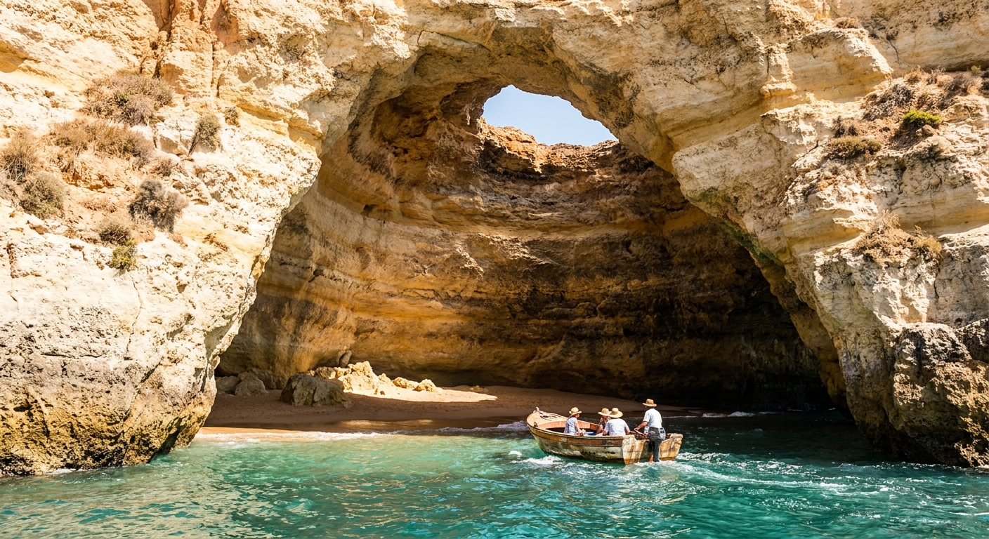
Almost everyone who books Benagil wants the same twenty minutes: a boat, kayak or paddleboard slipping under the arch into the domed chamber with the hole in its roof. Everything around it (the cliff path toward Praia da Marinha, lunch in Carvoeiro, an afternoon on a cove the size of a tennis court) runs on ordinary Algarve weather. The cave trip runs on something nobody puts in a forecast table: the state of the water at the entrance.
Air temperature you can plan around, and the normals below do it cleanly: twelve months of highs, lows, rainfall, rain-day counts and sea readings, with one month named as the answer. Sea state you cannot, so the calendar question here is really two questions stacked, and they have different answers.
THE YEAR AT A GLANCE · BENAGIL
September is the pick: 79.5°F days, sea at 65.4°F, and 1.9 rain days in an average month, with the August holiday charters already flown home.
BEST MONTH: SEPTEMBER · WARMEST SEA: OCTOBER AT 67.3°F · WETTEST: DECEMBER AT 3.54 IN
Go for: September and the first half of October, when the water is at its yearly warmest (67.3°F in October) and the cliff walk is dry underfoot.
Think twice before: building a short December trip around the cave: 7.0 days record 1 mm of rain or more, 3.2 of them record 10 mm or more, and daylight is down to 9 hours 41 minutes.
Air normals: IPMA station 554, Faro, 1991-2020 · Sea: Open-Meteo Marine, 2015-2024 · full sources at the end
On this page
- Month-by-month highs, rain and sea temperatureThe 12-month table
- The single best month to bookSeptember, with its numbers
- When the water is warm enough to swimSea temperature, month by month
- The quiet months at the coveNovember through February
- The month to avoidDecember, and for whom
- May or October instead of high summerThe shoulder verdict
Three or four nights is the usual shape of a stay on this stretch, with a rental car for the coves the boats skip. The national calendar sits in our Portugal timing guide, and the coast itself in the Algarve guide.
Benagil weather month by month: highs, lows, rain and sea
| Month | Avg high | Avg low | Rain | Days ≥1 mm | Sea (avg of daily max) |
|---|---|---|---|---|---|
| January | 61.3°F | 46.9°F | 1.94 in | 6.0 | 62.0°F |
| February | 62.6°F | 47.8°F | 1.65 in | 5.4 | 61.3°F |
| March | 66.0°F | 51.4°F | 1.84 in | 5.6 | 60.9°F |
| April | 69.3°F | 54.3°F | 1.54 in | 5.3 | 63.5°F |
| May | 74.3°F | 59.0°F | 1.03 in | 3.8 | 63.4°F |
| June | 80.2°F | 64.0°F | 0.20 in | 0.8 | 66.9°F |
| July | 84.9°F | 67.3°F | 0.04 in | 0.2 | 66.8°F |
| August | 84.6°F | 67.8°F | 0.12 in | 0.2 | 66.8°F |
| September | 79.5°F | 64.9°F | 0.85 in | 1.9 | 65.4°F |
| October | 73.9°F | 60.4°F | 2.20 in | 6.0 | 67.3°F |
| November | 67.3°F | 53.4°F | 2.97 in | 6.6 | 65.3°F |
| December | 62.8°F | 49.5°F | 3.54 in | 7.0 | 63.4°F |
A long dry summer sits inside a mild, wet winter: rainfall runs from 0.04 inches in July to 3.54 inches in December, while the average high never falls below 61.3°F, even in January.
The swings happen in spring and fall, not in the middle of either season. May adds 5.0°F over April’s 69.3°F high and cuts rain days from 5.3 to 3.8. Going the other way, October keeps daytime warmth at 73.9°F but more than triples September’s rain days, 6.0 against 1.9, and carries 2.20 inches against 0.85. Between them, June through August barely moves at all: highs of 80.2, 84.9 and 84.6°F, and a combined 1.2 days of measurable rain across the three months.
December is the hardest month, and specifically for the visitor whose trip is built around the boat. Rainfall peaks at 3.54 inches over 7.0 days, 3.2 of those days deliver 10 mm or more, and daylight is down to 9 hours 41 minutes on the 15th, with the sun gone by 5:17 pm. A traveler with three nights and one cave booking has very little room to reschedule.
Every figure here for air comes from IPMA station 554 at Faro, altitude 5 m, roughly 60 km east of the cove, over 1991-2020. The rain-day counts use the Portuguese service’s own thresholds, 1 mm and 10 mm, which are not interchangeable with the 0.10-inch threshold American tables print. Sea readings come from a marine model averaged over 2015-2024, a different source and a different period. And no station on this stretch measures sea state, the one variable that decides whether a boat reaches the cave.
When is the best time to visit Benagil?
Book September. Highs average 79.5°F with lows of 64.9°F, rainfall totals 0.85 inches over 1.9 days, and the sea reads 65.4°F, within 1.4°F of its August value. Daylight on the 15th runs 12 hours 27 minutes, sunrise at 7:13 am and sunset at 7:40 pm local, which is enough for a morning on the water and a cliff walk before dinner without either feeling rushed.
Its neighbors each give up something. August is 5.1°F hotter at 84.6°F and drier at 0.2 rain days, but it is also the month the European school holidays put every charter flight and every rental car on this coast at once. October keeps only 73.9°F and jumps to 6.0 rain days, 4.1 more than September, with 2.20 inches of rain. September takes the summer sea and hands back the summer crowds.
That answer travels well beyond the cove. Fares and routes for early fall are in our guide to flights from the US, the driving and toll setup in renting a car in Portugal, and what a week costs in the trip-cost breakdown. Base yourself in Carvoeiro for the short hop, or in Lagos if you want a town with evenings in it.
When can you swim in Benagil? Sea temperature month by month
Six months average 65°F or above in the water: October at 67.3°F, June at 66.9, July and August at 66.8, September at 65.4 and November at 65.3. No month in the marine record reaches 70°F, so this is Atlantic swimming, bracing on entry and fine after five minutes. The other half of the year sits between 60.9°F in March and 63.5°F in April, which is kayak-and-wetsuit water rather than beach-towel water.
One caveat worth carrying into the booking: those sea figures are the mean of daily maxima over 2015-2024, not a 24-hour average, so they run a shade warm. An 8 am paddle in September meets water cooler than 65.4°F, and the reading says nothing about swell or visibility inside the chamber.
When is Benagil quietest?
By the calendar, the quiet stretch is November through February, with the first half of March attached to it: no European school holidays, no Easter week, and the summer charter program wound down. That is a fact about the calendar, not a price ranking, and the cove behaves accordingly.
What you gain is room and walkable weather. November highs of 67.3°F make the cliff path a pleasure rather than an endurance test in August’s 84.6°F, and the water is still 65.3°F, a full 1.9°F warmer than May’s 63.4°F even though the air is 7.0°F cooler than May. Even at the rainiest, November’s 6.6 rain days leave two dry days in three.
What you lose is daylight and reliability. November 15 gives 10 hours 14 minutes, sunrise 7:09 am and sunset 5:23 pm, which is 4 hours 31 minutes less than June 15. Rain days climb from 0.8 in June to 6.6, with 2.97 inches to place, and winter swell can shut a cave trip on a morning that looks perfect from the parking lot.
Which month should you avoid in Benagil?
December, if the cave is the reason you are coming and you have a fixed short window. It is the wettest month at 3.54 inches across 7.0 days, 3.2 of which pass 10 mm, and daylight bottoms out at 9 hours 41 minutes. Stack a four-night stay against those odds and a single canceled departure can take the trip’s whole purpose with it.
For anyone else, December is a decent month wearing a bad reputation. Highs of 62.8°F beat January’s 61.3°F, the sea holds 63.4°F, warmer than it will be in March at 60.9°F, and those 7.0 rain days still leave 24 days of the month without a measurable millimeter. Walk the coast, eat long lunches, treat any boat morning as a bonus rather than a booking.
Is the shoulder season worth it in Benagil?
The two shoulder months are May and October, and each gives up roughly ten degrees against its summer neighbor: May’s 74.3°F high is 10.6°F below July’s 84.9°F, October’s 73.9°F is 10.7°F below August’s 84.6°F.
In exchange, May keeps almost all the summer light, 14 hours 13 minutes on the 15th against July’s 14 hours 30, sunrise at 6:21 am and sunset at 8:34 pm. October does something the brochures rarely price in: its sea averages 67.3°F, the warmest reading of the year, 0.5°F above August, because the Atlantic here warms slowly and cools slower still.
The subtraction is real in both. May’s water sits at 63.4°F, 3.4°F below July’s 66.8°F, so the swimming is a plunge rather than a soak. October’s rain jumps to 6.0 days and 2.20 inches against August’s 0.2 days and 0.12 inches, which is the difference between a forecast you can ignore and one you check nightly.
Cut it this way: May for walkers, kayakers and anyone who wants long evenings, October for swimmers willing to accept one wet day in five. If you want both halves at once, that is September, which is why it wins the page.
The last word
Pick September, give the coast three or four nights, and put the cave trip on the first clear morning rather than the last, so a swell cancellation still has somewhere to go. One number to file before you pack for a spring visit: the sea is coldest in March at 60.9°F, two months after the air bottoms out in January, so a March week is spring on the cliff path and midwinter in the water. Bring the wetsuit, and a windproof layer for the boat.
Sources & data for this guide
- Monthly air normals, 1991-2020 (highs, lows, precipitation) · IPMA, station 554 Faro, altitude 5.0 m · checked Sep 12, 2026
- Rain-day counts at the 1 mm and 10 mm thresholds · IPMA, station 554 Faro · checked Sep 12, 2026
- Sea surface temperature, mean of daily maxima 2015-2024 · Open-Meteo Marine API · checked Sep 12, 2026
- Daylight, sunrise and sunset on the 15th of each month, converted to Portuguese local time · sunrise-sunset.org · checked Sep 12, 2026
- Editorial admission: the Faro station is some 60 km east of Benagil and inland weather on higher ground differs · no station on this stretch of coast publishes sea state, so cave-access conditions could not be quantified here · confirm with operators before you book.