
GULF ISLANDS NATIONAL SEASHORE · MARCH · FLORIDA & MISSISSIPPI
March is when the barrier islands off Pensacola warm up enough to walk all day in a T-shirt and still cool off enough at night to want a sweater. The forts, the dune trails and the long white beaches of Santa Rosa Island and Perdido Key are at their most comfortable for anyone who plans to stay on dry land.
The Gulf lags behind the air. At 67.5°F on its warmest afternoons, the water invites wading more than swimming, and that gap between sand and sea shapes the whole trip. March is also spring break month in Florida, so the calendar of school holidays matters as much as the forecast when you book.
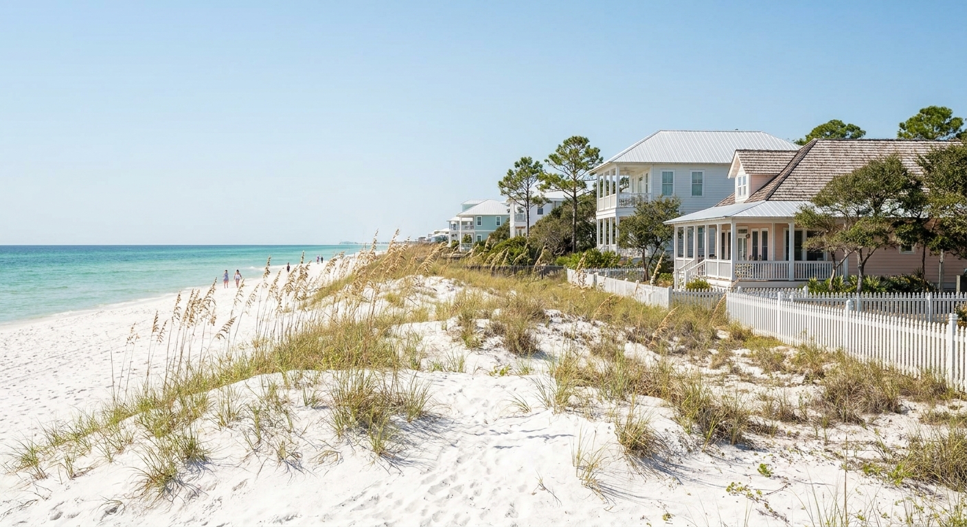
MARCH AT A GLANCE · GULF ISLANDS NATIONAL SEASHORE
March suits walkers, cyclists and fort visitors in highs near 71°F, while swimmers who want warmer water should wait for April.
NOAA STATION NORMALS 1991-2020 · SEA 67.5°F DAILY MAX · SPRING BREAK MONTH
Go for: the forts and dune trails in mild air, long beach walks at sunrise, and evenings that stay light until nearly 7 p.m.
Think twice before: booking March for a swimming vacation, or picking dates without checking school spring break weeks.
Climate: NOAA NCEI station USW00053853 · Sea: Open-Meteo Marine API · Light: sunrise-sunset.org · full sources at the end
On this page
- Gulf Islands weather in MarchHighs of 70.7°F, lows of 53.6°F and 5.2 rain days
- Can you swim in March?Sea at 67.5°F on its warmest afternoons
- Spring break crowds and lodging pricesHow busy March gets and when to book
- Things to do in MarchFort Pickens, Opal Beach, Naval Live Oaks and Johnson Beach
- A two-day March itineraryTwo days set to a 6:52 a.m. sunrise and a 6:54 p.m. sunset
- March vs February and AprilHow the three months compare on air, rain and sea
- Is March a good time to visit?Who should go in March and who should wait
The NOAA station behind the normals below stands in South Walton, east of the seashore’s Florida units. If you are still choosing a month, our Florida best-time guide covers the whole year, and the February page shows the month before.
Gulf Islands National Seashore weather in March: average highs, lows and rain days
| March normal | Value | Source |
|---|---|---|
| Average high | 70.7°F | NOAA NCEI, 1991-2020 |
| Average low | 53.6°F | NOAA NCEI, 1991-2020 |
| Precipitation | 4.70 in | NOAA NCEI, 1991-2020 |
| Days with 0.10 in or more | 5.2 | NOAA NCEI, 1991-2020 |
| Days with 1 in or more | 1.3 | NOAA NCEI, 1991-2020 |
| Daylight, March 15 | 12 h 02 min | sunrise-sunset.org |
NOAA’s National Centers for Environmental Information put the 1991-2020 March normals at an average high of 70.7°F, an average low of 53.6°F and 4.70 inches of precipitation. These come from a real thermometer at station USW00053853, not from a reanalysis grid cell. That station is in South Walton, and the seashore runs 160 miles west from there into Mississippi, so every figure here describes the eastern end of the park more closely than Ship Island or Ocean Springs.
Measurable rain, 0.10 inch or more, falls on 5.2 days of an average March, roughly one day in six. On 1.3 of those days the total reaches an inch or more, enough to wash out a beach afternoon. For a two- or three-day trip, the odds favor dry weather, but keep one covered option in reserve, such as the brick casemates of Fort Pickens.
Between the average low and the average high sits a 17.1°F swing. A morning at the fort starts in the mid-50s and a beach walk at 3 p.m. can feel like early summer. Pack a fleece or light jacket for dawn and evening, shorts for midday, and a windproof layer for the open sand after sunset.
On March 15 the islands get about 12 hours 02 minutes of daylight. Sunrise comes at 6:52 a.m. and sunset at 6:54 p.m. Central Daylight Time (11:52 and 23:54 UTC). Clocks have already jumped forward by mid-March, so an evening walk on the beach can run until almost 7 p.m.
Swimming at Gulf Islands National Seashore in March: sea temperature
Open-Meteo’s Marine API puts the sea surface off the seashore at 67.5°F in March, averaged over 2015-2024. That figure is a mean of daily maxima, the warmest reading of each day, so it runs a shade warmer than a 24-hour average would. It also comes from a different source and period than the NOAA air normals, and early-morning water will feel cooler than 67.5°F.
In practice, water in the upper 60s is cool on first contact. Most visitors wade to the knees, cold-tolerant swimmers manage a short dip on a sunny afternoon, and anyone planning to snorkel or paddleboard for long should think about a wetsuit. Children tend to tire of it quickly, so plan sandcastles over swimming.
Our sources carry no March wind or wave data for the seashore, so we give no figure. Check the National Weather Service surf forecast and the beach flag on the day before going in, and read our Florida safety guide for what each flag color means.
How busy is Gulf Islands National Seashore in March? Crowds and prices
March is Florida’s spring break month, and beach towns near the seashore feel it in the weeks when colleges and school districts are on holiday. We found no occupancy series for Pensacola Beach, Perdido Key or the Mississippi coast, so we crown no week of March the busiest or the cheapest.
Break weeks differ by university and school district, and they cluster in March. Book your room as soon as your dates are set, especially for weekends. We have no booking-lead data for these towns, so we give no number of weeks. Our where-to-stay guide compares the bases.
We could not verify the lodging-tax rate for Escambia County or for the Mississippi units, so we give no percentage. Ask for the total with taxes and fees before you confirm a rental.
With 1.3 days of inch-plus rain in an average March, a refundable or changeable rate is the one upgrade worth paying for. It lets you move a beach night if a downpour lines up with your dates. Our Florida trip-cost guide covers the rest of the budget.
Things to do in Gulf Islands National Seashore in March
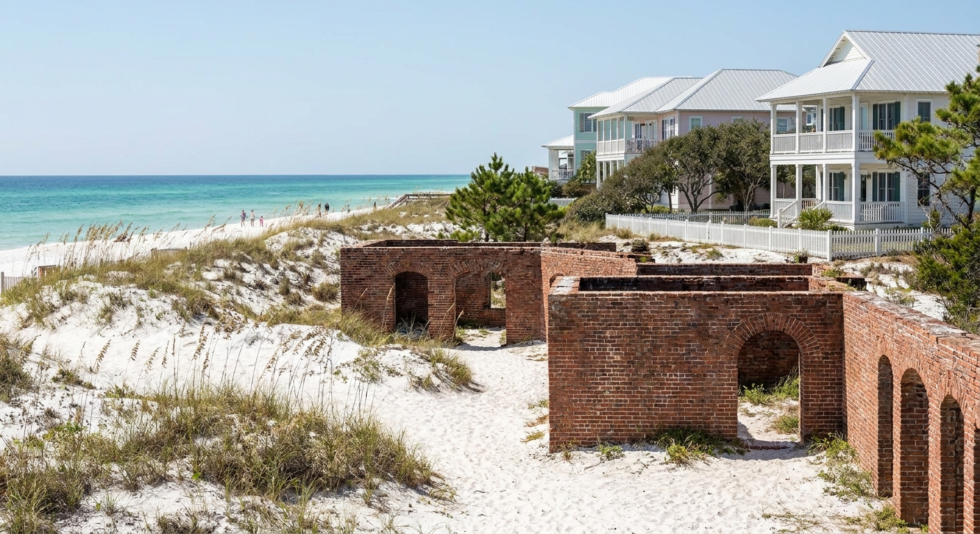
Of the three months compared below, March is the first with an average high above 70°F. That makes it a good month for the land side of the park: long beach walks, bike rides along the island road and hours inside the forts without the heat of later spring.
On the Florida side, Fort Pickens guards the western tip of Santa Rosa Island, Opal Beach sits on the undeveloped stretch toward Navarre, Naval Live Oaks in Gulf Breeze has shaded trails, and Johnson Beach covers the Perdido Key end. In Mississippi, Davis Bayou lies in Ocean Springs. Check the NPS site for Gulf Islands for current fees, hours, and parking before you drive.
The gap between air and water gives the month its character. A 70.7°F afternoon sits about 3°F above a 67.5°F sea, a smaller gap than April’s 5.2°F (76.2°F air, 71.0°F sea). So in March the sand is for walking and the water is for wading.
We could not verify which units charge an entrance fee in March, or whether a fee-free day falls in the month, so we name none. Our Florida national parks guide covers passes, and the beaches outside the fee areas cost nothing to walk.
Gulf Islands National Seashore in March: a two-day itinerary
Day one. Watch the 6:52 a.m. sunrise at Johnson Beach on Perdido Key with a jacket on, since mornings start in the 50s. Drive to Fort Pickens by 9 a.m. and walk the fort and its batteries before midday. After lunch, spend the warmest hours, when highs reach about 71°F, on the sand at Opal Beach. Stay for the 6:54 p.m. sunset and head back once the light goes.
Day two. Walk the Naval Live Oaks trails in the morning, then spend the afternoon on the Santa Rosa Island beaches or drive west to Davis Bayou in Mississippi for a quieter bayou shoreline. If the day is one of March’s 5.2 rainy ones, move the fort visit to the wet hours and save the beach for the next dry spell. For a longer trip, see our Florida road trip.
Gulf Islands National Seashore in March vs February and April
| Month | Average high | Average low | Precipitation | Days 0.10 in+ | Sea (mean daily max) |
|---|---|---|---|---|---|
| February | 65.8°F | 47.9°F | 4.96 in | 5.3 | 62.1°F |
| March | 70.7°F | 53.6°F | 4.70 in | 5.2 | 67.5°F |
| April | 76.2°F | 60.1°F | 4.55 in | 4.0 | 71.0°F |
Measured at the same NOAA station over 1991-2020, March runs 4.9°F warmer than February by day and 5.7°F warmer by night, with almost the same rain (5.2 days against 5.3). April adds another 5.5°F to the high and 6.5°F to the low, and drops to 4.0 rain days. The sea, from Open-Meteo’s marine data, climbs from 62.1°F to 67.5°F to 71.0°F.
Moving four weeks later gets you water that crosses 70°F, 1.2 fewer rain days and warmer evenings. You give up the cooler air that makes midday fort visits comfortable. Moving four weeks earlier drops the water to 62.1°F and nights into the upper 40s, with no less rain than in March.
Is March a good time to visit Gulf Islands National Seashore?
Yes, if your trip is built around walking, cycling, forts and beachcombing: highs near 71°F and a rain day roughly one in six suit all of it. No, if the plan is long swims or snorkeling, because a sea at 67.5°F on its warmest afternoons stays cool for most people.
Swimmers should pick April, when the sea averages 71.0°F on its daily maxima and rain days fall to 4.0. Our Florida flights guide covers getting to Pensacola in either month.
In March you get highs above 70°F with the Gulf still in the 60s, so a full day at Fort Pickens and a sunset on the sand fit into the same comfortable afternoon.
The last word
Choose March for the land and April for the water, and book early if your dates overlap a spring break week. Pack one proper warm layer: in an average March, 0.2 nights fall to 32°F or below at the NOAA station, about one March in five, so the coldest dawn at Johnson Beach can still call for gloves.
Sources & data for this guide
- March, February and April air normals, precipitation, rain days and freezing nights · NOAA NCEI monthly normals 1991-2020, station USW00053853 (South Walton) · checked Sep 24, 2026
- Station reach · the thermometer stands at the eastern end of a seashore that runs 160 miles west into Mississippi, so conditions at Ship Island or Ocean Springs may differ · checked Sep 24, 2026
- Sea surface temperature, February to April · Open-Meteo Marine API, mean of daily maxima 2015-2024, a shade warmer than a 24-hour mean · checked Sep 24, 2026
- Daylight, sunrise and sunset on March 15 · sunrise-sunset.org, converted from UTC to Central Daylight Time · checked Sep 24, 2026
- What we could not verify · March fees, hours and parking at Fort Pickens, Opal Beach, Naval Live Oaks, Johnson Beach and Davis Bayou, fee-free days, lodging-tax rates, occupancy and wind or wave data. Check the NPS site and your lodging before you book.
To plan your stay
- Best Time to Visit Gulf Islands National Seashore: Weather, Sea Temperature and the Quiet Months
- Gulf Islands National Seashore in February: Weather, Sea Temperature, Crowds and a Two-Day Itinerary
- Gulf Islands National Seashore in April: Weather, Water Temperature and Crowds
- Gulf Islands National Seashore in January: Weather, Sea Temperature, Crowds and a Two-Day Plan