
FLORIDA · GULF ISLANDS NATIONAL SEASHORE · APRIL
April hands Gulf Islands National Seashore to walkers and beach-sitters first. Afternoons run warm enough for bare arms on the brick ramparts of Fort Pickens, and evenings cool enough to want a sleeve on the sand at Perdido Key. The Gulf is waking up too, with water in the low 70s that invites a quick, bracing swim rather than an hour of floating.
You have already picked the seashore. The open question is the date: whether April suits your trip, or whether four weeks either way would serve you better. Every figure here is dated and sourced, March and May sit alongside for comparison, and the wider Florida calendar lives in our best-time guide for the state.
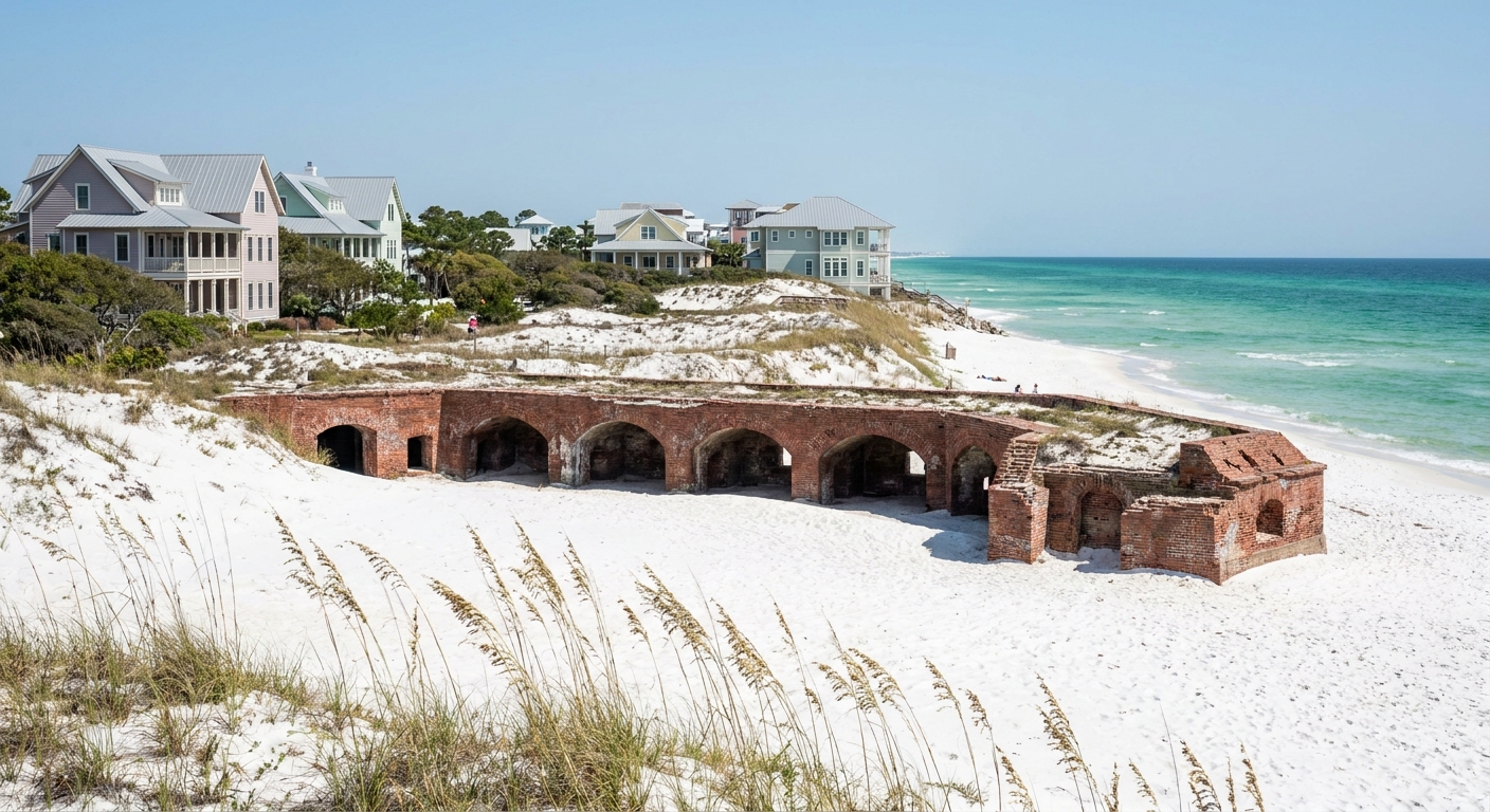
APRIL AT A GLANCE · GULF ISLANDS NATIONAL SEASHORE
April suits walkers, fort visitors and short-dip swimmers: mild afternoons, cool evenings and a Gulf just past 70°F, with fewer rain days than March.
NOAA STATION NORMALS 1991-2020 · SOUTH WALTON STATION · SEA 71.0°F DAILY-MAX MEAN
Go for: fort and beach walking in mid-70s afternoons, long evenings with sunset after 7 pm, and water warm enough for a brisk swim.
Think twice before: planning long lazy swims. The sea runs 7.2°F cooler than in May, and evenings drop near 60°F.
Air: NOAA NCEI station normals · Sea: Open-Meteo Marine API · Light: sunrise-sunset.org · full sources at the end
On this page
- Gulf Islands weather in April76.2°F highs, 4.0 rain days, 7:13 pm sunset
- Gulf Islands water temperature in April71.0°F sea and what a swim feels like
- Crowds and prices in AprilBooking, lodging tax and where to spend
- Things to do in AprilFort Pickens, Perdido Key and Ship Island
- A two-day April itinerarySanta Rosa Island to Perdido Key in two days
- April vs March and MayHow the three months compare on air, rain and sea
- Is April a good time to visit?Yes for walkers, May for long swims
Still shaping the wider Florida trip around this stop? Flights into the Panhandle are in our Florida flights guide, driving between units in getting around Florida, and the neighboring beach towns east of the seashore in our South Walton guide.
Gulf Islands National Seashore weather in April: average highs, lows and rain days
| April measure | Value | Source |
|---|---|---|
| Average high | 76.2°F | NOAA NCEI, 1991-2020 |
| Average low | 60.1°F | NOAA NCEI, 1991-2020 |
| Precipitation | 4.55 in | NOAA NCEI, 1991-2020 |
| Days with 0.10 in or more | 4.0 | NOAA NCEI, 1991-2020 |
| Days with 1 in or more | 1.4 | NOAA NCEI, 1991-2020 |
| Daylight on April 15 | 12 h 58 min | sunrise-sunset.org |
| Sunrise / sunset, April 15 | 6:15 am / 7:13 pm CDT | sunrise-sunset.org |
| Sea surface (mean of daily maxima) | 71.0°F | Open-Meteo Marine, 2015-2024 |
The NOAA National Centers for Environmental Information publish 1991-2020 normals for station USW00053853, a real thermometer at South Walton in the Panhandle, and every air figure here comes from it: an average April high of 76.2°F, an average low of 60.1°F and 4.55 inches of precipitation. These are official station normals, not a reanalysis grid cell. The seashore runs 160 miles west from that station into Mississippi, so the numbers describe its eastern end best.
An average April logs 4.0 days with at least 0.10 inch of rain. Across 30 days, that puts measurable rain on roughly one day in seven or eight. A long weekend has good odds of staying dry, and a full week will probably meet one wet day. Keep one morning flexible on any trip longer than four nights, and hold the fort visit for it.
The average swing between afternoon and dawn is 16.1°F, from 76.2°F down to 60.1°F. Shorts and a swimsuit cover the middle of the day. For the sunset walk and an early start at the beach, pack long sleeves and a light jacket, plus a towel you can wrap around your shoulders after a swim.
On April 15 the seashore gets about 12 hours 58 minutes of daylight. Sunrise comes at 6:15 am and sunset at 7:13 pm Central Daylight Time, converted from the 11:15 and 00:13 UTC times sunrise-sunset.org calculates. That leaves time for a full beach afternoon and a fort visit, with the light going gold over the water shortly before seven.
Gulf Islands National Seashore water temperature in April: can you swim?
The sea surface off the seashore averages 71.0°F in April, according to the Open-Meteo Marine API over 2015-2024. That figure is a mean of daily maxima, the warmest reading of each day, so it runs a shade warmer than a 24-hour average would. Expect early-morning water to sit a little below it. The marine series is modeled offshore and covers a different period than the NOAA air normals.
In practice, 71°F water under a 76°F afternoon means a swim that takes your breath on the first plunge and settles after a minute or two. Most people swim in short bursts and warm up on the sand. Children and anyone who chills easily will want the warmest hours after lunch, and a rash guard helps. Compared with March, the water is 3.5°F warmer.
We found no wind or wave series for April, so we give no figure for surf or chop. Check the National Weather Service surf-zone forecast and the beach flag at the lifeguard stand on the day, and read our Florida safety guide for what each flag color means.
How busy is Gulf Islands National Seashore in April? Crowds and prices
We found no occupancy series and no monthly room rates for the Pensacola and Perdido Key area, so we crown no month expensive or cheap. The Florida spring-break peak our state guide describes is a March pattern, and school calendars vary by state. For budget ranges across Florida, our trip-cost guide prices a day three ways.
We could not verify how many weeks ahead April beds sell out, so we give no lead time. Once your dates are fixed, book a refundable room and the flight together, and compare fares into Pensacola against the drive from a larger Florida airport. Our where-to-stay guide sorts the bases.
We could not verify the lodging-tax rate for Escambia or Santa Rosa County, so we give no percentage. Ask for the total with taxes and any resort fee before you confirm, and compare that figure between listings.
The one place where spending more changes an April visit is location. A bed on Santa Rosa Island or Perdido Key puts you minutes from the sand at 6:15 am sunrise and lets you walk back for a jacket when the evening drops toward 60°F. A mainland room saves money but adds a bridge crossing at both ends of the day.
Things to do in Gulf Islands National Seashore in April
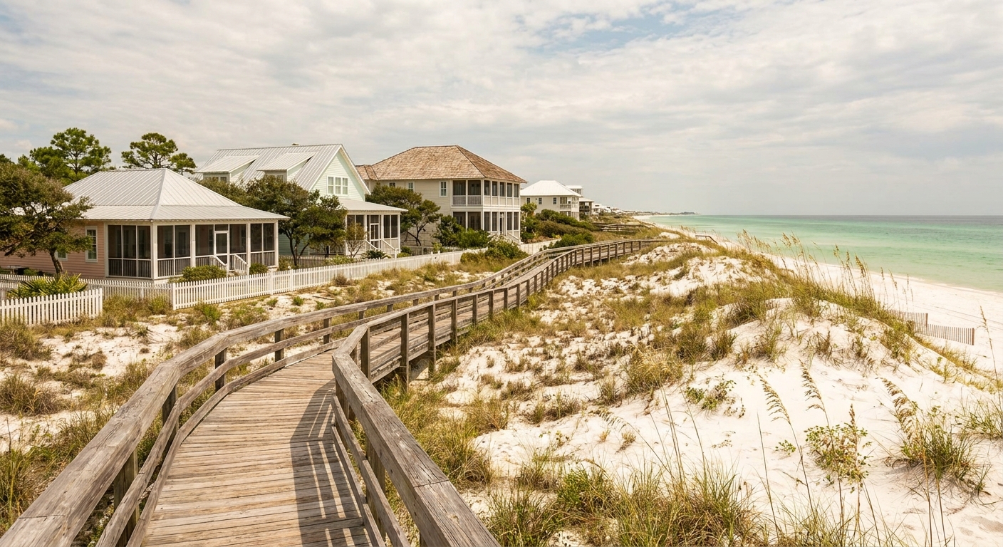
April lets you do the whole seashore on foot in comfort. At a 76.2°F average high, a midday walk across the dunes or through a brick fort is pleasant, while May’s 83.5°F turns the same walk into shade-hunting. The water is warm enough to finish a hike with a swim, which March, at 67.5°F, makes harder.
On the Florida side, Fort Pickens sits at the western tip of Santa Rosa Island beyond Pensacola Beach, and Opal Beach lies farther east on the same island. Johnson Beach anchors the Perdido Key unit, and the Naval Live Oaks trails run through Gulf Breeze. In Mississippi, Davis Bayou sits at Ocean Springs, and West Ship Island is reached by boat from Gulfport. We could not verify April entrance fees, gate hours or the Ship Island boat schedule, so we quote none. The National Park Service site posts them.
The forts and trails stay the same all year. The air around them moves, and that gap sets the season. In April, lows near 60°F keep the first hours at Fort Pickens cool, and afternoons stay 7.3°F below May’s average high, so the hottest part of the day is still usable for walking.
We could not verify which units charge entry in April or whether a fee-free day falls in the month, so we name none. The 7:13 pm sunset from any beach you have already reached costs nothing extra. For other free parks across the state, see our Florida national parks guide.
Gulf Islands National Seashore in April: a two-day itinerary
Day one, Santa Rosa Island. Be on the beach near Fort Pickens around 6:30 am, just after the 6:15 sunrise, with a jacket for the 60°F start. Walk the dunes until mid-morning, then swim after lunch when the water is at its daily peak. Spend the afternoon at Opal Beach, and stay for the 7:13 pm sunset before driving back across the bridge for dinner in Pensacola Beach.
Day two, Perdido Key. Start with a morning walk and swim at Johnson Beach, then move to the Naval Live Oaks trails in Gulf Breeze for the afternoon. If day two turns into one of April’s 4.0 rain days, swap the order: take the covered casemates of Fort Pickens while it pours and save Johnson Beach for the next dry spell. Check the forecast the evening before.
Gulf Islands National Seashore in April vs March and May
| Measure | March | April | May |
|---|---|---|---|
| Average high | 70.7°F | 76.2°F | 83.5°F |
| Average low | 53.6°F | 60.1°F | 68.0°F |
| Precipitation | 4.70 in | 4.55 in | 3.22 in |
| Days with 0.10 in or more | 5.2 | 4.0 | 3.7 |
| Sea surface (daily-max mean, Open-Meteo) | 67.5°F | 71.0°F | 78.2°F |
The average high climbs 5.5°F from March to April and another 7.3°F into May, while lows rise from 53.6°F to 60.1°F and then to 68.0°F, per the same NOAA station. Rain eases in step: 5.2 wet days in March, 4.0 in April, 3.7 in May, with May’s total down to 3.22 inches. The sea, from the Open-Meteo Marine API, gains 3.5°F into April and 7.2°F into May.
Moving four weeks earlier costs you 3.5°F of water and adds 1.2 rain days, in exchange for cooler walking at 70.7°F. Our March guide covers that month. Moving four weeks later buys 78.2°F water and the driest of the three months, but afternoons at 83.5°F push fort visits into the early morning.
Is April a good time to visit Gulf Islands National Seashore?
Yes, if your vacation centers on walking the forts, beachcombing and short swims: 76.2°F afternoons and 4.0 rain days make April an easy month to be outdoors all day. It suits a weekend or a four-night stay. It is a weaker choice for families who want children in the water for hours, since 71.0°F still feels cool after the first twenty minutes.
If long swims are the point, book May. The Gulf reaches 78.2°F, precipitation drops to 3.22 inches, and evenings hold near 68°F. Plan the walking for early morning, before highs climb toward 83.5°F.
Among March, April and May, April alone pairs a mid-70s afternoon with a sea above 70°F and evenings cool enough for a sweater.
The last word
Choose April for the walking, and the swim comes as a bonus. Rain is the only real variable: a typical April brings 1.4 days with an inch or more, enough to wash out one afternoon. So keep the fort visit as your rain plan, carry the light jacket to every sunset, and let Johnson Beach wait for the clear morning after.
Sources & data for this guide
- April, March and May air normals, precipitation and rain days · NOAA NCEI monthly normals 1991-2020, station USW00053853 at South Walton · checked Sep 24, 2026
- Station reach: the seashore runs 160 miles west of the station into Mississippi, so these normals describe its eastern end · NOAA NCEI · checked Sep 24, 2026
- Sea surface temperature, mean of daily maxima, 2015-2024 · Open-Meteo Marine API · checked Sep 24, 2026
- Daylight, sunrise and sunset on April 15 (UTC, converted to CDT) · sunrise-sunset.org · checked Sep 24, 2026
- We could not verify entrance fees, gate hours, the Ship Island boat schedule, lodging-tax rates or booking lead times, so we quote none · check the National Park Service and your lodging before you book.
To plan your stay
- Best Time to Visit Gulf Islands National Seashore: Weather, Sea Temperature and the Quiet Months
- Gulf Islands National Seashore in March: Weather, Sea Temperature, Crowds and a Two-Day Itinerary
- Gulf Islands National Seashore in May: Weather, Sea Temperature, Crowds and a Two-Day Itinerary
- Gulf Islands National Seashore in February: Weather, Sea Temperature, Crowds and a Two-Day Itinerary