
GULF ISLANDS NATIONAL SEASHORE · DECEMBER · THE MONTH GUIDE
December turns Gulf Islands National Seashore into a walking coast. The summer heat has gone, the white sand stays as bright as ever, and the old brick forts on Santa Rosa Island and at Pensacola Bay become comfortable to explore at midday. NOAA’s 1991-2020 normals put the average December afternoon at 65.6°F, a temperature for a long beach walk and a fleece at sunset.
The month also takes things away. The Gulf has cooled to the mid-60s, the sun sets before five, and December is the wettest of its three neighboring months. If you have already picked the seashore for your trip, the question is timing: whether December suits your plans, or whether November or January would serve you better.
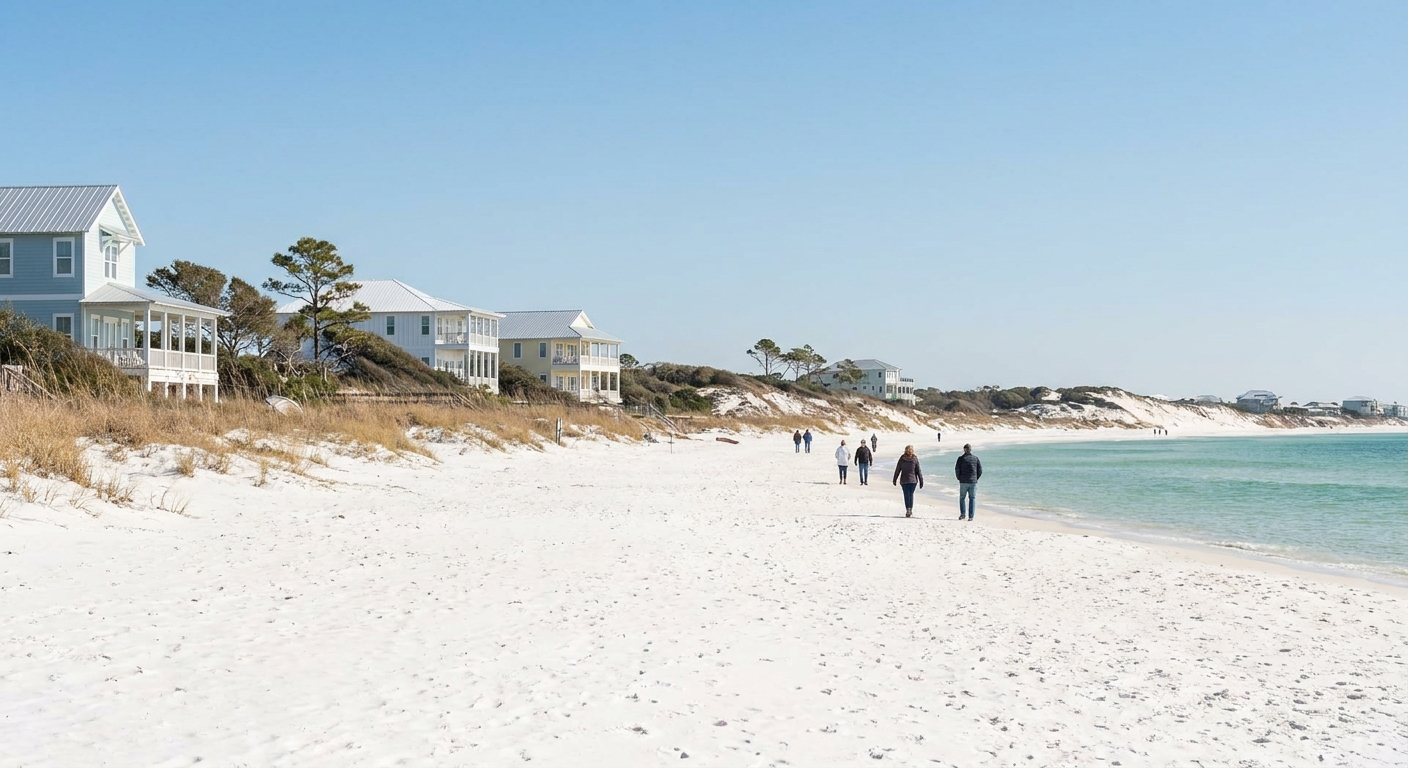
THE MONTH AT A GLANCE · GULF ISLANDS NATIONAL SEASHORE · DECEMBER
Come in December for cool, bright days on the forts and trails, and choose November instead if a proper swim is part of the vacation.
COOL-SEASON WALKING · SEA IN THE MID-60S · SUNSET BEFORE 5 P.M.
Go for: fort visits and beach walks in 65°F afternoons, cool nights for sleeping, and sunsets early enough to watch before dinner.
Think twice before: planning the trip around swimming. The Gulf averages 65.9°F even in its daily maxima, about 6.5°F cooler than in November.
Air normals: NOAA NCEI 1991-2020 · Sea: Open-Meteo Marine API 2015-2024 · Light: sunrise-sunset.org · full sources at the end
On this page
- December weather at Gulf Islands65.6°F highs, 47.5°F lows, 6.5 wet days
- Is the Gulf warm enough to swim in December?Sea surface at 65.9°F
- December crowds and room pricesHoliday weeks, booking and lodging tax
- Things to do in DecemberFort Pickens, Naval Live Oaks, Perdido Key
- A two-day December itinerarySunrise at 6:32, sunset at 4:47
- How December compares with November and JanuaryAir, rain and sea for all three months
- Is December a good time to go?Yes for walkers, no for swimmers
The seashore is split between Florida and Mississippi units, and its beaches, forts and trails get their full treatment on our Gulf Islands guide. For the other federal sites in the state, see Florida’s national parks. The weather, water and daylight in December come next.
Gulf Islands National Seashore weather in December: average highs, lows and rain days
| December measure | Value | Source |
|---|---|---|
| Average high | 65.6°F | NOAA NCEI, 1991-2020 |
| Average low | 47.5°F | NOAA NCEI, 1991-2020 |
| Precipitation | 4.72 in | NOAA NCEI, 1991-2020 |
| Days with 0.10 in or more | 6.5 | NOAA NCEI, 1991-2020 |
| Days with 1 in or more | 1.7 | NOAA NCEI, 1991-2020 |
| Sea surface (mean of daily maxima) | 65.9°F | Open-Meteo Marine API, 2015-2024 |
| Daylight on December 15 | About 10 h 15 min | sunrise-sunset.org |
| Sunrise / sunset, December 15 | 6:32 a.m. / 4:47 p.m. CST | sunrise-sunset.org |
Our air figures are official station normals, from NOAA’s National Centers for Environmental Information for 1991-2020, measured by a real thermometer at station USW00053853 in South Walton. December averages a 65.6°F high, a 47.5°F low and 4.72 inches of precipitation. That station sits at the Panhandle end, and NOAA’s own record places the seashore running 160 miles west of it into Mississippi. Every figure here therefore describes the eastern end of the coast. It is a guide to the Pensacola and Mississippi units, and we have not checked how far they diverge from it.
An average December brings 6.5 days with at least a tenth of an inch of rain. That works out to roughly one day in five, enough to wet a beach walk or send you under cover for an hour. Downpours of an inch or more come on 1.7 days a month, about one day in eighteen. On a two-night trip, most visitors meet no soaking day at all, but a week-long vacation will probably include one.
The gap between the afternoon high and the overnight low is 18.1°F. You can walk a fort in a T-shirt at two in the afternoon and want a warm jacket by the time you head to dinner. Pack in layers: a fleece or light down jacket, a windproof shell for the rain days, long pants, and closed shoes for the fort floors and trails.
On December 15 the sun rises at 6:32 a.m. and sets at 4:47 p.m. Central Standard Time, giving about 10 hours 15 minutes of daylight. Visits to forts, beaches and trails have to fit that window. Plan the farthest stop first, and head to the beach by about 4 p.m. if you want the sunset over the water.
Can you swim in Gulf Islands National Seashore in December? Sea temperature
The Open-Meteo Marine API puts the December sea surface off the seashore at 65.9°F, averaged over 2015-2024. That value is a mean of daily maxima, the warmest reading of each day, so it runs a shade above a true 24-hour average. Early mornings in the water will usually be a little cooler than 65.9°F. The figure comes from a different source and a different period than the NOAA air normals, and we report each under its own label.
In practice, water in the mid-60s feels bracing to most swimmers. A quick dip on a sunny afternoon is realistic, and children tend to leave the water after a few minutes. If you want to spend real time in the Gulf, bring a wetsuit. With the average high at 65.6°F, the air on shore is about as cool as the water, so pack a towel and a dry layer for when you come out.
We could not obtain December wind or swell data for this coast, so we give no figures on waves or chop. Look at the National Weather Service marine forecast for the Pensacola and Mississippi coastal waters the day before you plan a swim or a paddle.
How busy is Gulf Islands National Seashore in December? Crowds and prices
Our Florida overview identifies holiday weeks as the state’s annual price peaks and early December as one of its quiet stretches. That describes the whole state, and we found no occupancy series for the Gulf Islands coast itself. We therefore rank no December week as the cheapest or most expensive of the year.
We also have no booking-lead data for rooms near the seashore, so we cannot say how many weeks ahead to reserve. The calendar still helps. Nights around Christmas and New Year’s fall inside the holiday peak, and those are the ones to book first. Early December has no holiday pressure. Compare neighborhoods on where to stay in Florida and budget the trip with our Florida trip-cost guide.
We could not verify the lodging-tax rate for Escambia and Santa Rosa counties or for the Mississippi coast, so we give no percentage. Look for the tax line before you confirm a booking, next to any resort or parking fee.
A flexible, refundable rate is the extra cost most likely to pay off in December. The normals show 1.7 days a month with an inch of rain or more. A rate that lets you move a night keeps one of those days from wiping out a short stay. The other extra worth budgeting is a wetsuit, and only if swimming matters to you.
Things to do in Gulf Islands National Seashore in December
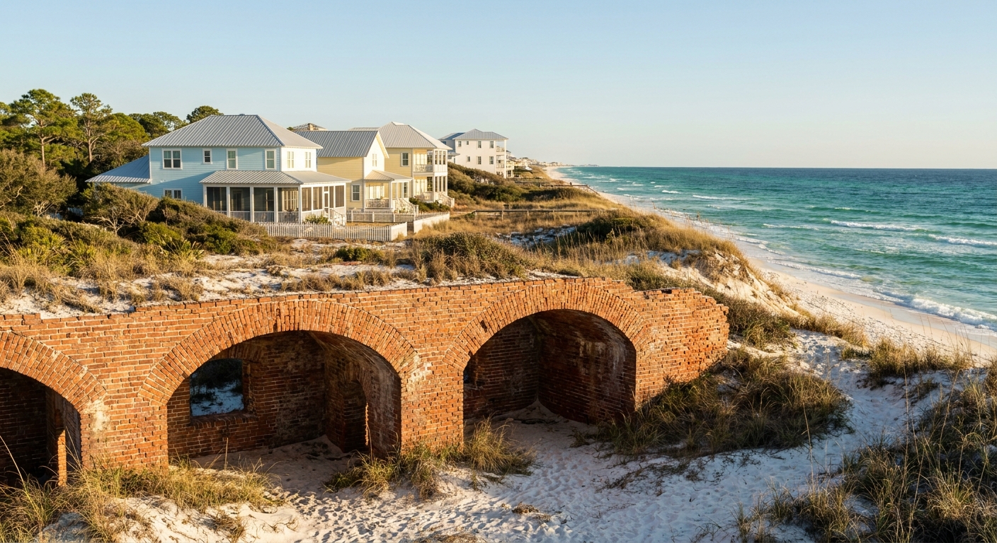
December makes long days on foot comfortable. Afternoons at 65.6°F let you combine a fort, a trail and a beach in one outing. In warmer months the heat usually breaks that kind of day into short pieces. With sunset at 4:47 p.m., you can also watch the sun go down over the Gulf and still get to dinner early.
On the Florida side, Fort Pickens sits at the western end of Santa Rosa Island, with brick casemates you can walk through. Fort Barrancas stands on the bay shore inside Naval Air Station Pensacola. The Naval Live Oaks area in Gulf Breeze has wooded trails, and Perdido Key and Opal Beach offer open sand. In Mississippi, Davis Bayou at Ocean Springs is the mainland unit. We could not verify December hours, entrance fees, base-access rules or the Ship Island ferry schedule. Check each on the National Park Service site before you drive out.
The changes between months happen in the water and the air. The Gulf’s daily maxima drop from 72.4°F in November to 65.9°F in December, and the average afternoon falls by the same 6.5°F, from 72.1°F to 65.6°F. Beach time in December means walking or sitting on the sand more than swimming. Fort visits and trail walks are more pleasant in the cooler air.
We could not confirm current entrance fees or any fee-free days in December, so we list nothing as free. The National Park Service publishes its fee-free calendar and the seashore’s entrance rates. Our Florida national parks guide covers how the annual passes work across the state.
Gulf Islands National Seashore in December: a two-day itinerary
Day one, Santa Rosa Island. Be on the beach road soon after the 6:32 a.m. sunrise, when the low light is still on the sand. Walk the shore by Fort Pickens through the cool morning, then tour the fort itself between 11 a.m. and 2 p.m., when the air is closest to its 65.6°F high. Save the afternoon for Opal Beach, and be on the sand by 4 p.m. for the 4:47 p.m. sunset. Put the warm layer on as soon as the sun drops.
Day two, the bay side. Start with the trails at Naval Live Oaks in the morning, then drive west to Fort Barrancas or out to Perdido Key after lunch. If one of December’s 6.5 wet days arrives, swap the order and spend the rain in covered casemates, then go to the beach once the front clears. For more ideas across the region, see things to do in Florida, and for flight options, see our Florida flights guide.
Best month to visit Gulf Islands National Seashore: December vs November and January
| Measure | November | December | January |
|---|---|---|---|
| Average high | 72.1°F | 65.6°F | 63.1°F |
| Average low | 53.0°F | 47.5°F | 45.3°F |
| Precipitation | 4.13 in | 4.72 in | 4.52 in |
| Days with 0.10 in or more | 4.3 | 6.5 | 5.6 |
| Sea surface (mean of daily maxima, Open-Meteo Marine API 2015-2024) | 72.4°F | 65.9°F | 60.4°F |
By NOAA’s station normals, November runs 6.5°F warmer than December by day and 5.5°F warmer by night. January is only 2.5°F cooler in the afternoon and 2.2°F cooler after dark. December is the wettest of the three, with 4.72 inches over 6.5 wet days, against 4.13 inches over 4.3 days in November and 4.52 inches over 5.6 days in January. In the Open-Meteo Marine API figures, the sea cools 6.5°F from November to December and another 5.5°F into January.
Moving four weeks earlier into November gets you water at 72.4°F, a real swimming temperature for many visitors, and two fewer wet days. You give up the cool afternoons that make December good for the forts. Moving four weeks later into January costs you little in air temperature, but the sea falls to 60.4°F and rules out swimming for most people.
Is December a good time to visit Gulf Islands National Seashore?
Yes, if your trip is built around walking the forts, beachcombing and trails in 65°F afternoons, and you are happy with a sweater at night. No, if the vacation depends on long swims or on evenings outdoors after five, when the light has gone and the air is heading toward 47.5°F.
If December is not right for you, choose November. Its 72.4°F sea and 72.1°F afternoons keep swimming on the list, and its 4.3 wet days are the fewest of the three months. The November guide has the details, and the best time to visit Florida covers the rest of the year statewide.
December is the last of the three months in which the Gulf’s daily-maximum temperature, 65.9°F, sits above the average afternoon air, 65.6°F.
The last word
The main decision for December is whether to pack a wetsuit or leave swimming for another trip. The rest suits a cool-weather visit: fort tours at midday, beaches at sunset, a warm dinner afterward. Pack for the cold too. An average December brings 1.2 nights at 32°F or below, so a real coat belongs in the bag alongside the sandals.
Sources & data for this guide
- December, November and January air normals, precipitation, wet days and frost nights · NOAA NCEI monthly normals 1991-2020, station USW00053853 (South Walton) · checked Sep 24, 2026
- Station scope · the station sits at the Panhandle end and the seashore runs 160 miles west into Mississippi, so the normals describe the eastern end · checked Sep 24, 2026
- Sea surface temperatures · Open-Meteo Marine API, mean of daily maxima 2015-2024, a shade warmer than a 24-hour mean · checked Sep 24, 2026
- Daylight, sunrise and sunset on December 15 · sunrise-sunset.org, converted from UTC to Central Standard Time · checked Sep 24, 2026
- We could not verify entrance fees, fort hours, base access, the Ship Island ferry schedule, lodging-tax rates or wind and swell data for December · check the National Park Service and your booking before you travel.
To plan your stay
- Best Time to Visit Gulf Islands National Seashore: Weather, Sea Temperature and the Quiet Months
- Gulf Islands National Seashore in January: Weather, Sea Temperature, Crowds and a Two-Day Plan
- Gulf Islands National Seashore in November: Weather, Sea Temperature, Crowds and a Two-Day Itinerary
- Gulf Islands National Seashore in February: Weather, Sea Temperature, Crowds and a Two-Day Itinerary