
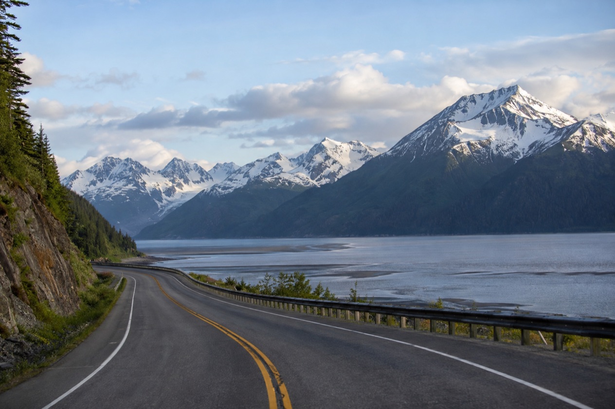
On the stretch of road beside Turnagain Arm, the water pulls out to a wide gray mudflat, the Chugach Mountains rise straight from the shoulder, and drivers slow down for a view they did not expect. That road is the Seward Highway, the link between Anchorage and the port town of Seward. It is a drive made of pullouts, small communities and long views, and it is worth treating as part of the trip rather than the way to get there.
What is the Seward Highway?
The Seward Highway is the road that runs 125 miles from Seward to Anchorage, and it carries three scenic labels at once: National Forest Scenic Byway, State Scenic Byway and All-American Road. Few roads in the country hold all three. It is also part of the unsigned Interstate Highway System as Interstate A-3, a detail you will never see on a sign.
The route crosses some of the most varied country in Southcentral Alaska. It passes through the Kenai Peninsula, the Kenai Mountains, Chugach National Forest and the shore of Turnagain Arm. About 72 miles of the road lie inside the national forest, so for most of the drive the trees, ridges and rivers on either side belong to public land.
The two ends of the road
Seward sits at the head of Resurrection Bay, a small port city of about 2,700 people on the Kenai Peninsula. It is where the highway ends, and it is also the town from which Exit Glacier is reached. Exit Glacier is the only part of Kenai Fjords National Park you can get to by road, and visitors can walk close to an active glacier or join a ranger-led walk.
At the other end is Anchorage, where the road begins its run along the water. Between the two, the highway is the main line through the region, and the pace of the day is set by the scenery, the pullouts and the traffic rather than by the clock.
Other ways to cover the same ground
The Alaska Railroad runs daily rail passage between Anchorage and Seward in the summer, from May 13 to September 14. The Park Connection offers twice daily bus service on the same pair of towns in the summer, from mid-May to mid-September. Both follow the same corridor as the highway, so the same mountains and water slide past the window.
Cyclists have their own line on the map. U.S. Bicycle Route 97 runs alongside the Seward Highway along its entire length and was created in 2011.
The road in numbers
| Item | Detail |
|---|---|
| Length | 125 miles, Seward to Anchorage |
| Inside Chugach National Forest | About 72 miles |
| Designations | National Forest Scenic Byway, State Scenic Byway, All-American Road |
| Interstate designation | Unsigned Interstate A-3 |
| Bicycle route | U.S. Bicycle Route 97, created in 2011 |
| Alaska Railroad, Anchorage to Seward | Daily, May 13 to September 14 |
| Park Connection bus | Twice daily, mid-May to mid-September |
What do you see along it?
You see water, mountains and a few small places with real stories, starting with Turnagain Arm, a long inlet that the highway follows for much of its length. The road follows a portion of the southern edge of Chugach State Park along the arm, so the mountains stand close on one side while the mudflats open out on the other.
Turnagain Arm, tides and mudflats
Turnagain Arm runs east to west for 40 to 45 miles, and its tides reach up to 40 feet, the largest in the United States. At low tide the whole arm becomes a broad mud flat cut by stream channels, a wide gray plain that looks solid and is not. Hikers are warned to take care not to get stuck in the quicksand-like mud.
When the flood tide comes in, it often begins with a tidal bore up to 6 feet high, moving at 5 to 6 miles per hour. Adventurous kayakers and surfers ride it as an extreme sport. For most travelers the pleasure is simpler: stopping at a pullout and watching the water change the shape of the landscape.
Girdwood and the Alyeska valley
Girdwood is 37 miles south of Anchorage, about an hour by car. The Alaska Railroad also serves it: the Coastal Classic, running between Anchorage and Seward, and the Glacier Discovery, which stops in Whittier, Portage and Spencer Glacier. The train from Anchorage takes about an hour and a half.
Two trails give the town its character. The Winner Creek Trail winds through the northernmost rainforest in the US to a thundering waterfall, and the North Face Trail goes up Mt. Alyeska. The calendar has its own marks: the Slush Cup festival takes place the second weekend of April, and the Forest Fair takes place July 4th weekend.
Portage, the ghost town
Portage lies about 47 miles southeast of Downtown Anchorage on Turnagain Arm. It first appeared on the 1950 census as an unincorporated village of 34 people. The 1964 Alaska earthquake ended that: the ground sank about six feet, putting most of the town below high tide level.
What remains are the ruins of a few buildings and a ghost forest of trees that died after salt water flooded their roots. Today Portage is a road and rail junction linking the Seward Highway and the Alaska Railroad to Portage Glacier park and the Anton Anderson Memorial Tunnel, which leads to Whittier. Around it, people visit the wildlife center, float the Portage, Twentymile and Placer rivers, fish for hooligan in the Twentymile River, and ice skate on the marshy areas, creeks and Portage Lake.
What do you need to know before you drive it?
Before you drive it, know the speed rules on the busy section, how heavy summer traffic gets, and where to read live road conditions. The highway is a main route, and the stretch near Girdwood and Portage is where most of the trouble gathers.
Speed limits and summer traffic
In July 2016, the Alaska Department of Transportation and Public Facilities posted updated speed limits on a five-mile section south of Anchorage, between Hope Junction and the top of Turnagain Pass: 55 mph in the right lane and 65 mph in the left lane. The two limits say something about the road itself, which has lanes for different paces.
In the summer months, up to 15,000 vehicles a day use the 15-mile stretch from Girdwood past the Portage curve toward Turnagain Pass, ending at Ingram Creek. That is the part of the road where a pullout for a photograph deserves a little extra thought.
Reading Alaska 511
Alaska 511 is the state’s road information service, and it sorts conditions into Good, Fair, Difficult, Very Difficult, Hazardous, Road Closure and No Winter Maintenance. The Alaska Department of Transportation has partnered with Waze to publish Waze-reported incidents and closures on the site, through the Waze for Cities program, a free data exchange between Waze and government entities.
You can look at cameras on the map. Click a camera icon, then the My Cameras button in the popup, to add it to your list. On the camera page, the My Cameras option sits under the three dots below the image.
Saving routes and notifications
Alaska 511 lets you create an account to save routes and receive notifications. You must log in to save routes for future viewing. Route notifications are sent by default on weekdays from 6 AM to 6 PM by SMS. For a drive along Turnagain Arm and over the Kenai Mountains, a saved route with the cameras near Girdwood and Portage gives you a quick look at the road before you leave.
Good to know before you go
The calendar shapes the trip. The Alaska Railroad and the Park Connection run between Anchorage and Seward in the summer only, so the road is the way to cover the corridor outside those dates. Keep clear of the mudflats at Turnagain Arm, where the mud can trap a walker, and let Alaska 511 tell you the condition of the road before you set out, because a category such as Hazardous or Road Closure changes the day.
Sources
- Wikipedia, Seward Highway (https://en.wikipedia.org/wiki/Seward_Highway), checked October 11, 2026
- Wikivoyage, Seward (https://en.wikivoyage.org/wiki/Seward), checked October 11, 2026
- Wikipedia, Turnagain Arm (https://en.wikipedia.org/wiki/Turnagain_Arm), checked October 11, 2026
- Wikipedia, Portage, Alaska (https://en.wikipedia.org/wiki/Portage,_Alaska), checked October 11, 2026
- Alaska.org, dest girdwood (https://www.alaska.org/destination/girdwood), checked October 11, 2026
- Alaska 511 (https://511.alaska.gov/), checked October 11, 2026
To plan your stay
- Best Time to Visit Seward: Summer Daylight, Weather by Month and Things to Do in Each Season
- Where to Stay in Seward: Downtown, the Boat Harbor, Mt. Marathon Streets and Lodges Outside Town
- Seward from Anchorage: the Seward Highway, the Coastal Classic Train and the Park Connection Bus
- Know Before You Go to Seward: Getting There, Weather, Bears and Local Habits