
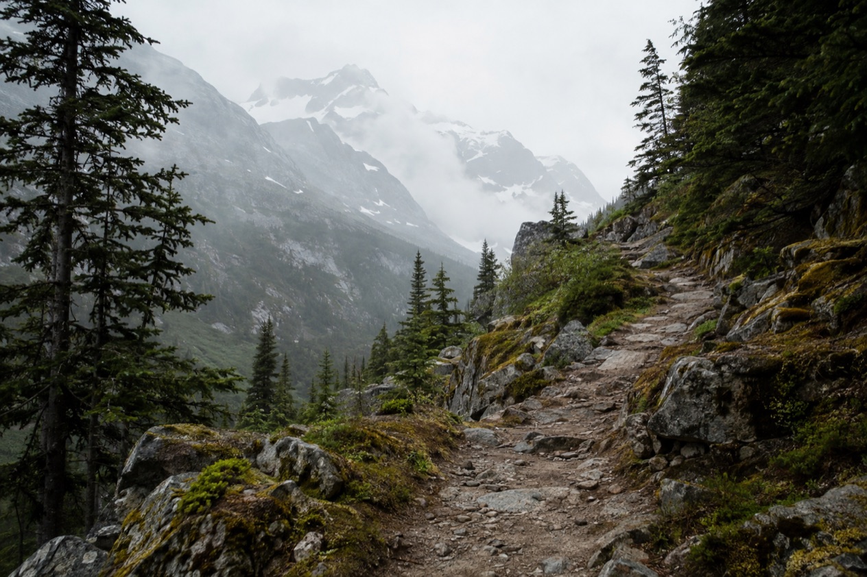
At Dyea the road gives out among cottonwoods and tidal flats, and the only things left of a gold rush boomtown are pilings, a few weathered foundations and a trail disappearing into the forest. Rain often drips from the spruce, and the mountains close in quickly. The Chilkoot Trail is a multi-day backpacking route that follows the path of the Klondike prospectors from Alaska into Canada, and it suits hikers who want their scenery mixed with history.
Is visiting the Chilkoot Trail worth it?
The trail runs 33 miles from Dyea, Alaska, to Bennett, British Columbia, and it is a journey through a country’s memory as much as through mountains. The National Park Service calls it the world’s longest museum, and the nickname fits.
Along the way you pass the remains of what thousands of people carried over the mountains: rusted stoves, boots, cable, bottles and tools lying where their owners dropped them. The trail has been nicknamed the meanest 33 miles in history, a phrase that tells you how the gold seekers felt about it. Hiking it today, with a pack you chose and a campsite waiting at the end of each day, you get a taste of the effort without the desperation.
What sets it apart from other Alaska history stops is that you do not look at the gold rush behind glass. Skagway’s historic district shows you the town the rush built, and the White Pass trail, nicknamed Dead Horse Trail, tells its own grim story. The Chilkoot is the route where you actually walk the past, climb through the same pass and cross into another country on foot, even if the border itself is not meant to be crossed casually.
What to see at the Chilkoot Trail
Dyea and the trailhead
Dyea was once a port town and the starting point for around 22,000 prospectors who took the Chilkoot route during the gold rush. Today it is a ghost town and a campground, quiet and green, with interpretive signs that help you picture the tent city that stood here. The National Park Service operates a campground in Dyea for visitors who are spending several days in Skagway.
The trailhead sits on the U.S. side, north of the Dyea townsite. Spend a little time walking the old townsite before you shoulder a pack, because the contrast between this empty valley and the crowds of 1898 sets the tone for everything that follows.
Sheep Camp and the climb to Happy Camp
Sheep Camp is the last stop before the steepest ground, and a ranger station stands close by. In the gold rush it was a staging place where people rested and sorted their loads before the pass. The stretch from Sheep Camp to Happy Camp is the hard day of the trip, and rangers recommend 7.5 to 10 hours for a group to cover it.
Expect a long scramble over boulders and rock near the top, with the forest thinning out into open alpine country. Weather can change quickly up there, and the views, when the clouds lift, are some of the finest on the route.
Chilkoot Pass and the border
Chilkoot Pass roughly marks the halfway point of the trail and the line between the United States and Canada. Canadian authorities required each person entering Yukon Territory to bring a year’s supply of food, typically around 1,150 pounds, so many climbed again and again, ferrying loads in stages.
Steps cut into the ice here could be used for a daily fee, a detail that sums up the gold rush economy neatly. Note that it is illegal to cross the international border via the Chilkoot Trail in either direction at the pass, so the walk is planned as one continuous route with the proper permits.
The visitor center and history in Skagway
Before or after the hike, the National Park Visitor Center in Skagway fills in the background. It occupies the restored 1898 rail depot, and its theater shows the 24-minute film Gold Fever: Race to the Klondike. Ranger chats are offered daily on varying topics, and you can pick up a National Parks Passport Stamp.
The park also has a self-guided walking tour of its buildings in the historic district, .64 mile long, and the free NPS App can be downloaded for it. A daily tour of Jeff. Smiths Parlor Museum adds a colorful chapter about the town’s con men and outlaws.
Hours, tickets and rules
The trail is a seasonal outing. Rangers and the trail crew are on duty only for the official hiking season, and a validated permit is required for overnight hikers through the busiest stretch of it. The Skagway side offers a few free, timed experiences that need a ticket from the Visitor Center.
| Site | Open | Requirement |
|---|---|---|
| Chilkoot Trail | Usually late May to early September, when rangers are on duty | Validated permit for all overnight hikers from June 1 to September 12 |
| Jeff. Smiths Parlor Museum tour | Daily at 1 pm, meeting at 2nd Avenue and Broadway | Free timed-entry ticket from the Visitor Center, group limited to 14 people |
On the U.S. side, hikers reserve a permit through Recreation.gov and print it ahead of time. To validate it, every member of the group must attend a mandatory safety orientation at the Trail Center in Skagway.
No more than 50 backpackers may start the trail each day. Camping is allowed only in the nine designated, maintained campgrounds, and firearms are not permitted on the Canadian side of Klondike Gold Rush International Historical Park, which includes the trail.
How to get to the Chilkoot Trail
The nearest base is Skagway, Alaska, and the trail begins in Dyea, a ghost town and campground 15 minutes from town. The trailhead lies north of the Dyea townsite, about 10 miles from Skagway, and it is accessible by road.
Skagway is also where the paperwork happens. The Trail Center is where hikers get a permit and take the required orientation, so plan to stop there before you head out to Dyea. The Visitor Center, at 2nd and Broadway in the restored depot, is a separate stop for the film, ranger chats and the stamp.
The trail ends at Bennett, British Columbia, in Canada, so the route is a one-way crossing from the Alaska side. Most prospectors in the gold rush came through the ports of Dyea and Skagway, and the way in today follows the same two towns.
When to visit the Chilkoot Trail
The season is short. The official hiking season, when rangers are on duty and the trail crew is on site, usually begins in late May and ends in early September. Demand peaks from June through August, which is also when permits are required for overnight hikers from June 1 to September 12.
Within a day, the hardest section is the one to plan around. Rangers recommend a long stretch of hours for the climb from Sheep Camp, so starting early gives you room to reach Happy Camp without hurrying. Choose a clear spell if you can, since the pass is the highlight and views vary widely from one day to the next.
For the Skagway side of the visit, the daily ranger chats and the 1 pm Parlor Museum tour fit around a trail day or fill a rest day before or after. The shoulders of the season, late May and early September, fall in the period when rangers are on duty but the permit requirement has not yet begun or has just ended.
Tips for your visit
Plan on three to five days for the full trail, with camps spaced along the route. The elevation gain is about 3,500 feet over the whole trail, and the steep, rocky middle section is where most of it comes. Since camping is allowed only in the nine designated campgrounds, your itinerary is built around those camps rather than around wherever you happen to tire.
Remote parts of the park, the Chilkoot Trail among them, have limited cell phone and GPS coverage, so a paper map and an itinerary shared with someone back home are sensible habits. Rangers are on duty during the season, and a U.S. ranger station stands close to Sheep Camp.
The Dyea campground suits those staying several days, the self-guided walking tour pairs well with the film and ranger chats, and the Skagway City Museum at 7th and Spring Street adds more local history. Because the park no longer offers ranger-led walking tours, the NPS App is the way to follow the historic district on your own.
Pick up your Parlor Museum ticket at the Visitor Center on the day, since the free same-day tickets are limited and needed for entry. The trail itself is a backpacking route rather than a casual outing, so families and anyone who wants to see the story without the long hike will find more in Skagway’s exhibits.
Good to know before you go
Permits and the orientation are the heart of the planning, and they are tied to the Trail Center in Skagway and to Recreation.gov for the U.S. side. Cell and GPS coverage is limited on the trail, and the border at the pass is not a place to cross in either direction. Rangers and the trail crew are present only during the hiking season, which usually runs from late May to early September, so the trail is not a good fit for dates outside it.
Sources
- Wikipedia, Chilkoot Trail (https://en.wikipedia.org/wiki/Chilkoot_Trail), checked October 11, 2026
- National Park Service, Klondike Gold Rush National Historical Park (Skagway), plan your visit: planning your hike (https://www.nps.gov/klgo/planyourvisit/planning-your-hike.htm), checked October 11, 2026
- National Park Service, Klondike Gold Rush National Historical Park (Skagway), plan your visit: things2do (https://www.nps.gov/klgo/planyourvisit/things2do.htm), checked October 11, 2026
- Wikipedia, Klondike Gold Rush (https://en.wikipedia.org/wiki/Klondike_Gold_Rush), checked October 11, 2026
- National Park Service, Klondike Gold Rush National Historical Park (Skagway), plan your visit: basicinfo (https://www.nps.gov/klgo/planyourvisit/basicinfo.htm), checked October 11, 2026
- National Park Service, Klondike Gold Rush National Historical Park (Skagway), plan your visit: fees (https://www.nps.gov/klgo/planyourvisit/fees.htm), checked October 11, 2026
- National Park Service, Klondike Gold Rush National Historical Park (Skagway), plan your visit: conditions (https://www.nps.gov/klgo/planyourvisit/conditions.htm), checked October 11, 2026
- National Park Service, Klondike Gold Rush National Historical Park (Skagway), plan your visit: placestogo (https://www.nps.gov/klgo/planyourvisit/placestogo.htm), checked October 11, 2026
- National Park Service, Klondike Gold Rush National Historical Park (Skagway), plan your visit: safety (https://www.nps.gov/klgo/planyourvisit/safety.htm), checked October 11, 2026