
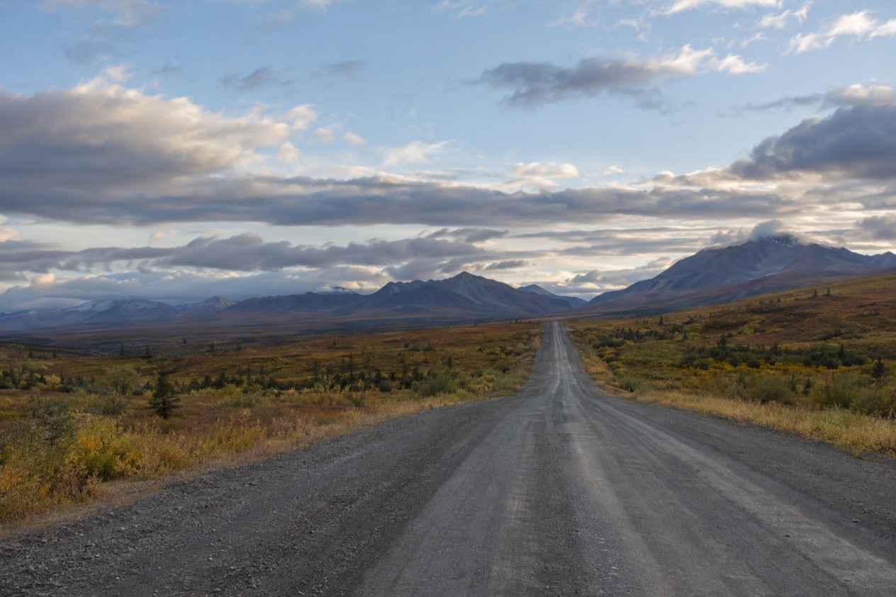
The spruce thins out, the road keeps unrolling between the pipeline and the hills, and then a pullout appears with a sign that tells you the map line you have been following has just turned real. Trucks rumble past on their way to the oilfields, and the wayside is quiet once they are gone. The Arctic Circle crossing on the Dalton Highway is a stop on a working northern road, a place to stand on the line, read the displays and feel how far north you have driven.
Is visiting the Arctic Circle worth it?
It is worth it for travelers who like a journey as much as a destination, and who find something satisfying in standing on a line they have only ever seen on a globe. If you expect a grand monument or a polished attraction, you will be underwhelmed. What you get is a modest pullout, a sign, a viewing deck and a landscape of boreal forest rolling away in every direction.
The line itself is an idea about sunlight. At the Circle, the sun does not set at the June solstice and does not rise at the December solstice, which is where the phrases midnight sun and polar night come from. Standing here, you are at the edge of that world, and every mile farther north pushes deeper into it.
What sets this spot apart from other northern stops is that you reach it by road, in Alaska, on a highway shared with freight trucks. Utqiagvik, the largest U.S. settlement north of the Circle, sits far beyond it and is a different kind of trip altogether.
Here, the Circle is a roadside pause on the way into the Brooks Range country, not a town or a resort. Fairbanks gives you the midnight sun and the aurora season from its own doorstep, but only the Dalton Highway lets you cross the line itself and look at the sign that says so.
Think of it as a day or more of driving with one memorable stop in the middle. The reward is the sense of scale: the forest, the pipeline, the long road ahead and the knowledge that you have passed into the Arctic.
What to see at the Arctic Circle
The sign and the pullout
A sign along the Dalton Highway marks the location of the Arctic Circle, and the pullout around it has a picnic area and information boards. This is the photograph everyone comes for: the sign, the open sky behind it, the road stretching off in both directions. The setting is plain by design, with no gate or souvenir stand, so what you notice is the quiet and the way the trees look slightly shorter and sparser than the ones you passed farther south.
Take your time with the information boards. They explain what the line means and put the place on the map of the highway, and reading them while a truck hums by in the distance makes the whole scene feel more grounded. The picnic area is the spot for a sandwich with a view of the forest.
The viewing deck and its displays
The Arctic Circle Wayside Rest Area has a short side road that leads to a viewing deck with interpretive displays. From the deck you look out over the treed hills and the broad valley, and the displays help you read what you are seeing: the northern forest, the long winters, the idea of the solstice sun.
Go to the railing and just look for a while. The land here is wide and low-key, and it rewards patience more than a quick glance. On a clear day the horizon opens a long way, and the stillness is part of the appeal.
Midnight sun and polar night, explained on the spot
The idea behind the sign is simple and strange. Because of the tilt of the Earth, the sun stays above the horizon at the June solstice and stays below it at the December solstice, exactly at this line. Farther north, those spells of endless day and endless night stretch longer. Farther south, they fade away.
It helps to hold that picture in your mind while you stand at the sign. You are not at a place where something visible happens every day. You are at the threshold of a seasonal rhythm that shapes how people live, build and travel across the far north.
The Dalton Highway itself
The road is part of the sight. The Dalton Highway, Alaska Route 11, runs for 414 miles from the Elliott Highway to Deadhorse, and the full length was opened to the general public on December 2, 1994. Working trucks use it year round, with about 160 a day in the summer months, so you share the road with the freight that keeps the oilfields supplied.
Stand at the wayside and watch for the rigs passing. They are a reminder that this crossing sits on a lifeline, not a sightseeing loop, and that the highway continues for a very long way beyond where you are standing.
Hours, tickets and rules
The wayside is a roadside pullout with a viewing deck, and it is set up as a place you simply pull into, look around and walk about. The staffed visitor center farther up the road in Coldfoot is a separate stop, and it is the place for information on the highway ahead.
| Site | Where | What you find |
|---|---|---|
| Arctic Circle Wayside Rest Area | Mile 115 of the Dalton Highway | Pullout with picnic area, information boards, and a short side road to a viewing deck with interpretive displays |
| Coldfoot visitor center | Mile 175, Coldfoot | Small center jointly staffed by the BLM, USFWS and NPS during the summer |
The rules that matter are the rules of the road. The speed limit on the Dalton Highway is 50 mph for its entire length, and headlights must be kept on at all times. Those two requirements apply as soon as you leave pavement behind and enter highway country, and they are worth following from the first mile.
How to get to the Arctic Circle
From Fairbanks, you drive. The Arctic Circle is 196 driving miles north of Fairbanks, reached by the Dalton Highway, which begins at the Elliott Highway north of the city. Fairbanks is the natural base, and it is also where businesses can provide equipment for adventures in Interior Alaska.
As the crow flies, the distance is shorter, 140 air miles, which is why the Circle can seem close on a map and far on the road. Midnight Sun events in downtown Fairbanks happen south of the line, and the city makes a good starting and ending point for the trip.
Think about services before you go, because the Dalton is not a road with a station on every corner. Fuel is available at the E. L. Patton Yukon River Bridge at Mile 56 (the station there is closed in winter), at Coldfoot and at Deadhorse.
North of Coldfoot toward Deadhorse, there are no services for 240 miles. The Circle sits between the Yukon River crossing and Coldfoot, so you pass the first fuel stop on the way and reach the second a bit farther along.
If you prefer not to drive, bus tours along the Dalton Highway typically take two days, with passengers spending the night in Coldfoot. Coldfoot also has an airport with a gravel strip on the west side of the Dalton Highway, used for air taxi and general aviation. From Anchorage, experienced guides and tours offer polar bear tours above the Arctic Circle.
When to visit the Arctic Circle
The most meaningful moment to be at the Circle is around the June solstice, when the sun does not set at the line. Standing at the sign in that light, with the day refusing to end, is the clearest way to understand why the spot is marked at all. The December solstice is the opposite, when the sun does not rise, though the staffed summer services in Coldfoot and the closed winter fuel stop at the Yukon River show that the road changes character with the seasons.
Summer is when the small visitor center in Coldfoot is staffed by the BLM, USFWS and NPS, so a trip in that season gives you a place to stop and ask about the road ahead. Trucks use the highway all year round, with about 250 a day in the winter, so the road is never empty of traffic whatever the date.
Time of day matters less here than in a town. In the long light of the summer months, an evening visit feels very different from a morning one, with the forest turning softer and the trucks fewer in your mind than in your ears.
Back in Fairbanks, the seasons keep their own shows. The city has a season when the midnight sun shines nearly 24 hours a day, and an Aurora Season when the northern lights may dance overhead. Pairing a Circle crossing with those chances is a natural way to build a northern trip, though the lights are never guaranteed.
Tips for your visit
Plan the Circle as part of a longer outing, not a quick errand. The wayside itself rewards a slow hour of looking, reading the boards, eating at the picnic area and walking out to the deck. The drive is the larger part of the day, so treat it as the experience and pack as if you were going somewhere real.
Bring food and drinks for the road, a full tank before the long stretches and a camera for the sign. Keep your headlights on and your speed at or under the limit. Remember that the services thin out as you go, and that the stretch beyond Coldfoot has none at all for a long way.
Combine the Circle with the places on either side. In Fairbanks, you can explore the Chena River, visit the museums and visitor centers that share the history, stories and local ways of life of Interior Alaska, and catch art, theater and music events and exhibitions. For information on the city, Explore Fairbanks answers the phone at (907) 456-5774.
Farther up the road, Coldfoot is the stopping point many trips build around, a small community that has appeared on the reality series Ice Road Truckers, with its truck stop first seen in season three. Polar bears can be seen wandering the outskirts of Deadhorse at the end of the highway, though that is a far longer journey than the Circle crossing.
Good to know before you go
The Arctic Circle crossing is a stop along a working highway, so the practical habits are the ones of the road: fuel up when you can, keep your headlights on and give the trucks room. The Yukon River fuel station is closed in winter, and daylight changes dramatically with the solstices, so plan your driving around the light.
Beyond that, the crossing asks for little. Pull in, walk to the deck, read the displays and take your photograph at the sign.
Sources
- Wikipedia, Arctic Circle (https://en.wikipedia.org/wiki/Arctic_Circle), checked October 11, 2026
- Wikipedia, Dalton Highway (https://en.wikipedia.org/wiki/Dalton_Highway), checked October 11, 2026
- Wikivoyage, Dalton Highway (https://en.wikivoyage.org/wiki/Dalton_Highway), checked October 11, 2026
- Wikipedia, Coldfoot, Alaska (https://en.wikipedia.org/wiki/Coldfoot,_Alaska), checked October 11, 2026
- Explore Fairbanks, things to do (https://www.explorefairbanks.com/things-to-do/), checked October 11, 2026
- Visit Anchorage, wildlife viewing (https://www.anchorage.net/outdoors/wildlife-viewing/), checked October 11, 2026
- Explore Fairbanks, summer and solstice events (https://www.explorefairbanks.com/events/summer-and-solstice-events/), checked October 11, 2026