
Somewhere around the second cup of coffee at an Anchorage hotel breakfast, the question comes up: is there a day to spare for the farm country on the other side of the Chugach? Palmer sits in the Matanuska Valley, the old agricultural colony where the cabbages grow big and the mountains stand close behind the fields. The short answer is that you drive the Glenn Highway north from Anchorage, and the trip takes about as long as a long lunch break.
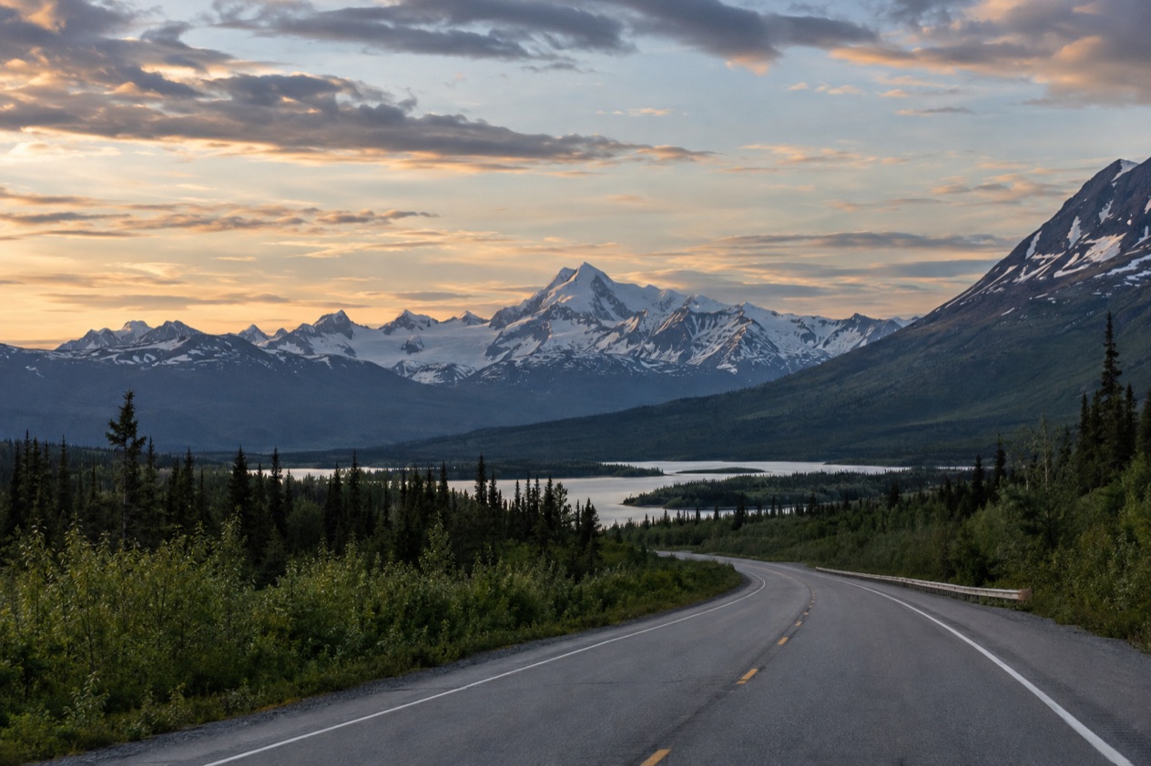
How do you get from Anchorage to Palmer?
You drive: take the Glenn Highway north out of Anchorage and follow the off-ramp toward Palmer. Palmer and Wasilla both sit about 45 minutes from downtown Anchorage, so the valley works as a half-day outing or as the first leg of something longer.
The Glenn Highway begins near Merrill Field in Anchorage and, in its full length, runs all the way to Glennallen on the Richardson Highway. You only ride the first slice of it.
That slice starts as freeway in north Anchorage, and the freeway carries on onto the Parks Highway at the interchange and ends in Wasilla. It is the longest stretch of freeway in Alaska, and for most of the state it is the only road in or out of Anchorage, apart from the Seward Highway toward the Kenai Peninsula.
The route in plain steps
Leave downtown Anchorage and pick up the Glenn Highway heading north. The road climbs out of the city with the Chugach Mountains on one side and the flats of the inlet country on the other. When the signs point to Palmer, take that off-ramp. If you stay on the freeway instead, you end up in Wasilla, which is a perfectly good stop but not the same town.
Ted Stevens Anchorage International Airport lies about an hour from Wasilla by car, which gives you a sense of how the valley fits around the airport if you land in the afternoon and want to sleep in Palmer or Wasilla the first night.
A road with a past
The highway began in the 1930s as the Palmer Road, built to reach the agricultural colony at Palmer. During World War II it was extended to Glennallen as part of the military road and base building program that also produced the Alaska Highway. Driving it today, you follow a route that started with farmers and ended up with soldiers, and the valley still feels more like a farming community than a suburb.
Going farther than Palmer
Matanuska Glacier lies an hour beyond Palmer on the same highway. Plenty of travelers fold Palmer and the glacier into one long day, stopping in town for coffee and a look at the fields on the way out. Past Palmer the Glenn Highway climbs to Eureka Summit, its highest point, on the divide between the Chugach and Talkeetna ranges.
Which options are there?
The main option is your own vehicle on the Glenn Highway, and the Alaska Railroad’s Denali Star is the one train that touches the valley, though it stops in Wasilla rather than Palmer.
Driving the Glenn Highway
Driving puts you in charge of the day. You can pull off for a farm stand, turn up into the Talkeetna Mountains toward Hatcher Pass, or keep going to the glacier. Independence Mine Historical State Park sits in Hatcher Pass, between Willow and Palmer, and the hiking up there is one reason people give the valley more than an hour.
In summer the hills around Wasilla and Palmer open up for walking, with Hatcher Pass, The Butte, Lazy Mountain, Crevasse Moraine and Matanuska Glacier all named as hiking areas. Canoeists have the Wasilla Lakes canoe trail, the Nancy Lakes canoe trail and Meadow Creek. In winter the same ground turns to Nordic skiing at Hatcher Pass, Moose Meadows and Government Peak.
The Denali Star train to Wasilla
The Denali Star runs between Anchorage and Fairbanks, 356 miles in 12 hours, with stops in Wasilla, Talkeetna and Denali National Park. For a Palmer day it gets you as far as Wasilla, the last city of any size on the Parks Highway going north, so the train suits a traveler whose real destination is farther up the line and who wants a taste of the valley on the way.
The ride itself is scenery. Between Anchorage and Talkeetna the train crosses the Knik River with the Chugach Mountains behind it. Just south of Talkeetna, passengers can see Denali rising above the Susitna River on a clear day. North of Talkeetna, the train crosses Hurricane Gulch on a 296-foot bridge and passes through the roadless Hurricane area, then Broad Pass opens views of the Alaska Range in every direction, and Healy Canyon follows the Nenana River beyond the park.
A stop in Wasilla
Wasilla is a frequent stopping point for people driving to Denali National Park, Fairbanks or other points north. For a meal, Windbreak Café (The Trout House) on East Parks Highway is open Monday to Saturday from 6 AM to 11 PM and Sunday from 7 AM to 11 PM. The Grape Tap on North Boundary Street pours Tuesday to Thursday from 5 to 9 PM and Friday and Saturday from 5 to 10 PM.
| Place | Open |
|---|---|
| Windbreak Café (The Trout House), Wasilla | Mon-Sat 6 AM-11 PM, Sun 7 AM-11 PM |
| The Grape Tap, Wasilla | Tue-Thu 5-9 PM, Fri-Sat 5-10 PM |
What should you know before you travel from Anchorage to Palmer?
Know the season you are going in, because the valley changes its offer from one month to the next, and know where to look at road conditions before you leave. The Alaska Department of Transportation runs the Alaska 511 site for exactly that.
What the valley offers by season
You-pick farms around Palmer and Wasilla are open in August or early September, and the Alaska State Fair takes place in late August. A trip timed for those weeks gets you berries and vegetables from the field and the fair crowds on top. Northern lights can be seen in the Palmer and Wasilla area from late August through mid-April, a chance and never a promise, so a clear night in that window is worth keeping free.
Hiking and paddling belong to the summer months, and Nordic skiing to winter. If you are reading this in mid-October, as the leaves go, the practical picture is the late-season end of the you-pick weeks and the start of the lights window, with ski country still ahead.
Checking the road with Alaska 511
Alaska 511 sorts road conditions into Good, Fair, Difficult, Very Difficult, Hazardous, Road Closure and No Winter Maintenance. AKDOT has partnered with Waze to publish Waze-reported incidents and closures on the site, so a slowdown reported by drivers can show up there too.
To keep an eye on the highway, add a camera to My Cameras on the map page by clicking a camera icon and then the My Cameras button in the popup. On the camera page, the My Cameras option sits behind the three dots icon below the image.
You must log in to save routes, and creating an account also gets you notifications. Route notifications come by SMS by default on weekdays from 6 AM to 6 PM.
Reading the highway’s size
The whole Glenn Highway stretches 179 miles to Glennallen, or 328 miles if the Tok Cut-Off is counted as part of it. Eureka Summit, the high point at 3,332 feet, is far past Palmer, so the stretch you drive for this outing stays in the valley and does not climb that high.
Good to know before you go
Palmer is a town to enjoy at the pace of a farm stand: coffee, a walk among the fields, a look at the mountains. Wasilla’s cafés keep long hours for a late return, and the Alaska 511 cameras give a last look at the highway before you head back toward Anchorage.
Sources
- Wikipedia, Glenn Highway (https://en.wikipedia.org/wiki/Glenn_Highway), checked October 11, 2026
- Alaska.org, dest palmer wasilla (https://www.alaska.org/destination/palmer-wasilla), checked October 11, 2026
- Wikivoyage, Wasilla (https://en.wikivoyage.org/wiki/Wasilla), checked October 11, 2026
- Alaska Railroad, Denali Star (https://www.alaskarailroad.com/ride-a-train/our-trains/denali-star), checked October 11, 2026
- Alaska 511 (https://511.alaska.gov/), checked October 11, 2026
To plan your stay
- Best Time to Visit Anchorage: Long Summer Days, Northern Lights, Weather by Month and Festivals
- Things to Do in Anchorage: Museums, Alaska Native Heritage, Chugach Trails and Day Trips
- Where to Stay in Anchorage: Downtown, Eagle River, Girdwood and Lodging Types
- Know Before You Go to Anchorage: Weather, Wildlife, Getting Around and Local Habits