
You step off the road into shade, and the first thing you hear is birdsong overhead and the click of bike chains on a white stone path. Coba does not announce itself with a grand plaza. The jungle keeps most of it hidden, and the pyramids appear between the trees one at a time. It is a visit for people who like to wander, with a big climb waiting at the far end.
Is visiting Coba Ruins worth it?
Yes, especially if you want ruins that feel like an expedition rather than a stroll, and you are happy to spend a few hours in the forest.
What sets Coba apart from the coastal ruins of Tulum is the setting. Tulum sits on a cliff above the Caribbean, compact and seaside. Coba is spread across a wide area around several lakes, still largely covered in jungle, and linked in ancient times by stone causeways called sacbeob. Its tallest pyramid is among the tallest on the Yucatan Peninsula.
What to see at Coba Ruins
Ixmoja (Nohoch Mul), the great pyramid
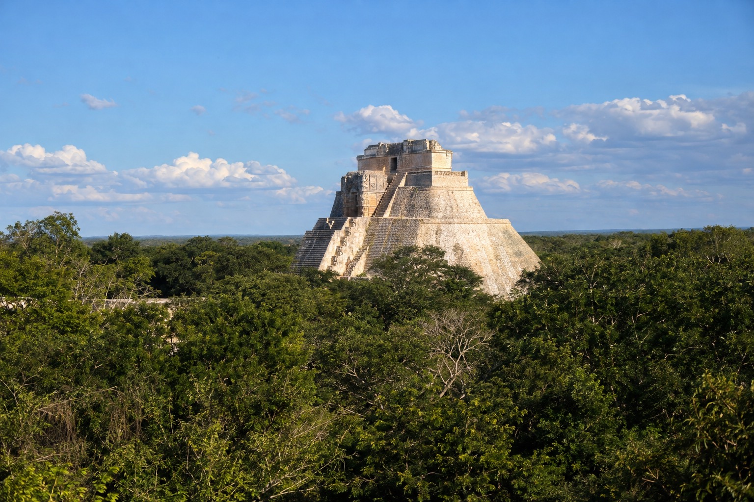
Ixmoja, also called Nohoch Mul, is the reason most people come. It rises about 138 feet, second only to the pyramid at Calakmul among the tallest on the peninsula. Seen from the base, it towers over the treetops, with steep stone steps running straight up the face and a small temple at the summit.
Climbing was long closed, and it was reinstated in late 2025 with a new wooden staircase. From the top, the view is a green sea of forest canopy broken by the glint of distant lakes, which is the best way to grasp how large the ancient city was.
It sits at the far end of the site, so you reach it after a long walk through the trees. Go early, when the stone is cooler and the stairs are quieter. It suits anyone comfortable with heights and a steep ascent, and the walk and the climb both ask for decent shoes.
The sacbeob, Maya causeways through the forest
Coba was a hub of roads. The sacbeob were raised white stone causeways that tied the city’s districts and lakes together, and you walk parts of them on the way between groups of buildings. They are straight, wide and quiet, and they give the site its rhythm of walking, pausing and discovering.
Look for the way the path runs dead straight into the trees, a reminder that this was a planned network and not a scatter of ruins. The paths are also where you notice the forest itself: butterflies, birds and the filtered light under the canopy.
The lakes and the jungle setting
The city grew around several lakes, which explains why it spread so widely. Glimpses of water between trunks give the walk variety, and the surrounding forest is as much a part of the visit as the stonework. It is a place to slow down, listen and watch for birds.
Because the site is so large and still largely covered by forest, a visit feels less like a museum and more like a long outdoor walk. Many buildings are only partly cleared, which adds to the sense of discovery and keeps the experience quiet away from the main path.
Hours, tickets and rules
Coba opens every day of the week, from morning until late afternoon. Foreign visitors pay a higher fee than Mexican nationals and foreign residents of Mexico, and several groups get in free.
| Site | Open | Admission |
|---|---|---|
| Coba archaeological zone | Monday to Sunday, 8:00 a.m. to 5:00 p.m. (last entry 4:00 p.m.) | $210 pesos for foreign visitors; $105 pesos for Mexican nationals and foreign residents of Mexico. Free on Sundays for Mexican nationals and foreign residents; also free for children under 13, visitors 60 and older, people with disabilities, and Mexican teachers and students with valid ID |
Climbing Ixmoja is permitted again, using the new wooden staircase installed in late 2025. Beyond that, no other rules are set out here, so the key point is simply that the climb is open to visitors.
How to get to Coba Ruins
The ruins lie about 29 miles northwest of Tulum, which is the nearest base for most travelers. Tulum has its own international airport, open since late 2023, a short way southwest of town.
Cancun’s airport is farther away, to the north of Tulum. Whichever base you choose, plan the day around the trip to Coba rather than squeezing it between other stops, since the site itself takes real time to explore.
When to visit Coba Ruins
Arrive when the gates open at 8:00 a.m. The forest is cooler, the light is soft, and the long walk to Ixmoja is easier before midday heat builds. Late entry closes at 4:00 p.m., so the afternoon is better for a shorter visit.
Highs sit in the mid-80s year-round, so heat is a factor in every month. February and April are the driest, with about four rain days each. September and October bring the most rain, around eleven days each, usually as showers, and they fall in the Atlantic hurricane season, which runs through November. Winter months are a little cooler and shadier on the paths.
Tips for your visit
- Bring water, sun protection and shoes with good grip, since the site is big and the pyramid steps are steep.
- Plan several hours, as the walk through the forest and the climb both take time.
- Bikes or tricycles are used by some visitors to cover the long distances between structures, though no current rental price is available here.
- Pair Coba with a stop in Tulum, whose ruins stand on a seaside cliff, or with a cenote such as Gran Cenote or the Dos Ojos system, which are run independently.
- Families should expect a lot of walking, and the climb up Ixmoja is steep, so it is best for those comfortable with stairs and heights.
Good to know before you go
The U.S. State Department rates the state of Quintana Roo Level 2, ‘Exercise increased caution,’ due to terrorism and crime.
Bring pesos for entry and small purchases. Foreign visitors entering Quintana Roo also pay the Visitax, about 293 pesos per person, unless they enter through the state’s southern border. Keep an eye on your belongings as you would anywhere, and remember that the Atlantic hurricane season runs from June through November.
Sources
- Wikipedia, "Coba", en.wikipedia.org, checked September 29, 2026 (source secondaire)
- INAH, boletin 2025 (inauguration of the new Nohoch Mul staircase on December 7, 2025; groups of 15 at most, 15 minutes at the summit), inah.gob.mx, checked October 5, 2026
- common knowledge
- INAH, official for the Coba archaeological zone, inah.gob.mx/zonas/515-zona-arqueologica-de-coba, checked September 29, 2026
- INAH, inah.gob.mx/zonas-arqueologicas, checked September 29, 2026
- reserve de sourcage, aucun chiffre affirme
- INAH, official for the Tulum archaeological zone, inah.gob.mx/zonas/99-zona-arqueologica-de-tulum, checked September 29, 2026
- Wikipedia, "Tulum", en.wikipedia.org, checked September 29, 2026 (source secondaire)
- UNESCO World Heritage Centre, record 410, whc.unesco.org/en/list/410, checked September 29, 2026
- reserve de sourcage (CONANP dediee non atteinte, 404), aucun chiffre affirme
- Wikipedia, "Tulum International Airport", en.wikipedia.org, checked September 29, 2026 (secondary source; the group’s official site not reachable that day)
- Wikipedia, "Tulum Municipality", en.wikipedia.org, checked September 29, 2026 (source secondaire)
- U.S. Department of State, Bureau of Consular Affairs, Mexico Travel Advisory, travel.state.gov, checked September 29, 2026 (date issued May 29, 2026) (date issued May 29, 2026)
- Ley de Derechos del Estado de Quintana Roo, art. 51-Octies and 51-Nonies ; UMA value 2026 : INEGI
- NOAA National Hurricane Center, checked September 29, 2026
- Servicio Meteorologico Nacional (CONAGUA), normales climatologicas 1991-2020, estacion 23025 (Tulum, Tulum), checked September 29, 2026
To plan your stay
- Best Time to Visit Mexico: Weather by Region, Crowds, Hurricane Season and Festivals
- Where to Stay in Mexico: Riviera Maya, Los Cabos, Puerto Vallarta, Mexico City and All-Inclusive Areas
- Getting Around Mexico: Buses, the Tren Maya, Taxis and Driving Your Own Car
- Mexico Travel Tips: Dollars, Tourist Tax, Tipping, Tap Water, Driving and Safety by State