
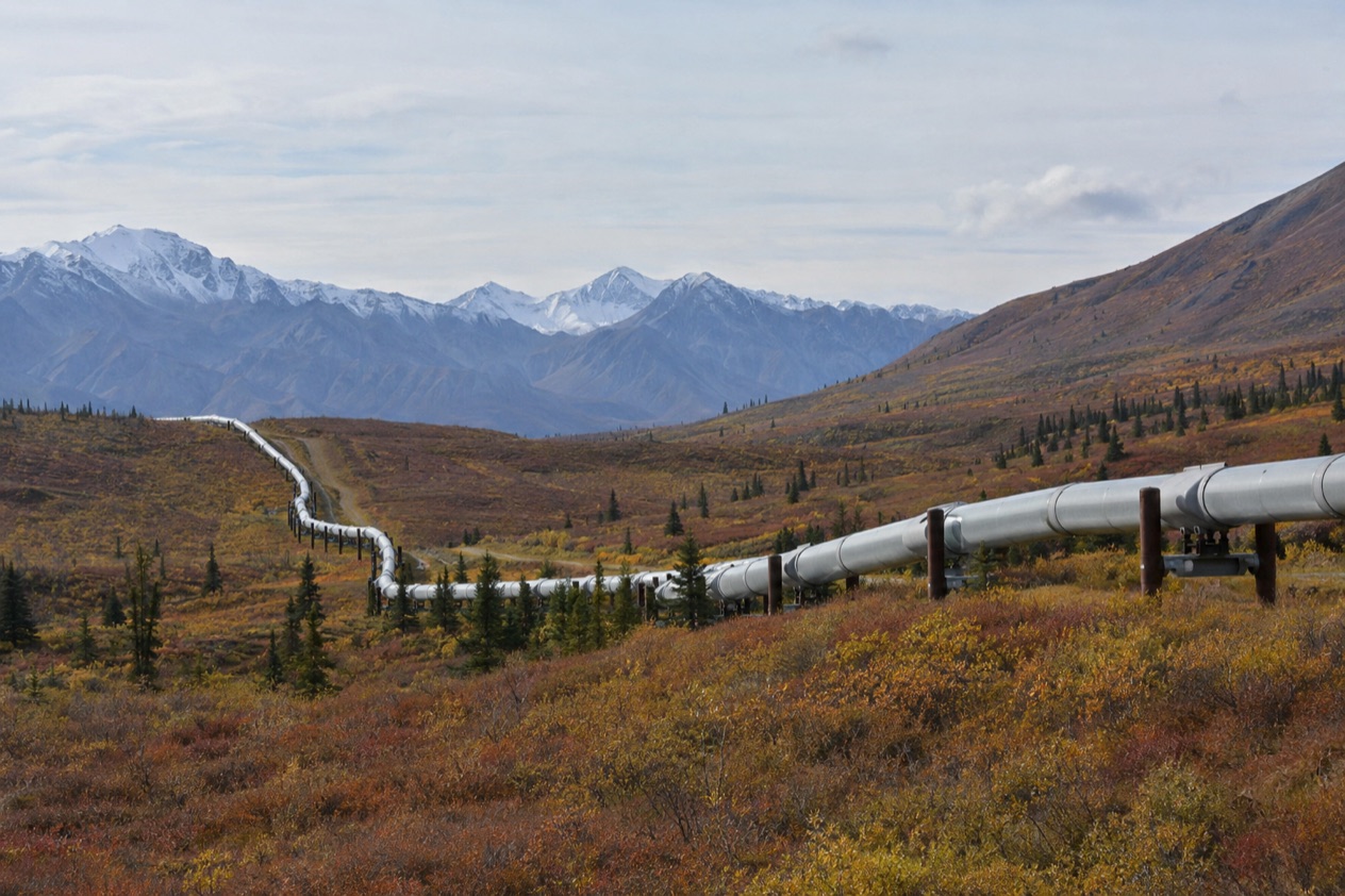
Out on the Alaska landscape, a silver pipe comes into view beside the highway, lifted off the ground on steel supports and running straight toward the horizon through spruce and tundra. It looks like a long, thin line drawn across the whole state. The Trans-Alaska Pipeline is less a single attraction than a thread you follow by road, from the Interior towns to the Arctic oil fields and down to the Pacific port where it ends.
Is visiting the Trans-Alaska Pipeline worth it?
Yes, if you like industrial landmarks, road trips and the story of how Alaska got built, because the pipeline rewards travelers who enjoy seeing a big idea in the landscape rather than a ticketed site with a gate. The system carries petroleum from the North Slope south to Valdez on the Pacific Ocean, and it was built between 1973 and 1977. Seeing it is part of a longer journey, and the pipe itself is the thread that ties the places together.
What sets it apart from the museums and monuments of other Alaska towns is that it is alive and working, and it crosses so much country. You can meet it in Fairbanks and the small communities around it, such as Fox and North Pole.
You can meet it again on the Richardson Highway near Delta Junction and Glennallen, and far to the north at Deadhorse. Each stretch has a different mood, from river valleys to the treeless Arctic plain.
It suits drivers, photographers, families curious about how things work, and anyone who wants to understand why the Dalton Highway exists. It suits less well anyone who wants a single tidy stop with a gift shop and a guided tour. The pipeline draws tens of thousands of visitors a year on pipeline tourism trips, and most of them see it in pieces, as a companion to the road.
What to see at the Trans-Alaska Pipeline
The pipe beside the Richardson Highway
Much of the pipe rides above ground on supports, a design meant to keep the warm oil from thawing the frozen soil beneath. Look for the zigzag layout of the pipe, which lets it flex with the ground and with changes in temperature.
Towns along this corridor include Fox, North Pole, Delta Junction and Glennallen, and the line passes through each area. Watch for the way the pipe rises over animal crossings and dips underground in places. A pull-off beside the road gives a chance to stand next to the metal, hear the wind hum along it and notice how small a car looks beside it.
The Dalton Highway and the Arctic Circle
North of Fairbanks, the Dalton Highway begins at the Elliott Highway and runs alongside the pipeline all the way to Deadhorse. It was opened to the general public on December 2, 1994, and it is still a working truck road. About 160 trucks travel it daily in the summer months, and 250 daily in the winter, so you share the road with the freight that keeps the oil fields running.
At the Arctic Circle Wayside Rest Area, at Mile 115, a short side road leads to a viewing deck with interpretive displays. The highway climbs on to cross the Brooks Range at Atigun Pass, its highest point at 4,739 feet, where the pipe and the road share a mountain landscape. Fuel is available at the E. L. Patton Yukon River Bridge (Mile 56), at Coldfoot and at Deadhorse.
Deadhorse and Prudhoe Bay
Deadhorse sits at the end of the Dalton Highway, near the Arctic Ocean and the Prudhoe Bay Oil Fields, where the pipeline begins its trip south. Visitors come for the tundra, the Arctic Ocean and the midnight sun, and they stay in lodgings assembled from modular buildings. The bay itself lies 10 miles further north through a security checkpoint, so open water is not visible from the highway.
The area around Prudhoe Bay has large herds of caribou and more than 200 bird and waterfowl species, including geese, swans, gulls and eagles, and you may see some of them. Polar bears can be seen wandering the outskirts of Deadhorse. Alcohol is not sold in Deadhorse, which gave rise to the slogan ‘All that far and still no bar.’
Valdez, where the pipeline ends
At the southern end, the pipeline reaches Valdez, the largest port on Prince William Sound. This is the Pacific end of the story, where oil from the North Slope is loaded for its next journey. A trip here turns the pipeline from a line in the tundra into a complete route from the Arctic coast to open water.
Pipeline maps and other souvenirs
Welders who worked on the pipeline made their own keepsakes: pipeline maps, pieces of scrap pipe cut into the shape of Alaska. They were frequently sold to tourists or given away as gifts. If you come across one in a shop or a stall, it is a small piece of the construction years, made by the hands that built the line.
Hours, tickets and rules
Seeing the pipeline from the highway is part of the road, and the pipe itself stands in the open beside it. The places where it is easiest to take in are the highway corridors, the Arctic Circle viewing deck on the Dalton Highway and the towns along the way. Because this is a working industrial system, the practical details belong to each stop rather than to one gate.
A few rules are worth knowing from the places themselves. The bay at Prudhoe lies beyond a security checkpoint, so the ocean is not something you simply drive up to. In Deadhorse, no alcoholic beverages are sold. Along the Dalton Highway, you share the road with heavy trucks, which are a constant presence in summer and even more so in winter.
Fuel is the other practical point on the Dalton Highway, and it is available at the Yukon River Bridge, at Coldfoot and at Deadhorse. Lodging in Deadhorse comes in modular buildings. If you need hospital care in Prudhoe Bay, patients are usually moved by helicopter or air ambulance to the hospital in Utqiaġvik, a flight of about 45 minutes.
How to get to the Trans-Alaska Pipeline
Fairbanks is the natural base. It is a town of 31,000 people in interior Alaska, the state’s second-largest city, and the pipeline runs through the area. Fairbanks International Airport has domestic flights from Chicago, Dallas, Denver, Minneapolis and Seattle-Tacoma, operated by airlines including Alaska Airlines/Horizon Air, American, Delta and United.
From Anchorage, the drive to Fairbanks on Highway 3, the George Parks Highway, takes about 7 to 8 hours in summer with stops, and passes through Denali National Park. From Fairbanks, the Richardson Highway follows the pipeline toward Valdez, passing through Delta Junction and Glennallen.
For the Arctic end, overland access to Prudhoe Bay and Deadhorse is by the Dalton Highway from Fairbanks, 495 miles away. Tourists typically travel by tour bus on this road, a two-day journey with an overnight stop in Coldfoot. Deadhorse can also be reached through its public airport on the North Slope.
When to visit the Trans-Alaska Pipeline
The light shapes the visit. In Fairbanks in June, the sun is up from 3 AM to 12:45 AM and it never gets fully dark, which leaves very long days for driving and stopping. In winter the sun is only up from 10:45 AM to 2:45 PM, so the pipe is seen in a low, short day.
At Deadhorse, which lies above the Arctic Circle, summer brings the midnight sun, and winter brings polar night. That makes summer the time when tourists come for the tundra, the Arctic Ocean and the wildlife on the North Slope, including caribou and a long list of birds. Truck traffic on the Dalton Highway is busy in both seasons, with more trucks in winter.
Winter has its own appeal around Fairbanks, where the northern lights are best seen between September and mid-April on cold, clear nights. The aurora is a chance, never a promise, but a trip to the pipeline in that season can be paired with an evening outside the city. Whichever month you choose, plan around the light of that month.
Tips for your visit
Think of the pipeline as a route rather than a stop. A day around Fairbanks can take in the pipe near Fox and North Pole, while a longer trip down the Richardson Highway gives the pipeline the space it deserves. The Dalton Highway is a bigger commitment, which is why visitors take the two-day bus journey with a night in Coldfoot.
On the Dalton Highway, fuel stops matter, and the places that sell fuel are the Yukon River Bridge, Coldfoot and Deadhorse. Plan for trucks sharing the road. At the Arctic Circle Wayside Rest Area, the short side road to the viewing deck gives a pause with interpretive displays, a good place to read the story of the road.
Combine the pipeline with the places around it. In Fairbanks, there is no sales tax, so souvenirs cost what the tag says. Near Deadhorse, watch the tundra for caribou and birds, and keep in mind that polar bears can be seen wandering the outskirts of town. A pipeline map made from scrap pipe is a fitting thing to look for as a keepsake.
Good to know before you go
Distances are long and the places in between are few, so the pipeline rewards a trip with a plan for fuel, lodging and light. In Deadhorse, alcohol is not sold, and the Arctic Ocean is not visible from the highway because the bay lies beyond a security checkpoint. Daylight changes the whole feel of the journey, from the long June days to the short winter ones, and the pipe is there in every season.
Sources
- Wikipedia, Trans-Alaska Pipeline System (https://en.wikipedia.org/wiki/Trans-Alaska_Pipeline_System), checked October 11, 2026
- Wikivoyage, Fairbanks (https://en.wikivoyage.org/wiki/Fairbanks), checked October 11, 2026
- Wikipedia, Prudhoe Bay, Alaska (https://en.wikipedia.org/wiki/Prudhoe_Bay,_Alaska), checked October 11, 2026
- Wikipedia, Dalton Highway (https://en.wikipedia.org/wiki/Dalton_Highway), checked October 11, 2026
- Wikipedia, Alaska North Slope (https://en.wikipedia.org/wiki/Alaska_North_Slope), checked October 11, 2026
- Wikipedia, Prince William Sound (https://en.wikipedia.org/wiki/Prince_William_Sound), checked October 11, 2026
- Wikipedia, Richardson Highway (https://en.wikipedia.org/wiki/Richardson_Highway), checked October 11, 2026