
The arrivals hall at Ted Stevens Anchorage International Airport is where the question usually starts: the bags are on the carousel, the mountains are showing through the windows, and the next few days still have no shape. Some travelers have a train ticket in hand and others have a lodge waiting down a long road. Anchorage is the place where the roads of Southcentral Alaska begin, so this is where a rental car, if you choose one, turns into a plan.
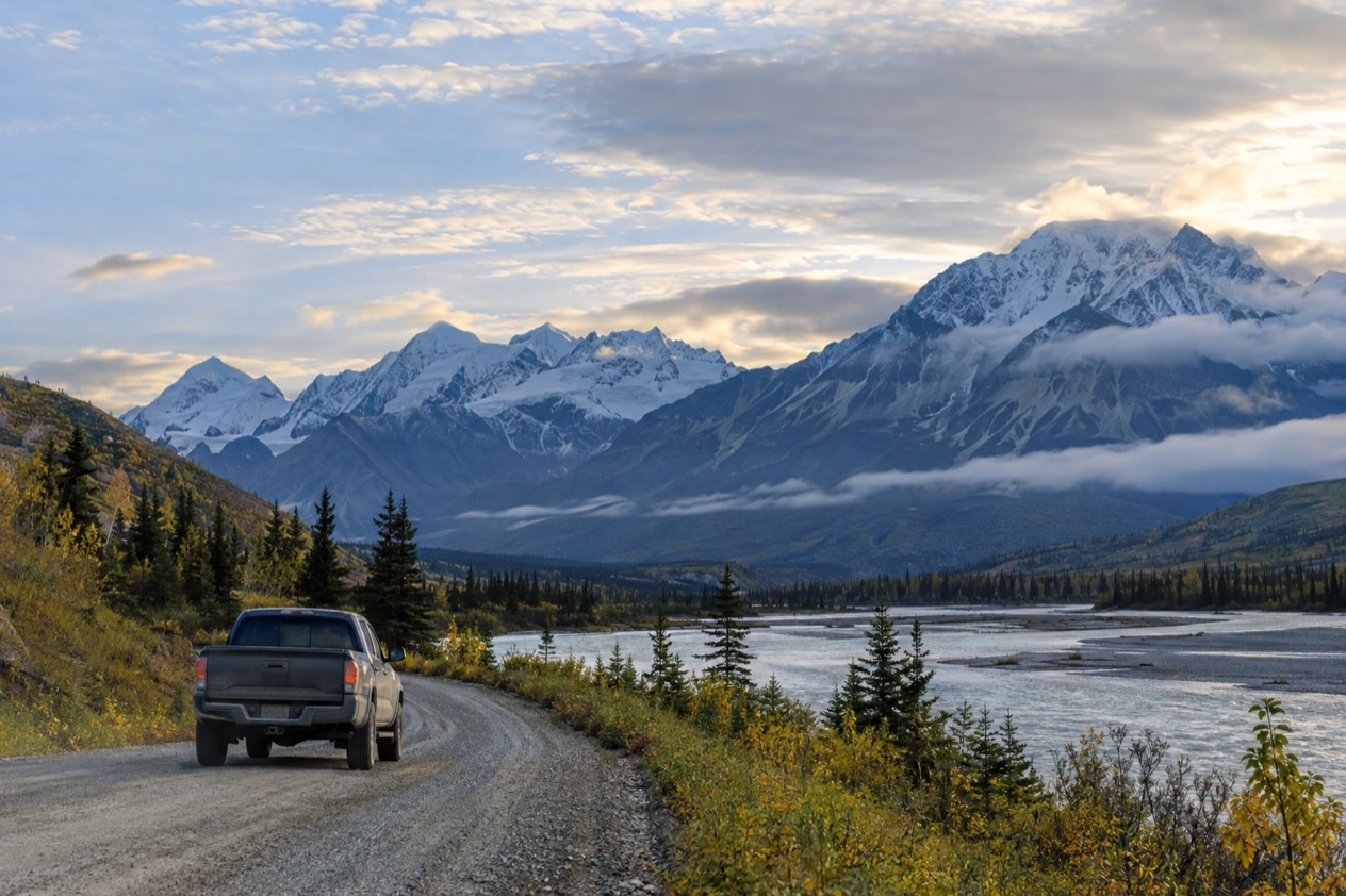
Where can you rent a car in Anchorage?
The natural place to start is the airport itself, Ted Stevens Anchorage International, at 5000 W. International Airport Rd., since that is where most trips into the city begin. From there the roads out of town are within reach, and the first decision is whether you want the car for your whole stay or only for part of it.
Alaska trips are built in many shapes. Plenty of vacation deals bundle motorcoach and train excursions with overnight stays and activities, and in those itineraries the transportation is already part of the package. A car then becomes something you add for the days you want to set your own pace, not a requirement for the whole trip.
Starting at the airport
Arriving by air puts you in the same building as the rest of your first day: baggage claim, ground transportation and the first look at Alaska light. If you plan to drive from the moment you land, think through the first stretch before you leave the terminal. Decide which road you will take first, and where you will sleep that night, so the car works for you instead of the other way around.
Many travelers like to keep the first evening easy. Anchorage has plenty to fill a first day without a long drive, and the city is a sensible place to adjust to the time zone. Most people plan at least three days in the city during their Alaska travels, which leaves room to settle in before heading out on the highways.
Finding local businesses
The free Official Anchorage Visitor Guide includes a business directory covering Anchorage and Southcentral Alaska. It is a practical place to look when you want to see which local businesses serve the area, whether you are comparing options for getting around or looking for lodging and activities along the way.
You can also sign up for the Anchorage e-newsletter, which sends trip inspiration, travel deals and planning tools. Reading it a few weeks before you travel is a pleasant way to see what the city and its surroundings offer, and to decide how much of your stay needs wheels.
A car, a train, or both
Alaska offers several ways to see the country that do not involve driving yourself. You can book an Alaska Railroad trip, take a flightseeing tour or a day cruise, or stay in a remote Alaska lodge. Each of these changes how much driving you need, and some travelers mix them: a train for one leg, a flightseeing hop for another, and a car for the stretches in between.
Think of the car as one tool among several. A day on the Seward Highway or the Parks Highway looks very different from a day spent on a boat, and your own list of places will tell you where the wheels belong. The roads described below show what is reachable from Anchorage by road.
What do you need to rent one?
Beyond whatever documents the rental business asks for, what you need most in Alaska is a clear idea of your route and a way to watch the road conditions as you go. Check the requirements with the business you choose, and then give your attention to the tools that make driving here more predictable.
Identification for the flight in
Getting to Anchorage usually means a flight, and the airport reminds travelers that they may need a Real ID or another acceptable ID to fly. It is worth checking your identification before you leave home, since it is the first document of the trip and the one that gets you to the rental counter at all.
Once you land, you are in a U.S. state, so the journey from the airport to the road is a domestic one. Nothing about the drive itself calls for the paperwork of a border crossing, and your attention can go to the practical side of the route.
Alaska 511, your road companion
Alaska 511 is the state’s road information site, and it sorts conditions into clear categories: Good, Fair, Difficult, Very Difficult, Hazardous, Road Closure and No Winter Maintenance. Those words tell you at a glance what the road ahead is like, and they are worth reading before every long drive, not only the first one.
The site also shows cameras. On the map page you click a camera icon, then the My Cameras button in the popup to add it to your list. On the camera page, the three dots below the image open the My Cameras option. It gives you a quick look at the road you are about to drive, which is more useful than any guess.
Saving routes and getting alerts
If you create an account on Alaska 511, you can save routes for future viewing and receive notifications. You must log in to save routes. By default, route notifications arrive by SMS on weekdays from 6 AM to 6 PM, which suits a trip where you check the road each morning before setting out.
The Alaska Department of Transportation has also partnered with Waze, so Waze-reported incidents and closures appear on the Alaska 511 website. The Waze for Cities program is a free data exchange between Waze and government entities. In practice it means one more source of information about what is happening on the road, gathered in one place.
Which roads can you drive from Anchorage?
From Anchorage you can drive three main highways: the Seward Highway toward the Kenai Peninsula, the Glenn Highway toward Palmer and Glennallen, and the George Parks Highway toward Denali and Fairbanks. Each one has its own character, and each opens a different part of Alaska.
| Highway | Length (miles) | Runs between |
|---|---|---|
| Seward Highway | 125 | Seward and Anchorage |
| Glenn Highway | 179 | Anchorage (near Merrill Field) and Glennallen |
| George Parks Highway | 323 | The Glenn Highway and Fairbanks |
The Seward Highway
The Seward Highway is designated a National Forest Scenic Byway, a State Scenic Byway and an All-American Road. It runs through the Kenai Peninsula, Chugach National Forest, Turnagain Arm and the Kenai Mountains, and about 72 miles of it lie inside Chugach National Forest. It is also part of the unsigned Interstate Highway System as Interstate A-3.
Traffic here can be heavy in the summer months. Up to 15,000 vehicles a day use the stretch from Girdwood past the Portage curve toward Turnagain Pass, ending at Ingram Creek.
In July 2016, Alaska DOT&PF posted updated speed limits on a five-mile section between Hope Junction and the top of Turnagain Pass: 55 mph in the right lane and 65 mph in the left. U.S. Bicycle Route 97, created in 2011, runs alongside the highway for its whole length.
The Glenn Highway
The Glenn Highway begins near Merrill Field in Anchorage and ends at Glennallen on the Richardson Highway. If the Tok Cut-Off is counted as part of it, the total reaches 328 miles. Its highest point is Eureka Summit, at 3,332 feet, on the divide between the Chugach and Talkeetna mountain ranges.
The longest stretch of freeway in Alaska runs mostly along the Glenn Highway, from north Anchorage onto the Parks Highway at the interchange and ending in Wasilla, for approximately 38 miles. That portion is the only road access to Anchorage for most of the state, apart from the Kenai Peninsula on the Seward Highway.
The road began in the 1930s as the Palmer Road, built to reach the agricultural colony at Palmer, and was completed to Glennallen during World War II as part of a military road and base building program that also produced the Alaska Highway. It is named for Captain Edwin Glenn, who led an 1898 U.S. Army expedition to find an Alaska route to the Klondike gold fields.
The George Parks Highway
The George Parks Highway leaves the Glenn Highway 35 miles from Anchorage and carries on to Fairbanks in the Alaska Interior. It is the principal access to Denali National Park and Preserve and to Denali State Park, and it passes through Denali State Park, with signs for entering and exiting. It meets the Denali Highway, Alaska Route 8, in Cantwell.
The highway was completed in 1971 and given its current name in 1975. It is numbered Interstate A-4 and signed as Alaska Route 3.
Its mileposts begin with Mile 35, continuing the numbering of the Glenn Highway, so a milepost on the Parks Highway tells you how far you are from Anchorage. Two sections were built to freeway standards: near the intersection with the Glenn Highway in Palmer and the Robert J. Mitchell Expressway in Fairbanks.
Good to know before you go
Look at Alaska 511 on the morning of any long drive, since its condition categories run from Good to Road Closure and No Winter Maintenance, and a camera view can show you the road in a moment. Keep your identification handy for the flight, and use the Official Anchorage Visitor Guide and the Anchorage e-newsletter to sort out where you want to go. Then pick the highway that leads to the place you came for.
Sources
- Visit Anchorage, plan your trip (https://www.anchorage.net/plan-your-trip/), checked October 11, 2026
- Ted Stevens Anchorage International Airport (https://www.ancairport.com/), checked October 11, 2026
- Alaska 511 (https://511.alaska.gov/), checked October 11, 2026
- Wikipedia, Seward Highway (https://en.wikipedia.org/wiki/Seward_Highway), checked October 11, 2026
- Wikipedia, Glenn Highway (https://en.wikipedia.org/wiki/Glenn_Highway), checked October 11, 2026
- Wikipedia, George Parks Highway (https://en.wikipedia.org/wiki/George_Parks_Highway), checked October 11, 2026
To plan your stay
- Best Time to Visit Anchorage: Long Summer Days, Northern Lights, Weather by Month and Festivals
- Things to Do in Anchorage: Museums, Alaska Native Heritage, Chugach Trails and Day Trips
- Where to Stay in Anchorage: Downtown, Eagle River, Girdwood and Lodging Types
- Know Before You Go to Anchorage: Weather, Wildlife, Getting Around and Local Habits