
On the Placencia peninsula, the evening begins when the sun drops behind the mainland and the bars along the shore turn on their string lights, with a band tuning up on the sand. Out on the cayes, the same hour is quieter, with the lodges ringing a dinner bell and the water turning the color of brass. Belize’s beaches are about sand between your toes, a reef just offshore and small islands you can cross on foot, and they are scattered from Ambergris Caye in the north to the Placencia peninsula in the south.
What are the best beaches in Belize?
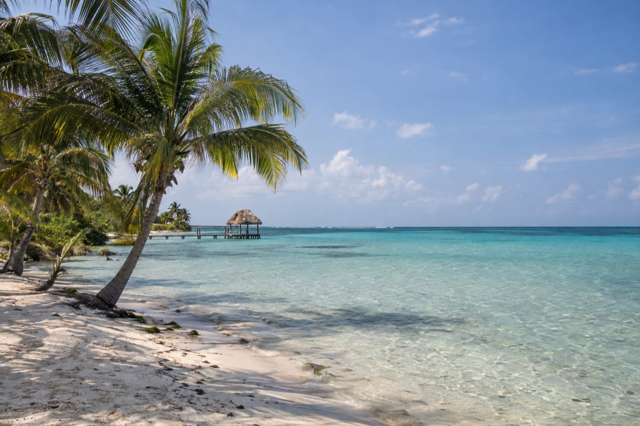
The best beaches in Belize are the ones that put you next to the barrier reef: the shoreline of Ambergris Caye, the strip of sand along the Placencia peninsula, and the tiny palm-fringed cayes such as Tobacco Caye. This is a coast for people who want to step out of a lodge and be near the water, rather than for those looking for a long, empty surf beach. The reef sits close, and that shapes everything about the shore: the snorkeling, the boat trips, the sunrise over the sea and the pace of the day.
The sea itself is warm all year. Near San Pedro it runs in the low 80s in the early months of the year and climbs into the mid-80s by midsummer, and near Placencia it is a degree or two warmer through the seasons. Those readings are in the table, and what they mean on the shore is simple: you do not need a wetsuit to enjoy a long time in the water.
| Month | Sea near San Pedro, Ambergris Caye (°F) | Sea near Placencia (°F) |
|---|---|---|
| January | 81.4 | 81.0 |
| April | 82.6 | 84.3 |
| July | 85.7 | 86.4 |
| October | 86.5 | 87.1 |
Ambergris Caye: the beach with the reef at its door
Ambergris Caye is the largest of the several hundred cayes in the northern waters of Belize, and its main attractions are the barrier reef and its beaches. The island is about 25 miles long and only about a mile wide, so the sea is never far from wherever you are staying. The sand around San Pedro town is lined with piers, beach bars and small hotels, and the mood is lively and casual.
Getting there is part of the pleasure. A flight from Belize City takes about 20 minutes, with Tropic Air and Maya Island Air serving the island’s small airstrip, and fast sea ferries also run. Once on the island, the main form of powered transportation is the golf cart. Hol Chan Marine Reserve lies 4 miles south of San Pedro, which makes a morning on the beach easy to combine with time on the reef.
Placencia: a long peninsula and a sidewalk to the sea
The Placencia peninsula runs 18 miles, and its beach life is spread among Riversdale, Maya Beach, Seine Bight and Placencia village at the southern tip. In the village, a concrete pedestrian-only path called The Sidewalk runs most of the length of the village and ends at the seashore, lined with small businesses. Walking it at an easy pace, past galleries and restaurants, is a good way to arrive at the water.
The evenings have a rhythm. Happy hour at the Barefoot Beach Bar runs from 6 to 7 PM, and on Sunday evenings a band called Inner Vibrations plays there.
In the morning, Belgian Cafe on Main Street serves breakfast and lunch until 2:30 PM, which is plenty of time to turn a walk on the sand into a slow start to the day. Offshore, Laughing Bird Caye, a National Park and World Heritage Site, lies even closer than the barrier reef, which is a 45-minute boat ride from the coast.
Tobacco Caye: a beach you can walk around in minutes
Tobacco Caye is a tiny island, about three acres, roughly 10 miles east of Dangriga, with a permanent population of about 20 and five small lodges. There are no roads or vehicles of any sort, and not even a single sidewalk. You step off the boat and the whole island is a few strides across, ringed with sand and palms and sitting inside the South Water Caye Marine Reserve.
Days here follow the meal bells, which usually ring around 7 AM, noon and 6 PM. The rest of the time belongs to hammocks, the shore and the water. Checkout at the lodgings is at 10 AM, so the last morning is for a final look at the sea before the boat back.
Which cayes and towns have beaches?
Beaches in Belize are found on the northern cayes (Ambergris Caye and Caye Caulker), on the small islands off the central coast (Tobacco Caye and St. George’s Caye), and along the southern shore at Placencia and Hopkins. Each has its own character, shaped by size, history and the people who live there.
Caye Caulker
Caye Caulker is a small island about 5 miles long, with around 2,000 residents, sitting 1 mile west of the barrier reef. One theory for its name is that boats were caulked in La Ensenada, the protected bay on the western side. The northern 100 acres of the island form the Forest Reserve, mostly dense mangrove forest, which gives the island a green, wild edge beside its shoreline.
Manatee tours go to Swallow Caye Wildlife Sanctuary, though swimming with the manatees is not allowed and some days it may be harder to see them. If you are traveling with children, note that Iguana Reef Inn does not allow guests under 10.
St. George’s Caye
St. George’s Caye lies eight miles east of Belize City, and its village shares the island’s name. Spaniards once called it Cayo Cocina, or Kitchen Cay. It was settled as a town in 1650 and was the largest settlement in what was then British Honduras, and Belize’s first capital in the 1700s.
The island’s story is tied to the Battle of St. George’s Caye, when British settlers defeated a small Spanish fleet in September 1798. It is marked as a national holiday on September 10 each year. The British Army once ran an adventure training establishment here, offering diving and sailing, but it closed in the late 20th century.
Hopkins
Hopkins is a seaside village backed by the Maya Mountains and the Cockscomb Range, with the Caribbean on its shore and the Sittee River close by. At the 2010 census it had 1,610 residents, and more than two-thirds of them were Garifuna. That heritage gives the village its identity, from its drumming to its food.
The village was created in 1942 to replace Newtown, which a hurricane had devastated further up the coast. Today it is a place where the beach and the village are one and the same, with mountains on the horizon behind you and the sea in front.
What should you know before you go?
Before you go, know that the Atlantic hurricane season runs from June 1 to November 30, that the cayes are small and simple places, and that each beach has its own way of getting you there. Placencia’s history is a reminder: on October 8, 2001, Hurricane Iris hit southern Belize with 145 mph winds and caused major damage to nearly 95% of the buildings in the village. Tobacco Caye was levelled by Hurricane Mitch in 1998, and nearly everything on it has been rebuilt since.
The sections of coast are reached in different ways. Ambergris Caye can be reached by plane or helicopter from Belize City and by numerous fast sea ferries, and also by ferry from Chetumal in Mexico. Astrum Helicopters serves the local airstrip and various resorts. Placencia, the southernmost village on its peninsula, is served by Placencia Airport.
Wildlife on the water
Near Placencia, whale sharks pass a spot called Gladden Spit around the full moon between March and June, and visitors should arrange their spot upfront. The local activity list also mentions whale shark watching during the full moons between April and July, along with kayaking, snorkeling, diving and saltwater fly fishing.
Tobacco Caye lies within the South Water Caye Marine Reserve, part of Belize’s national system of protected waters, with a range of restrictions on fishing. Around Placencia, the water from the tap is drinkable, plumbed in from an artesian well on the mainland.
Local days and traditions
San Pedro Day is celebrated each year on June 27 in San Pedro Town on Ambergris Caye, a day when the town turns out for the saint who watches over its fishing community. On September 10, the national holiday for the Battle of St. George’s Caye gives the whole country a reason to be on the water and in the streets.
Placencia once belonged to the Maya, who produced salt on the peninsula and traded it with other coastal settlements. Walking its shoreline today, you are on ground with a long history of people coming and going by sea.
Good to know before you go
The U.S. State Department rates Belize Level 2, “Exercise increased caution”, because of crime, and says the south side of Belize City has historically had the highest concentration of violent crime.
The Atlantic hurricane season runs from June 1 to November 30, so the late-year months fall within it and the early months of the year fall outside it. Hopkins keeps Central Standard Time, which is useful when you are catching a morning boat or a dinner bell. Tobacco Caye’s lodgings keep their own rhythm, with checkout at 10 AM, so plan your last morning around it.
Sources
- Wikipedia, Ambergris Caye (https://en.wikipedia.org/wiki/Ambergris_Caye), checked October 11, 2026
- Wikivoyage, Ambergris Caye (https://en.wikivoyage.org/wiki/Ambergris_Caye), checked October 11, 2026
- Wikivoyage, Caye Caulker (https://en.wikivoyage.org/wiki/Caye_Caulker), checked October 11, 2026
- Wikivoyage, Placencia (https://en.wikivoyage.org/wiki/Placencia), checked October 11, 2026
- Wikipedia, Placencia (https://en.wikipedia.org/wiki/Placencia), checked October 11, 2026
- Wikipedia, Tobacco Caye (https://en.wikipedia.org/wiki/Tobacco_Caye), checked October 11, 2026
- Wikipedia, Hopkins, Belize (https://en.wikipedia.org/wiki/Hopkins,_Belize), checked October 11, 2026
- Wikipedia, St. George's Caye (https://en.wikipedia.org/wiki/St._George's_Caye), checked October 11, 2026
- Wikivoyage, Tobacco Caye (https://en.wikivoyage.org/wiki/Tobacco_Caye), checked October 11, 2026
- Open-Meteo Marine API, average 2015-2024, checked October 11, 2026
- U.S. Department of State, Belize Travel Advisory, Level 2, March 11, 2026 (https://travel.state.gov/), checked October 11, 2026
- NOAA National Hurricane Center, Climatology (https://www.nhc.noaa.gov/climo/), checked October 11, 2026