
At sunset on the malecón in La Paz, fishermen hose down their skiffs, pelicans drop onto the bay, and the whole town drifts out for ice cream and a walk along the water. Past the last streetlight the desert runs on in every direction, cactus and rock all the way to the sea. Baja California is that mix of dry mountains, empty beaches and small harbor towns, with a very good table at the end of the road.
Where is Baja California and what is it like?
Baja California is a long, narrow peninsula in northwestern Mexico, stretching about 760 miles from the U.S. border to its southern tip, with the Pacific Ocean on one side and the Gulf of California (the Sea of Cortez) on the other. Two states share it: Baja California in the north, with its capital in Mexicali, and Baja California Sur in the south, with its capital in La Paz.
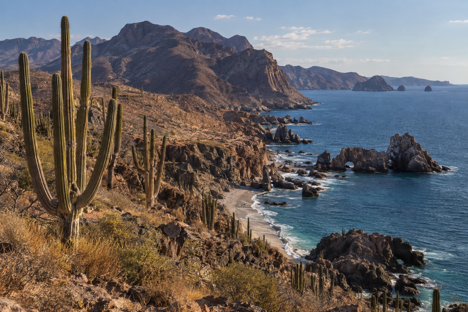
It is a mountainous desert, drier and far emptier than the Mexican mainland, with forests of cactus and a rugged coastline on both sides. Distances feel large and towns are small, so the peninsula suits travelers who like a road trip, a boat ride at dawn and a long dinner by the water. The north leans toward wine and seafood, and the south toward diving, fishing and beach days.
Where to go in Baja California
Ensenada and La Bufadora
Ensenada is the northern port, a working harbor town with a fish market, taco stands and a waterfront that fills on cruise-ship days. It is where most visitors from the border region start, and it suits anyone who wants an easy first taste of Baja: a seafood lunch, a stroll on the malecón and a drink in a lively old cantina.
La Bufadora, a sea geyser on the Punta Banda peninsula roughly 20 miles southwest of town, is the classic excursion. Waves force seawater into a coastal blowhole and send up a plume that can climb to around 100 feet, and it is best watched when the swell is running. A lane of craft and snack stalls leads to the viewpoint.
The usual land route into Sierra San Pedro Mártir National Park also goes through Ensenada, and this protected range of granite and pine forest holds Mexico’s National Astronomical Observatory. The skies up there are famously dark. South of here, the highway turns into true desert on its way toward Baja California Sur.
La Paz and Isla Espíritu Santo
La Paz is the relaxed capital of Baja California Sur, a city of sunset promenades, seafood stands and pastel colonial-era buildings. It faces a wide bay on the Sea of Cortez, and the pace is slower and more local than in Los Cabos. It suits couples, families and anyone who wants to be on the water without a resort scene.
Boats leave the city for Isla Espíritu Santo, which has held national park status since 2007 and is part of UNESCO’s World Heritage listing of the Gulf of California islands. Day trips bring sea lions, pale cove beaches, red cliffs and clear water for snorkeling. La Paz is also the base for whale shark encounters in its bay, and the ferry to the mainland leaves from here.
Loreto
Loreto is a small, quiet town between the Sea of Cortez and the Sierra de la Giganta, with a tidy plaza, a cobbled center and fishing boats pulled up on the beach. It suits travelers who want calm, slow mornings and boat days rather than nightlife.
The Mission of Nuestra Señora de Loreto Conchó was founded here on October 25, 1697 by the Jesuit Juan María de Salvatierra, the first permanent mission in the Californias. Offshore lies Bahía de Loreto National Park, a protected stretch of sea and five islands, part of the same UNESCO listing. Boat trips go out for snorkeling, birds and dolphins.
Los Cabos
Cabo San Lucas and San José del Cabo sit at the southern tip, and they are very different. Cabo San Lucas is the busy one, with a marina, sportfishing boats, beach clubs and late nights. San José del Cabo is calmer, with a plaza, art galleries and a historic center, and it suits couples and travelers who like a quieter base.
Birders who take a brief drive from Cabo San Lucas find the Estero de San José del Cabo to be a protected wetland offering them a wonderfully diverse mix of species. Resorts, golf and spas fill the corridor between the two towns, so Los Cabos suits anyone who wants comfort and a beach day with plenty of restaurant choices.
Todos Santos
Todos Santos sits on the Pacific side, at the western base of the Sierra La Laguna, a creative town where old adobe houses hold galleries, cafes open onto courtyards, and organic farms lie at its edge. It became one of Mexico’s Pueblos Mágicos in 2006, and it suits travelers who like browsing, long lunches and surf beaches nearby.
A hotel called Hotel California fuels a popular local legend tying the town to the Eagles song, though the hotel itself makes no such claim. Behind town, the mountains make up a biosphere reserve, dividing the peninsula’s Pacific shore from the Sea of Cortez shore, and the difference between those two coasts is one of the joys of this place.
Things to do in Baja California
Whales and whale sharks
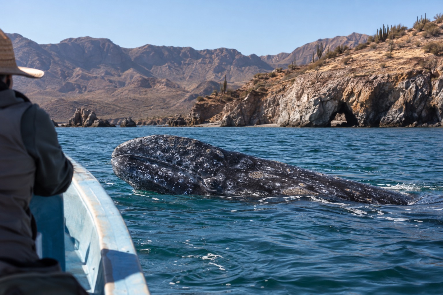
Each autumn, gray whales swim south to spend the winter and give birth in the protected lagoons lining Baja California’s Pacific coast. Calves are born from early January to mid-February, and the whales head north again from mid-February through May. Small boats take visitors out on the lagoons, and curious whales sometimes come right up to them.
In the Bay of La Paz, whale shark encounters are regulated by a federal management plan, and the 2026-2027 season opened on October 1, 2026 and runs to April 30, 2027. These gentle giants feed near the surface, and boat operators handle the permits and rules for each outing.
Cabo Pulmo and its coral reef
Cabo Pulmo National Park shelters the Gulf of California’s only living coral reef system, and commercial and sport fishing are prohibited within the park. The result is clear water and busy schools of fish, which makes it a favorite for snorkelers and divers. The village is tiny and the beaches are open and wild.
It suits travelers who prefer nature to nightlife, and a day here pairs well with a stay in the East Cape or Los Cabos. Bring reef-safe habits and expect simple food rather than a resort scene.
| Site | Open | Admission |
|---|---|---|
| Cabo Pulmo National Park | Daily, 8:00 a.m. to 6:00 p.m. | 125 Mexican pesos |
Land’s End and the beaches of Cabo
At the tip of the peninsula, boats leave Cabo San Lucas marina for Land’s End, where El Arco, the famous rock arch, can only be reached by water. The rocks around it hold a resident sea lion colony, and the Pacific and the Sea of Cortez meet here in a noisy swirl of color.
El Médano is the main swimming beach in town, sheltered from open swell by the Land’s End headland. At Lover’s Beach, swimming is only on the Sea of Cortez side, while neighboring Divorce Beach faces the open Pacific and is considered extremely dangerous because of rip currents. Cabo is also known worldwide for sportfishing, especially striped and blue marlin.
Wine, seafood and slow meals
Inland from Ensenada sits Valle de Guadalupe, which the state touts as the Ruta del Vino. Rows of vines, rustic tasting rooms and open-air restaurants spread across the hills, and lunch there tends to stretch comfortably into the afternoon. It suits couples and food lovers, and a day trip from Ensenada is the usual way to see it.
Back in town, the seafood is the draw: fish tacos with crisp batter, ceviche on tostadas, grilled octopus and sea urchin straight from the market stalls. The wine country and the harbor together give northern Baja a food scene that rewards a slow pace, ideally with a glass of local white and a sea breeze.
When to visit Baja California
Winter and spring are the comfortable months, with warm sunny days, cool evenings and almost no rain, and they are also when the whales and whale sharks are around. From midsummer into early fall the south turns hot and humid, with short, sometimes heavy showers and the warmest sea of the year, which suits beach days and diving more than long walks.
The eastern Pacific hurricane season, which governs the Pacific coast and the Gulf of California, officially runs from May 15 to November 30. It is still running now, so a trip this fall means keeping an eye on forecasts, especially for boat days. December through April sits outside the official season.
Holiday weeks, especially around Christmas and Easter, bring crowds and peak-season rates to Los Cabos and La Paz. Holy Week moves every year, so check when it falls before booking.
| Month | Average high (°F) | Days with rain |
|---|---|---|
| January | 80 | 1 |
| February | 81 | 1 |
| March | 83 | 0 |
| April | 86 | 0 |
| May | 90 | 0 |
| June | 91 | 0 |
| July | 94 | 1 |
| August | 94 | 4 |
| September | 93 | 4 |
| October | 92 | 1 |
| November | 87 | 1 |
| December | 81 | 1 |
Getting around Baja California
The peninsula is long and the towns are far apart, so most travelers fly into one end, either Tijuana in the north or La Paz, Loreto or Los Cabos in the south, and then use buses or a car along the Transpeninsular Highway. Many people base themselves in one region rather than trying to cover the whole thing.
From La Paz, Baja Ferries crosses the Sea of Cortez to Topolobampo on the mainland. The weekday sailing leaves in the afternoon and arrives in the evening, and the Saturday sailing runs overnight.
| Sailing | Check-in | Departure | Arrival |
|---|---|---|---|
| Monday to Friday | 12:00 | 13:30 | 20:30 |
| Saturday | 21:30 | 23:00 | 08:00 next morning |
Good to know before you go
Distances are long and services thin between towns, so fill the tank and carry some pesos when you leave the main centers. The sea can change quickly, so look at the beach flags before swimming, especially on the Pacific side. Keep a little flexibility in your plans for boat days, since wind and swell decide what runs.
Sources
- Encyclopaedia Britannica, "Baja California peninsula", britannica.com/place/Baja-California-peninsula-Mexico, checked September 29, 2026
- fait de geographie administrative de notoriete publique
- common geographic knowledge
- UNESCO World Heritage Centre, whc.unesco.org/en/list/1182/, checked September 29, 2026
- US Bureau of Transportation Statistics, "Border Crossing/Entry Data", bts.gov, checked September 29, 2026
- NOAA Fisheries, "Gray Whale" species page, fisheries.noaa.gov/species/gray-whale, checked September 29, 2026
- NOAA National Hurricane Center, official Eastern Pacific season (nhc.noaa.gov), checked October 5, 2026
- XXV Ayuntamiento de Ensenada, press release of April 4, 2026, ensenada.gob.mx, checked September 29, 2026
- Visit Mexico (official portal of the federal Secretaria de Turismo), La Bufadora, visitmexico.com ; supplemented by CICESE (Centro de Investigacion Cientifica y de Educacion Superior de Ensenada), explanatory note on La Bufadora, cicese.edu.mx, read on September 29, 2026
- Secretaria de Medio Ambiente y Recursos Naturales (SEMARNAT), official notice of September 17, 2026 on the 2026-2027 season of the whale shark refuge zone, gob.mx, checked September 29, 2026
- CONANP (national park status) and UNESCO, inscription "Islands and Protected Areas of the Gulf of California" (2005), corroborated by El Sol de Mexico, August 10, 2024, oem.com.mx, checked September 29, 2026
- Baja Ferries, "Rutas y Horarios", bajaferries.com.mx, checked September 29, 2026
- CONANP, "Aviso" and documents of Parque Nacional Bahia de Loreto, conanp.gob.mx (pdf/aviso_loreto), checked September 29, 2026
- Centro INAH Baja California Sur (official Facebook) and Secretaria de Turismo y Economia de l'Etat de BCS (setuesbcs.gob.mx, "Mision de Nuestra Senora de Loreto Conchó"), checked September 29, 2026
- CONANP, Cabo Pulmo National Park, descubreanp.conanp.gob.mx, read on (indexed excerpt; the site refuses any direct connection from this network) September 29, 2026
- Cabo Adventures (exploitant de tours locaux), "Is Cabo San Lucas Safe for Travelers", cabo-adventures.com, checked September 29, 2026
- H. XV Ayuntamiento de Los Cabos / IMPLAN Los Cabos, "REE Estero de San Jose del Cabo", implanloscabos.mx, checked September 29, 2026
- Secretaria de Turismo (SECTUR), "Todos Santos, Baja California Sur", sectur.gob.mx, checked September 29, 2026
- Servicio Meteorologico Nacional (CONAGUA), normales climatologicas 1991-2020, estacion 03005 (Cabo San Lucas, Los Cabos), checked September 29, 2026