
At mid-morning, halfway into your trip, you stand in a market in Oaxaca, pulling a warm tortilla apart over a bowl of black mole as the scent of chocolate and roasting chiles moves through the stalls. A few days earlier you were floating in a cenote under a ceiling of roots. This route pairs the Caribbean coast with the colonial and Aztec heart of the highlands, then closes the loop in Mexico City.
Is 2 Weeks enough for Mexico?
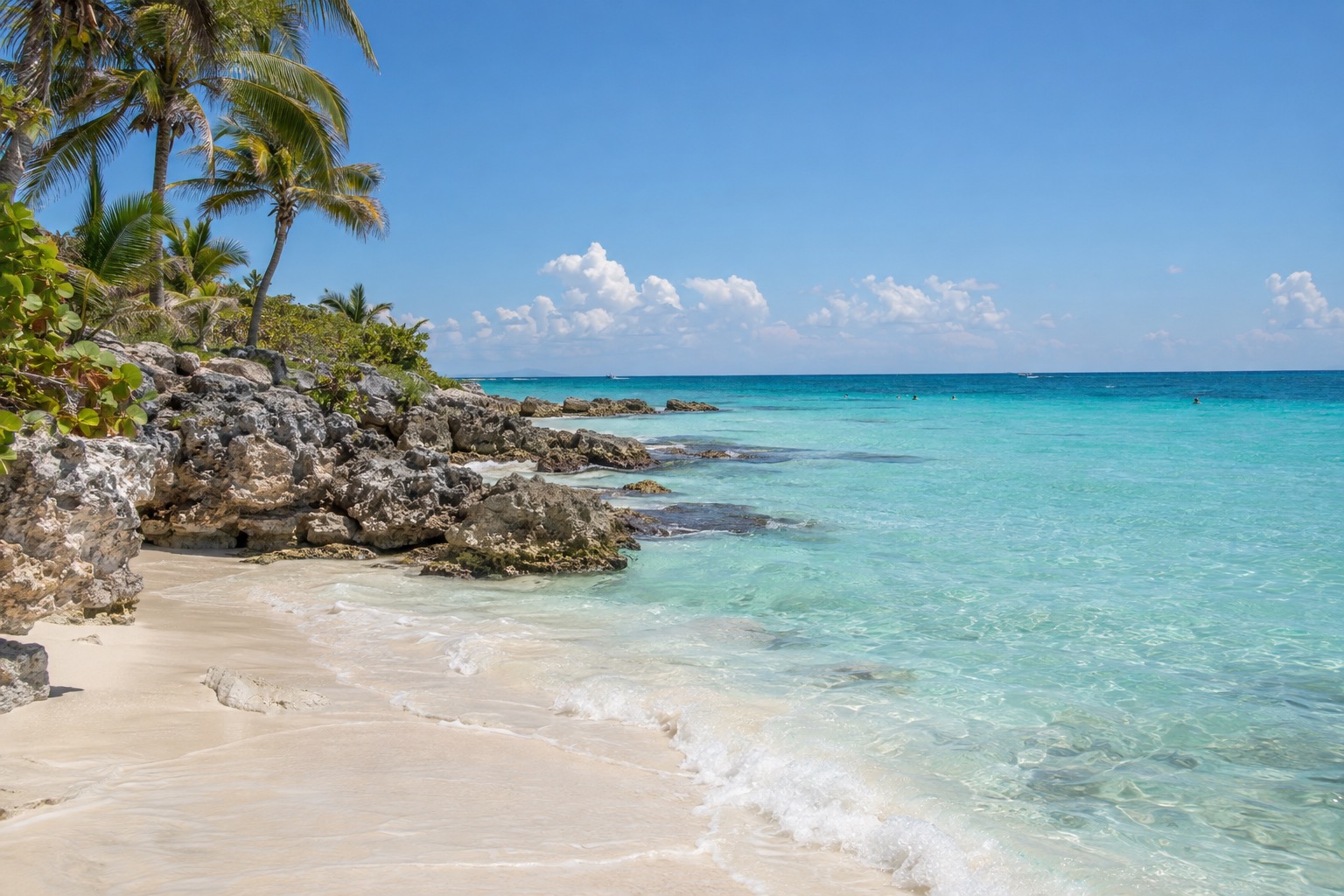
Two weeks is enough for a satisfying first look, as long as you accept choosing two or three regions instead of trying to see the whole country. This route covers the Caribbean coast of Quintana Roo, then Mexico City and Oaxaca in the central highlands, which gives you beaches, Maya ruins, museums and some of the best eating in the country.
Saved for a later trip are the Pacific side (Puerto Vallarta, Sayulita), the scenery of Los Cabos where the desert meets the sea, and colonial towns like Guadalajara or San Miguel de Allende. Those regions sit far from one another, and driving between them takes days, so adding one would cost you a stage you will probably not want to give up.
The itinerary stage by stage
Days 1 to 4: Cancún and Isla Mujeres
Start on the Caribbean coast, where your body clock can settle into beach time. Cancún is the practical gateway, and sleeping in the Hotel Zone or in the downtown neighborhoods keeps the first days easy. Spend one day on Isla Mujeres, reached by ferry, where you can wander the small town, laze on the calm-looking northern beach and eat grilled fish at a simple seaside table.
Go in the morning, when the ferries are busy with day-trippers heading out and the light on the water is soft. The island suits couples, families and anyone who wants a slow day before the longer moves ahead. Check the beach flags before swimming, since the sea changes from day to day.
Days 5 to 8: Playa del Carmen, Tulum and Chichén Itzá
Move south to Playa del Carmen, an easy base with a walkable pedestrian street, plenty of restaurants and quick access to the rest of the coast. From here, Tulum is a natural outing: the ruins stand on a cliff above the turquoise sea, and the town has cafés and beach clubs for the afternoon. A cenote swim, in one of the limestone sinkholes scattered through the jungle, fits well on the same day.
Chichén Itzá is the long day of the stage, a few hours each way by road from Cancún, so it works best as an early start with a late return. You walk the great plaza around El Castillo, the pyramid that dominates the site, and the ball court nearby.
Midday brings the heat and the tour groups, so the first hours of the morning are the kindest. It suits anyone with a taste for history who does not mind a day mostly spent on the road.
Days 9 to 11: Mexico City
Fly to Mexico City and trade sand for a huge, high-altitude capital where nights stay cool. Make your home base a neighborhood that’s easy to walk, like Roma, Condesa or the historic center, then begin with the Zócalo, the cathedral and the old palaces’ murals. The city rewards slow eating: tacos al pastor at a street counter, a long lunch of tlayudas or pozole, churros with thick chocolate in the evening.
One day goes to the museums, with the National Museum of Anthropology as the anchor for understanding everything you saw in the Maya world. Another goes to Teotihuacan, the ancient city where you walk the Avenue of the Dead beneath the Pyramid of the Sun. Leave early, before the heat and crowds build.
The last three days: Oaxaca and the return
Oaxaca comes next, by a short domestic flight or an overnight bus. The city is all low colonial buildings, painted walls, chocolate shops and markets, and it is the best place on the route to eat with real curiosity: mole in its many colors, tlayudas, quesillo, mezcal tasted slowly at a small bar. The Benito Juárez and 20 de Noviembre markets are good for a first lunch, and the churches and plazas reward an unhurried evening walk.
Use the last days for craft villages and the surrounding valleys, where weavers and potters work much as they have for generations. Keep the final morning loose, since most international departures route back through Mexico City or Cancún and you will want a margin for the connection.
Getting between stops
| Leg | How | Time |
|---|---|---|
| Cancún airport to Playa del Carmen | ADO bus | About 1 hour |
| Cancún airport to Tulum | ADO bus | About 2 hours |
| Cancún to Chichén Itzá | Road | About 2.5 to 3 hours each way |
For most trips around the peninsula, first-class ADO buses are the usual pick, serving the majority of routes and airport runs too, and the Tren Maya connects Cancún, Valladolid and Tulum as well. The direct road from Cancún to Tulum is a regular federal highway, not a toll road, so expect speed bumps near towns.
Between the coast, Mexico City and Oaxaca, domestic flights are the sensible way, and many routes pass through Mexico City. Overnight buses work for Oaxaca if you prefer the ground. At the big airports, a booth inside the terminal is where you pay for official taxis and shuttles.
Adapting the route
With a shorter trip, keep the Caribbean coast and Mexico City and drop Oaxaca, or pair Mexico City with Oaxaca alone for a culture-and-food week. If you have more time, the natural addition is a beach area reached by domestic flight, for example Puerto Vallarta, home to the Bay of Banderas and jungle hills, or Los Cabos, where many beaches facing the Pacific are too rough for swimming.
Season changes the mood. Winter on the Caribbean is warm and noticeably drier, while summer brings hot, humid days, and the Atlantic hurricane season runs through the second half of the year. Mexico City and Oaxaca turn rainy in summer, usually with afternoon downpours, while winter there is dry with cool nights. Sargassum can wash up on Caribbean beaches in warmer months, so keep the cenotes and the ruins in mind as the backup plan.
Families will like the Isla Mujeres day, the cenotes and the pyramids at Teotihuacan, and may want to skip the overnight bus. A slower trip can simply stay longer in each place: drop Chichén Itzá, give Tulum a full day and let Oaxaca stretch to four nights.
Good to know before you go
Carry some pesos for markets, street food and small shops, and use official airport taxis or ride-hailing apps in the cities. Avoid unnecessary night driving outside cities. Mexico City sits high, so take the first day gently and bring a layer for the evenings. Hurricane season on the Caribbean side deserves a look at the forecast before you book.
Sources
- U.S. Department of State, Mexico Travel Advisory (main, level banner), travel.state.gov, read live via browser (protected by Cloudflare, direct fetching blocked with 403) on 29 September 2026
- U.S. Department of State, Mexico Travel Advisory, section "Risks in specific areas" / State of Guerrero, travel.state.gov, read live via browser on September 29, 2026
- U.S. Department of State, Mexico Travel Advisory, section "Risks in specific areas" / State of Baja California, travel.state.gov, read live via browser on September 29, 2026
- U.S. Department of State, Mexico Travel Advisory, section "Risks in specific areas" / State of Baja California Sur, travel.state.gov, read live via browser on September 29, 2026
- U.S. Department of State, Mexico Travel Advisory, section "Risks in specific areas" / State of Sonora, travel.state.gov, read live via browser on September 29, 2026
- U.S. Department of State, Mexico Travel Advisory, section "Risks in specific areas" / State of Michoacan, travel.state.gov, read live via browser on September 29, 2026
- U.S. Department of State, Mexico Travel Advisory, section "Risks in specific areas" / State of Quintana Roo, travel.state.gov, read live via browser on September 29, 2026
- U.S. Department of State, Mexico Travel Advisory, section "Risks in specific areas" / State of Mexico (Estado de Mexico), travel.state.gov, read live via browser on September 29, 2026
- U.S. Department of State, Mexico Travel Advisory (reissued May 29, 2026), section « Risks in specific areas », travel.state.gov/en/international-travel/travel-advisories/mexico.html, read via browser (Cloudflare blocks curl) on 29 September 2026
- Servicio Meteorologico Nacional (CONAGUA), normales climatologicas 1991-2020, estacion 23155 (Cancun, Benito Juárez), checked September 29, 2026
- Open-Meteo Marine API, average 2015-2024, checked September 8, 2026
- Servicio Meteorologico Nacional (CONAGUA), normales climatologicas 1991-2020, estacion 09048 (Tacubaya Central (Obs), Miguel Hidalgo), checked September 29, 2026
- Servicio Meteorologico Nacional (CONAGUA), normales climatologicas 1991-2020, estacion 03005 (Cabo San Lucas, Los Cabos), checked September 29, 2026
- Servicio Meteorologico Nacional (CONAGUA), normales climatologicas 1991-2020, estacion 14339 (El Cuale, Puerto Vallarta), checked September 29, 2026
- Servicio Meteorologico Nacional (CONAGUA), normales climatologicas 1991-2020, estacion 20079 (Oaxaca, Oaxaca De Juárez), checked September 29, 2026
To plan your stay
- Best Time to Visit Mexico: Weather by Region, Crowds, Hurricane Season and Festivals
- Where to Stay in Mexico: Riviera Maya, Los Cabos, Puerto Vallarta, Mexico City and All-Inclusive Areas
- Getting Around Mexico: Buses, the Tren Maya, Taxis and Driving Your Own Car
- Mexico Travel Tips: Dollars, Tourist Tax, Tipping, Tap Water, Driving and Safety by State