
A ship horn rolls across the Mississippi, the smell of chicory coffee and powdered sugar drifts off a café table in the French Quarter, and somewhere nearby a traveler is wondering how a week of Caribbean reef and jungle fits into a sailing that starts here. New Orleans is a Gulf Coast port with its own music, food and river, and Belize is a country of cayes, rainforest and Maya history. Put the two together and the question is which ships connect them, where they land and what you carry on board.
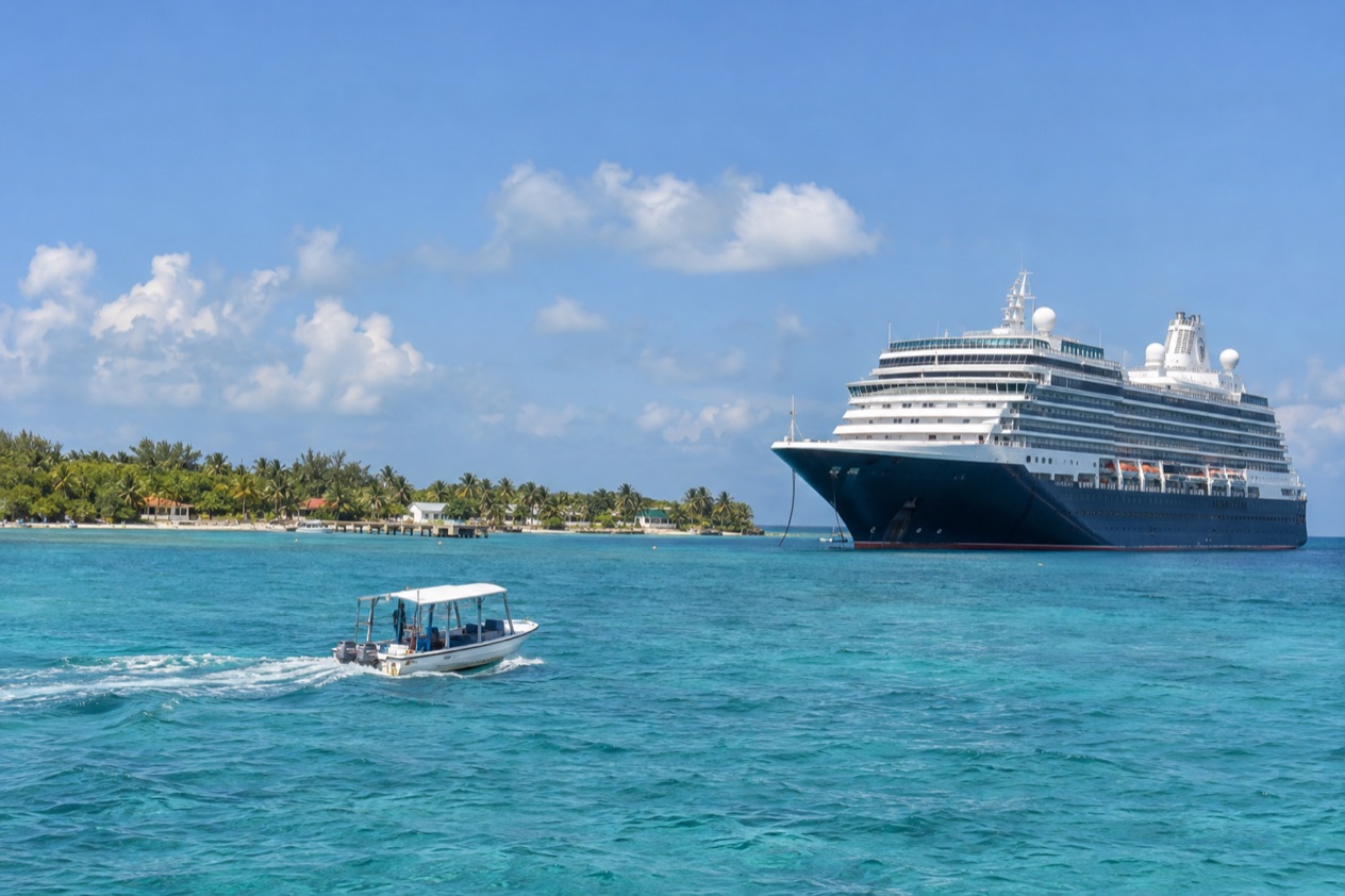
Which Belize cruises leave from New Orleans?
The sailings that call at Belize are listed in the Port of New Orleans cruise schedule, which you open online by choosing ‘View Cruise Schedule’ from the dropdown menu. The port’s website also has a section on cruise lines and itineraries, and that is where a ship’s route, with any stop in Belize, is laid out. New Orleans is the sixth-largest cruise port in the United States, so the list of lines and ships is a real one.
The port presents cruising from here as two vacations in one: the city before the ship, the ship after the city. That pairing suits Belize well, because both ends of the trip are built around food, music and water. You can eat gumbo and listen to a brass band the night before you sail, then spend a day at a Belizean port later in the week.
The lines that sail from Port NOLA
Several well-known names have sailed from the city. Disney Cruise Line ran six cruises from New Orleans in 2020, and Royal Caribbean International returned to the port that same year with Enchantment of the Seas. Each line posts its own itineraries, so a ship’s name on the port schedule leads you to the route and the ports it visits.
Two other operators work a different kind of water. American Queen Steamboat Company and American Cruise Lines offer cruises along the coast and the nation’s inland river system from Port NOLA. Those are paddlewheel and river-and-coast voyages, a very different experience from a sailing to a Belizean port, so read an itinerary to the end before you assume where it goes.
A port with a long river behind it
New Orleans sits on the Mississippi, about 100 miles upriver from the Gulf of Mexico. That shapes the start of every sailing here: your ship spends its first hours moving down the river past levees, refineries, small towns and pelicans on the pilings before it reaches open water. For many travelers the river passage is part of the pleasure, a slow, green and muddy introduction to the trip.
The size of ships that can reach the city is also set by the river. The air draft at the port is 170 feet, limited by the Crescent City Connection bridge. That is a fact about the harbor, not something you have to plan around, but it explains why the ships that start here are the ones that fit under that span.
How do you get to the cruise terminal in New Orleans?
The terminals and parking facilities sit in the heart of the city, steps from restaurants, museums and other cultural offerings. That location is the main thing to know, because it means you do not have to leave town to sail. The French Quarter, the riverfront and the warehouse district of galleries and restaurants are all part of the same city that holds your ship.
Parking is on the port’s own grounds, next to the terminals. If you drive in, you arrive in a downtown setting rather than at an isolated pier, and you can fold a meal or a walk into the day. If you come by plane, you still arrive in the city first and reach the ship from there.
A night in the city before you sail
Because the terminal is in the middle of town, an evening in New Orleans costs nothing in logistics. A first night can start with oysters or a po’boy, continue with beignets and café au lait the next morning, and still leave you close to the ship. The Quarter’s streets, the Mississippi riverfront and the music clubs of Frenchmen Street are the sort of places that fill a pre-cruise day.
Think of it as the first half of the two-vacations idea. The city rewards slow eating and wandering, so give yourself a morning that is not rushed. A ship that sails in the afternoon leaves you time for a last plate of red beans or a stroll along the river.
Arriving from the airport or by car
Drivers will find parking facilities at the port, and the central location keeps hotels, restaurants and shops within reach on foot or a short ride.
Once you are on board, the river carries the rest of the story. You leave a city of brick balconies and iron lace behind you, and the next ports are a long way downstream and across the Gulf.
Where do the ships stop in Belize?
Cruise ships stop at two ports in Belize: the Fort Street Tourism Village in Belize City and the Harvest Caye Port on the southern end of Harvest Caye. The first cruise ship dropped anchor in Belizean waters in 1991, and the two ports now work in quite different ways.
| Port | Where | How ships reach it |
|---|---|---|
| Fort Street Tourism Village | Mouth of Halouver Creek, northern bank, Belize City | Tender port, approximately 15 minutes ship to shore |
| Harvest Caye Port | Southern end of Harvest Caye, southern Belize | Ships dock rather than tender |
Fort Street Tourism Village, Belize City
The village stands at the mouth of Halouver Creek, on about two acres on the northern bank in Belize City. Because it is a tender port, the ship stays offshore and small boats carry passengers in. On land you find several courtyards, snack bars, restaurants and local stores with duty-free shopping, with live local entertainment as part of the setting.
It is a compact place to start, and it puts you in Belize City itself. A first stroll can be as simple as a coffee in a courtyard and a look through the shops. The State Department says the south side of Belize City has historically had the highest concentration of violent crime, a good reason to read your ship’s guidance before you wander far from the village.
Harvest Caye, southern Belize
Harvest Caye is a private island owned by Norwegian Cruise Line, in southern Belize. Its port was the first in Belize to let cruise vessels dock instead of tendering, so passengers step directly from ship to island. The port sits on the southern end of the caye.
Among the island’s attractions are wildlife exhibitions, including a blue morpho butterfly house. Which of the two ports your ship uses depends on the line and the itinerary, so look at the route before you picture the day.
What do you need to board?
For the return to the United States by sea, U.S. citizens can present a valid U.S. Passport, a Passport Card, an Enhanced Driver’s License, a Trusted Traveler Program card (NEXUS, SENTRI or FAST), a U.S. Military identification card on official orders, a U.S. Merchant Mariner document for official maritime business, a Form I-872 American Indian Card or an Enhanced Tribal Card. That is the list for entering the country by land or sea, and a cruise that ends at the New Orleans pier falls under it.
Children and families
U.S. and Canadian citizen children under age 16 need only present a birth certificate or other proof of citizenship when entering by land or sea. The same relief applies to children under 19 who travel with a school, religious or youth group. A family sailing from New Orleans can therefore carry a birth certificate for a younger child rather than a passport, for the sea return.
Air travel is different. Children must present their own passport when traveling by air, and the Indian or tribal card cannot be used for air travel. A family that flies home from a port instead of sailing back needs to think about that distinction.
Other travelers
Lawful permanent residents of the United States still need a valid Permanent Resident Card to enter the country, and a passport is not required. If you are flying rather than sailing, U.S. citizens entering by air must present a valid U.S. Passport, a Trusted Traveler Program card, a U.S. Military identification card when traveling on official orders or a U.S. Merchant Mariner document when traveling in conjunction with official maritime business.
Your cruise line will say what it asks of you at the pier, so keep its instructions together with your identity papers. These are the documents that matter for crossing the U.S. border, and the line’s own paperwork covers the rest of the boarding process.
Good to know before you go
The U.S. State Department rates Belize Level 2, “Exercise increased caution”, because of crime, and says the south side of Belize City has historically had the highest concentration of violent crime.
Passengers entering or leaving Belize must declare currency exceeding US$10,000. Most cruise days involve small purchases, but that rule applies to anyone carrying a large sum. The Atlantic hurricane season runs from June 1 to November 30, so sailings in the autumn months fall inside it, and it is reasonable to follow your cruise line’s notices about the route.
At Fort Street the shops and snack bars are the place to spend a few dollars, and the duty-free stores are part of the draw. On Harvest Caye the butterfly house and the other exhibits give the day its shape. The last concrete thing to carry off the ship in New Orleans is the memory of a week that began with beignets and the sound of a horn on the river.
Sources
- Port of New Orleans, cruise (https://www.portnola.com/cruise), checked October 11, 2026
- Wikipedia, Port of New Orleans (https://en.wikipedia.org/wiki/Port_of_New_Orleans), checked October 11, 2026
- Belize Tourism Board, Cruise licensing (https://www.belizetourismboard.org/licensing/cruise/), checked October 11, 2026
- Belize Port Authority, Fort Street Tourism Village port (https://portauthority.bz/belize-port-facilities/fort-street-tourism-village-port/), checked October 11, 2026
- Belize Port Authority, Harvest Caye port (https://portauthority.bz/belize-port-facilities/harvest-caye-port/), checked October 11, 2026
- Wikipedia, Harvest Caye (https://en.wikipedia.org/wiki/Harvest_Caye), checked October 11, 2026
- Philip S. W. Goldson International Airport (Belize), FAQ (https://www.pgiabelize.com/about-us/faq/), checked October 11, 2026
- Philip S. W. Goldson International Airport (Belize), Quick facts (https://www.pgiabelize.com/passenger-info/quick-facts/), checked October 11, 2026
- U.S. Customs and Border Protection, Western Hemisphere Travel Initiative (https://www.cbp.gov/travel/us-citizens/western-hemisphere-travel-initiative), checked October 11, 2026
- U.S. Department of State, Belize Travel Advisory, Level 2, March 11, 2026 (https://travel.state.gov/), checked October 11, 2026
- NOAA National Hurricane Center, Climatology (https://www.nhc.noaa.gov/climo/), checked October 11, 2026
To plan your stay
- Best Time for a Belize Cruise: Dry Season, Hurricane Season and Month-by-Month Weather
- Belize Shore Excursions: Altun Ha, Lamanai, Nohoch Che'en and Flights Over the Great Blue Hole
- Fort Street Tourism Village: Belize City's Cruise Port, What Is Inside and How Passengers Reach It
- Harvest Caye Belize: Norwegian's Private Island, the Dock and What to Do Ashore