
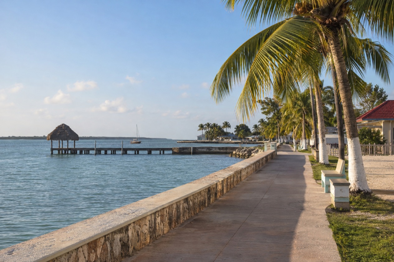
Leave Belize City while the light is still soft and the road north soon fills with sugarcane, roadside fruit stands and Spanish spoken at the gas pumps. At the far end, Corozal Town sits on a low, quiet waterfront, with a breeze coming off the bay and plazas where families gather in the evening. It is the northernmost town of Belize, and the trip from the country’s largest city is a change of pace as much as a change of place.
How do you get to Corozal from Belize City?
Corozal lies about 84 miles north of Belize City, and you reach it either by road or by a Maya Island Air flight that connects from the international airport.
What decides between the two is mostly where your trip begins. If you land at the Philip S. W. Goldson International Airport, the only international airport in Belize, you are already on the northern side of Belize City in Ladyville. From there the domestic flight and the rental car desks are both at hand. If you are staying in the city itself, the road north is the way the whole route unfolds, and you see the country change as you go: city streets give way to farmland, then to the low, open landscape of the north.
A third thing worth knowing is that the water taxi from Belize City does not stop at Corozal. It serves Chetumal, the Mexican city across the bay, and that makes it a separate trip rather than a way into Corozal itself. Whichever option you choose, the district you are heading to is the quietest corner of the country, a place of Mestizo culture, Spanish as the everyday language and a waterfront made for slow walks.
Corozal is also the gateway to Mexico, so some travelers come through on their way across the border. Others come only for the town and the bay. Either way, the first decision is the same: air or road.
Ways to get to Corozal from Belize City
Flying with Maya Island Air
Maya Island Air lists Corozal among the destinations it reaches with connecting flights from the Philip S. W. Goldson International Airport. The same list includes Caye Caulker, San Pedro, Dangriga (for Hopkins), Placencia and Punta Gorda, so Corozal is part of a small network that links the airport with towns around the country rather than a one-off route.
This way suits anyone arriving by international flight who wants to go straight north without handling a road trip. The airport receives services from the United States, Canada, Central America and the Caribbean, so the connection can follow an arrival from many places. You step off one plane and onto a smaller one, and the northern coast opens below you: lagoons, cane fields and the shoreline of the bay.
A practical tip: the airport is about 10 miles outside Belize City. If your hotel is in the city rather than near the airport, think of the airport as a starting point of its own and plan your morning around reaching it.
Driving a rental car from the airport
Two rental companies keep desks at the Philip S. W. Goldson International Airport: Hertz/Safari Belize and Crystal Auto Rental. Picking up a car there means you start the journey at the edge of the city, ready to follow the road north toward Corozal Town, which lies about 84 miles from Belize City.
One thing on the way out is the airport access road itself. Roadwork and dredging are underway there, which means slower traffic, uneven surfaces and flaggers directing cars through the work zone. Drivers are asked to reduce speed, follow the flaggers and watch for dredging equipment and workers near the roadway. Allow extra time at the beginning of the trip, because that is where the delay is.
Driving suits travelers who want to stop where they like: a roadside fruit stand, a village on the way, a viewpoint over the water. It also puts you in charge of the return, so the town and the bay can be visited at your own rhythm.
The water taxi to Chetumal, on the Mexican side
San Pedro Belize Express runs multiple daily trips between Belize City, San Pedro and Caye Caulker, and it also serves Chetumal, Mexico from Belize City. The ticket office in Belize City is at #111 North Front Street, at the Belize Marine Terminal. On the Mexican side, the water taxi leaves from the Terminal Maritima Internacional Filiberto Sabido Padilla.
This is not a way into Corozal. It is the option for travelers who are building a larger loop that includes Chetumal, the capital of the Mexican state of Quintana Roo, set on the western side of Chetumal Bay near the mouth of the Río Hondo. The boat company takes most major credit cards (Visa, Mastercard, Discover) for walk-in purchases at its terminals, which keeps the booking at the counter simple.
Options compared
| Option | Route | What to know |
|---|---|---|
| Maya Island Air flight | Philip S. W. Goldson International Airport to Corozal | A connecting flight on a network that also reaches Caye Caulker, San Pedro, Dangriga, Placencia and Punta Gorda |
| Rental car | Road north from Belize City to Corozal Town | Hertz/Safari Belize and Crystal Auto Rental have desks at the airport, and roadwork on the airport access road slows traffic |
| San Pedro Belize Express water taxi | Belize City to Chetumal, Mexico | Serves Chetumal rather than Corozal, with the ticket office at the Belize Marine Terminal on North Front Street |
The flight and the car lead to the same town, but they feel different. In the air, you see the geography of the north all at once: the bay, the low coast, the flat farmland. On the road you meet it piece by piece, through its villages and its fields, and the town arrives at the end of a long slow unrolling of the landscape.
The car also matters for what comes after Corozal. The town sits on the Caribbean Sea in the north of the country, and the surrounding district has Sarteneja, a fishing village at the mouth of the Bay of Chetumal. With your own wheels, those places stay within reach as you decide on the day.
The water taxi belongs to another kind of trip. It is for travelers whose plans stretch across the border, with Chetumal as the destination. If your goal is Corozal itself, it plays no part in the route, and the choice is simply between the air and the road. Roadwork near the airport touches the road option at the first mile, so factor that into the start of the day.
Making a day of it
Corozal Town rewards a walk. The waterfront is the center of daily life, with the bay in front and the plaza close behind. It is predominantly Mestizo, and Spanish is the language you hear most often, in shops, on the street and across the counters of the market.
The House of Culture and the town’s history
The House of Culture holds a mural that documents the history of Corozal, and it is the best place to understand how this town came to look the way it does. An estimated 90% of Corozal Town was destroyed by Hurricane Janet in 1955, and most of the structures standing today were built after that storm. The streets feel orderly and fairly new for that reason.
Under the modern town lies something far older. Corozal sits on the foundations of the ancient Maya ceremonial center of Santa Rita, dating from 2000 BC. You do not need to see a pyramid to feel the depth of that fact: the bay, the breeze and the low ground have been a gathering place for a very long time.
Sarteneja and the Bay of Chetumal
Sarteneja is a small coastal village at the mouth of the Bay of Chetumal and the largest fishing community in Belize, as well as the second largest village in the country. It lives mainly from fishing, away from the main tourist crowds, and a visit there is about the working waterfront: boats, nets and the rhythm of a village that depends on the sea.
The name has a story. It is a Castilian distortion of the original Maya name Tza-ten-a-ha, which means water between the rocks, a reference to the many wells found throughout the area. Knowing that gives the village a sense of place before you arrive: water has always been the point here.
A look across the border
Chetumal, on the other side of the bay, is the capital of Quintana Roo and a city of more than 169,000 people in 2020, which makes it a very different scale from the small Belizean town you came to. Seeing both sides of the bay puts Corozal in context: a quiet northern town at the edge of a much larger region.
For a day built around Corozal alone, though, the town, the House of Culture, the waterfront and a turn toward the fishing villages of the bay are plenty. Linger over a meal near the water, and let the evening arrive on the plaza as it does every day.
Good to know before you go
The U.S. State Department rates Belize Level 2, “Exercise increased caution”, because of crime, and says the south side of Belize City has historically had the highest concentration of violent crime.
The Atlantic hurricane season runs from June 1 to November 30, and Corozal’s history includes Hurricane Janet, which destroyed most of the town in 1955. Before you travel in those months, follow the forecasts for the coast. For the trip itself, the flight and the rental car both start at the Philip S. W. Goldson International Airport, so the airport is the one place to sort out first.
Sources
- Philip S. W. Goldson International Airport (Belize), Travel and ground transportation (https://www.pgiabelize.com/passenger-info/travel-ground-transporation/), checked October 11, 2026
- Philip S. W. Goldson International Airport (Belize), FAQ (https://www.pgiabelize.com/about-us/faq/), checked October 11, 2026
- San Pedro Belize Express Water Taxi, FAQ (https://belizewatertaxi.com/information/faq/), checked October 11, 2026
- San Pedro Belize Express Water Taxi, Schedule (https://belizewatertaxi.com/schedule/), checked October 11, 2026
- Tropic Air, Belize International Airport (https://www.tropicair.com/belize-international-airport-bze/), checked October 11, 2026
- Maya Island Air, International flights (https://www.mayaislandair.com/belize-international-flights/), checked October 11, 2026
- Wikipedia, Corozal Town (https://en.wikipedia.org/wiki/Corozal_Town), checked October 11, 2026
- Wikivoyage, Corozal (https://en.wikivoyage.org/wiki/Corozal), checked October 11, 2026
- Wikipedia, Corozal District (https://en.wikipedia.org/wiki/Corozal_District), checked October 11, 2026
- Wikipedia, Sarteneja (https://en.wikipedia.org/wiki/Sarteneja), checked October 11, 2026
- Wikivoyage, Sarteneja (https://en.wikivoyage.org/wiki/Sarteneja), checked October 11, 2026
- Wikipedia, Chetumal (https://en.wikipedia.org/wiki/Chetumal), checked October 11, 2026
- Great-circle distance computed from the GPS coordinates of the two places, October 10, 2026
- San Pedro Belize Express Water Taxi, Chetumal (https://belizewatertaxi.com/destinations/chetumal/), checked October 11, 2026
- Tropic Air, Corozal (https://www.tropicair.com/corozal-czh/), checked October 11, 2026
- U.S. Department of State, Belize Travel Advisory, Level 2, March 11, 2026 (https://travel.state.gov/), checked October 11, 2026
- NOAA National Hurricane Center, Climatology (https://www.nhc.noaa.gov/climo/), checked October 11, 2026
To plan your stay
- Best Time to Visit Corozal: Weather by Month, Sea Temperatures and Festivals
- Things to Do in Corozal: Santa Rita Ruins, the Bayfront, Day Trips to Chetumal and Bacalar
- Where to Stay in Corozal: Corozal Town, Sarteneja, Hotel Licenses and the Lodging Tax
- Know Before You Go to Corozal: Entry Rules, Money, Roads and Health