
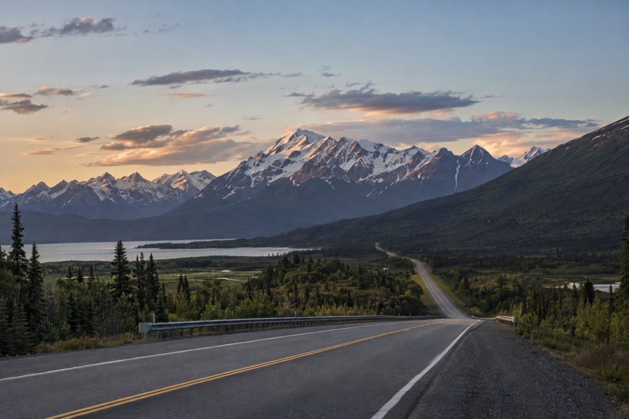
The Denali Highway is Alaska Route 8, a lightly traveled road that runs mostly on gravel between Paxson and Cantwell. It is a road for people who want open tundra and mountain horizons, and it is open only in the warm part of the year.
What is the Denali Highway?
The Denali Highway is a lightly traveled, mostly gravel road in the Alaska interior that links Paxson, on the Richardson Highway, with Cantwell, on the Parks Highway. It carries the designation Alaska Route 8, and it is the kind of road where the pace of the day is set by the surface and the scenery rather than by the schedule.
Despite the name, it is not the road into Denali National Park and it does not replace the Denali Park Road. It is a separate route that shares a name with the great mountain and the park, and the two should not be confused when you plan a trip.
| Detail | Figure |
|---|---|
| Total length | 135 miles |
| Paved section at the Paxson end | 21.3 miles |
| Paved section at the Cantwell end | 2.6 miles |
| Recommended speed limit | 30 mph |
| Maclaren Summit elevation | 4,086 feet |
The route from Paxson to Cantwell
The road begins at Paxson, a junction on the Richardson Highway, and ends at Cantwell, a small community on the Parks Highway. Between those two points it crosses a wide stretch of the Alaska interior, a country of open tundra, river valleys and mountain ranges that stay in view for much of the way.
Lodges, campgrounds and roadside pullouts are the only built things along the route, and the mileposts that mark them are the way people talk about the road. When someone says a lodge is at MP 42, they mean its distance along the highway, counted from the Paxson end.
Gravel, pavement and the summit
Only the two ends of the highway are paved, and the stretch at the Paxson end is by far the longer of them. Everything between the two paved pieces is gravel, which is what gives the road its character and what sets the speed you should expect to drive.
The high point is Maclaren Summit, which is the second highest road in Alaska. It is a place where the road climbs out of the valleys and the land opens up to wide, bare country. Photographers and sightseers tend to slow down here, and the pullouts nearby make it an easy place to stop and look around.
Cantwell and the Parks Highway end
Cantwell, the western terminus of the highway, began as a flag stop on the Alaska Railroad. It sits at an elevation of 2,190 feet on the George Parks Highway, with Anchorage 212 miles to the south and Fairbanks 150 miles to the north.
It is a small place with its own school, Cantwell School, run by the Denali Borough School District. About 20 miles from town stands Igloo City, a giant abandoned hotel shaped like an igloo, which is not made of ice and which road-trippers on the Parks Highway often stop to photograph.
When is it open?
The Denali Highway is closed to all traffic from October to mid-May each year, so it is a road for the late spring, summer and early autumn months only. The closure applies to the whole road, not just to one stretch, and it is the first thing to settle when you think about a trip.
In practice this means the road is shut in the weeks when the first snow arrives and stays shut through the long Alaska winter. When it reopens in mid-May the season begins again, and the route is open to vehicles through the summer and into the early part of autumn.
How to plan around the closure
Because the road is shut for the rest of the year, a trip on the Denali Highway has to fit inside the open months. If your dates fall outside them, the sensible alternative is the Parks Highway, which passes through Cantwell and connects Anchorage and Fairbanks.
Snow can also fall at Cantwell in the middle of summer. On one July day in 2003, six inches came down there, a reminder that this is high interior country where the weather can turn quickly even in the warm season. It is a fact about Cantwell, not a forecast for the whole road, but it shows how changeable the region can be.
Lodges that operate year-round
Several businesses along the highway are listed as operating year-round. They are spread across the length of the road, from near Paxson to the Cantwell end, and they are the main places to find a roof, a meal or a conversation with someone who knows the road.
| Business | Milepost |
|---|---|
| Denali Highway Cabins & Tours | MP 0.2 |
| Maclaren River Lodge | MP 42 |
| Alpine Creek Lodge | MP 68 |
| Backwoods Lodge | MP 134 |
| Cantwell Lodge | MP 138 |
The first of these sits at the very start of the highway and the last two are close to the Cantwell end, so a traveler heading either way passes at least one of them early in the drive. The two in the middle, at Maclaren River and Alpine Creek, are the ones that break up the long gravel stretch.
What the road report calls the closed months
The state’s Alaska 511 service uses a set of condition categories for roads: Good, Fair, Difficult, Very Difficult, Hazardous, Road Closure and No Winter Maintenance. Those last two are the labels that matter for a road like this one, because they tell you plainly when a route is not available.
If you are reading about the highway in the closed months, a Road Closure or No Winter Maintenance entry on that service is simply the seasonal shutdown showing up on the map. Once the road reopens in mid-May, the same service is where you look for the day-to-day state of the surface.
What do you need to know before you drive it?
The main thing to know is that this is a mostly gravel road with a recommended speed limit well below a normal highway, so the drive takes patience and a steady pace. The recommendation is there because of the surface, and it sets the rhythm of the whole trip.
Plan your day around those stops rather than around a clock, and let the road decide how fast you go.
Surface, pace and the paved ends
Pavement covers only the two ends of the highway, so the gravel begins fairly soon after you leave Paxson and carries on until the last stretch before Cantwell. On gravel, the recommended 30 miles an hour is the figure to keep in mind, and the long views make that pace easier to accept than you might expect.
Because most of the road is gravel, the drive feels different from the highways at either end. The sound of the tires changes, the dust trails behind you, and the landscape seems to open up as the road climbs toward Maclaren Summit.
Camping and pullouts
There are two developed campgrounds along the road, at Tangle Lakes (MP 22) and at Brushkana Creek (MP 104). Beyond those, dozens of pullouts along the highway are places where people camp on public land, which suits travelers who want a quieter spot of their own.
The campgrounds sit at different points of the route, so they work as natural stopping places on a trip that is spread over more than a day. A night at one of them, or at a pullout, lets you see the tundra and the mountains in the long light of the evening and the early morning.
Checking Alaska 511 and the park road
Alaska 511 is the state’s road information service, and it publishes road conditions, cameras and incidents, including closures reported through a partnership with Waze. You can save routes if you log in, and notifications go out by text message, by default on weekdays from 6 AM to 6 PM.
One more thing is worth keeping straight if you are also heading to Denali National Park. Private vehicles may drive only the first 15 miles of the Denali Park Road, as far as Savage River, and beyond that travel is by park shuttle bus, on foot or by bicycle. That rule belongs to the park road, not to the Denali Highway.
Good to know before you go
The road is closed from October to mid-May, the lodges at Maclaren River, Alpine Creek and the two ends are the places to find a bed, and Alaska 511 is where road conditions are posted. At the Cantwell end, the Parks Highway carries you on toward Anchorage or Fairbanks, and Igloo City waits nearby for anyone who wants a last stop.
Sources
- Wikipedia, Denali Highway (https://en.wikipedia.org/wiki/Denali_Highway), checked October 11, 2026
- Wikipedia, Cantwell, Alaska (https://en.wikipedia.org/wiki/Cantwell,_Alaska), checked October 11, 2026
- Alaska 511 (https://511.alaska.gov/), checked October 11, 2026
- Wikivoyage, Denali National Park (https://en.wikivoyage.org/wiki/Denali_National_Park), checked October 11, 2026
To plan your stay
- Best Time to Visit Denali National Park: Summer Buses, Fall Road, Winter Quiet and Weather by Month
- Where to Stay in Denali National Park: Park Entrance, Healy, Backcountry Lodges and Campgrounds
- Denali National Park from Anchorage: the Parks Highway, the Denali Star Train and Park Shuttles
- Know Before You Go to Denali National Park: Fees, Bus Season, Weather and Bears