
The fjord narrows, the mountains close in on both sides, and a small town appears on the shore of Lynn Canal with a row of old white officers’ houses facing a parade ground. That is Haines, a place where the landscape does most of the talking. Cruise passengers who call here find a compact waterfront community, a historic fort and, in the colder months, a river valley full of bald eagles.
How do cruise passengers reach Haines?
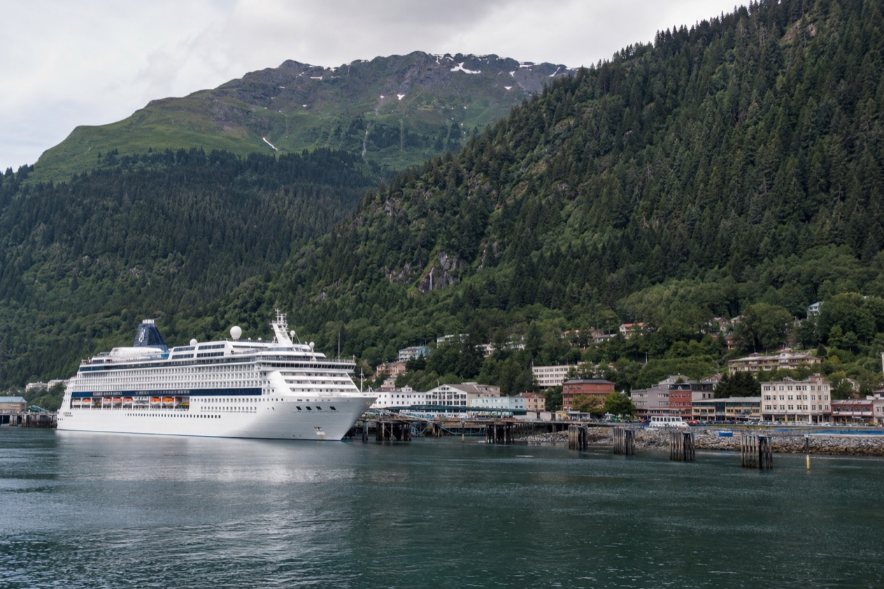
Cruise passengers reach Haines by water, up Lynn Canal, the longest fjord in the state, to a small port community in Southeast Alaska. The approach is part of the visit. The channel is long and deep, the shores rise steeply, and the town sits at the edge of it with the Chilkat country behind.
Haines has long been a port of call. Between 2010 and 2012, an average of 30,000 cruise ship passengers visited annually. That is a figure from those years, not a count for today, but it shows that the town is used to visitors stepping ashore and finding their way around a place of modest size.
By ship on Lynn Canal
Haines lies on the shore of the fjord, and the water is the town’s front door. Travelers who arrive on a ship see the community from the channel first: the waterfront, the wooded slopes, the high ridges across the water. This is a place that looks small from the deck and stays small on land, which suits anyone who prefers a town they can take in without a plan.
The Alaska Marine Highway also serves Haines. A mainline route in Southeast Alaska runs from Bellingham to Ketchikan, Wrangell, Petersburg, Juneau, Haines, Skagway and Sitka. Another runs from Ketchikan to Wrangell, Petersburg, Sitka, Juneau, Haines and Skagway. Most communities in Southeast Alaska receive year-round ferry service, with mainline vessels serving the larger communities and day boats serving the smaller ones.
By air and by road
Haines Airport has one air carrier, Alaska Seaplanes, with service to Skagway and Juneau. Those are the only scheduled commercial flights. Haines is also tied to the North American road network. The Haines Highway, which is Alaska Route 7 on the American side and Highway 3 in Yukon, was built by the U.S. Army in 1943 as an alternate route from the Pacific Ocean to the Alaska Highway.
The road follows the old Dalton Trail, the route that once led inland from the port toward the Yukon. It passes through British Columbia on its way to Haines Junction, where it meets the Alaska Highway. For a traveler on the water, it explains why this small town has always been a gateway and why the fjord and the highway both matter here.
| Connection | What the FACTS give |
|---|---|
| Haines Highway (Alaska Route 7) | 45 miles in Alaska, Haines to Haines Junction, Yukon |
| Haines Highway to the Canadian border | 39 miles from Haines |
| Haines Airport | On the Haines Highway, about 4 miles west of town |
| Scheduled flights | Juneau and Skagway, Alaska Seaplanes |
| Haines State Ferry Terminal | About 4 miles north of town |
What is within reach of the dock?
Within reach of a visitor stepping ashore in Haines is a small town on Lynn Canal, with a nationally recognized historic fort and the fjord views that frame everything. It is a town of modest scale, where the sights are about atmosphere, old buildings and open water rather than a long list of attractions.
Fort William H. Seward
Fort William H. Seward was declared a National Historic Landmark in 1978, and it is the place visitors want to see first. The old military post is built around a parade ground, with its large frame buildings arranged in a quiet rectangle. The setting is calm and open, with the mountains rising beyond the roofs.
Some of the structures are open to the public as businesses and restaurants. That makes the fort a living part of town rather than a museum behind a fence. You can wander between the buildings, read the look of the place from the porches and the lawn, and stop for a meal or a browse in a space that once housed soldiers. It rewards slow walking more than a checklist.
The town and the fjord
Beyond the fort, Haines is a working small port community. The shoreline gives long views down Lynn Canal, and the light on the water changes with the weather, from silver on gray days to a sharp blue when the sky clears. Fishing boats, wooden buildings and the ridgelines across the channel are what you see most.
The Chilkat country has deep roots, and the name recurs across the landscape, from the river to the preserve. Haines is a good place to notice that the region is shaped as much by its rivers and eagles as by its visitors. Take your time on the streets, look at what is in the windows, and let the pace of the town set yours.
Getting beyond the waterfront
The Haines Highway is the road that leads out of town toward the eagle country and, farther on, toward Canada. The Alaska Chilkat Bald Eagle Preserve is a state park and wildlife refuge near Haines. It is a short name for a large landscape, and the highway runs through part of it.
The preserve covers 49,320 acres, mainly along the Chilkat River, with sections along the Klehini and Tsirku rivers. Whether you reach it depends on how you travel and the time you have. It is worth knowing it is there, because it is what gives Haines its reputation beyond the cruise stop.
What can you do in a day?
In a day in Haines you can walk through Fort Seward, take in the fjord and, depending on the time of year, look for eagles along the Haines Highway.
A day around the fort and the waterfront
Start at Fort William H. Seward, where the parade ground and the old buildings set the scene. Walk the grounds, then step into one of the structures that now hold businesses and restaurants. A meal here, with the old fort around you, is one of the pleasant ways to spend part of a day in Haines.
From there, drift toward the shoreline and look down Lynn Canal. The fjord is the backdrop to nearly every view in town. If the weather is clear, the ridges stand out sharply. If it is gray, the mist and low clouds give the place a quieter, moodier feel, and the old wooden buildings look right in it.
Looking for eagles on the Haines Highway
The Haines Highway from miles 12 to 18 is a popular viewing location for bald eagles in the Alaska Chilkat Bald Eagle Preserve. The preserve is home to the world’s largest concentration of bald eagles, and Haines is known for it. The big gathering, however, belongs to the colder months.
The annual appearance of eagles occurs between October and February. More than 3,500 bald eagles visit the Haines area in those months, and up to 4,000 have been observed in the preserve during the annual Fall Congregation. Even outside that stretch, between 200 and 400 bald eagles live in the preserve year-round, so a sighting is a chance at any time, never a promise.
Other moments in the Haines calendar
Haines hosts the Southeast Alaska State Fair with four days of festivities on the last weekend of July. A fair in a small town draws locals and visitors together, and the community fills with the sounds and smells of a summer gathering. If your call falls on that weekend, the town will feel different from an ordinary day.
Many tourists visit Haines in summer, and the eagles draw visitors in the colder season. The two moments give the town two quite different characters. One is open, busy and bright, the other quiet and wild, and either one gives you something specific to this corner of Southeast Alaska.
Good to know before you go
Haines is a small place, so the pleasures are simple: the old fort, the long fjord and the chance of eagles in the cold months. The airport and the ferry terminal lie outside town on the Haines Highway, which also leads to the eagle preserve. Come ready to enjoy a quiet port with views that change with the weather.
Sources
- Wikipedia, Haines, Alaska (https://en.wikipedia.org/wiki/Haines,_Alaska), checked October 11, 2026
- Wikivoyage, Haines (https://en.wikivoyage.org/wiki/Haines), checked October 11, 2026
- Wikipedia, Chilkat Bald Eagle Preserve (https://en.wikipedia.org/wiki/Chilkat_Bald_Eagle_Preserve), checked October 11, 2026
- Wikipedia, Haines Highway (https://en.wikipedia.org/wiki/Haines_Highway), checked October 11, 2026
- Alaska Department of Transportation, Alaska Marine Highway System, Route guide (https://dot.alaska.gov/amhs/route.shtml), checked October 11, 2026
To plan your stay
- Alaska Cruise in May: Port Weather, Whales and Glaciers, and the Cruise Lines
- Which Side of the Ship for an Alaska Cruise: Glacier Bay, Inside Passage Routes and Balcony Choices
- How Much Does an Alaska Cruise Cost?: Cruise Lengths, What's Included and Extras
- Alaska Cruise in June: Weather, Ports, Wildlife and Glaciers