
SAGRES · APRIL · 1991-2020 NORMALS
You have already picked the town. April is the part still open for argument, and the figures settle it fast: an average high of 66.4°F, an average low of 53.6°F, and 1.37 inches of rain spread across roughly six wet days. On April 15 the sun is up for 13 hours 13 minutes, which on a headland this bare means you walk at noon instead of hiding from the sun.
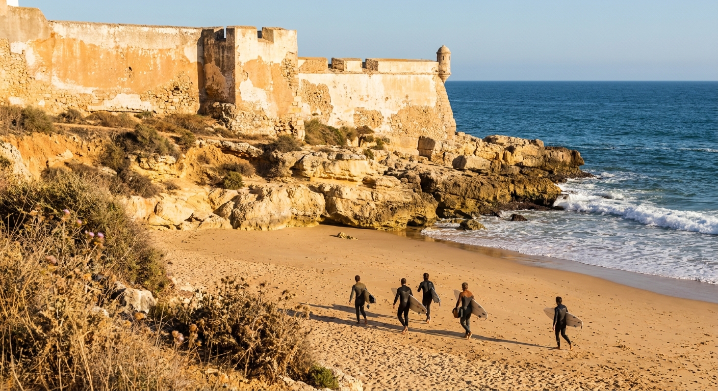
The sea lags behind the land, as it does every spring on this coast. Off the cape it averages 61.8°F in April, cold enough that the people in the water are wearing rubber and carrying a board. What April hands back is long light and an empty clifftop: sunset at 20:12, dinner after it, and a drive out to Cabo de São Vicente that nobody is queuing for.
THE MONTH AT A GLANCE · SAGRES IN APRIL
April gives Sagres 66.4°F afternoons, light until 20:12 and only 5.7 wet days, but the sea at 61.8°F is wetsuit water, so plan a cliff-and-car trip rather than a swimming one.
HIGH 66.4°F · LOW 53.6°F · SEA 61.8°F · 5.7 RAIN DAYS · 13H13 OF DAYLIGHT
Go for: the clifftop between the fortress and the cape, surfing in a wetsuit at Tonel, a rental car that reaches Lagos in a shower, and sunsets that hold off until after eight.
Think twice before: booking April as a beach-swimming week with children: 61.8°F water and 53.6°F nights make for short dips and early jackets.
Air and rain: IPMA station 533 · Sea: Open-Meteo Marine · Sun times: sunrise-sunset.org · full sources at the end
On this page
- Sagres weather in April66.4°F highs, 1.37 inches, 5.7 wet days
- Can you swim in April?The sea at 61.8°F, and what that means in practice
- Crowds, costs and when to bookWhat we could price and what we could not
- Things to do in Sagres in AprilThe fortress, Cabo de São Vicente, four beaches
- A two-day plan for SagresTwo days keyed to a 20:12 sunset
- April vs March vs MayHow the three months compare, degree by degree
- Is April a good time to go?Our verdict, and who should shift to May
Two sources carry the month: IPMA’s 1991-2020 normals from the weather station on the cape for air and rain, and Open-Meteo’s marine reanalysis for the water. Where we came up empty, on room rates and on the municipal tax, we say so instead of guessing a number.
Sagres weather in April: average highs, lows and rain days
| April at Sagres, station 533 | Normal (1991-2020) |
|---|---|
| Average high | 66.4°F (19.1°C) |
| Average low | 53.6°F (12.0°C) |
| Precipitation | 1.37 in |
| Days with 1 mm (0.04 in) or more | 5.7 |
| Days with 10 mm (0.39 in) or more | 0.9 |
| Sea surface, mean of daily maxima | 61.8°F (16.6°C) |
| Daylight on April 15 | 13h 13m, 06:59 to 20:12 |
The air figures come from IPMA, the Portuguese weather service, station 533, a real thermometer standing 22.9 m above the water on the cape itself rather than a model grid cell. Across 1991 to 2020 its April averages a high of 66.4°F, a low of 53.6°F and 1.37 inches of precipitation. One caveat rides with every figure here: the station reads the exposed southwest cape and nothing beyond it. The hills inland run colder and a good deal wetter, and the eastern Algarve keeps its own weather, so nobody should pack for a hill walk on a coastal reading.
Rain registers on 5.7 days in an average April, about one day in five, and only 0.9 of those days deliver 10 mm (0.39 inch) or more. Those thresholds are IPMA’s own, 1 mm and 10 mm, not the 0.10-inch line American tables use, so the two counts do not swap. Translated into a week on the ground: one or two days when a shower crosses and the rest of the afternoon dries out, plus a fair chance of a single properly wet day somewhere in the month.
Twelve point eight degrees separate the 66.4°F afternoon from the 53.6°F night, and on a promontory with open ocean upwind that gap wears heavier than it reads. Layers beat a big coat: a shirt for the middle of the day, a fleece and a windproof shell for the cliff at either end of it, and something that dries quickly for the shower that crosses. Our packing guide runs the full list for a spring trip.
Light is the quiet argument for April. On the 15th the sun rises at 06:59 and sets at 20:12 local time, 13 hours 13 minutes between them, computed at 05:59 and 19:12 UTC with Portugal on summer time. That pushes the cape’s sunset into the evening proper, so the drive out to the lighthouse comes after the beach and before dinner, not instead of it.
Can you swim in Sagres in April? Sea temperature and what it feels like
Open-Meteo’s marine reanalysis puts the sea surface off Sagres at 61.8°F (16.6°C) in April, averaged over 2015 to 2024. Read the small print with us: that average is built from daily maxima, the warmest reading of each day, so it sits a shade above a true 24-hour mean. Tables that average around the clock will show a cooler number for exactly the same water, and neither one is wrong.
Sixty-two degrees is cold-water swimming, not beach swimming. You can get in, and people do it every day of the month, but it goes shock, then ten good minutes, then out for the towel. Anyone planning longer than that wants a wetsuit, and Sagres being a surf town they are rented alongside boards. Children run out of patience for it well before adults do, and the 53.6°F nights mean nothing dries on a line by morning.
We found no wind or wave series for Sagres in April, so we publish no figure for either. What the map guarantees instead is a choice within one village: Praia da Mareta faces south into the lee of the headland, Praia do Tonel faces west straight into the Atlantic. On a blown-out day the two behave like different coasts, and the drive between them is a couple of minutes.
How busy is Sagres in April? Crowds, prices and when to book
Cards on the table before anything else: we found no occupancy series and no monthly room-rate series for Sagres, so we name no cheapest month and no dearest one. The calendar does settle one thing on its own. April falls outside the European summer holidays, and outside the July and August weeks that fill this coast, which is a fact about school terms rather than a claim about prices. For tiers and daily budgets, our trip cost guide does that work.
That leaves booking advice short on numbers and long on order. Reserve the rental car at the same time as the flight into Faro rather than after it, and keep the room refundable while the month still carries 5.7 wet days on the record. We will not attach a number of weeks to that advice, because we have not verified one.
We could not verify a tourist tax for Vila do Bispo, the municipality Sagres belongs to, so no per-night percentage or euro figure comes from us. Ask the property directly what it collects at check-in, and read the line items on the booking before you pay the balance.
One spending line genuinely changes the month, and it is the car. The fortress, the cape, Tonel and Martinhal sit strung along a headland, and a wet afternoon is only salvageable if you can drive out of it toward Lagos. Our getting-around guide covers the road west and the alternatives to driving it.
Things to do in Sagres in April: the fortress, Cabo de São Vicente and the four beaches
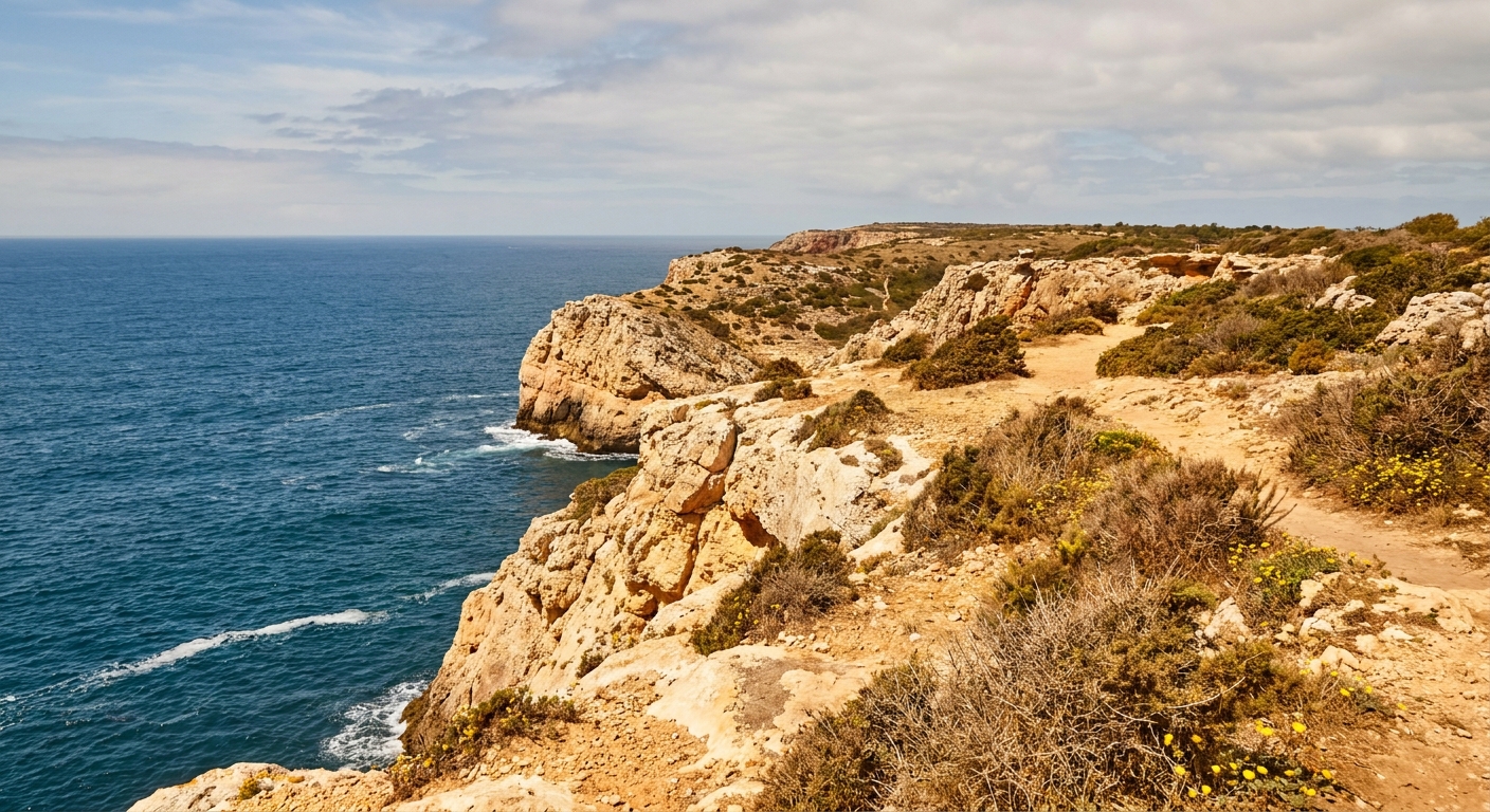
April opens the middle of the day. With 13 hours 13 minutes of light and afternoons at 66.4°F, the clifftop between the village and the cape is walkable at noon in a shirt, and the long-distance coastal path that runs north from here is in its walking season rather than its enduring season. Come back in high summer and the same two hours are a heat management exercise.
Fortaleza de Sagres takes up the flat promontory at the end of the village, with its own clifftop circuit inside the walls. We could not verify its April admission price or opening hours, so we quote neither: check before you drive out. Cabo de São Vicente and its lighthouse close the southwest corner of the mainland, a short run further west on the cliff road. The beaches sort themselves by compass: Mareta below the village facing south, Tonel under the fortress facing west, Beliche tucked into the cliff between the two, Martinhal east of the harbor at Baleeira.
What April changes at those places happens in the air, not the water. The sea reads 60.2°F in March, 61.8°F in April, 62.2°F in May, barely noticing the season. The afternoons move properly, from 64.0°F in March to 70.7°F in May. So April alters how long you can sit on the sand at Martinhal in a windbreaker, and almost nothing about what the Atlantic does to your ankles at Beliche.
We verified no free-admission day at any Sagres site for April, so we promise none. The walking costs nothing in any month, and in April it is the better half of the trip: the cliff circuit, the headland at the cape, and the four beaches end to end.
Sagres in April: a two-day itinerary
Day one runs against a 06:59 sunrise and a 20:12 sunset, so there is no need to be heroic early. Out by nine to the fortress promontory, an hour on the clifftop circuit inside the walls, then down to Mareta for lunch on the sheltered side. Give the flat middle of the afternoon to Tonel, where the west swell lands and the surf schools set up in rubber. Leave for Cabo de São Vicente around seven, stay for the sun going down at 20:12, and eat in the village afterward.
Day two goes north along the coast road to the beaches below the cliffs, with the fishing harbor at Baleeira as the lunch stop. If the day arrives wet, and one April day in five does, drive east instead: Lagos gives you a covered market and an old town you can walk between showers, and the cliffs at Ponta da Piedade photograph as well under gray as under blue. Keep the cape for whichever of the two evenings looks clearer.
Sagres in April vs March and May
| Measure | March | April | May |
|---|---|---|---|
| Average high | 64.0°F | 66.4°F | 70.7°F |
| Average low | 51.1°F | 53.6°F | 57.0°F |
| Precipitation | 1.92 in | 1.37 in | 0.87 in |
| Days with 1 mm (0.04 in) or more | 6.3 | 5.7 | 3.9 |
| Sea surface, daily maxima | 60.2°F | 61.8°F | 62.2°F |
Line the three up and the shape is clear. March runs 64.0/51.1 with 1.92 inches over 6.3 wet days and a sea at 60.2°F. April warms to 66.4/53.6, cuts the rain to 1.37 inches over 5.7 days, and lifts the water to 61.8°F. May takes the biggest step on land, 70.7/57.0 with 0.87 inch over 3.9 days, while the sea crawls to 62.2°F. All five rows come from the same IPMA station and the same marine series, with no estimates among them.
Shift four weeks forward and you buy 4.3°F of afternoon and 1.8 fewer wet days. The water thanks you by 0.4°F, which is nothing you can feel. Shift four weeks back to March and you give up 2.4°F of afternoon and take on half an inch more rain plus 0.6 of an extra wet day, for a coast that is quieter still. The full twelve-month picture sits in our best time to visit Portugal guide.
Is April a good time to visit Sagres?
Yes for walkers, drivers, photographers and surfers who own or rent a wetsuit: 66.4°F afternoons, 5.7 wet days and light until 20:12 make a generous week on a headland that can be brutal in August. No for a family whose idea of a holiday is swimming. A 61.8°F sea and a 53.6°F night will produce short, loud dips and a lot of towels.
If swimming is the point, May is the obvious shift, though it adds 4.3°F to the air and only 0.4°F to the water. A genuinely swim-first trip belongs later in the year than either month, and the comparison across all twelve sits on our best-time page rather than here. For a trip built on coastline and driving, May’s 3.9 wet days against April’s 5.7 are the honest reason to move.
What April holds alone is the combination: warm enough for the cliff in one layer at noon, cool enough to walk it for three hours, and 13 hours 13 minutes of daylight to spend on both.
The last word
Book the car, keep the room refundable, and put Cabo de São Vicente at the end of a day rather than the start of one. Keep April’s rain in proportion while you pack: 1.37 inches spread over 5.7 wet days works out near a quarter inch on a day that rains at all, which closes a beach hour and not a holiday. Bring the windproof shell anyway. That thermometer stands 22.9 m above the Atlantic with nothing upwind of it, and averages never record the wind.
Sources & data for this guide
- April highs, lows, precipitation and rain-day counts · IPMA, climate normals 1991-2020, station 533 Sagres, altitude 22.9 m · checked Sep 23, 2026
- Rain-day thresholds (1 mm / 0.04 in and 10 mm / 0.39 in) are IPMA’s own and do not match the 0.10-inch threshold used in US tables · checked Sep 23, 2026
- March and May normals, same station and same 1991-2020 period · IPMA · checked Sep 23, 2026
- Sea surface 61.8°F, mean of daily maxima 2015-2024 · Open-Meteo Marine API · checked Sep 23, 2026
- Daylight 13h 13m, sunrise 05:59 UTC and sunset 19:12 UTC on April 15, converted to Europe/Lisbon · sunrise-sunset.org · checked Sep 23, 2026
- We found no occupancy series and no monthly room-rate series for Sagres, and we could not verify a tourist tax for Vila do Bispo or the admission and hours at Fortaleza de Sagres, so no figure for any of them appears above · confirm with operators when you book