
A weather map with a white spiral drifting toward the islands is usually when this question comes up, often while a trip is already half planned. The Japan National Tourism Organization names August and September as the months when typhoons can disrupt travel. Okinawa sees the most storms, the main islands see far fewer, and the Japan Meteorological Agency’s warnings are what shape a day on the ground.
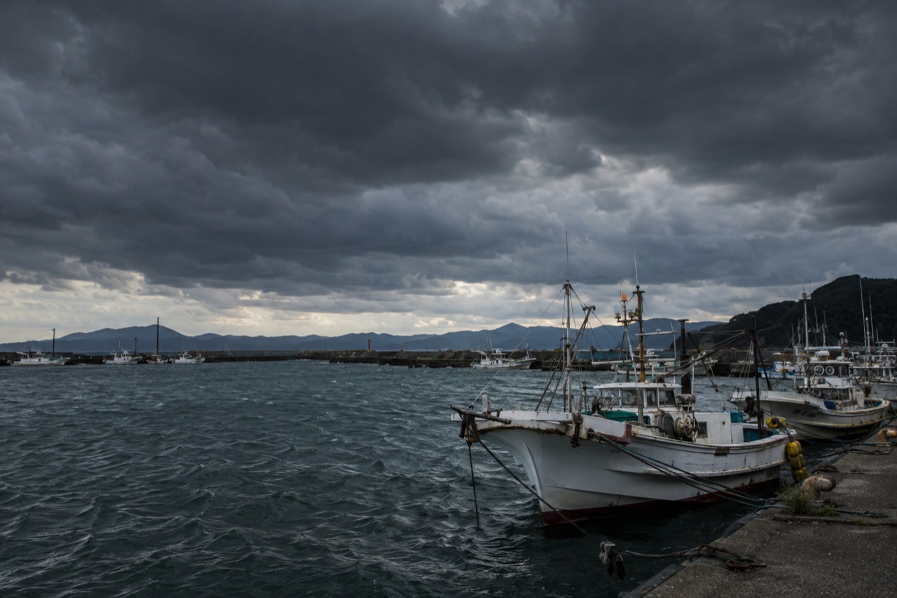
When is typhoon season in Japan?
Typhoon season in Japan is centered on late summer, and the Japan National Tourism Organization singles out August and September as the months when a storm can upset travel plans. That is the stretch after the rainy season, which arrives between May and June as summer approaches. The two are different weather: the rainy season is a long, damp spell, while a typhoon is a single storm with a name, a track and a forecast cone.
For a traveler, the practical meaning is that a trip in late summer carries a chance of a day or two rearranged around weather, while a trip at another time of year may not. The cherry blossoms, which move from south to north between March and May, and the autumn colors, which spread from Hokkaido southward between late September and early December, belong to calmer chapters of the calendar. Late September is where the two seasons overlap.
What a typhoon season means for a trip
A typhoon approaches over several days, and the forecasts track it closely, so an itinerary is more likely to bend than to break. The storms that cause trouble are the ones that line up with your route, your flight or your ferry.
Japan is long, stretching from Hokkaido in the north to the subtropical islands of Okinawa. A storm that closes the south can leave a northern city in ordinary autumn weather. That is why the useful question is rarely whether it is typhoon season and more often where the storm is heading and which part of your trip it touches.
Storms with names in the country’s memory
Japan remembers its worst storms by name. Typhoon Vera, known in Japan as the Isewan Typhoon, struck the Tokai region in September 1959, with about 5,000 casualties, and it remains the most destructive on record. The Muroto Typhoon, which came ashore on September 21, 1934, was the strongest to strike mainland Japan by barometric pressure.
More recent storms are told in the same way. Typhoon Hagibis was the costliest to affect the country, and the Japan Meteorological Agency gave it the special name Reiwa 1 East Japan Typhoon. Typhoon Faxai became the Reiwa 1 Boso Peninsula Typhoon. The agency assigns such names only to storms that caused significant damage in Japan, so a name on the news means a storm the country takes seriously.
How much safer the storms have become
Until the 1960s, a single typhoon often killed hundreds of people. Better construction, flood prevention, high tide detection and early warnings have since cut the toll substantially, and it now rarely exceeds a dozen people per typhoon. The country also keeps special search and rescue units to reach people in distress during storms.
A storm can still be deadly. Typhoon Shanshan hit Kyushu on August 29, 2024, and caused 8 deaths and damages of at least US$6 billion. So the season is taken seriously by the people who live through it, and a visitor can take the same posture: watch the forecast, follow the warnings and let the plan flex.
Which regions are most affected?
Okinawa is the most vulnerable region, because of where it sits, while the four main islands of Kyushu, Shikoku, Honshu and Hokkaido receive far fewer storms.
| Area | Average typhoons per year |
|---|---|
| Okinawa | 7 |
| Kyushu, Shikoku, Honshu and Hokkaido | 2.6 |
Okinawa and the southern islands
Okinawa is the subtropical end of the country, close to Taiwan and the island of Yonaguni, and typhoons reach it more often than anywhere else in Japan.
Farther out in the Pacific lies the Ogasawara Archipelago, a UNESCO World Heritage site far south of Tokyo. It is a different kind of destination, reached across open ocean, and a storm over that water is a reminder of how far from the mainland such islands sit.
Kyushu, Shikoku and the Pacific side of Honshu
The main islands average fewer storms, but the ones that arrive can be severe. Kyushu took Typhoon Shanshan in late August. The Tokai region, around Ise Bay, suffered the worst typhoon in the record, and the Boso Peninsula, east of Tokyo’s bay, gave its name to Typhoon Faxai. Those names show that the Pacific-facing parts of Honshu have been struck hard.
The same coastlines draw travelers for other reasons. These are places where sea conditions are part of the experience, so a storm out in the Pacific is worth watching even when it never reaches land.
Mountains, cities and the north
Dense forest and mountains cover most of Japan, and the Japan Alps run across the center of Honshu. Heavy rain on steep terrain is what the warning system calls landslide risk, which is one of the four phenomena for which the agency issues alert levels. A storm does not need to come ashore to bring that rain to a mountain valley.
Hokkaido, the northernmost island, is one of the four main islands in the average of 2.6 storms a year, so the north is not outside the picture. Where a given storm goes is a matter for that week’s forecast, and the cities of Tokyo, Kyoto and Osaka are as affected by it as any rural town if a track points their way.
What should travelers do?
Travelers should follow the Japan Meteorological Agency’s warnings, which come in five alert levels, and treat an Urgent Warning as the point by which evacuation must be finished.
| Alert Level | What it means |
|---|---|
| Level 3 | Elderly people, those with disabilities and others who need more time begin to evacuate |
| Level 4 (Urgent Warning) | Catastrophe is highly likely and all residents should evacuate from dangerous areas |
Reading the alert levels
For heavy rain, floods, landslides and storm surge, the agency issues warnings and advisories matched to five alert levels. Evacuation should be finished while an Urgent Warning is in force at the latest, so waiting for it to appear is leaving things late.
Ordinary warnings and advisories continue in their usual form. The agency stresses that people who need more time to leave should not wait for the higher level, and a traveler with a child, a stroller or a heavy bag can reasonably count among them when deciding when to move.
The Emergency Warning
Above the alert levels sits the Emergency Warning, a system the agency launched on 30 August 2013. It exists to alert people to a significant likelihood of catastrophe from natural phenomena of extraordinary magnitude, such as the storms and tsunami that Japan remembers. When one is issued for an area, it signals a risk seen only once every few decades.
The instruction is plain: residents should take all measures possible to protect themselves. Earthquake Early Warnings that predict strong tremors are also issued in the Emergency Warning class. The same system, then, speaks to storms, quakes and tsunami alike.
When the danger is the sea or a volcano
Japan sits on the Pacific Ring of Fire and has more than 100 active volcanoes. For a tsunami, the agency’s guidance is to evacuate immediately to a safer place such as high ground or a tall building designated as an evacuation center. For volcanic activity, it is to evacuate or prepare to evacuate from alert areas.
For a traveler, these are worth knowing as one family of warnings. The Japan National Tourism Organization keeps a Japan Safe Travel Information page with safety tips and government information for visitors, and it is the place the agency’s own advice is gathered for people from abroad.
Good to know before you go
Typhoons are one weather story among several in Japan, alongside the rainy season that begins between May and June and the blossoms and leaves that follow the calendar from south to north and back. A late summer trip is simply one that keeps an eye on the forecast. The Japan Safe Travel Information page from the national tourism organization also carries a notice about power banks on flights, which is useful if a storm leaves you charging a phone at an airport.
Sources
- Japan Meteorological Agency, Emergency Warnings (https://www.jma.go.jp/jma/en/Emergency_Warning/ew_index.html), checked October 11, 2026
- Japan National Tourism Organization, safety information (https://www.japan.travel/en/japan-safe-travel-information/), checked October 11, 2026
- Japan National Tourism Organization, weather and seasons in Japan (https://www.japan.travel/en/plan/weather/), checked October 11, 2026
- Wikipedia, Typhoons in Japan (https://en.wikipedia.org/wiki/Typhoons_in_Japan), checked October 11, 2026
To plan your stay
- Autumn Leaves Dates by City: Usual Maple Dates, 2025 Results and How Much They Shift
- Japan Autumn Leaves Forecast: Maple Dates by City, Sources and Reliability
- Autumn Leaves in Hakone: Sengokuhara Susuki Grass, Lake Ashi and Getting Around
- Autumn Leaves in Hiroshima: Color Dates, Peace Park, Miyajima and Rail Access