
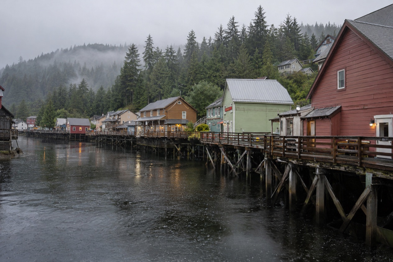
You step off the gangway into damp, cool air that smells of spruce and salt, with forested mountainsides rising almost straight from the waterfront. Ketchikan sits on an island in Southeast Alaska, shaped by Tlingit history, salmon and timber, and nothing here is arranged around sunshine. A few things are worth knowing before you arrive: where the ships tie up, how much it rains, and how Alaskans like to be treated as guests.
What should you know before visiting Ketchikan?
Four things matter most: the rain, the dock your ship uses, the layers you wear, and the fact that bears live in this part of Alaska. Ketchikan is an island community surrounded by rainforest and sea, and everything about the town follows from that setting, from its fishing past to the way people dress for a walk to the store.
Rain is the first surprise. Southeast Alaska is among the wettest parts of the state, and some areas of it receive as much as 275 inches of precipitation in a year.
Ketchikan itself sees rain or melted snow on many days of the year, so a hooded waterproof shell is as ordinary here as sunglasses are elsewhere. Locals tend to carry on with their plans in a drizzle, and visitors who do the same usually have the better day.
The second surprise is how much history sits within a few blocks. Ketchikan began as a seasonal Tlingit fish camp and later became a border town that drew pioneers from the late 1800s on.
Commercial fishing, canneries, logging and maritime trades built the place, and it earned the nickname Canned Salmon Capital of the World. The Tongass Historical Museum tells that story through exhibits on the town’s people, businesses and events, and Totem Bight State Historical Park is a place to see Alaska Native culture in carved form.
The third surprise is geography. Cruise ships dock at one of two main areas, downtown Ketchikan or Ward Cove, so where you step ashore changes what is around you. Downtown puts you in the middle of the waterfront streets, while Ward Cove sits well outside the center. Knowing which one your ship uses saves a confused first hour.
Fees, passes and reservations
The sources for Ketchikan give no entry fees, park passes or reservation rules, so there are no amounts to list here. What they do establish is that Totem Bight State Historical Park and the Tongass Historical Museum are places to visit in and around town, and that the Ketchikan Visitors Bureau runs visitktn.com, where the cruise ship calendar and the maps of the area are published.
Before you go, settle which of those places you want to see and treat the visitors bureau website as your starting point for the ship schedule. The bureau offers maps of Alaska, Southeast Alaska, Revillagigedo Island, the city of Ketchikan and downtown Ketchikan, which helps when you want to see where a pier sits relative to the museum and the waterfront before you arrive.
A good plan is simple. Pick the one or two sights that matter most to you, look at the downtown map to see how they relate to your dock, and leave the rest of the day open for wandering. In a town this tied to the water and the weather, a loose schedule fits better than a tight one, and the best moments are often the ones that were not on the list.
Money, phones and getting online
Ketchikan is in the United States, so you are spending dollars and using your usual American phone plan, with no currency to exchange and no new rules to learn. The sources for the town say nothing more specific about cards, cash machines or cell coverage on the island, so there is little to prepare beyond what you already do at home.
One practical point concerns time. Ketchikan keeps Alaska time, which is nine hours behind Coordinated Universal Time in winter and eight hours behind during daylight saving time. Clocks change on the second Sunday in March and go back on the first Sunday in November. If you are coming from the Lower 48, your phone should update on its own, but it is worth remembering when you set an alarm for a morning departure.
For the road system, Alaska 511 is the state’s traveler information site. It shows road conditions in categories running from Good through Difficult and Hazardous to Road Closure, and it publishes incidents reported through Waze. On the map you can save a camera to My Cameras by clicking its icon and then the My Cameras button.
Getting around and staying connected
How you get around depends first on where your ship ties up. Downtown Ketchikan has five possible docking spots, Piers 1 through 4 and Doyon Landing, which typically takes smaller overnight ships. Ward Cove has a single pier that can be used on both sides, and it lies about 5.5 miles from downtown.
That distance is the main thing to keep in mind. A ship at one of the downtown piers puts you at the edge of the town you came to see, while a ship at Ward Cove leaves you some miles out.
The sources do not describe taxis, ride-hailing, buses or rental cars, so there is nothing to promise about them. The useful step is simply to find out which berth your ship has been given and plan your first hour around it.
The maps published by the visitors bureau are handy here. Besides the downtown and city maps, they include a Revillagigedo Island map, which shows the larger island on which Ketchikan sits. Looking at it before you arrive gives you a sense of how compact the town is compared with the forest around it, and how little of the island the road network reaches.
Weather, daylight and wildlife
Ketchikan is damp in every season, and the airport figures show how the year unfolds. Layers are the answer in all of them.
| Month | Average high (°F) | Average low (°F) | Precipitation (inches) | Days with precipitation |
|---|---|---|---|---|
| January | 39.7 | 31.5 | 16.17 | 17.1 |
| April | 49.8 | 37.2 | 10.25 | 14.2 |
| July | 64.5 | 53.2 | 7.33 | 10.8 |
| October | 51.1 | 41.3 | 18.37 | 18.7 |
In words, January is cold and wet, April is cool with rain on most days, July is the mildest and driest of the four, and October is the wettest, with rain or melted snow on nearly two days out of three. Statewide advice for spring through early fall puts temperatures from 50 to 70 degrees, with possible rain and wind. The recommendation is to dress in layers, carry a backpack so you can shed or add clothing as the weather shifts, and wear a fully waterproof, breathable outer shell with a hood.
Wildlife is a real part of the landscape. Black bears, brown bears and polar bears all flourish in Alaska, though polar bears are not part of Southeast. The rule from the Alaska Department of Fish and Game is that people in Alaska must keep all human sources of food secure from bears. A dangerous bear situation should be reported to the department using its wildlife encounter form.
Local customs and etiquette
Alaskans tend to dress for the weather and not for the occasion, so a rain jacket, sturdy shoes and a fleece are perfectly acceptable almost anywhere, from a restaurant to a museum. Nobody expects polish, and a visitor in practical clothes fits in better than one trying to look smart in the drizzle.
The pace is unhurried. People chat at counters, stop to talk on the boardwalks and are often glad to say what the town was like when the canneries ran. A little patience and a willingness to ask questions go a long way, and it helps to remember that for many residents fishing, logging and the water are a livelihood and a family history, not a backdrop.
Respect for Alaska Native culture is part of being a good guest. Ketchikan began as a Tlingit fish camp, and totem poles, carving and the stories attached to them belong to living communities. Visitors usually treat the poles and the grounds around them quietly, as they would any place of cultural meaning, and read what is written about them before taking photographs.
Toward wildlife, the habit is distance and tidiness. Locals keep food and garbage out of reach of bears and expect visitors to do the same. Animals are watched, never fed or lured closer for a picture.
Good to know before you go
The sources give no seasonal closures for Ketchikan, and no documents or receipts are required for a visit within the United States. What they do give is the calendar of cruise ships, published by the Ketchikan Visitors Bureau, which tells you which days the town is busy with arrivals. Pack a waterproof hooded shell, keep a layer in your bag, and look at the downtown map the night before so you know where your pier sits when you walk off the ship.
Sources
- Visit Ketchikan (https://www.visit-ketchikan.com/), checked October 11, 2026
- Wikipedia, Climate of Alaska (https://en.wikipedia.org/wiki/Climate_of_Alaska), checked October 11, 2026
- Alaska 511 (https://511.alaska.gov/), checked October 11, 2026
- Alaska Department of Fish and Game, Living with bears (https://www.adfg.alaska.gov/index.cfm?adfg=livingwithbears.main), checked October 11, 2026
- Alaska.org, what to wear (https://www.alaska.org/advice/what-to-wear-in-alaska), checked October 11, 2026
- Wikipedia, Alaska Time Zone (https://en.wikipedia.org/wiki/Alaska_Time_Zone), checked October 11, 2026
- NOAA NCEI, U.S. Climate Normals 1991-2020, monthly (https://www.ncei.noaa.gov/access/services/data/v1?dataset=normals-monthly-1991-2020&stations=USW00025325), station Ketchikan Intl Ap, elevation 76 feet, checked October 11, 2026
To plan your stay
- Best Time to Visit Ketchikan: Weather by Month, Long Summer Days, Totem Parks and Quiet Seasons
- Things to Do in Ketchikan: Totem Poles, Creek Street, Misty Fjords and Fresh Seafood
- Where to Stay in Ketchikan: Downtown, Ward Cove and How to Choose Your Base
- Ketchikan from Seattle: Ferry from Bellingham, Flights, Cruise Docks and What to Do on Arrival