
Leaving Juneau early means watching the mountains slide past while the water of the Lynn Canal turns from pewter to silver. At the far end sits Haines, a small port town with a harbor, a fair-sized reputation for eagles and a pace that feels a long way from the capital. Travelers coming from Juneau reach it by water or by the long road through Canada, and each way suits a different kind of trip.
How do you get to Haines from Juneau?
From Juneau, you reach Haines by water, on the Alaska Marine Highway ferries that serve most communities in Southeast Alaska, because the only road into Haines from the rest of the continent runs through Canada. That one fact shapes the whole journey. Juneau and Haines both sit on the Lynn Canal side of the Inside Passage, the state’s longest fjord, but there is no direct road tying them together, so the route you choose is really a choice between a boat day and a very different overland trip.
What decides it is the kind of trip you are building. If Haines is a stop in a Southeast Alaska loop, with Juneau, Skagway or Sitka on either side, the ferry is the thread that ties the towns together.
It lets you watch the coast instead of driving past it, and the Alaska Marine Highway describes most Southeast communities as receiving year-round service, with mainline vessels for larger towns and day boats for smaller ones. If you are coming from the Yukon or the Alaska Highway side, the Haines Highway is the way in, and it becomes part of the adventure itself.
Season matters too, and this is a good moment to think about it. October is when the bald eagles begin to gather along the Chilkat River, and the eagle season runs to February.
Whichever way you travel, look up the sailing schedule for your exact dates before you commit, because the departures that suit a summer visit are not always the ones that suit a visit in the eagle months.
One more thing that decides it is how much you are carrying. Walk-on passengers on the ferry have a baggage allowance for hand-carried items, and pets travel under their own rules. A traveler with a light pack and a flexible schedule has an easy time of it. Someone with a vehicle, a dog or a lot of gear has more to think through, and the details below explain what the ferry system asks.
Ways to get to Haines from Juneau
By Alaska Marine Highway ferry
The ferry is the natural way to make the trip. The Alaska Marine Highway System runs through Southeast Alaska on a network that stretches along thousands of miles of coastline, and Juneau is one of its regional hubs, with Ketchikan, Whittier and Homer. From a hub, riders reach smaller communities using one or more vessels, so a trip to Haines is built from a sailing found in the schedule rather than from a fixed daily departure.
To plan it, the system offers a Sailing Calendar that shows ferry schedules month by month and can be sorted by month, port or vessel. Clicking an entry opens the full schedule in a pop-up.
If the calendar does not give you what you need, the Sailing Search tool lets you enter a port and a travel date. On the schedules, arrivals appear in plain text and departures in bold, which is worth knowing before you misread a line and miss your boat.
Passengers without vehicles check in two hours before departure in Juneau. Walk-ons may bring up to 100 pounds of hand-carried baggage. Animals stay on the car deck, in an approved carrier or in a vehicle with an adult passenger. The ferry suits travelers who like the water, who have a flexible day and who want the trip itself, with the fjord walls and the changing light, to be part of the memory.
By road through Canada
The road is a different story, and not a commute from Juneau. The only road access to Haines from the remainder of the continent is the Haines Highway, also called Highway 3, which comes in from Haines Junction in the Yukon.
From Haines, it travels northwest to the Canadian border and onward to a junction with the Alaska Highway. The highway passes through British Columbia on its way, so a drive in or out means crossing an international border.
The highway follows the line of the old Dalton Trail, the route that carried travelers from the port of Haines into the interior. It is a road with history under the tires, and it passes through the country of the Chilkat Tlingit, whose territory ran along the Chilkat River and who controlled one of the mountain passes into the Yukon. The scenery rewards the effort, but this is a trip for people who want a road journey as a goal, with a vehicle already in hand.
For road conditions along the way, Alaska 511 publishes categories from Good and Fair up to Difficult, Very Difficult, Hazardous and Road Closure, along with incidents reported through its Waze partnership. Looking at it before you set out on the Alaska side of the highway is simply sensible in the months when weather turns.
Options compared
| Option | Best for | What to know |
|---|---|---|
| Alaska Marine Highway ferry | Travelers linking Juneau with other Southeast towns and wanting the fjord views | Check in two hours before departure in Juneau without a vehicle, look up the sailing by date, up to 100 pounds of hand-carried baggage for walk-ons |
| Haines Highway through Canada | Travelers arriving from the Yukon or the Alaska Highway with their own vehicle | The only road in from the rest of the continent, passes through British Columbia, follows the old Dalton Trail |
The comparison is less about speed than about what the trip is for. The ferry is the way a Juneau traveler arrives, and it keeps the whole journey in Alaska, on the water, along a coast that the system covers with its own network of hubs and day boats. The road belongs to a bigger itinerary, one that pulls Haines into the Yukon and the Alaska Highway and that suits people who want to cross a border and see the interior on the way.
For most readers starting in Juneau, the ferry is the answer that fits the geography, and the road is the answer to a different question. If your plans include a rental or your own vehicle on a longer loop, the highway deserves a look. If you are traveling light, with a day pack and a few nights in town, the ferry’s rules about check-in, baggage and animals are simple enough to plan around, and the sailing tools tell you what is running on your dates.
Making a day of it
A day built around the journey starts with the schedule. Look up your sailing first, then work backward: the check-in time in Juneau sets the hour you leave your lodging, and the arrival in Haines sets what you can do that same afternoon. In the fall, the light fades earlier than in summer, so plan on arriving with enough daylight to walk the waterfront and get your bearings rather than counting on a full evening outdoors.
The best reason to come this time of year is the eagles. From October to February, more than 3,500 bald eagles visit the Haines area, and the Alaska Chilkat Bald Eagle Preserve, a state park and wildlife refuge, protects a large stretch of the Chilkat River where they gather.
The preserve covers a wide area, mainly along the Chilkat River, with sections along the Klehini and Tsirku rivers. A few hundred eagles live there year-round, so you may see them in any season, but the autumn gathering is the draw. Treat sightings as a chance rather than a promise, and bring binoculars if you have them.
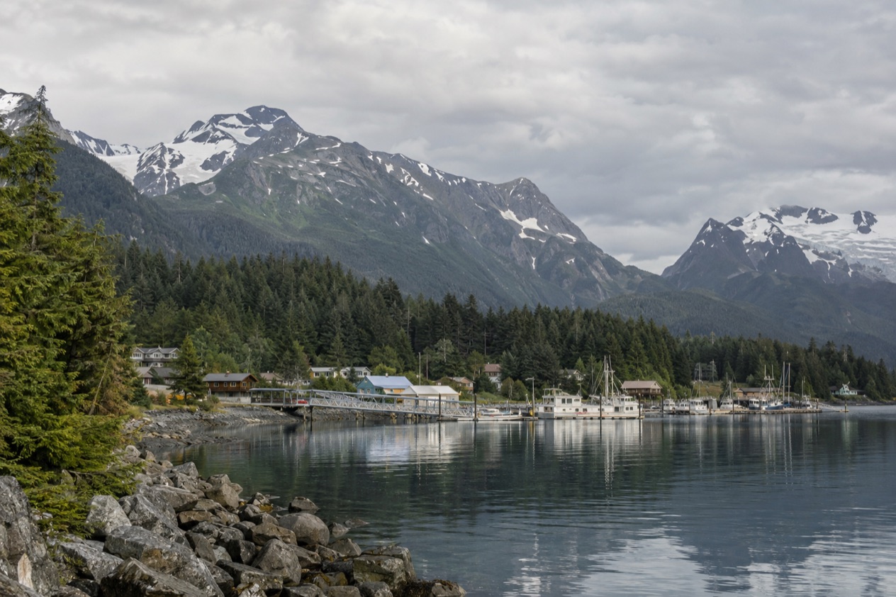
In town, give yourself time to be unhurried. Walk the harbor, look at the boats, and take in the way the mountains close in around the water. Haines is a small port community, and its scale is the point. The Chilkat and Chilkoot Tlingit have long histories in this valley, and the culture is part of what you see around you in names, art and local stories. Come curious and let the day be loose.
If you plan to stay a night or two, the eagle season gives you a reason to linger. Early mornings along the river are different from afternoons, and a second day lets you go back to the same spot at a different hour.
Bring layers for the damp, a hat and gloves for the cold off the water, and sturdy shoes for riverbank paths. If the weather turns gray, the town’s cafés and galleries make a reasonable shelter, and a rainy day suits the mood of the place as much as a clear one.
Summer has its own rhythm. The Southeast Alaska State Fair fills the town with four days of festivities on the last weekend of July, and many tourists come through in the warm months. A fall trip trades that bustle for open river banks and a calmer waterfront. That is the Haines this time of year offers, and it is worth planning the day around.
Good to know before you go
Before you leave Juneau, look up the sailing for your dates with the Sailing Calendar or Sailing Search, and keep in mind that the schedule changes between seasons. If your route takes you onto the Haines Highway, look at Alaska 511 for road conditions and closures, and expect the weather to shape your timing in the colder months.
Sources
- Wikivoyage, Haines (https://en.wikivoyage.org/wiki/Haines), checked October 11, 2026
- Wikipedia, Haines, Alaska (https://en.wikipedia.org/wiki/Haines,_Alaska), checked October 11, 2026
- Wikipedia, Haines Highway (https://en.wikipedia.org/wiki/Haines_Highway), checked October 11, 2026
- Wikipedia, Chilkat Bald Eagle Preserve (https://en.wikipedia.org/wiki/Chilkat_Bald_Eagle_Preserve), checked October 11, 2026
- Wikipedia, Southeast Alaska (https://en.wikipedia.org/wiki/Southeast_Alaska), checked October 11, 2026
- Wikipedia, Tlingit (https://en.wikipedia.org/wiki/Tlingit), checked October 11, 2026
- Alaska Railroad, Our trains (https://www.alaskarailroad.com/ride-a-train/our-trains), checked October 11, 2026
- Alaska Department of Transportation, Alaska Marine Highway System, Alaska Marine Highway System (https://dot.alaska.gov/amhs/index.shtml), checked October 11, 2026
- Alaska 511 (https://511.alaska.gov/), checked October 11, 2026
- Alaska Department of Transportation, Alaska Marine Highway System, Route guide (https://dot.alaska.gov/amhs/route.shtml), checked October 11, 2026
- Alaska Department of Transportation, Alaska Marine Highway System, Schedules (https://dot.alaska.gov/amhs/schedules.shtml), checked October 11, 2026