
On a cold November morning, the gravel bars of the Chilkat River fill with bald eagles, hundreds of them perched in the cottonwoods and calling back and forth over the water. Behind them the mountains rise straight out of the Lynn Canal, and the little town of Haines goes about its business as if this were perfectly ordinary. It is a quiet, outdoorsy corner of Southeast Alaska, made for travelers who like wildlife, history and a slow pace.
Where is Haines and what is it like?
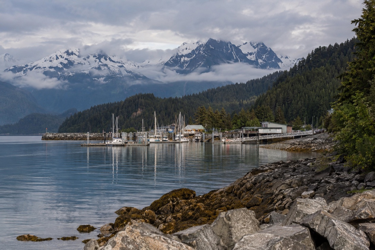
Haines is a small port community in Southeast Alaska, set on the shores of the Lynn Canal, the state’s longest fjord. It sits in a region of 35,138 square miles whose largest cities are Juneau, Sitka and Ketchikan, and it feels much more like a village than any of them. Mountains close in on the water, the streets are short, and the pace is set by the weather and the tides.
What makes Haines unusual is that it is tied to the rest of the continent by a road. The Haines Highway runs from town to Haines Junction in the Yukon, so travelers can arrive by wheel as well as by air. That link gives the town a crossroads quality, with a few people passing through on long northern drives and others staying for the eagles.
The land has a long human story. This is Tlingit country, and the Chilkat Tlingit have lived along the Chilkat River and on the Chilkat Peninsula for generations. The Coastal Tlingit controlled one of the mountain passes into the Yukon interior, which is part of why the route out of Haines matters as much as it does today.
It may not suit those who want a long list of nightlife, big shops or a crowded waterfront. The character here is low-key, and that is the point.
What is there to do in Haines?
The big reasons to come are the eagles, the history of Fort Seward, the Haines Highway itself and the Southeast Alaska State Fair. Each one is tied to a particular stretch of the year, and together they give the town a character quite different from its neighbors, which lean more on cruise ships and shops.
The Chilkat Bald Eagle Preserve
The Alaska Chilkat Bald Eagle Preserve is a state park and wildlife refuge near Haines, covering 49,320 acres, mainly along the Chilkat River, with sections along the Klehini and Tsirku rivers. Between 200 and 400 bald eagles live there year-round, so you may see them in any season.
The great gathering comes later. From October to February, Haines has the largest concentration of bald eagles in the world, and more than 3,500 visit the area. In the Fall Congregation, up to 4,000 have been observed in the preserve. Bring binoculars and a camera with a long lens, and dress for cold, damp riverbank air.
Fort William H. Seward
Fort William H. Seward was declared a National Historic Landmark in 1978, and it stands in Haines today as one of the town’s great pleasures to wander. Some of its structures are open to the public as businesses and restaurants, so a stroll through the old fort grounds can easily turn into a coffee, a meal or a browse through a shop.
It is a good place for people who enjoy architecture and local history without a rigid schedule. You can drift between buildings at your own pace, then walk back into town.
The Haines Highway
The Haines Highway follows the route of the old Dalton Trail from the port of Haines inland for about 110 miles to Klukshu, Yukon, and then continues to Haines Junction. In Alaska it is part of Alaska Route 7, and it runs northwest to the Canadian border. For travelers who like the idea of a road with a long history under it, simply driving a stretch is an outing in itself.
The Southeast Alaska State Fair
Haines hosts the Southeast Alaska State Fair with four days of festivities on the last weekend of July. It is the town’s big communal moment of summer, when locals and visitors share the same grounds, and it is the best reason to plan a stay around a date rather than a season.
How many days do you need in Haines?
A long weekend is enough to get a real taste of Haines, and a few more days let the town sink in. The place is small, so the question is less about ticking off sights and more about how much time you want to spend watching, walking and lingering.
In the eagle season, the river deserves more than a quick look, since the birds come and go and the light changes along the water.
With more time, add a drive along the Haines Highway, letting the road pull you toward the Canadian border and the Yukon. If you are heading on, Haines Junction is the next named stop, and Klukshu lies along the historic Dalton Trail route. Planning around the last weekend of July also lets you add the state fair to the stay.
If you are arriving from Juneau or Skagway by small plane, the short hop means you can slot Haines into a longer Southeast Alaska trip without much fuss. A night or two is a natural pause between larger stops in the region.
Where to stay in Haines
Staying in town is the natural choice, since Haines is a small place and its main sights cluster close together. The town sits on the shores of the Lynn Canal, and a base here puts you near the water, near the shops and cafés, and near Fort Seward, where some historic structures now serve as businesses and restaurants.
Staying near the fort suits travelers who like a historic setting and want to wander on foot. Staying elsewhere in town suits those who want a more everyday feel, close to the waterfront and the rest of the community.
For eagle season, a base near the Chilkat River area puts you close to the preserve, which runs mainly along the Chilkat River. Haines Airport is about 4 miles west of town on the Haines Highway, so anyone who prefers to be near the arrival point can look in that direction. Whatever you choose, the pace is quiet, and the greatest luxury here is simply waking up with mountains and water outside the window.
How do you get to Haines and get around?
You reach Haines by air or by the Haines Highway. The only scheduled commercial flights to Haines Airport are from Juneau and Skagway, and the airport has one air carrier, Alaska Seaplanes. The airport is on the Haines Highway, about 4 miles west of town.
The only road access to Haines from the rest of the continent is the Haines Highway from Haines Junction, Yukon, 155 miles away. The highway runs 39 miles northwest from Haines to the Canadian border and joins the Alaska Highway at Haines Junction, passing through British Columbia on the way. About 45 of its miles lie in Alaska, and the Yukon section is designated Highway 3.
Haines is compact, and the central area with Fort Seward is the kind of place you explore at a walking pace. Beyond that, the highway is the main route out to the preserve and toward the border. No further detail on buses, taxis or ferry schedules is given here, so plan your local movements around the town itself and the highway.
When is the best time to visit Haines?
The best months depend on what you came for. For eagles, come from October to February, when the annual gathering in the Chilkat Bald Eagle Preserve makes Haines the place with the largest concentration of bald eagles in the world. This is a cold, quiet stretch of the year, and the show is on the river.
For a summer visit, July is the month to know. Afternoons reach the mid-60s and nights stay in the low 50s, with rain on about five days, mostly light. The last weekend of July brings the Southeast Alaska State Fair, four days of festivities, so it is also the liveliest moment in town. Many tourists visit Haines in summer.
January is the other end of the scale. Highs hover around 30 degrees and lows in the high teens, with precipitation on about ten days, so expect cold, wet and wintry conditions. That is still eagle season, and for visitors who bundle up it is a rewarding time, though it asks for warm layers and patience with the weather.
Good to know before you go
Haines is a small town, so plan to bring what you need for the season. Winter eagle watching means cold, damp days beside the river, while a July visit is milder but still has a few rainy days. The Haines Highway is the only road out of town to the rest of the continent, and it crosses into Canada, so anyone driving on it should treat it as an international trip.
Sources
- Wikivoyage, Haines (https://en.wikivoyage.org/wiki/Haines), checked October 11, 2026
- Wikipedia, Haines, Alaska (https://en.wikipedia.org/wiki/Haines,_Alaska), checked October 11, 2026
- Wikipedia, Haines Highway (https://en.wikipedia.org/wiki/Haines_Highway), checked October 11, 2026
- Wikipedia, Chilkat Bald Eagle Preserve (https://en.wikipedia.org/wiki/Chilkat_Bald_Eagle_Preserve), checked October 11, 2026
- Wikipedia, Southeast Alaska (https://en.wikipedia.org/wiki/Southeast_Alaska), checked October 11, 2026
- Wikipedia, Tlingit (https://en.wikipedia.org/wiki/Tlingit), checked October 11, 2026
- Wikipedia, Climate of Alaska (https://en.wikipedia.org/wiki/Climate_of_Alaska), checked October 11, 2026
- NOAA NCEI, U.S. Climate Normals 1991-2020, monthly (https://www.ncei.noaa.gov/access/services/data/v1?dataset=normals-monthly-1991-2020&stations=USW00025323), station Haines Ap, elevation 15 feet, checked October 11, 2026