
Somewhere in a Fairbanks hotel lobby, a traveler unfolds a map and notices that Denali sits at the bottom of it, straight down the main road. The park entrance and the Alaska Range feel close, and the question is how to cover the ground between them. The answer is the George Parks Highway for anyone on wheels, or the Denali Star Train for anyone who would rather watch the country go by.
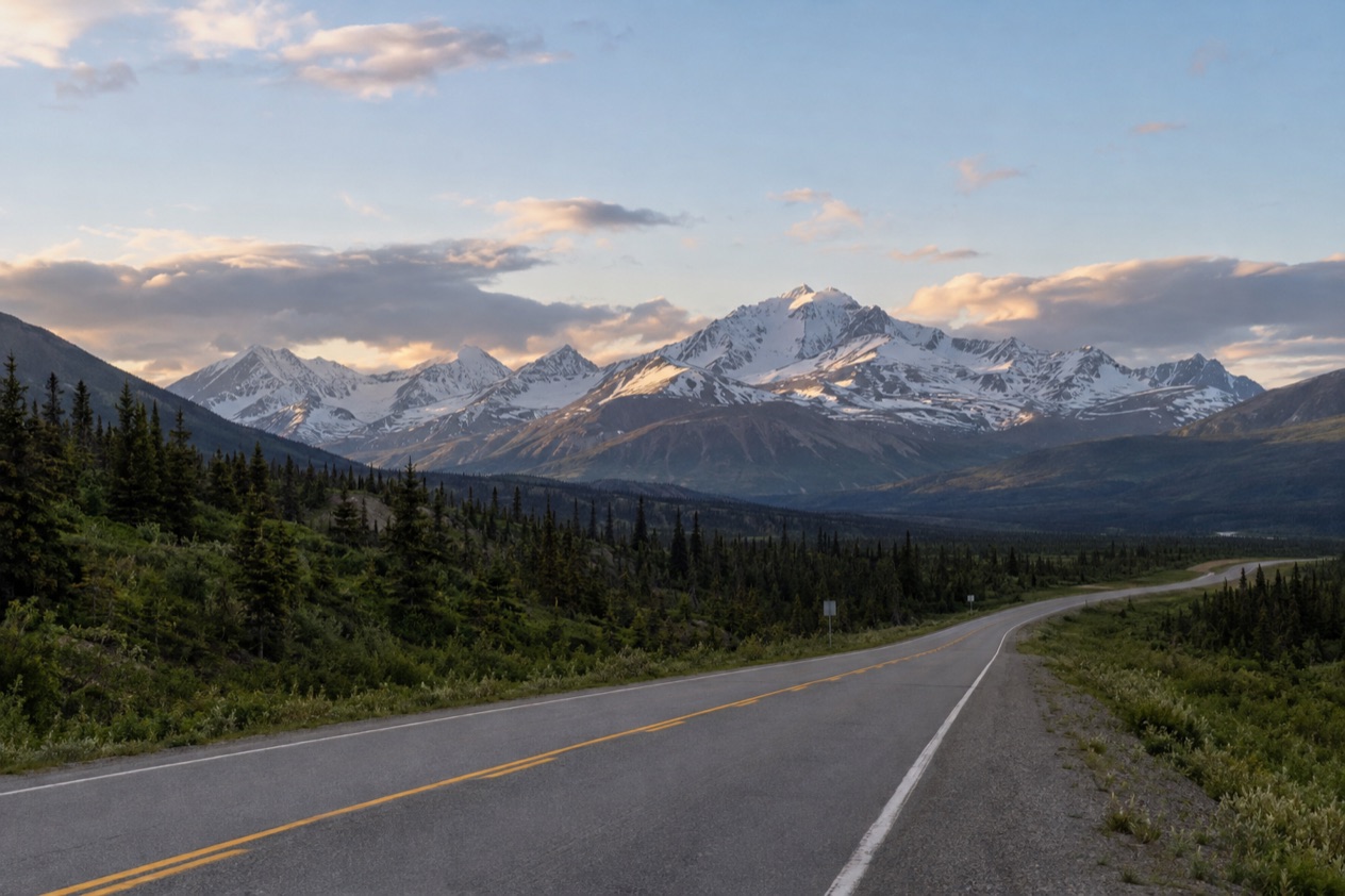
How do you get from Fairbanks to Denali?
You head south on the George Parks Highway, which is the principal access to Denali National Park and Preserve, and the park entrance lies 120 miles from Fairbanks. There is only one road entrance to the park, at Mile 237 on Alaska Highway 3, the same road under another name. Because the highway is numbered and signed as Alaska Route 3, you may see both labels on maps and signs, and they mean the same ribbon of pavement.
The Parks Highway itself runs 323 miles from the Glenn Highway, 35 miles north of Anchorage, to Fairbanks in the Interior. It was completed in 1971 and took its current name in 1975.
Its mileposts begin at Mile 35, continuing the numbering of the Glenn Highway, which is why the park entrance sits at Mile 237 even though it is only part of the way along the route. Leaving Fairbanks, the road begins on the Robert J. Mitchell Expressway, one of two sections built to freeway standards.
Driving the Parks Highway
Driving is the direct way to reach the park entrance, and it lets you decide where to stop and when. The highway also meets the Denali Highway, Alaska Route 8, in Cantwell, a junction you will see on the map if you are looking at the area beyond the park.
Before you set out, Alaska 511 gives road conditions in categories running from Good, Fair, Difficult and Very Difficult to Hazardous, Road Closure and No Winter Maintenance. The Alaska Department of Transportation has also teamed up with Waze so that incidents and closures reported there appear on the Alaska 511 website. It is a handy window on what the road looks like before you leave town.
What waits at the entrance
At the entrance area, the Alaska Railroad depot is a five-minute walk from the Denali Visitor Center, so the train and the visitor center sit close together. Free shuttles serve the entrance area, the sled dog kennels and other stops along the park road up to mile 15. Beyond that point, the Denali Park Road changes character: in summer, private vehicles are restricted past the Savage River crossing at mile 15.
The nearest year-round community is Healy, 12 miles north of the park entrance, which means it lies on your side of the park as you come down from Fairbanks. It is the place the map points to when you wonder where a community of any size sits near the park.
Which options are there?
There are two main ways to make the trip in the material at hand: driving the George Parks Highway, or riding the Denali Star Train on the Alaska Railroad. The train runs the full length of the route between Anchorage and Fairbanks, with Denali National Park as one of its stops, and the highway reaches the same park entrance by road.
The Denali Star Train
The Denali Star covers 356 miles between Anchorage and Fairbanks in 12 hours, with stops in Wasilla, Talkeetna and Denali National Park. The scenery is the reason people choose it. Between Anchorage and Talkeetna, the train crosses the Knik River with the Chugach Mountains in the background, and just south of Talkeetna passengers can see Denali rising above the Susitna River.
Further along, the train crosses Hurricane Gulch on a 296-foot bridge and passes through the roadless Hurricane area. Just south of the park, Broad Pass offers views of the Alaska Range in all directions. North of the park, the line follows Healy Canyon along the Nenana River, which is the stretch that matters most if you are coming from the Fairbanks side.
On a clear day, passengers can see Denali, the tallest mountain in North America, from the train. The words that count are “on a clear day”: the mountain is a chance, not a promise, and it depends on the weather on the day you ride.
Driving or riding: how the two compare
| Option | Route | Distance or time |
|---|---|---|
| George Parks Highway | Fairbanks to the Denali park entrance, Mile 237 | 120 miles |
| Denali Star Train | Anchorage to Fairbanks, with a stop at Denali National Park | 356 miles in 12 hours (full route) |
The two options meet at the same place, the park entrance area, where the depot and the Denali Visitor Center sit a five-minute walk apart. What differs is the experience: behind the wheel you choose your stops along the highway, and on the train you watch the Susitna, Hurricane Gulch and the Nenana River go by from your seat.
What should you know before you travel from Fairbanks to Denali?
Know what the Denali Park Road allows, and check road conditions before you drive. The entrance is only the start of the park, and the rules change a few miles in. In summer, private vehicles are restricted beyond the Savage River crossing at mile 15, so what you can do in your own car stops at that point, while the free shuttles cover the entrance area, the sled dog kennels and the other stops along the road up to mile 15.
Checking the road with Alaska 511
Alaska 511 is the tool for the highway itself. Its condition categories run from Good to Hazardous, and the last two, Road Closure and No Winter Maintenance, tell you when a stretch is not an ordinary drive. Cameras are part of the site: on the map page you can add one to My Cameras by clicking a camera icon and then the My Cameras button in the popup, and on a camera page the My Cameras option sits under the three dots icon below the image.
If you plan to follow the same route more than once, you can create an account and log in to save routes and receive notifications. You must log in to save a route for future viewing. Route notifications arrive by SMS by default on weekdays from 6 AM to 6 PM.
Planning help in Fairbanks
If you want a person rather than a website, Explore Fairbanks can be reached by phone at (907) 456-5774. It offers visitor guide requests, an e-newsletter sign-up and a blog for trip planning, and its transportation pages cover the Fairbanks region as well as Denali Neighbors, Interior Neighbors, Arctic Neighbors and Alaskan Neighbors.
Fairbanks also has trip planning services, including travel agents and trip planners, and air transportation options for travel to and around the area.
Good to know before you go
The entrance is the only road entrance to the park, so every route ends at the same place, and Healy is the nearest year-round community if you need to anchor a plan on a town. Banks and ATMs are among the services in Fairbanks, which makes the city the place to sort out errands before the drive. The road beyond mile 15 is a summer matter for buses and not for private cars, and Alaska 511 is the first place to look when you wonder about the highway behind you.
Sources
- Alaska Railroad, Denali Star (https://www.alaskarailroad.com/ride-a-train/our-trains/denali-star), checked October 11, 2026
- National Park Service, Denali National Park & Preserve, plan your visit: directions (https://www.nps.gov/dena/planyourvisit/directions.htm), checked October 11, 2026
- Wikipedia, George Parks Highway (https://en.wikipedia.org/wiki/George_Parks_Highway), checked October 11, 2026
- Explore Fairbanks, transportation (https://www.explorefairbanks.com/planning-tools/transportation/), checked October 11, 2026
- Alaska 511 (https://511.alaska.gov/), checked October 11, 2026
To plan your stay
- Best Time to Visit Fairbanks: Midnight Sun, Northern Lights, Weather and Festivals
- Things to Do in Fairbanks: Riverboat, Aurora, Chena Hot Springs and Day Trips
- Where to Stay in Fairbanks: Downtown, Birch-Wood Cabins, Chena Hot Springs and Denali Lodges
- Know Before You Go to Fairbanks: Midnight Sun, Aurora Season, Layers and Local Habits