
Standing at the Denali Visitor Center with a map spread out, travelers ask the same thing: how far into the park you can actually go. The park has a single road, and what you can do on it depends on the season, on the weather and on a landslide that has closed it at Mile 43. Private vehicles reach Savage River in summer, buses go farther, and cyclists and walkers have their own rules.
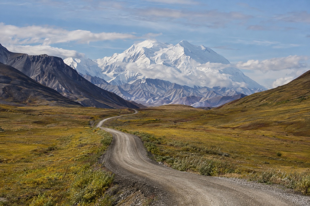
What is the Denali Park Road?
The Denali Park Road is the only road in Denali National Park and Preserve, and it is the way into the park’s interior. It begins where the park entrance meets Highway 3, the George Parks Highway, at Mile 237. Everything you see from a vehicle in the park, from the entrance area to the far edge of the sightseeing route, is seen from this one ribbon of road.
At the moment the road is closed to all traffic at Mile 43 because of the Pretty Rocks landslide. With the completion of the Pretty Rocks bridge, full bus service along the length of the road will resume in 2027. Until then, the trip you can take ends short of the full route, and that shapes any plan you make.
Getting to the entrance
The entrance sits 237 miles north of Anchorage and 120 miles south of Fairbanks, so visitors arrive by the George Parks Highway or by the Alaska Railroad. The train depot is a five-minute walk from the Denali Visitor Center, which makes the center a natural first stop whichever way you come.
The nearest year-round community is Healy, 12 miles north of the entrance. Free shuttles serve the entrance area, the sled dog kennels and other stops along the park road up to Mile 15, so you can move around the busy part of the park without moving your own vehicle each time.
Buses on the road
Most sightseeing in Denali is done by bus, either a narrated tour bus or a non-narrated transit bus. Bus trips run only in summer, from mid-May through mid-September, and all of them are operated by a private company under contract, not by the National Park Service.
The two kinds feel different. Narrated tour buses offer either a snack or a full lunch, and the driver talks you through the landscape.
On the non-narrated transit buses, passengers may get off and climb back on anywhere along the restricted portion of the road, which suits anyone who wants to walk a stretch of tundra and then ride on. Advance reservations are strongly encouraged if you are in the area for less than two full days.
Fees at the entrance
Denali charges an entrance fee. You can pay online or in person when you arrive at the entrance area, by credit card only, with no cash accepted. Keep a park pass or proof of online purchase handy, on your phone or as a printed receipt, in case a ranger asks to see it.
How far can you drive it?
In summer you can drive your own vehicle to the Savage River crossing at Mile 15, and no farther. That window runs roughly from late May through early September. Beyond the Savage River Check Station, visitors must be on a bus, a bicycle or on foot.
Savage River at Mile 15
Savage River is where most private-vehicle trips end, and it is a destination in its own right. The Savage River Loop Trail runs 2 miles alongside the river, a way to stretch your legs and get a first feel for the country the road crosses.
A free bus called the Savage River Shuttle runs from roughly mid-May to mid-September and carries you from the park entrance to the river. It takes about an hour each way, so plan on at least two hours round trip before you walk anywhere. It suits a visit of half a day or less, and it can carry up to two bikes at a time.
Come prepared, because there is no cell service, no water and no food service at Savage River. There is no parking for RVs there, though limited RV parking exists at Mountain Vista, Mile 13. Camping in the area is allowed only at Savage River Campground with a reservation, or in the backcountry with a backpacking permit.
Spring and fall limits
Outside the summer window the distance changes with conditions. In spring or fall, visitors may find anywhere from 3 to 30 miles of the road open to private vehicles. In the fall the road closes to vehicles at Savage River whenever wintry weather sets in, sometimes as early as late September.
Winter weather can also close the road at Mountain Vista, Mile 13, or at Park Headquarters, Mile 3, at any time. The road is expected to stay open, weather permitting, through October 15, or until snow or ice closes it at Park Headquarters. Anyone arriving in mid-October should treat the open stretch as a bonus, not a given.
On foot or by bike
Cyclists and pedestrians may travel on any part of the park road, even where vehicles cannot. Occasional temporary closures happen because of wildlife activity. Bikers can also combine a ride with the shuttle, since it takes two bikes at once.
What should you know before you go?
The main thing to know is that the road you can use depends on the date, and that the Mile 43 closure cuts short even the summer bus trips. The park itself is open year-round, but access by bus becomes possible only as winter ice and snow melt, which is why visitors come in summer.
How long to stay
The real minimum for a visit is one full day or part of two days, with one night in the area. A second gives you room for a ranger program, held at the Denali Visitor Center or the sled dog kennels, and for the trails.
Rangers offer adventurous off-trail Discovery Hikes, trail walks and campground talks. You can also join the Denali Alpine Wildlife Project and help scientists by photographing pika, marmots, Dall sheep and Arctic ground squirrels. The park provides photography tips on where to see Mount McKinley, which stands 20,310 feet tall.
Parking at the visitor center
At the Denali Visitor Center, personal vehicles park in lots 1, 2, 3 and 6, while school buses use lots 4 and 5. It is a small detail, but it saves circling when the lots are busy.
Hiking and wildlife closures
Visitors can explore established trails or hike off-trail in the wilderness. Temporary wildlife closures lasting less than 24 hours may be in place and not appear on the map, so check at the visitor center when you arrive and before you hike.
Backcountry permits can be obtained at the Winter Visitor Center. The park holds six million acres of wilderness, and backpackers can find campsites from the sublime to the subtle.
Winter on the road
From October to April the park stays open, and visitors can explore on foot, ski, snowshoe or bike, among other ways. Winter brings solace and tranquility along with the challenges of extreme weather, and no bus trips run until the summer season returns in mid-May.
Good to know before you go
Roughly 600,000 travelers come to Denali each year, mostly from late May to early September, and the park’s summer season runs from mid-May to mid-September. Bring what you need for Savage River, where there is no water, food or cell service.
Pay the entrance fee by credit card, and keep proof of purchase on hand. With the road likely to close at Mile 15, Mile 13 or Mile 3 once wintry weather arrives, a day in early October may look very different from one in July.
Sources
- National Park Service, Denali National Park & Preserve, plan your visit: visiting denali (https://www.nps.gov/dena/planyourvisit/visiting-denali.htm), checked October 11, 2026
- National Park Service, Denali National Park & Preserve, plan your visit: directions (https://www.nps.gov/dena/planyourvisit/directions.htm), checked October 11, 2026
- National Park Service, Denali National Park & Preserve, plan your visit: savage river area (https://www.nps.gov/dena/planyourvisit/savage-river-area.htm), checked October 11, 2026
- National Park Service, Denali National Park & Preserve, plan your visit: conditions (https://www.nps.gov/dena/planyourvisit/conditions.htm), checked October 11, 2026
- National Park Service, Denali National Park & Preserve, plan your visit: things2do (https://www.nps.gov/dena/planyourvisit/things2do.htm), checked October 11, 2026
To plan your stay
- Best Time to Visit Denali National Park: Summer Buses, Fall Road, Winter Quiet and Weather by Month
- Where to Stay in Denali National Park: Park Entrance, Healy, Backcountry Lodges and Campgrounds
- Denali National Park from Anchorage: the Parks Highway, the Denali Star Train and Park Shuttles
- Know Before You Go to Denali National Park: Fees, Bus Season, Weather and Bears