
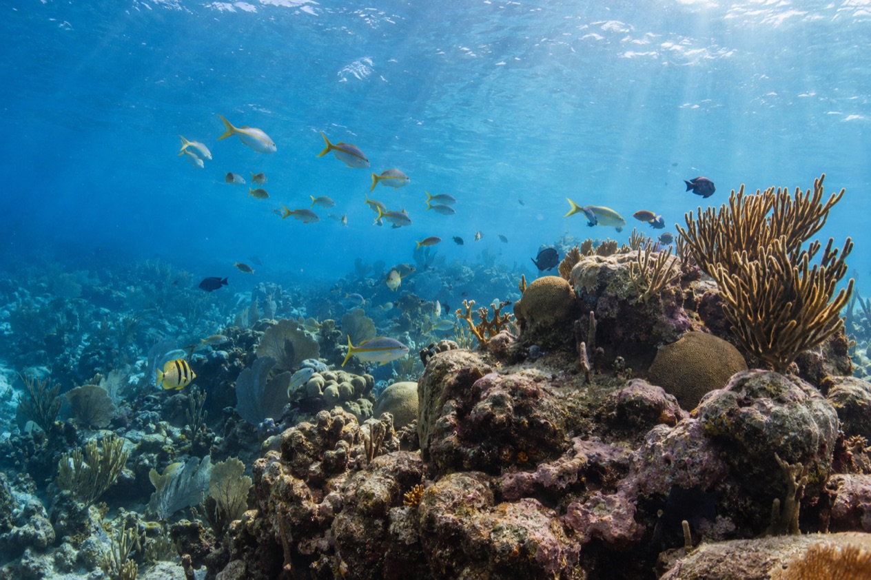
A snorkeler slips over the side of a small boat and the world turns to blue light, with a line of coral sliding beneath the surface and fish flickering through the sea grass. Belize sits along the Mesoamerican Barrier Reef, and its marine reserves give the sport a map of named places, from a little channel off Ambergris Caye to a spawning site off Placencia. This is a page for anyone planning to spend vacation days face down in warm water.
Where is the best snorkeling in Belize?
There is no single best spot, but the marine reserves along the barrier reef are where most snorkelers start, and the most talked-about of them is Hol Chan, close to San Pedro on Ambergris Caye. Others sit off Caye Caulker, off the Stann Creek coast near Placencia and Hopkins, and on the cayes of the South Water Caye reserve. Each one has its own character, so the right choice depends on where you are staying.
The sea itself is welcoming. Near San Pedro the surface runs from the low 80s in winter to the mid-80s by midsummer and reaches its warmest in autumn. Near Placencia it is a degree or two warmer in most seasons. Water like that makes long hours of floating feel natural, and the table gives the readings for four months.
| Month | Sea near San Pedro (°F) | Sea near Placencia (°F) |
|---|---|---|
| January | 81.4 | 81.0 |
| April | 82.6 | 84.3 |
| July | 85.7 | 86.4 |
| October | 86.5 | 87.1 |
Hol Chan Marine Reserve, Ambergris Caye
Hol Chan lies about four miles south of San Pedro, and its name is Maya for “little channel”, a nod to the cut in the reef that gives the reserve its heart. It was established in July 1987 as the first marine protected area in Belize, and today it covers coral reef, sea-grass meadows and mangrove swamp. Within the reef zone fishing is not permitted, while snorkeling and diving are allowed on payment of a fee.
What you see is a reef that has been left alone for decades: coral heads, schools drifting along the channel, and the quiet green of the sea-grass beds behind the reef. The reserve is divided into zones, and the mangroves of southern Ambergris Caye form one of them. Inside the reserve no one may remove or disturb anything, from shells and dead coral to sand, so you leave with photographs only.
Shark Ray Alley
Shark Ray Alley joined the reserve in 1999 to protect the sharks and rays that gather at a feeding point. This is the place for the moment snorkelers talk about afterward, when the shapes of rays glide under the boat and sharks circle in the shallows below you. It is a stop in its own right, and it makes a pairing with the reef at Hol Chan in the same reserve.
Because the animals gather here for food, the scene feels more like a gathering than a chance encounter. Keep your hands to yourself and let the animals pass. The reserve’s rules against disturbing flora and fauna apply here as they do on the reef.
Caye Caulker Marine Reserve
The Caye Caulker Marine Reserve, established in April 1998, covers more than 9,000 acres of the barrier reef system and is shaped like the number seven. It takes in mangroves, littoral forest, lagoon marshland, sea-grass beds and coral reef, five habitats in all, and its use is regulated through preservation, conservation and general use zones.
Snorkelers who base themselves on Caye Caulker find a reserve that blends reef and shallow sea grass. West Indian manatees are seasonal residents of its north channel, a reason to keep your eyes open on the way out and back. Fish and rays tend to favor the sea-grass and mangrove edges, so this is a reserve where the scenery changes within a short stretch.
Laughing Bird Caye and the south
Off Placencia, Laughing Bird Caye sits 12 miles from the village in the Stann Creek District, a tiny island of 1.8 acres that became a national park in December 1991. It is named for the laughing gulls that once bred there and moved to quieter islands as human activity increased. The caye is part of the Belize Barrier Reef Reserve System World Heritage Site, registered in 1996.
It belongs to the Southern Belize Reef Complex, alongside South Water Caye, Laughing Bird Caye National Park and the Sapodilla Cayes Marine Reserve. From Hopkins, Hamanasi Adventure and Dive Resort lists Barrier Reef snorkeling among its daily reef adventures, weather permitting.
What can you see underwater?
You can see coral reef, sea-grass meadows and mangrove edges, with sharks, rays and schooling fish as the headline animals and manatees and whale sharks as the occasional stars. The habitats change within a few hundred yards, which is why a single reserve can feel like three different snorkels in one outing.
Reef, grass and mangrove
Hol Chan’s 102,400 acres of reserve water, as listed by the Fisheries Department, mix coral reef, sea-grass meadows and mangrove swamp. The three habitats work together, with young fish sheltering in the roots and grass, then moving out to the reef as they grow. A snorkeler drifting from one zone to the next sees that cycle laid out in a few minutes of swimming.
Caye Caulker’s reserve offers the same mix, with lagoon marshland added. Look for the contrast between the bright, structured reef and the soft, swaying grass beds. Both reward slow movement, and a calm, patient float usually shows more than a hard kick toward the next coral head.
Sharks, rays and manatees
Shark Ray Alley is the clearest answer to the question of big animals. Sharks and rays gather at the feeding point, and the reserve was extended in 1999 to protect them. The sight of rays gliding along the sandy floor is one many visitors remember long after the trip.
Manatees are different. In the north channel of the Caye Caulker Marine Reserve they appear as seasonal residents, so a sighting is a chance and never a promise. If one surfaces near the boat, the shape and the slow breath are unmistakable.
Spawning fish and whale sharks at Gladden Spit
Gladden Spit supports more than 30 species of fish, including grouper and snapper, that gather in the thousands at full moon. That aggregation draws whale sharks, and the reserve describes one of the largest predictable whale shark congregations in Belize here. It is an important resource for Placencia and other coastal communities.
The spectacle follows the moon and nature’s own timing, so treat it as a chance rather than a certainty. The reserve protects the spawning site, the whale sharks that congregate there and the Silk Cayes, which makes this corner of the reef a living classroom in how the sea renews itself.
The southern cayes
South Water Caye Marine Reserve is the second largest marine protected area in Belize, covering 117,875 acres on the inner side of the barrier reef and sitting west of the most southerly part of Glover’s Reef atoll. It is one of the seven protected areas of the Belize Barrier Reef Reserve System World Heritage Site. In its Conservation Zone, only non-extractive recreation is permitted, so no fishing or collecting of any kind.
Tobacco Caye, a small island in this part of the reef, has no roads or vehicles and not even a sidewalk. What can you see underwater? Hurricane Mitch levelled most of the island in 1998, and nearly everything there now has been rebuilt since.
What should you know before you go?
Know the reserve rules, the season and the way each place handles its visitors, and the snorkel will go smoothly. Reserves are protected for good reason, and the rules are short enough to carry in your head. They are what keeps the reef worth the trip.
Reserve rules
In Hol Chan, no one may remove or disturb flora or fauna, including rocks, dead corals, shells or sand, unless the fisheries administrator authorizes it. Discharging or depositing waste, toxic material, garbage or litter into the water or onto land in the reserve is prohibited. These rules apply to every visitor, so take nothing and leave nothing.
At South Water Caye, the Conservation Zone allows no fishing and no collection of marine items, living or not. Only non-extractive recreational activities are permitted, and a snorkel fits that description. A ranger station on Twin Cayes, with accommodation for rangers and a visitor center, shows how the reserve is looked after.
Timing and the sea
The water stays warm all year, and autumn brings the warmest readings of the four months in the table. The Atlantic hurricane season runs from June 1 to November 30, so a trip in those months falls inside it. Boat trips that run daily at a resort such as Hamanasi go out weather permitting, and the weather is the one thing nobody controls.
If whale sharks are your goal at Gladden Spit, remember that the fish gather at full moon, so the lunar calendar matters more than the month. A trip built around that gathering is a chance at a special encounter, not a guarantee of one.
Going with a resort or a dive shop
Hamanasi Adventure and Dive Resort in Hopkins Village includes its most popular Barrier Reef tours in its Reef & Rainforest Package, with Barrier Reef snorkeling among the daily adventures. Trips to Glover’s Reef Atoll or to Lighthouse Reef Atoll and the Great Blue Hole depend on interest and a minimum number of guests, and they can be added for an extra charge when a package does not include them.
Its dive shop is a PADI 5 star operation with modern equipment and a range of dive courses. Snorkelers who also feel the pull of scuba will find the next step close at hand.
Good to know before you go
The U.S. State Department rates Belize Level 2, “Exercise increased caution”, because of crime, and says the south side of Belize City has historically had the highest concentration of violent crime.
Snorkeling in Hol Chan’s reef zone carries a fee, so keep a little cash or a card ready for it. Stay aware of your surroundings on land as in any busy port town, and remember that the hurricane season runs from June 1 to November 30.
Sources
- Belize Fisheries Department, Hol Chan Marine Reserve (https://fisheries.gov.bz/hcmr/), checked October 11, 2026
- Belize Fisheries Department, Gladden Spit and Silk Cayes Marine Reserve (https://fisheries.gov.bz/gsscmr/), checked October 11, 2026
- Belize Fisheries Department, South Water Caye Marine Reserve (https://fisheries.gov.bz/swcmr/), checked October 11, 2026
- Belize Fisheries Department, Caye Caulker Marine Reserve (https://fisheries.gov.bz/ccmr/), checked October 11, 2026
- Wikipedia, Hol Chan Marine Reserve (https://en.wikipedia.org/wiki/Hol_Chan_Marine_Reserve), checked October 11, 2026
- Wikipedia, Laughing Bird Caye (https://en.wikipedia.org/wiki/Laughing_Bird_Caye), checked October 11, 2026
- Wikivoyage, Tobacco Caye (https://en.wikivoyage.org/wiki/Tobacco_Caye), checked October 11, 2026
- Hamanasi Adventure and Dive Resort, reef adventures (https://www.hamanasi.com/belize-reef-adventures/), checked October 11, 2026
- Open-Meteo Marine API, average 2015-2024, checked October 11, 2026
- U.S. Department of State, Belize Travel Advisory, Level 2, March 11, 2026 (https://travel.state.gov/), checked October 11, 2026
- NOAA National Hurricane Center, Climatology (https://www.nhc.noaa.gov/climo/), checked October 11, 2026