
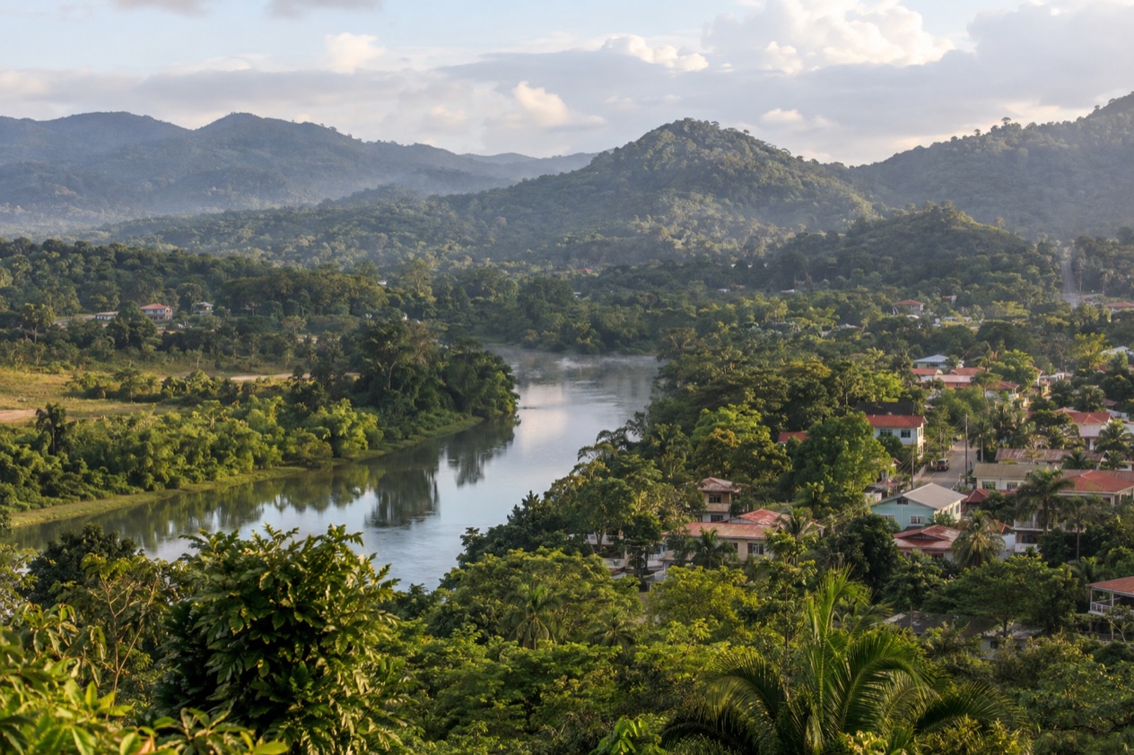
Before the sun clears the hills, the one-lane Hawkesworth Bridge hums under the first trucks, roosters call from Santa Elena, and mist lifts off the Macal River. In San Ignacio the day trips start early, because the Cayo District is full of ruined Maya cities, caves and pine forest. They all begin at the edge of town and spread out in every direction from the river.
What are the best day trips from San Ignacio and the Cayo District?
The best day trips within Belize from San Ignacio include Maya sites, caves and pine forest, each offering a different kind of day. The list runs from a ferry ride to a stone pyramid up to a jungle walk that ends in a cave full of ancient offerings.
- Xunantunich, where a hand-cranked ferry carries you over the Mopan River to a ridge-top pyramid.
- Caracol, the great Maya city deep in the forest, with the tallest manmade structure in Belize.
- Actun Tunichil Muknal, a cave that holds skeletons, ceramics and stoneware left by the Maya.
- Mountain Pine Ridge Forest Reserve, a landscape of native pines far from the tropical green of the valley.
- Barton Creek Cave, a natural cave that is both an archaeological site and a place to visit.
- Cave tubing and zip lining, a full day of water and treetops from Chaa Creek.
- Cahal Pech, the Maya hilltop above town, a short walk from the center.
Beyond San Ignacio, buses also reach Belmopan, the capital, and the Garifuna coast at Hopkins. Benque Viejo del Carmen, the westernmost town in Belize, sits on the Guatemalan border across from Melchor de Mencos.
The best day trips from San Ignacio and the Cayo District
The easiest start needs no transport at all. Cahal Pech stands on a hill above San Ignacio, with plazas and interconnected structures that show how Maya architecture changed over the centuries. Its name means the Place of Ticks. People have lived on the hill since 1200 BCE, and from the top you look over the meeting of the Macal and Mopan rivers.
Xunantunich
The village of San Jose Succotz is the gateway to Xunantunich, and the visit begins with a ride across the Mopan River on a hand-cranked ferry. On the far bank a path climbs to a ridge where plazas, temples and palaces surround the great pyramid. El Castillo rises 130 feet above the plaza and dominates the skyline for miles.
The ridge looks out over the river valley toward the Guatemala border, and the light is good for photographs when the stone is warm. It suits travelers who want a Maya site with a little adventure in the getting there. Leave time to sit in the plaza and listen to the forest, where birds often outnumber people.
Caracol
Caracol lies deep in the forest of the Cayo District, to the south of Xunantunich and San Ignacio. The only road to the site is paved for the last 9.9 miles, and it leads back to the Western Highway between San Ignacio and Belmopan and to Santa Elena. This is the longest of the ruin trips, and the forest around the site is part of the reward.
The great building here is Caana, the tallest manmade structure in Belize at 141 feet. You may hear howler monkeys and see colorful birds in the trees between the plazas, though wildlife is never a promise. The site suits travelers who want a Maya city on a grand scale and do not mind a long day.
| Site | Open | Admission |
|---|---|---|
| Caracol | Every day, 8:00 am to 5:00 pm, including Sundays and public and bank holidays | BZ$15.00 to BZ$25.00, depending on ticket type and age |
Actun Tunichil Muknal
Actun Tunichil Muknal, known locally as ATM, lies in the Tapir Mountain Nature Reserve. Tour schedules and transfer times for ATM depend on the departure point, so confirm both before booking. The approach is a walk of 45 minutes along a jungle trail that crosses three rivers before you reach the cave.
Inside, the cave is an archaeological site where the Maya left skeletons, ceramics and stoneware. One piece, the Monkey Pot, is one of just four of its type found in Central America. It is a day for travelers drawn to history in the dark, and it suits those who want to walk through the forest to get there.
Mountain Pine Ridge
Mountain Pine Ridge Forest Reserve was set aside to protect and manage the native Belizean pine forests. The Macal River forms its boundary to the west and south. The land rises into open pine country, a change of air and scenery from the broadleaf jungle of the valley.
Baldy Beacon marks the high point, and the reserve is known for its granite outcrops, creeks and waterfalls such as Big Rock Falls and the Rio On pools. It suits travelers who like a day of landscape and viewpoints. It is also a good contrast after a morning at the ruins, with the scent of pine in the air.
Barton Creek Cave
Barton Creek Cave sits in the upper Barton Creek area near San Ignacio. It is a natural cave and both an archaeological site and a place for visitors. The remains of at least 28 humans have been found inside, so the passages carry the weight of Maya ritual as well as the beauty of stone.
The cave has been surveyed over a length of 5.0 miles, and the part you see is only a small share of it. It suits travelers who want a quieter cave experience than the long trek to ATM.
Cave tubing and zip lining
The Cave Tubing and Zip Lining tour from Chaa Creek is a full-day outing, starting at 8:00 am. It combines two ways to see the forest, one underground and one above the canopy. This is the trip for those who want something active rather than an archaeological site.
The zip line soars 80 feet above the forest floor. It has five runs from treetop to treetop, on professionally installed double cables. Children and groups of friends often like this day, as it breaks up a week of temples with something playful.
Day trips from San Ignacio and the Cayo District compared
| Trip | Time or distance each way | Best for | How to go |
|---|---|---|---|
| Cahal Pech | 10-minute walk from the town center | A first look at Maya architecture | On foot from San Ignacio |
| Xunantunich | Near San Jose Succotz, with a ferry crossing at the river | A pyramid on a ridge | Ferry across the Mopan River |
| Caracol | Paved for the last stretch of the only road | The grand Maya city | By road via the Western Highway |
| Actun Tunichil Muknal | One and a half hours by drive from Chaa Creek, then a jungle trail on foot | History in a cave | Guided tour from Chaa Creek, all day |
| Mountain Pine Ridge | A forest reserve in the Cayo District | Landscape and waterfalls | By road |
| Barton Creek Cave | In the upper Barton Creek area near San Ignacio | A cave with Maya remains | By road |
| Cave tubing and zip lining | Full day from Chaa Creek | An active day | Tour from Chaa Creek |
| Belmopan | One hour by bus | The capital | Bus |
| Hopkins | Three hours by bus via Belmopan | The Garifuna coast | Bus via Belmopan |
To choose, start with what you want from the day. If it is caves, Barton Creek and ATM offer different experiences, with ATM reached by a jungle trail that crosses three rivers. For landscape, Mountain Pine Ridge is the answer, and for fun, the tubing and zip line day.
Belmopan and Hopkins are the trips for a change of scene. They suit a traveler who has seen the Cayo sites and wants to look at the capital or the coast. Each sits on the bus line, so a day there needs a plan for the return.
Tour or on your own?
A tour makes sense where the trip is long, the site is guided or a boat or cave is part of the day. The ATM and the cave tubing and zip lining outings from Chaa Creek are organized as full-day tours, with the early start built in. If a trip involves a hike through rivers or a cave, joining a group removes the guesswork about the route.
Before booking, ask whether the operator holds a license. Businesses providing tour services in Belize must be licensed by the Belize Tourism Board, and operator licenses are renewed every year. Guides are licensed too, and applicants must submit an original valid police record. These are good things to confirm, and the answer should be quick.
Ask also what the day includes, where it starts and how the time splits between travel and the site. The Chaa Creek tours give a clear pattern, with a set start time and a full-day format. Other operators will describe their own, and a clear answer is a good sign.
Some places suit independent travel, especially close to town. Cahal Pech is a walk from the center of San Ignacio, and a visit to Xunantunich includes a ferry crossing of the Mopan River. Belmopan and Hopkins are on the bus line, with the ride to the capital taking an hour and the road to the coast needing a change of plans around Belmopan.
Caracol is a different case, since the only road leads through the forest and the last stretch is paved. Before setting out for Caracol, verify current road access and site hours. Mountain Pine Ridge and Barton Creek Cave are both in the Cayo District.
Good to know before you go
The U.S. State Department rates Belize Level 2, “Exercise increased caution”, because of crime, and says the south side of Belize City has historically had the highest concentration of violent crime.
Fees at the sites are quoted in Belize dollars, so keep that in mind when you plan the day. The Atlantic hurricane season runs from June 1 to November 30, so a trip in October falls inside it. La Loma Luz Hospital in Santa Elena is the main hospital of the twin towns, and San Ignacio itself is a base with services close at hand.
Sources
- Wikipedia, San Ignacio, Belize (https://en.wikipedia.org/wiki/San_Ignacio,_Belize), checked October 11, 2026
- Wikivoyage, San Ignacio (Belize) (https://en.wikivoyage.org/wiki/San_Ignacio_(Belize)), checked October 11, 2026
- Wikipedia, Cayo District (https://en.wikipedia.org/wiki/Cayo_District), checked October 11, 2026
- Wikipedia, Xunantunich (https://en.wikipedia.org/wiki/Xunantunich), checked October 11, 2026
- Wikipedia, Cahal Pech (https://en.wikipedia.org/wiki/Cahal_Pech), checked October 11, 2026
- Wikipedia, Caracol (https://en.wikipedia.org/wiki/Caracol), checked October 11, 2026
- Wikipedia, Mountain Pine Ridge Forest Reserve (https://en.wikipedia.org/wiki/Mountain_Pine_Ridge_Forest_Reserve), checked October 11, 2026
- Wikivoyage, Mountain Pine Ridge (https://en.wikivoyage.org/wiki/Mountain_Pine_Ridge), checked October 11, 2026
- Wikipedia, Actun Tunichil Muknal (https://en.wikipedia.org/wiki/Actun_Tunichil_Muknal), checked October 11, 2026
- Wikipedia, Barton Creek Cave (https://en.wikipedia.org/wiki/Barton_Creek_Cave), checked October 11, 2026
- NICH ticketing, Xunantunich (https://ticketing.nichbelize.org/product/xunantunich/), checked October 11, 2026
- NICH ticketing, Cahal Pech (https://ticketing.nichbelize.org/product/cahal-pech/), checked October 11, 2026
- Wikipedia, Benque Viejo del Carmen (https://en.wikipedia.org/wiki/Benque_Viejo_del_Carmen), checked October 11, 2026
- Wikipedia, Melchor de Mencos (https://en.wikipedia.org/wiki/Melchor_de_Mencos), checked October 11, 2026
- Wikipedia, Mennonites in Belize (https://en.wikipedia.org/wiki/Mennonites_in_Belize), checked October 11, 2026
- Belize Tourism Board, Tour operator licensing (https://www.belizetourismboard.org/tour-operator/), checked October 11, 2026
- Belize Tourism Board, Tour guide licensing (https://www.belizetourismboard.org/tour-guide/), checked October 11, 2026
- NICH ticketing, Caracol (https://ticketing.nichbelize.org/product/caracol/), checked October 11, 2026
- Chaa Creek, ATM cave tour (https://chaacreek.com/tour/actun-tunichil-muknal/), checked October 11, 2026
- Chaa Creek, cave tubing tour (https://chaacreek.com/tour/cave-tubing-zip-lining/), checked October 11, 2026
- U.S. Department of State, Belize Travel Advisory, Level 2, March 11, 2026 (https://travel.state.gov/), checked October 11, 2026
- NOAA National Hurricane Center, Climatology (https://www.nhc.noaa.gov/climo/), checked October 11, 2026
To plan your stay
- Best Time to Visit San Ignacio and the Cayo District: Weather, Maya Sites and Seasons
- Where to Stay in San Ignacio and the Cayo District: Riverside Lodges, Town Stays and the Mountain Pine Ridge
- San Ignacio and the Cayo District from Belize City: Distance, Bus, Rental Car and Day Trips
- Know Before You Go to San Ignacio and the Cayo District: Entry, Money, Getting Around and Health