
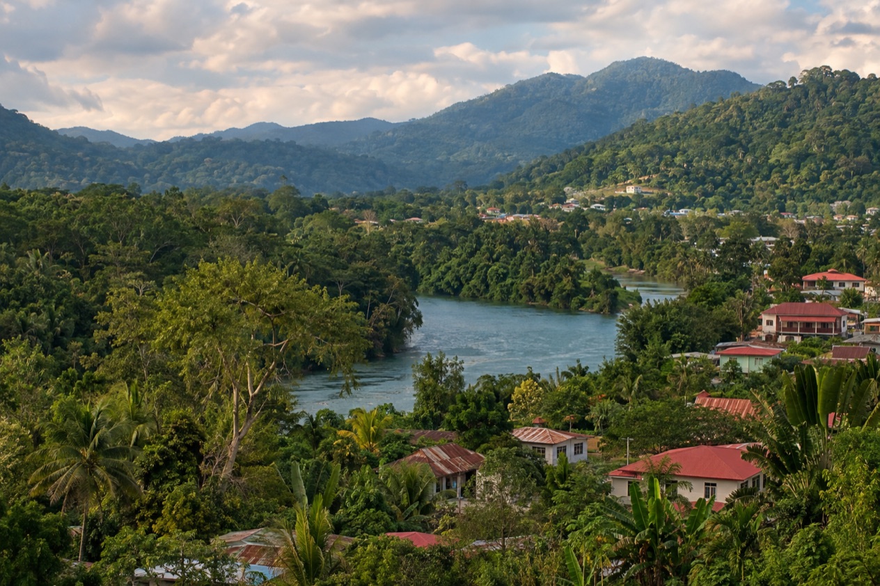
Early in San Ignacio the Macal River is still quiet, and the one-lane Hawkesworth Bridge starts to hum as people cross between Santa Elena and the town center. Coffee and fry jacks appear on café tables, and the hills around town hold ancient Maya temples above the treetops. Three days here let you walk to a hilltop ruin, ride a hand-cranked ferry to a pyramid and go deeper into the Cayo District, with a base in town that keeps each evening simple.
Is three days enough in San Ignacio and the Cayo District?
Yes, three days is enough for a first visit, especially for travelers who want ruins, rivers and forest more than a long list of beaches. San Ignacio works as a base because the main Maya sites around it sit close enough to be strung together without a fresh hotel every night. You can see one site in the neighborhood, one across the Mopan River and one deeper in the district, and still have evenings to spend in town.
What three days leave out is the cave side of Cayo, such as Actun Tunichil Muknal in the Tapir Mountain Nature Reserve and Barton Creek Cave, along with slower days along the rivers and the wider Mountain Pine Ridge. The smaller sites of the district, including Baking Pot, Lower Dover and El Pilar, also wait for another trip. With a few more days you could add one cave, one more ruin and a day with no plan at all, which is how many people find the district’s real rhythm.
Day 1 in San Ignacio and the Cayo District
Start with Cahal Pech, because it is the one big site you can reach on foot, a 10-minute walk from the town center. The name means The Place of Ticks, and the interconnected plazas and structures show how Maya building changed over centuries.
It sits high above the Macal River, looking toward the meeting of the Macal and the Mopan, so the view over the valley is part of the visit. Go early, when the light on the stone is soft and the town below is just waking up.
Come back down for a late breakfast or lunch at one of the small cafés and market-side eateries, where you find rice and beans, stew chicken, tamales and fresh juices. Then spend the afternoon on the town itself.
Walk the pedestrian stretch of downtown, browse the stalls and shops for crafts and local produce, and cross the Hawkesworth Bridge, the only suspension bridge in Belize and a fixture of local life since it was built in 1949. On the Santa Elena side you see the twin town that, together with San Ignacio, forms the third largest urban area in the country.
In the evening, stay close to the riverbank and the center. Dinner in a restaurant with a terrace is a good way to hear the town change gears as the heat eases, and the night market atmosphere around the central streets is relaxed and friendly.
The first day works because everything is within reach on foot, so you can arrive tired and still do it justice. Save your energy, because Day 2 means crossing a river by ferry.
Day 2 in San Ignacio and the Cayo District
Day 2 goes west toward the Guatemala border to Xunantunich, near the village of San Jose Succotz. The visit includes a ride across the Mopan River on a hand-cranked ferry, a small adventure that sets the tone before you even reach the ruins. The site sits atop a ridge above the river, a little under a mile from the border. Its core holds six plazas surrounded by more than two dozen temples and palaces.
| Site | Open |
|---|---|
| Xunantunich | Every day, 8:00 am to 5:00 pm, including Sundays and public and bank holidays |
The star is El Castillo, which rises 130 feet and is the second tallest structure in Belize after the temple at Caracol. Take time to wander the plazas rather than head straight for the tallest building, since the smaller courts and the views over the river valley give the site its character. Morning visits suit the day well, leaving the afternoon free.
After the ruins, continue to Benque Viejo del Carmen, the westernmost town in Belize, right on the Guatemalan border across from Melchor de Mencos. It is a Spanish-speaking border town where the Mopan River runs along the north and west edges, and it gives a different feel from San Ignacio. Have lunch at a simple local place, then return to San Ignacio for a quiet river-side evening, perhaps a drink on a terrace and an early night before the bigger day ahead.
Day 3 in San Ignacio and the Cayo District
Day 3 is for the deeper Cayo, and Caracol is the place that rewards it. This large Maya city lies south of Xunantunich and San Ignacio, and its main building, Caana, is the tallest man-made structure in Belize at 141 feet.
The government declared the area a national park in 1991. The only road in is paved for just its last 9.9 miles, so the journey is part of the day, and the forest around the ruins adds to the sense of distance.
The route also runs near the Mountain Pine Ridge Forest Reserve, a pine-covered upland that is a different landscape from the river valley around San Ignacio. Its rainy season runs from July to February, which is worth knowing when you plan the drier moments of the day. Together, Caracol and the Ridge make a full excursion, and the detail of each belongs to a separate day-trip plan.
Spend the evening back in San Ignacio, where the day’s travel feels well earned. Order something filling, perhaps stewed meat with coconut rice or a plate of fresh river fish if it is on the menu, and sit near the river as the light drops.
A last walk across the Hawkesworth Bridge makes a fitting loop with Day 1, now that you have seen what lies beyond the town. If your legs still have energy, wander the central streets once more for a souvenir or a cold drink.
Where to stay for three days in San Ignacio and the Cayo District
San Ignacio itself is the best base for this plan. It is the capital of the Cayo District and sits on the banks of the Macal River, so Cahal Pech, the restaurants and the market streets are all close. Staying in town means you can walk to your first ruin on Day 1, return from Xunantunich and Caracol to the same place and eat without ever planning a transfer after dark.
A traveler who prefers more quiet could choose a lodge outside town toward the river or the forest, the kind of place where the Macal or the Mountain Pine Ridge is right outside the door. Santa Elena, across the Hawkesworth Bridge, is also an option and is where La Loma Luz Hospital, the main hospital of the twin towns, is found. If you want to be near the border and Xunantunich, the village of San Jose Succotz or Benque Viejo del Carmen puts you at the western end of the district, though you lose the town evenings.
What to skip if you only have three days in San Ignacio and the Cayo District
Skip the cave circuit. Actun Tunichil Muknal, with its skeletons, ceramics and the rare Monkey Pot, and Barton Creek Cave, where the remains of at least 28 humans have been found, are both fascinating, but each is a major outing. Adding one would push out Caracol or Xunantunich. Choose a cave on a later trip, when it can have a day of its own.
Skip the border crossing into Guatemala. Melchor de Mencos is the only major crossing from Guatemala into Belize, and visiting another country, even briefly, takes a day you do not have here. Skip a coastal stop as well. Hopkins is 87 miles from San Ignacio, and the bus via Belmopan takes three hours, which would cost you most of a day on the road.
Finally, resist the urge to see every ruin in the district. Baking Pot, Lower Dover and El Pilar are real places, but three Maya sites in three days is a good rhythm, and the extra time is better spent over a long lunch, on the river or on a walk through the market. Spanish Lookout, the modernized Mennonite community in Cayo, is another detour that fits a longer stay.
Getting around San Ignacio and the Cayo District in three days
On Day 1 you hardly need a vehicle. This is why the first day can be slow and relaxed, with nothing to coordinate.
The ruins of Days 2 and 3 are another matter. Xunantunich sits near San Jose Succotz, reached by crossing the Mopan River on the hand-cranked ferry, and Benque Viejo del Carmen lies 8.1 miles east of San Ignacio’s neighbor on the same western road toward the border. Caracol is about 25 miles south of Xunantunich and San Ignacio, and its road leads to the Western Highway between San Ignacio and Belmopan and to Santa Elena, with only the last 9.9 miles paved.
For longer links, the bus from San Ignacio to Belmopan takes one hour, and Belmopan is 26 miles away. Belize City lies about 63 miles east. Between the town and the farther sites, by air, by sea or by road is how Belize works as a whole, but for this plan the road is what ties the Cayo District together.
Good to know before you go
The U.S. State Department rates Belize Level 2, “Exercise increased caution”, because of crime, and says the south side of Belize City has historically had the highest concentration of violent crime.
The Atlantic hurricane season runs from June 1 to November 30, and the rainy season in the Mountain Pine Ridge runs from July to February, so a plan with forest and river days is worth holding loosely in those months. In Belize City, January highs average in the low 80s and July highs in the upper 80s, and rain falls on about ten to twelve days in each of those months.
In San Ignacio, a light rain layer and sturdy shoes fit the ruins and the forest. Belize dollars are the local currency, and the town is compact enough that you can plan each day around what is open.
Sources
- Wikipedia, San Ignacio, Belize (https://en.wikipedia.org/wiki/San_Ignacio,_Belize), checked October 11, 2026
- Wikivoyage, San Ignacio (Belize) (https://en.wikivoyage.org/wiki/San_Ignacio_(Belize)), checked October 11, 2026
- Wikipedia, Cayo District (https://en.wikipedia.org/wiki/Cayo_District), checked October 11, 2026
- Wikipedia, Xunantunich (https://en.wikipedia.org/wiki/Xunantunich), checked October 11, 2026
- Wikipedia, Cahal Pech (https://en.wikipedia.org/wiki/Cahal_Pech), checked October 11, 2026
- Wikipedia, Caracol (https://en.wikipedia.org/wiki/Caracol), checked October 11, 2026
- Wikipedia, Mountain Pine Ridge Forest Reserve (https://en.wikipedia.org/wiki/Mountain_Pine_Ridge_Forest_Reserve), checked October 11, 2026
- Wikivoyage, Mountain Pine Ridge (https://en.wikivoyage.org/wiki/Mountain_Pine_Ridge), checked October 11, 2026
- Wikipedia, Actun Tunichil Muknal (https://en.wikipedia.org/wiki/Actun_Tunichil_Muknal), checked October 11, 2026
- Wikipedia, Barton Creek Cave (https://en.wikipedia.org/wiki/Barton_Creek_Cave), checked October 11, 2026
- NICH ticketing, Xunantunich (https://ticketing.nichbelize.org/product/xunantunich/), checked October 11, 2026
- NICH ticketing, Cahal Pech (https://ticketing.nichbelize.org/product/cahal-pech/), checked October 11, 2026
- Wikipedia, Benque Viejo del Carmen (https://en.wikipedia.org/wiki/Benque_Viejo_del_Carmen), checked October 11, 2026
- Wikipedia, Melchor de Mencos (https://en.wikipedia.org/wiki/Melchor_de_Mencos), checked October 11, 2026
- Wikipedia, Mennonites in Belize (https://en.wikipedia.org/wiki/Mennonites_in_Belize), checked October 11, 2026
- NOAA NCEI, GHCN-Daily station BHM00078583 (Philip S. W. Goldson International Airport, Belize City), normals 1991-2020 computed from the daily record (https://www.ncei.noaa.gov/access/services/data/v1?dataset=daily-summaries&stations=BHM00078583), checked October 11, 2026
- Tropic Air, Belize International Airport (https://www.tropicair.com/belize-international-airport-bze/), checked October 11, 2026
- U.S. Department of State, Belize Travel Advisory, Level 2, March 11, 2026 (https://travel.state.gov/), checked October 11, 2026
- NOAA National Hurricane Center, Climatology (https://www.nhc.noaa.gov/climo/), checked October 11, 2026
To plan your stay
- Best Time to Visit San Ignacio and the Cayo District: Weather, Maya Sites and Seasons
- Where to Stay in San Ignacio and the Cayo District: Riverside Lodges, Town Stays and the Mountain Pine Ridge
- San Ignacio and the Cayo District from Belize City: Distance, Bus, Rental Car and Day Trips
- Know Before You Go to San Ignacio and the Cayo District: Entry, Money, Getting Around and Health