
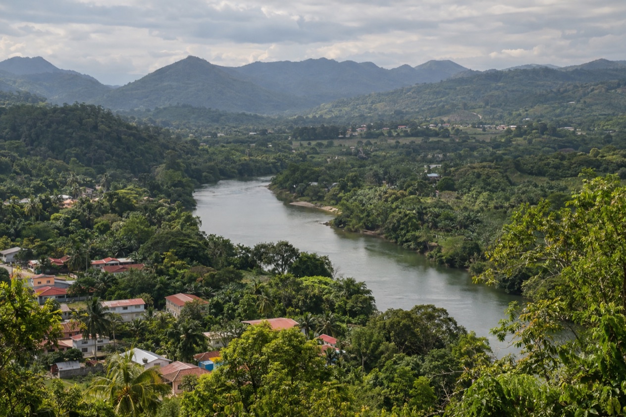
Leaving Belize City early means watching the city thin out into farmland, then into the green, rolling hills of the west. At the end of the road, San Ignacio sits on the Macal River, with a one-lane suspension bridge to its sister town and a market where the morning’s produce is laid out on tables. This is the road to the Cayo District, where the Maya ruins, the rivers and the jungle lodges begin.
How do you get to San Ignacio and the Cayo District from Belize City?
San Ignacio lies about 63 miles west of Belize City, and you reach it overland, heading west on the highway that also serves Belmopan. San Ignacio does not appear among Maya Island Air’s listed connecting destinations from the international airport.
What decides is how much of the Cayo District you want to see once you arrive. If San Ignacio is the destination and you plan to stay in town, the bus fits.
If you want to reach the ruins, the lodges and the villages scattered around it at your own pace, a car or a driver changes the shape of the days. The Philip Goldson International Airport, the only international airport in Belize, sits outside Belize City in Ladyville, and many travelers start the journey there, so the rental desks on site matter for some of them.
Straight-line distance is shorter than the road, since the map shows about 60 miles between the two places. Xunantunich, the ruins just outside town, lie about 70 miles west of Belize City, which gives a sense of how far the Cayo District stretches from the coast. Caracol, the great site deep in the district, is a separate outing from San Ignacio rather than a stop on the way.
Roadwork on the airport access road is causing slower traffic and uneven surfaces. Drivers are asked to reduce speed, follow the flaggers and watch for dredging equipment and workers near the roadway. If your day starts at the airport, that stretch is the first thing to plan around.
Ways to get to San Ignacio and the Cayo District from Belize City
By rental car from the airport
Two rental companies have desks at the Philip Goldson International Airport. Hertz, operating as Safari Belize, answers at +(501) 225 – 3300, and Crystal Auto Rental answers at +(501) 223 – 1600. Starting from the airport means you begin outside the city, with the highway west ahead of you.
A car turns the Cayo District into a set of choices rather than a single stop. The road to Caracol branches off the highway between San Ignacio and Belmopan, and it is paved for its last 9.9 miles. Xunantunich and Cahal Pech are both close to town. The trade-off is that you handle the route yourself, including the slower stretch of the airport access road.
By bus via Belmopan
Belmopan is 26 miles from San Ignacio, which makes it the natural landmark on the way. Travelers going on to Hopkins can also use Belmopan, since a bus from San Ignacio to Hopkins via the capital takes three hours.
From there the center of San Ignacio is the base for the day trips, with the sister town of Santa Elena across the Macal. This way suits someone who wants to settle in the town and add outings later.
With a tour or a private driver
The ruins are the obvious targets: Cahal Pech above the town, Xunantunich on its ridge above the Mopan River, and Caracol farther south. Baking Pot, Lower Dover and El Pilar are also in the district.
A driver or an organized outing means you spend the road looking out the window instead of at it. It suits those who arrive at the airport and want the first part of the trip to be simple, or who would rather not drive through the work zone on the airport access road. Whichever you choose, it works best when you decide which sites you want before the day begins.
Options compared
| Option | How it works | What to know |
|---|---|---|
| Rental car | Desks at the Philip Goldson International Airport (Hertz/Safari Belize and Crystal Auto Rental) | Leaves the Cayo District open to explore; the airport access road has roadwork and flaggers |
| Bus via Belmopan | Bus service connects Belmopan and San Ignacio, one hour between them | Arrives in the middle of town; Belmopan is the landmark on the way |
| Tour or private driver | Someone else handles the road to San Ignacio and the sites | Fits an arrival at the airport; pairs with Cahal Pech, Xunantunich or Caracol |
The three ways differ less in where they end than in what the days around them look like. A car gives the most freedom to wander the district, a bus keeps the focus on the town, and a driver or an outing leaves your attention free for the scenery. None of them changes what is at the end: the same river, the same bridge and the same ruins within reach.
Pairing them is also possible. Caracol sits about 25 miles south of Xunantunich and San Ignacio.
Making a day of it
Once in San Ignacio, the town itself rewards a slow start. The one-lane Hawkesworth suspension bridge over the Macal connects San Ignacio to Santa Elena. The two towns together make up the third largest urban area in Belize, yet the center is compact, with cafés, the market and riverside views that make a good first hour.
Cahal Pech above the town
Cahal Pech is the Maya site nearest to San Ignacio and sits high above the Macal River, overlooking the point where the Macal and the Mopan rivers meet. People lived here continuously from as early as 1200 BCE, which makes it one of the oldest recognizably Maya sites in western Belize.
What you see are plazas and stone buildings set on a hilltop, with the town and the valley spread below. It pairs naturally with a morning in town, since it sits so close to it. Light is softer at the start or the end of the day, and it makes a good first look at what the Cayo District holds.
Xunantunich on its ridge
Its core covers about one square mile and holds six plazas surrounded by more than 26 temples and palaces. Standing in the plazas, you get a sense of how large a Maya center could be, with the green of the river valley around it.
It combines well with a day based in San Ignacio, and with Cahal Pech if you want two sites that show different sides of the Maya world, one on a hilltop above a town and one on a ridge above a river.
Caracol, the big outing
Caracol is a large Maya site deep in the Cayo District, and its main pyramid, Caana, is the tallest manmade structure in Belize at 141 feet. The only road there leaves the highway between San Ignacio and Belmopan and is paved for its last stretch. Because it lies well to the south, Caracol tends to be an outing of its own rather than something to squeeze between other stops.
Bring water, a hat and something light to wear, since the district is green and the sun can be strong in the open plazas. Plan to stay in San Ignacio for more than one night if you want the sites without hurrying, and leave a day for each of the larger ones.
Good to know before you go
The U.S. State Department rates Belize Level 2, “Exercise increased caution”, because of crime, and says the south side of Belize City has historically had the highest concentration of violent crime.
The Atlantic hurricane season runs through the end of November, so a trip in these weeks falls inside it. San Ignacio’s main hospital, La Loma Luz, is in Santa Elena, just across the river.
If you are heading to the airport at the end of the trip, the Philip S. W. Goldson International Airport expects passengers to arrive at least 3 hours before their flight, and the roadwork on the access road is one more reason to leave early.
| Fee | Amount | Who pays |
|---|---|---|
| Airport passenger service fee | US$53.50 | Departing passengers |
| PACT fee | US$20.00 | Departing passengers |
| Airport parking, per day | US$2.00 | Drivers leaving a car at the airport |
| Airport overnight parking | US$9.00 | Drivers leaving a car overnight |
Sources
- Philip S. W. Goldson International Airport (Belize), Travel and ground transportation (https://www.pgiabelize.com/passenger-info/travel-ground-transporation/), checked October 11, 2026
- Philip S. W. Goldson International Airport (Belize), FAQ (https://www.pgiabelize.com/about-us/faq/), checked October 11, 2026
- San Pedro Belize Express Water Taxi, FAQ (https://belizewatertaxi.com/information/faq/), checked October 11, 2026
- San Pedro Belize Express Water Taxi, Schedule (https://belizewatertaxi.com/schedule/), checked October 11, 2026
- Tropic Air, Belize International Airport (https://www.tropicair.com/belize-international-airport-bze/), checked October 11, 2026
- Maya Island Air, International flights (https://www.mayaislandair.com/belize-international-flights/), checked October 11, 2026
- Wikipedia, San Ignacio, Belize (https://en.wikipedia.org/wiki/San_Ignacio,_Belize), checked October 11, 2026
- Wikivoyage, San Ignacio (Belize) (https://en.wikivoyage.org/wiki/San_Ignacio_(Belize)), checked October 11, 2026
- Wikipedia, Cayo District (https://en.wikipedia.org/wiki/Cayo_District), checked October 11, 2026
- Wikipedia, Xunantunich (https://en.wikipedia.org/wiki/Xunantunich), checked October 11, 2026
- Wikipedia, Cahal Pech (https://en.wikipedia.org/wiki/Cahal_Pech), checked October 11, 2026
- Wikipedia, Caracol (https://en.wikipedia.org/wiki/Caracol), checked October 11, 2026
- Great-circle distance computed from the GPS coordinates of the two places, October 10, 2026
- U.S. Department of State, Belize Travel Advisory, Level 2, March 11, 2026 (https://travel.state.gov/), checked October 11, 2026
- NOAA National Hurricane Center, Climatology (https://www.nhc.noaa.gov/climo/), checked October 11, 2026
To plan your stay
- Best Time to Visit San Ignacio and the Cayo District: Weather, Maya Sites and Seasons
- Things to Do in San Ignacio and the Cayo District: Maya Ruins, Caves, Rivers and Local Food
- Where to Stay in San Ignacio and the Cayo District: Riverside Lodges, Town Stays and the Mountain Pine Ridge
- Know Before You Go to San Ignacio and the Cayo District: Entry, Money, Getting Around and Health