
Before you see Big Rock Falls you hear it, a steady roar rising from the river while you are still among the pines. Then the trees open and the water comes into view, dropping over a rock face into a pool below. It is a half-wild corner of the Mountain Pine Ridge in the Cayo District, a place for people who like their waterfalls with a bit of forest road and effort attached.
Is visiting Big Rock Falls worth it?
Yes, if you like waterfalls that feel set apart from the usual stops, and especially if you are already exploring the Cayo District. Big Rock Falls drops about 150 feet on the Privassion River, which makes it a tall, impressive fall rather than a simple cascade, and it sits inside the Mountain Pine Ridge Forest Reserve.
What sets it apart from the other water stops nearby is the setting. Rio On Pools is a series of rock-lined pools and small cascades, while Hidden Valley Falls is another of the reserve’s waterfalls. Big Rock Falls is the larger waterfall, reached through pine country that looks more like a mountain landscape than the lowland jungle many people picture when they think of Belize.
It also suits a particular kind of traveler. There are no real services anywhere within the reserve, so this is a visit for people comfortable with a remote outing, a walk on uneven ground and a steep climb back up at the end.
If you want a paved path, a snack bar and a gift shop, this is not that place. If you want the sound of falling water and the smell of pine resin, it is.
What to see at Big Rock Falls
The waterfall itself
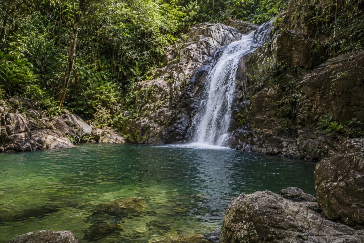
The main event is the fall, about 150 feet of water coming down a rock face on the Privassion River. Seen from below, it has the scale that photographs flatten, and the mist it throws off cools the air around the base. The water is usually fuller and louder in the rainy season, and it can thin to a quieter ribbon when the dry months wear on.
Look at how the water falls rather than just how far. It shifts between sheets and braids as it hits ledges, and the pool at the bottom catches the light differently depending on the hour. Take a moment at the edge of the clearing before you move in close, because the view widens and the sound builds as you approach.
The river and the pine forest around it
The falls sit in the Mountain Pine Ridge Forest Reserve, set aside in 1944 to protect and manage Belize’s native pine forests. The landscape is the surprise for many visitors: open stands of pine, a ground of reddish earth and a sky that feels wider than in the jungle valleys below. Broadleaf forest and rivers fill the folds between the ridges.
As you walk, notice the change in the trees and the smell of resin when the sun warms the pines. Birds move through the canopy, and the river offers the steady soundtrack. The reserve is large and sparsely visited, and the sense of space is part of the reward on the way to the falls.
The walk down and the climb back
Part of the experience is the hike itself. Hikers are warned to head home well before sunset at Big Rock Falls because the hike out can be steep. That means the return is the harder half of the outing, so the time you leave the water matters as much as the time you arrive.
Watch your footing on the way down, where the ground can be uneven, and give yourself room on the way up to stop and catch your breath. The reserve has no real services anywhere, so what you carry in is what you have for the whole outing.
Other stops in the Mountain Pine Ridge
The reserve holds more than one waterfall. Hidden Valley Falls is another, and Rio On Pools is a frequent companion stop. Underground, the Barton Creek river cave extends up to 4.5 miles, and the Rio Frio Cave has the largest entrance of any cave in Belize.
The highest point in the reserve is Baldy Beacon at 3,336 feet, and the Macal River forms its western and southern boundaries. Seen together, the falls, caves and ridges explain why people treat the Mountain Pine Ridge as a destination of its own, not just a detour from the ruins.
Hours, tickets and rules
Big Rock Falls sits in a forest reserve with no real services anywhere within it, and that shapes the whole visit. There is no town square or ticket plaza here, just a waterfall at the end of a forest outing. The reserve covers more than a hundred thousand acres, and the falls are one point in it.
The one rule worth carrying with you is a practical one about daylight. Hikers should head home well before sunset because the hike out can be steep. Plan the outing so the climb back happens while there is plenty of light left, and treat the late afternoon as your cue to start back rather than your window to arrive.
Beyond that, think of the reserve as a place you enter prepared. With no services inside it, the sensible approach is to carry water, food and anything you need for the day. Lodges in the area usually provide phone and internet for their guests, which is a comfort at the end of the day but not something you will find at the falls.
How to get to Big Rock Falls
Big Rock Falls is in the Mountain Pine Ridge Forest Reserve of the Cayo District, and the way in is by the reserve’s roads. Those roads are unpaved, and no real bus service serves them. The approach is part of the outing, a forest road through pine country rather than a highway run.
Many people reach the area on an excursion. Several tours pair Caracol with Rio On Pools or Big Rock Falls on the return journey, which lets visitors swim after walking around the ruins. That pairing makes sense on the map, because the pine ridge lies between the Maya city and the lowlands, and a waterfall stop fits naturally into a long day.
Another base is a lodge inside the reserve. Blancaneaux Lodge is in the Mountain Pine Ridge, with check-in at 3PM and check-out at noon. Staying in the reserve puts you close to the waterfalls and caves and gives you a phone and internet connection at the lodge, which matters because nothing else in the park provides one.
When to visit Big Rock Falls
The seasons matter here. The reserve has a rainy season from July to February and a dry season from February to May. In the rainy months the Privassion carries more water and the forest turns a deep, wet green, which suits a waterfall visit, though unpaved roads and a steep hike out deserve more care when the ground is wet.
The dry season brings a different feel. Temperatures in the reserve may reach 102°F, so the walk down and especially the climb back become a heat question as much as a distance one. The water may run thinner, but the light is clear and the pine hills are open and bright.
Time of day is the part you control. Start with plenty of daylight, because hikers are advised to head home well before sunset. Also keep the hurricane season in mind when planning: the Atlantic season runs from June 1 to November 30, which overlaps with the wetter months of the reserve.
Tips for your visit
Bring what you need for the whole outing, because there are no real services anywhere in the Mountain Pine Ridge. Water, food and sturdy footwear are the obvious starting points, and a towel and a change of dry clothes make sense if you plan to be near the pool. Think about the walk back up, which is the steep part.
Combine the falls with the other stops of the reserve. Rio On Pools and Hidden Valley Falls are nearby waterfalls and pools, and the Barton Creek and Rio Frio caves give you underground options. Many excursions already join Caracol with Big Rock Falls or Rio On Pools on the return, so a long ruins day can end with water.
Families and anyone with limited mobility should weigh the hike. The path out can be steep, and the roads to the reserve are unpaved. If the climb looks like too much, the reserve offers other things to see, from the pine scenery to the lodges, and you can still enjoy the Mountain Pine Ridge without descending to the falls.
Good to know before you go
The U.S. State Department rates Belize Level 2, “Exercise increased caution”, because of crime, and says the south side of Belize City has historically had the highest concentration of violent crime.
Plan on being self-sufficient. The reserve has no real services, though lodges usually provide phone and internet for their guests, so settle your arrangements before you head into the pines. The Atlantic hurricane season runs from June 1 to November 30, and a tropical system can bring days of heavy rain that make unpaved roads and a steep trail harder going.
Sources
- Wikipedia, Big Rock Falls (https://en.wikipedia.org/wiki/Big_Rock_Falls), checked October 11, 2026
- Wikipedia, Mountain Pine Ridge Forest Reserve (https://en.wikipedia.org/wiki/Mountain_Pine_Ridge_Forest_Reserve), checked October 11, 2026
- Wikivoyage, Mountain Pine Ridge (https://en.wikivoyage.org/wiki/Mountain_Pine_Ridge), checked October 11, 2026
- Wikivoyage, Caracol (https://en.wikivoyage.org/wiki/Caracol), checked October 11, 2026
- U.S. Department of State, Belize Travel Advisory, Level 2, March 11, 2026 (https://travel.state.gov/), checked October 11, 2026
- NOAA National Hurricane Center, Climatology (https://www.nhc.noaa.gov/climo/), checked October 11, 2026