
Early in the morning in Belmopan, civil servants cross the lawns of the government campus while the grey stone of the National Assembly catches the light on its broad steps. Buses pull in and out of the terminal, and the streets have the unhurried feel of a town built on purpose rather than one that grew by accident. This is the capital of Belize, a planted-in-the-green inland city that suits travelers who like architecture, forest parks and a base in the middle of the country rather than on the coast.
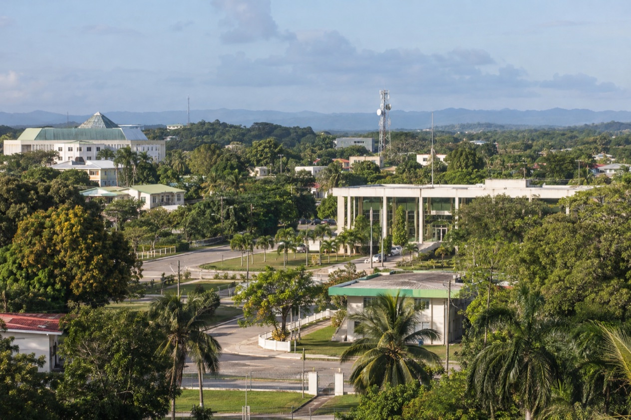
Where is Belmopan and what is it like?
Belmopan sits inland in the Cayo District, in the west of Belize, closer to the geographic center of the country than the old capital, Belize City. It is a government town first: a planned capital of low buildings, wide lawns and ministries, with an elevation of 249 feet that puts it in rolling green country instead of on the flat coastal plain.
The reason it exists is a storm. Hurricane Hattie struck Belize City and destroyed approximately 75% of the houses and business places in the low-lying coastal city, and the government proposed to build a new capital away from the water. The move was completed in 1970.
That history gives the town its character: it was designed on a drawing board, and it still feels more like a campus than a market town, with the National Assembly Building as its centerpiece. Its design resembles a Pre-Columbian Maya temple, and the grey stone and broad steps echo the nation’s cultural heritage.
Do not expect a beach resort or a reef town. The Belize Barrier Reef, a UNESCO World Heritage Site, is offshore, and Belmopan has no sea of its own.
What it offers instead is a calm, English-speaking base (Belize is the only country in mainland Central America where English is the official language) with national parks and ruins in the surrounding district. It suits people who want to see how the country runs and then head into the forest. It may disappoint anyone hoping for nightlife or a long evening promenade.
The district around it is a mixed one. In the 2022 census, about two thirds of Cayo’s residents identified as Hispanic/Mestizo, with Creole, Maya and Mennonite communities making up much of the rest. You hear that mix in the markets, on the buses and in the food, and it explains why the neighboring towns feel different from one another even though they are close on the map.
What is there to do in Belmopan?
The big reasons to come are the capital’s own architecture, a jungle pool and cave country just down the Hummingbird Highway, and the Maya sites and rivers of the Cayo District. Belmopan is the quiet base for all three, and that is what separates it from its neighbors: San Ignacio is the district’s town for visitors, Belize City is the port, and Belmopan is where the state sits.
The National Assembly and the government campus
The National Assembly Building is the one thing in town that looks like nothing else in Belize. Its grey stone massing and wide steps are modeled on a Maya temple, which makes the seat of a modern parliament look like an old ceremonial platform rising from a lawn. It photographs well in the low light of early morning.
Around it stretches the government campus, with the bus terminal at its southwest corner at the junction of Constitution Drive and Bliss Parade. A stroll here is a lesson in mid-century urban planning rather than a checklist of sights. It suits travelers who like to understand why a capital looks the way it does, and it pairs naturally with the story of Hattie and the move inland.
St. Herman’s Blue Hole National Park
Twelve miles southeast of town, on the right side of the Hummingbird Highway, the park wraps 575 acres of forest around a jungle pool called the Blue Hole for its vivid color. Two cave systems sit inside the boundaries, St. Herman’s and Crystal, and the forest is rich with wildlife. It is the nearest piece of real nature to the capital, and it explains why many people choose Belmopan as a jumping-off point.
The park has had its present name since 2005, chosen to avoid confusion with the Blue Hole Natural Monument out at sea. It is managed by the Belize Audubon Society and answers to the Belize Forest Department. Come for the green light under the canopy and the color of the water, and leave room to look at the forest itself rather than treating it as a quick photo stop.
| Site | Open | Admission |
|---|---|---|
| St. Herman’s Blue Hole National Park | 8:00am to 4:30pm | BZ$8 per day for non-nationals (BZ$2 for Belizeans) |
St. Herman’s Cave and the rules of the Cayo caves
St. Herman’s Cave lies south-southeast of Belmopan, and the ancient Maya used it for ceremony. It still holds hundreds of pieces of Maya pottery, along with stalactites and stalagmites. That mix of ritual history and natural formations is what gives the cave its pull.
A rule governs every cave in the district: in Cayo it is dangerous and illegal to enter caves without a licensed guide. Treat that as the starting point of any cave plan. The cave is a place to understand through its guide, its pottery and its geology rather than something to wander into alone.
Maya sites and rivers of the Cayo District
The district holds a cluster of pre-Columbian Maya ruins: Caracol, Xunantunich, Cahal Pech, Baking Pot, Lower Dover and El Pilar. Each has its own character, from big ceremonial plazas to quieter sites in the forest. Belmopan puts you in the same district as all of them, so you can pick the ones that interest you.
Two rivers shape the landscape here, the Macal and the Mopan. Their valleys are the green corridor along which much of the district’s life, farming and travel have run. Even if you never get into a boat, knowing where they run helps you read the map of western Belize and decide where to go next.
How many days do you need in Belmopan?
Two or three days are enough for the capital itself and its nearest sights, and a longer stay works if you treat the town as a base for the rest of Cayo. Belmopan is not a place people linger in for its own sake, so the number of days depends on how much of the district you want to cover.
A short stay fits the National Assembly and the government campus, a visit to St. Herman’s Blue Hole National Park, and a look at the story of the cave with a licensed guide. That covers the capital’s reason for being and the nearest nature, with room left over to simply sit in a café and watch the town go about its business. The history of Hattie gives the whole visit a thread.
With more time, widen the circle into the district. The ruins are the obvious additions: Xunantunich, Cahal Pech and the more remote Caracol each deserve their own day on the calendar, and El Pilar, Baking Pot and Lower Dover give you quieter alternatives. San Ignacio, the capital of Cayo, is the natural town to pair with them, and the Macal and Mopan valleys are worth a look along the way.
A different kind of addition is the Museum of Belize in Belize City, fifty miles away. The building served as the city prison until 1993 and was restored as a national museum in 2002. Its exhibits cover slavery in Belize, with a timeline, the slave revolts and the maroon communities of escaped slaves. Put next to a morning at the National Assembly, it fills in the colonial story that led to the new capital.
Where to stay in Belmopan
The choice is less about neighborhoods than about where you want to wake up: in the capital itself, along the Hummingbird Highway toward the park, or farther west in the Cayo District. Belmopan proper keeps you near the bus terminal at the southwest corner of the government campus, close to the ministries and, on Floral Park Road, the U.S. Embassy. It suits people with business in the capital and travelers who want to start the day at the National Assembly.
Staying out along the Hummingbird Highway puts you toward St. Herman’s Blue Hole National Park, which sits twelve miles southeast of town. That direction is for those whose plans center on the forest, the pool and the caves rather than on the town. The park is a place for the daytime, and it stands on its own as a reason to be on that road.
A third option is to base yourself farther west in the district, around San Ignacio, which is the capital of Cayo. From there the Maya sites of the district, the Macal and Mopan rivers and the lodges of the Cayo District are the draw, and Belmopan becomes a stop on a longer route instead of the place you sleep. That choice makes sense if your trip is mostly about ruins and rivers.
Whichever you pick, you stay inland, away from the coast. The sea, the cayes and the reef belong to a different part of the trip. Belmopan, with its elevation of 249 feet and its position near the center of the country, works best as one chapter in an itinerary rather than as the whole of it.
How do you get to Belmopan and get around?
You reach Belmopan overland, from Belize City, fifty miles to the northeast and the former capital. The road connects the port with the inland capital, and the bus terminal sits at the corner of Constitution Drive and Bliss Parade, toward the southwest corner of the government campus. That terminal is the arrival point for travelers coming in by bus and the place to look for onward connections.
Within the capital, the layout is that of a planned town: government buildings spread across a campus, with the terminal at one corner and the embassy on Floral Park Road. Knowing those two anchors, the terminal and the campus, gets you oriented quickly. The National Assembly Building, with its broad steps, is the landmark that tells you where you are.
Heading out of town, the Hummingbird Highway is the road to know. St. Herman’s Blue Hole National Park lies twelve miles southeast of Belmopan, just off the highway on the right side as you travel away from the capital. St. Herman’s Cave is south-southeast of town, in the same general direction.
West of Belmopan is the rest of the Cayo District, which borders Guatemala. San Ignacio is its capital, and the ruins of Xunantunich, Cahal Pech and Caracol lie in that country. Read the map as a line running from the coast at Belize City, through the capital, toward the western border, with the parks and sites strung along the way.
When is the best time to visit Belmopan?
February through May is the best stretch, because that is the dry season in Belize, when trails, ruins and the park are at their easiest underfoot and the forest is still green. If your plans center on St. Herman’s Blue Hole National Park, the Maya sites and the caves, the dry months give you the most reliable days for being outdoors.
The rainy season runs through November, and the Atlantic hurricane season spans June 1 to November 30. Hurricanes that bring coastal flooding are prevalent from June to November, especially in the south of Belize.
Belmopan exists because of a hurricane, so the season has a special place in its story, and the months from June to November are the ones in which you plan with a little more flexibility. Wet months bring a deeper green to the forest around town.
For a sense of the temperature range, take Belize City on the coast: January highs there average in the low 80s and July highs in the upper 80s, with the lows a good deal warmer in July. The two months frame the year, with a gentler January and a warmer July. The rest of the calendar sits between them.
In short, aim for the dry months of February to May if you want the clearest conditions for the ruins and the park, and treat the rainy months as a greener, more changeable alternative. The capital itself is a government town that works all year, so the season you choose depends on the outdoors rather than on the city.
Good to know before you go
The U.S. State Department rates Belize Level 2, “Exercise increased caution”, because of crime, and says the south side of Belize City has historically had the highest concentration of violent crime.
If you need the U.S. Embassy, it is at #4 Floral Park Road in Belmopan, and U.S. citizens with an emergency can call (+501) 822-4011, including outside office hours.
From outside Belize the number is 001-501-822-4011. Keep it with your travel papers, and remember that cave visits in Cayo go with a licensed guide.
Sources
- Wikipedia, Belmopan (https://en.wikipedia.org/wiki/Belmopan), checked October 11, 2026
- Wikivoyage, Belmopan (https://en.wikivoyage.org/wiki/Belmopan), checked October 11, 2026
- Wikipedia, Cayo District (https://en.wikipedia.org/wiki/Cayo_District), checked October 11, 2026
- Wikipedia, Hurricane Hattie (https://en.wikipedia.org/wiki/Hurricane_Hattie), checked October 11, 2026
- U.S. Embassy in Belize (https://bz.usembassy.gov/), checked October 11, 2026
- Belize Audubon Society, St. Herman's Blue Hole National Park (https://belizeaudubon.org/shbh/), checked October 11, 2026
- Wikipedia, St. Herman's Blue Hole National Park (https://en.wikipedia.org/wiki/Blue_Hole_National_Park), checked October 11, 2026
- Wikipedia, Museum of Belize (https://en.wikipedia.org/wiki/Museum_of_Belize), checked October 11, 2026
- Wikivoyage, Belize (https://en.wikivoyage.org/wiki/Belize), checked October 11, 2026
- Wikipedia, Climate of Belize (https://en.wikipedia.org/wiki/Climate_of_Belize), checked October 11, 2026
- NOAA NCEI, GHCN-Daily station BHM00078583 (Philip S. W. Goldson International Airport, Belize City), normals 1991-2020 computed from the daily record (https://www.ncei.noaa.gov/access/services/data/v1?dataset=daily-summaries&stations=BHM00078583), checked October 11, 2026
- U.S. Department of State, Belize Travel Advisory, Level 2, March 11, 2026 (https://travel.state.gov/), checked October 11, 2026
- NOAA National Hurricane Center, Climatology (https://www.nhc.noaa.gov/climo/), checked October 11, 2026
All our pages
When to go
- Best Time to Visit Belmopan: Dry Season, Weather by Month and Festivals
- Belmopan in January: George Price Day, Weather and Things to Do
- Belmopan in February: Dry-Season Weather, Cayo Ruins and What to Do
- Belmopan in March: Dry-Season Weather, St. Herman's Blue Hole and the Cayo Maya Sites
- Belmopan in April: Late Dry-Season Weather, St. Herman's Blue Hole and a Two-Day Plan
- Belmopan in May: Dry-Season Light, St. Herman's Blue Hole and Cayo Ruins
- Belmopan in June: Rainy-Season Weather, St. Herman's Blue Hole and Cayo Ruins
- Belmopan in July: Rainy-Season Weather, St. Herman's Blue Hole and a Two-Day Plan
- Belmopan in August: Weather, St. Herman's Blue Hole and a Two-Day Plan
- Belmopan in September: Independence Celebrations, Rainy-Season Weather and the Cayo District Ruins
- Belmopan in October: Green Season, St. Herman's Blue Hole and Rainy-Season Plans
- Belmopan in November: Garifuna Settlement Day, Weather and What to Do
- Belmopan in December: Weather, Cayo Day Trips and a Two-Day Plan